


Rocky Fork to WhiteHouse Mtn. Cliffs aka: Stonehenge – 12-11-2010
I knew when Bol’Dar and I first climbed to the summit of Whitehouse Mountain in Rocky Fork and were unable to descend down to the clifftops of what we call ‘Stonehenge’ on 10-19-2010, that we would be back there soon. This time we would be accompanied by our friends Melissa aka ‘Fireball’ and Dano. I had not formally met Dano before and Bol’Dar had not actually met Mel or Dano, so this was going to be a great hiking venture. We all met at Hairnt-quarters around 9:30 am and was at the trailhead and hiking up the snow covered road by 10:30 am . On our last trip here in October, the leaves were alive with Fall color and it was actually very warm and sunny. On this trip however, it would be quite the opposite, as it was cloudy and around freezing with snow covered trails that got deeper the further you went up. The creek was roaring even more so than the last time and the snow covered terrain made it a pleasing environment to hike and get some decent photos. There are several large cascades along Rocky Fork Creek as you make your way up the old road behind the gate, not to mention the lofty, jagged cliffs that tower above you on the left side. You can’t help but stop and take pictures of every one of them every time so, please allow some extra time when hiking there !

Whitehouse Mountain and Cliffs (aka: Stonehenge)
It was a chilly start to the hike, not to mention the many frozen ice formations we passed as we made our way up the old road beside the creek. It was easy walking the road but we were soon to take a right and head up the unmaintained trail that goes up and around to the backside of what is called Whitehouse Mountain.

Ice Formations
It is called this by ‘Hiking Bill’ Fuller, but I am unsure where that information derives from as it is not listed as such on any maps or anywhere else I have ever seen. We have always referred to the large cliffs that sit on the face of this mountain as ‘Stonehenge’ due to the way they look from the side as seen from the high road trail over from them.
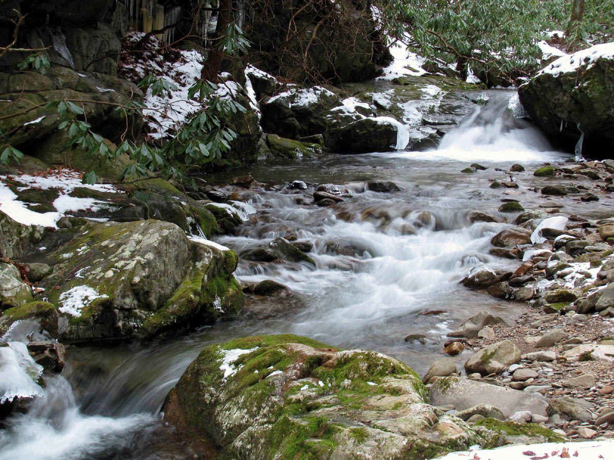
Cascades along Rocky Fork Creek
There was ample water flowing in the small creek that runs out of the hollow and joins Rocky Fork Creek due to the recent snow melt. The morning sun had finally made it above the ridge tops and the sky was a postcard blue as we made our way up the snow covered trail towards the gap. After a short break for a ‘Scooby snack’ and some water, we began the short bushwhack up and over to the red blazed Forest Service Boundary Trail that lies on the ridge which leads directly to the summit of Whitehouse Mountain.

Trail near the gap
Although it is not that far, I broke a sweat and was ready for another break by the time everyone reached the survey marker on the ridge trail. This is where the real climb begins. The ridge trail is very steep but direct and is mostly fresh cleared all the way to the top. With the snow being its deepest here, there were times where ‘granny gear’ just wasn’t enough but rather we had to also use both hands to gain enough traction to pull ourselves higher. ‘Fireball’ Mel provided us all with fireballs which somehow magically helped to propel us along. When I mentioned that I was leaving feet AND hand prints in the snow, Bol’Dar reminded me that this hill was a ‘Bastard Bear’. That terminology goes back to 1991 when we were hiking out of North Georgia (or Georiga as it was called then) into North Carolina with what later would be called the ‘Gnarly Family’ including Dave ‘Nurse Without A Purse’ Bigard , Gwen ‘Dr. Faustus’ Filter, Trish ‘Cookie’, Bol’Dar, and myself. For a more detailed story on ‘Bastard Bears’, please see Bol’Dar’s blog HERE.

Climbing the 'Bastard Bear' ridge
As you eventually near the elevation of the summit, the ridge becomes much rockier and steeper. We seen a fresh bear paw print there. Just when you think you are at the top, you realize it is a false summit as the ridge stretches out a short ways past yet another survey marker and sign before going up one last knob to the summit. This is where the amazing visuals begin but also where I became entangled in a small but strong tree that for some reason, did not wish for me to pass. I eventually won the battle but not before shedding blood and earning what Mel calls a ‘merit badge‘.

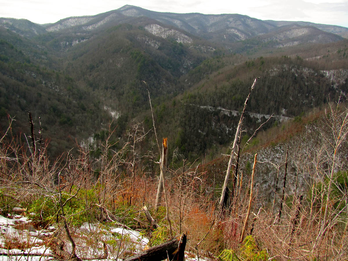
View towards Higgins Ridge and Erwin
Now that the leaves are all off the trees, you can see incredible views even sooner. I recall seeing the snow covered field of Beauty Spot from there. From the top it is mind-blowing as to just how many different major mountain ranges and miles of the Appalachian Trail profile you can see. Once again as I took off my pack and turned around 360 degrees, I was stupefied at the overwhelming views. It was becoming cloudy with an approaching weather front and with the mountains being covered in shallow snow, it allowed for much better pictures than our last trip here (minus the flaming leaf colors we had then). This time you could see the topography of every road, trail, elevation and depression, on every square inch of the surrounding mountains and valleys. It was absolutely astounding.
Summit View looking towards Flint Gap and Coldspring Mtn.
We took a lengthy break to appreciate and enjoy our accomplishment and the breathtaking beauty before contemplating the next leg of the adventure. My goal for this trip was to stand on top of the mighty ‘Stonehenge’ cliffs as we were unable to attempt that feat on our last trip here. This is not an easy task as the trail stops on the summit and to continue further is steep downhill and very rough going through briers, bramble, scrub brush, and plenty of huge rocks and cliff-like structures to stair-step down. Each phase of the descent is a new adventure and every part has its drop offs, some more vertical than others. It is very dangerous and should not be attempted by the inexperienced or faint of heart especially if you have any fear of heights.

Rat looking down towards the Stonehenge Cliffs
You can not see the rocks of the cliff tops from the summit as it is a fair ways down to them, so my fellow adventurers looked at Bol’Dar and myself as if we were crazed madmen when we started down the steep, seemingly impassable slope. It wasn’t until I made it almost out of sight of them and screamed back that I could see the rocks and it looked awesome to get their hiny’s down there, that they began descending down into what Mel described as ‘The Abyss‘ !

Descending down to the top of Stonehenge (Pic by Mel)
It was rough going especially knowing that we were most likely going to have to climb back up the way we came, as it was becoming apparent that there was not a very safe way to go down any further beyond the top of the actual cliffs. The gnarly growth finally relaxed some as we eventually came out on a rather large set of rocks with a steep vertical drop off where we could see others similar to it scattered across this side of the mountain. Much like the ‘Monkeyhead Rocks‘ above Sill Branch, only bigger. From this vantage point you could see the point of the ridge well below where it was very obvious was the end of the line for us at the top of the ‘Stonehenge’ cliffs.
Descending down to Stonehenge (Find Mel and Bol'Dar)
After stopping here for a rest, I was taking pictures when I noticed in my zoom view a very intriguing stone way down on the ridge point that looked to be sitting right on the edge of the cliffs. It resembled a shrine of sorts and soon as I pointed it out to Bol’Dar, he climbed down the massive rock we were standing on and was on his way down to it in a very determined manner.
Strange 'Shrine Rock' formation
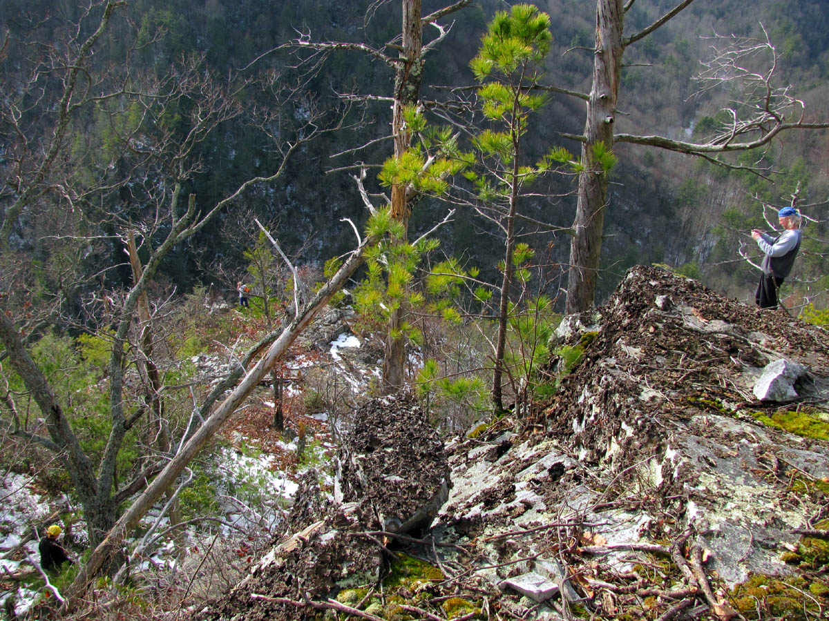
The rest of us stayed behind so he could take some pics of us standing on this huge set of rocks before we made our way down to the cliff tops. We took some pics of him from there to show just how far down it is and how small he seemed in comparison to this massive stone ridge.

Bol'Dar atop of Stonehenge
Once we reached the cliffs edge it was conclusive that it was worth every effort it took to get there along with the impending climb back up that we had now confirmed was going to be unavoidable. The ‘shrine rock‘ looked even more mysterious as I drew closer to it. It was indeed right on the cliff’s edge, sticking straight up like a shark or dragon`s tooth, with a vertical drop of hundreds of feet just behind it. The flat, squared area of broken rocks that it acted as a marker for, was like some sort of grave or memorial to something. I was fascinated by this unorthodox looking rock formation and couldn’t wait to stand upon it. As I took my turn in doing so and straddled the point of this ancient stone, I seen there was yet another boulder below it which was perched further out on the edge of this drop off. Dano was already there and it looked as if that rock could just break away and tumble at any time ! I would soon have my turn at sitting on this ancient stone. As soon as I poked my head beyond the edge to look down, I was hit with the blast of cool winds that were blowing up the mighty rock face. This was made obvious by Dano`s hair blowing as he was perched precariously below me ! I waited until Dano and Bol’Dar had already experienced being out on that extreme edge until I took my turn. Mel checked out the edge and then chose to observe our cliff hopping from a safer location just above.

Close up of the "Shrine Rock'
The views from there are indescribable as are the feelings you have when standing on top of these monolithic, fractured rocks. It was breathtaking to say the least, not just from the vertigo but more like a transcendental or almost spiritual experience. We spent quite a bit of time here and I was very content to finally be standing on top of ‘Stonehenge‘. I had a complacent feeling and actually felt honored to be there as I am sure not many have ever stood on those rocks. We had to cross a large crack, or chasm as it seemed, to sit on the stone that was the actual edge of the cliff we were on, and it was then after studying the rocks that it was apparent these were indeed fractured type rocks. There was a constant feeling that at any time, any part of them could go crashing down to the trees hundreds of feet below. This was an uneasy feeling, but it did not stop most of us from standing and sitting right on the edge, soaking in the indescribable views and taking several photos. As I climbed back up from my lofty perch, I couldn’t help but notice how different the ‘shrine rock‘ looked from below it. It was more ‘sphinx-like’ and much larger from that perspective not to mention the large crack running through it like many of the other rocks we had been climbing around on.

Sitting atop of Stonehenge
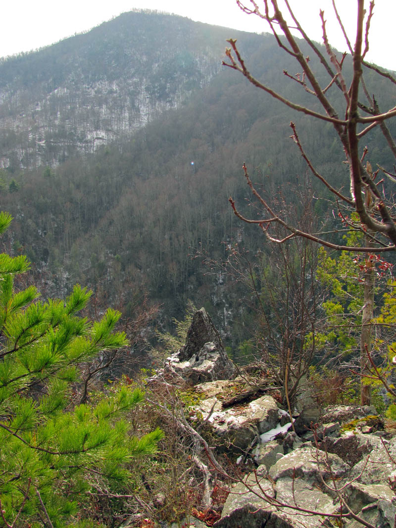
The views of the cliffs on Flint Mountain just across from there are most impressive from this unique ‘in your face‘ angle. Although you are still looking down on them. Remember, these are the same cliffs that you walk under as you start and end this hike along the old road and creek near the trail head. From the top of Stonehenge, the entire Rocky Fork Valley is laid out before you although still a very long ways down, yet the roaring of the creek can be heard above all else. Although they are significantly lower, I have been wanting to also climb to the top of the adjacent cliffs but, from this vantage point, it looks extremely steep and even more dangerous than this adventure. I can only imagine what the view of ‘Stonehenge’ would be like from there.

View of cliffs across from 'Stonehenge'
We stayed on the cliff’s edge until we ran out of time, knowing we had the long, laborious climb back to the summit, not to mention the steep descent after that which would be harder with the slick snow, so it was time for yet another ‘fireball’ from Mel to get us back up the Herculean sized rocks.

Dano atop rock ledge about 1/3 way up from Stonehenge
When I reached the top of the first set of this labyrinth of stone, I realized I had left my hiking staff down at the cliff’s edge. Fortunately for me, Bol’Dar went back and retrieved it for me. I can’t thank him enough for that kind gesture. We both stopped about halfway up to look off the other high rocky ledges on the left face of the mountain. It did not take as long nor was it as hard as I expected it to be, to ascend back to the summit of Whitehouse Mountain. Perhaps it was the ‘fireball’ ? If so, thanks Mel !

Ascending up the ridge from Stonehenge
It was getting to be late afternoon, and the light was changing, so I snapped another pic or two from the summit before beginning my careful descent down the precipitous ridge trail. I could see the others slipping and sliding as they precariously made their own way down the steep slope, but I was lucky enough to make it without earning any more ‘merit badges’.

Summit view: Spivey Gap (left) Little Bald (center) Big Bald (left)

View over Rocky Fork towards Coldspring Mtn.
We followed our tracks back through the short bushwhack down to the gap where we stopped for a short break to recollect the days events and consume some water and snacks. It had been such an awesome day, we were still feeling the adrenaline rush as we headed down the trail that leads from the gap, out of the curving hollow, back down to the road we came in on. This being all downhill, and much easier hiking, it did not take long to reach the road. It was not quite dark yet so we got a few more pics of the awesome cascades and cliffs before reaching the car.
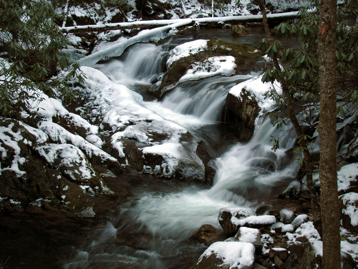
Cascades on Rocky Fork Creek

Flint Mtn. Cliffs across from Stonehenge
There was just enough light to stop and shoot a pic out the car door of the lower falls on Rocky Fork creek along the paved road on our way out. A perfect ending to another incredible day of epic, extreme, hiking adventures.

Lower Rocky Fork Falls
To see more photo’s of the Whitehouse Mountain area please visit our Photo Gallery.

 My name is 'RAT' and I love the mountains and waterfalls of the East TN. area where I live and I hope you enjoy this blog about my outdoor adventures.


5 Comments to “Rocky Fork to WhiteHouse Mtn. Cliffs aka: Stonehenge – 12-11-2010”