


Sill Branch Falls – 12-15-2013
Being the social network addict that I am, I had recently met a fellow waterfall enthusiast Daniel, on the Waterfalls of Tennessee Facebook page who is from middle TN and was looking to explore new waterfalls in my area of East TN. He expressed his interest in seeing the upper falls on Sill Branch. I knew it would be hard to tell him how to find the unmarked trail that leads there plus he mentioned that he did not use a gps so I agreed to meet with him and show him the way or if possible guide him all the way to the falls. This became reality on a cold and frost day in December 2013.

Upper Sill Branch Falls (Can you spot Mr. Bones ?)
Starting at the Sill Branch Trail head in Clarks Creek, we began the hike to the falls. Since I did not know how much time I had I decided we would pass up the lower falls and go to the upper falls first. After showing him the turnoff he agreed that he probably would not have found it so I was glad I was able to show him the way. Some friends and I had did a lot of work on this old trail this past summer opening it back up as it had gotten in pretty bad shape over the years but is now in much better shape. We stopped for a short break at the Umba Ba Gumba spot that overlooks to the MonkeyHead Rocks across the way before continuing on up the trail to the upper falls.
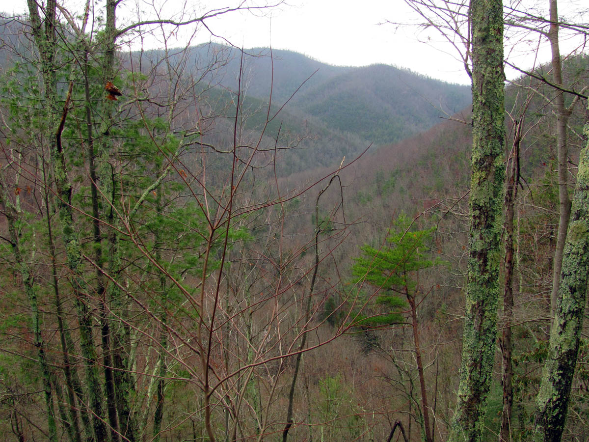
View from the Umba Ba Gumba Overlook – Looking out over the lower Sill Branch Valley as it leads down to Clarks Creek Valley with Sampson Mountain in the background

Looking over at the MonkeyHead Rocks

The MonkeyHead Rocks
There are some small falls and cascades along the way to the upper falls:
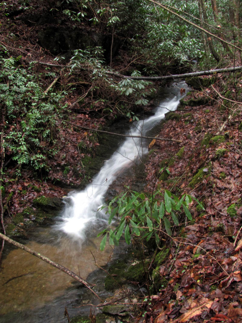
Small cascade along the trail to the upper falls
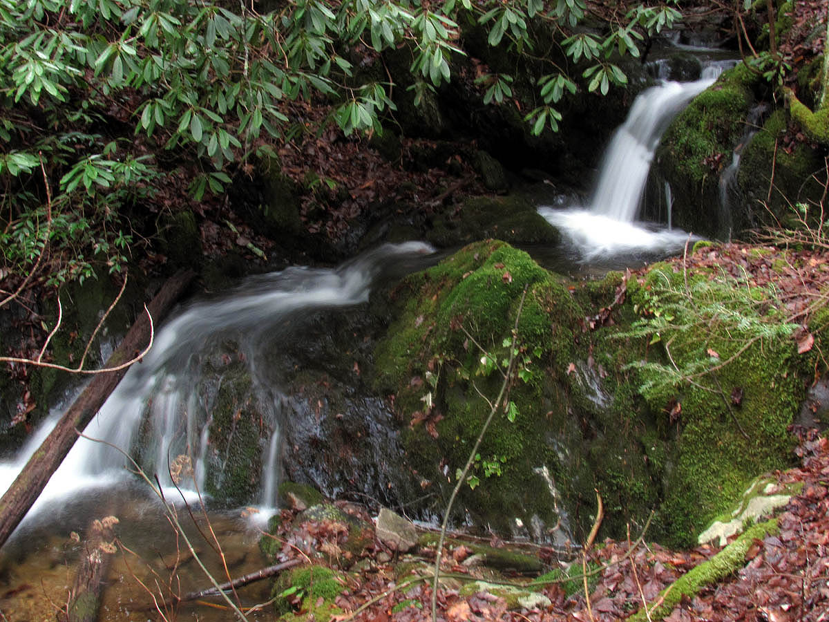
Small falls on the way to the upper falls
It got colder the closer we got to the falls and I could see that the trees were solid white with ice high above us on Rich Mountain and I was happy that we would not be going up there. There was some snow and ice but nothing bad. It did not take long to reach the upper falls and there was decent water flowing and it was not sunny so we got a few decent pics.

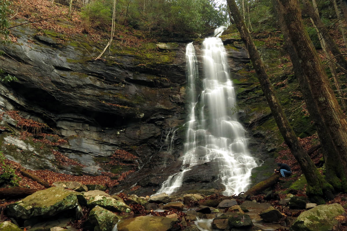
Upper Sill Branch Falls. Daniel using his elephant sized camera on a mosquito sized tripod !!

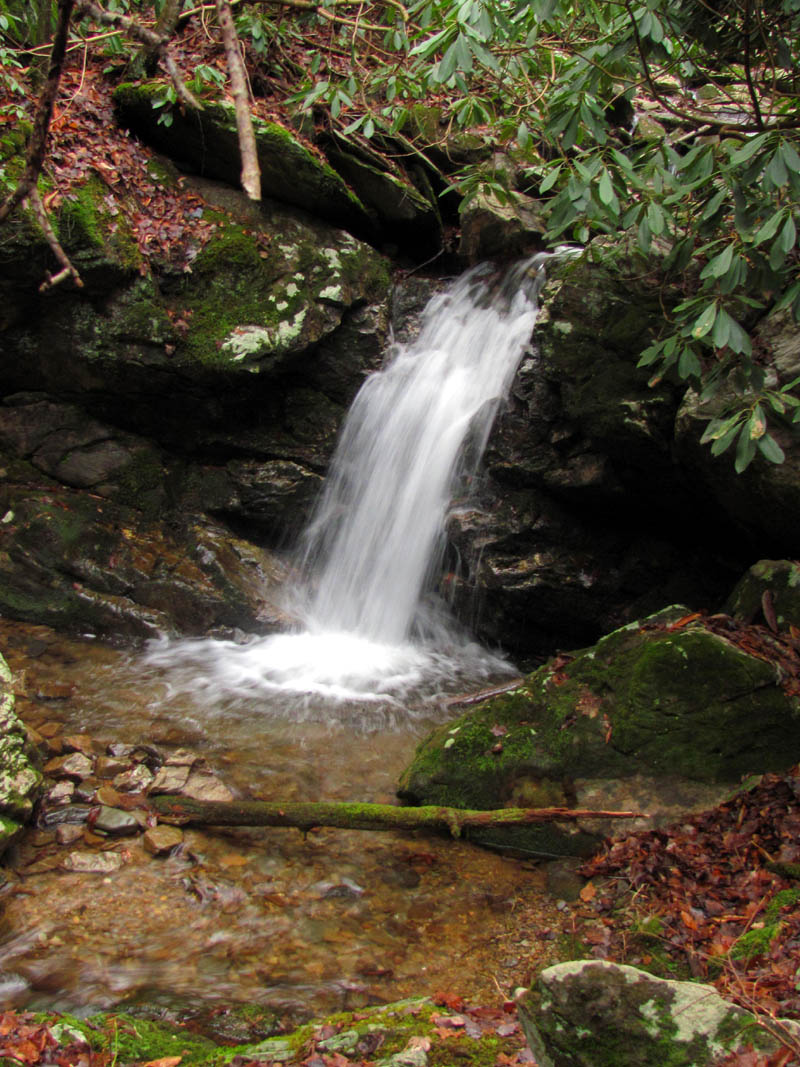
Upper Sill Branch Falls

Upper Sill Branch Falls
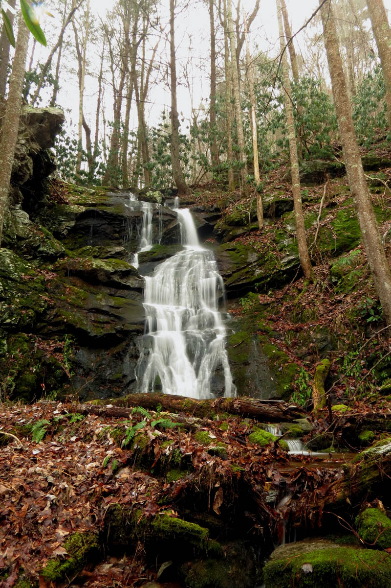
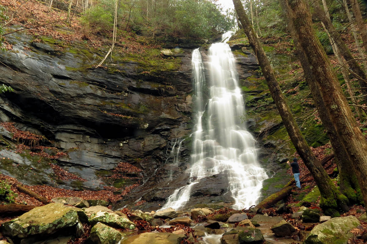
Upper Sill Branch Falls

Upper Sill Branch Falls
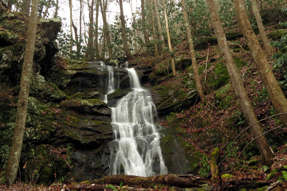
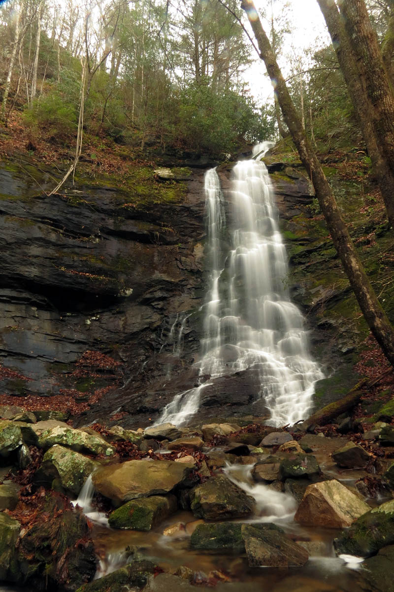
Upper Sill Branch Falls

Upper Sill Branch Falls
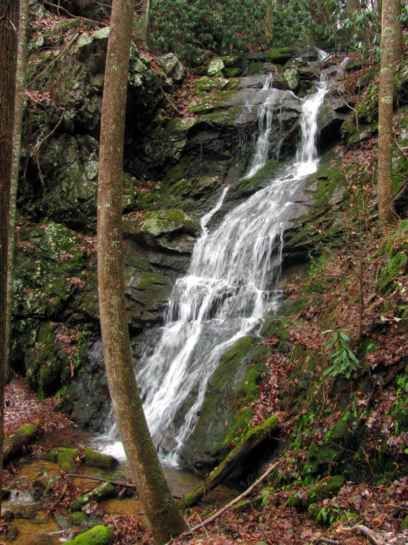
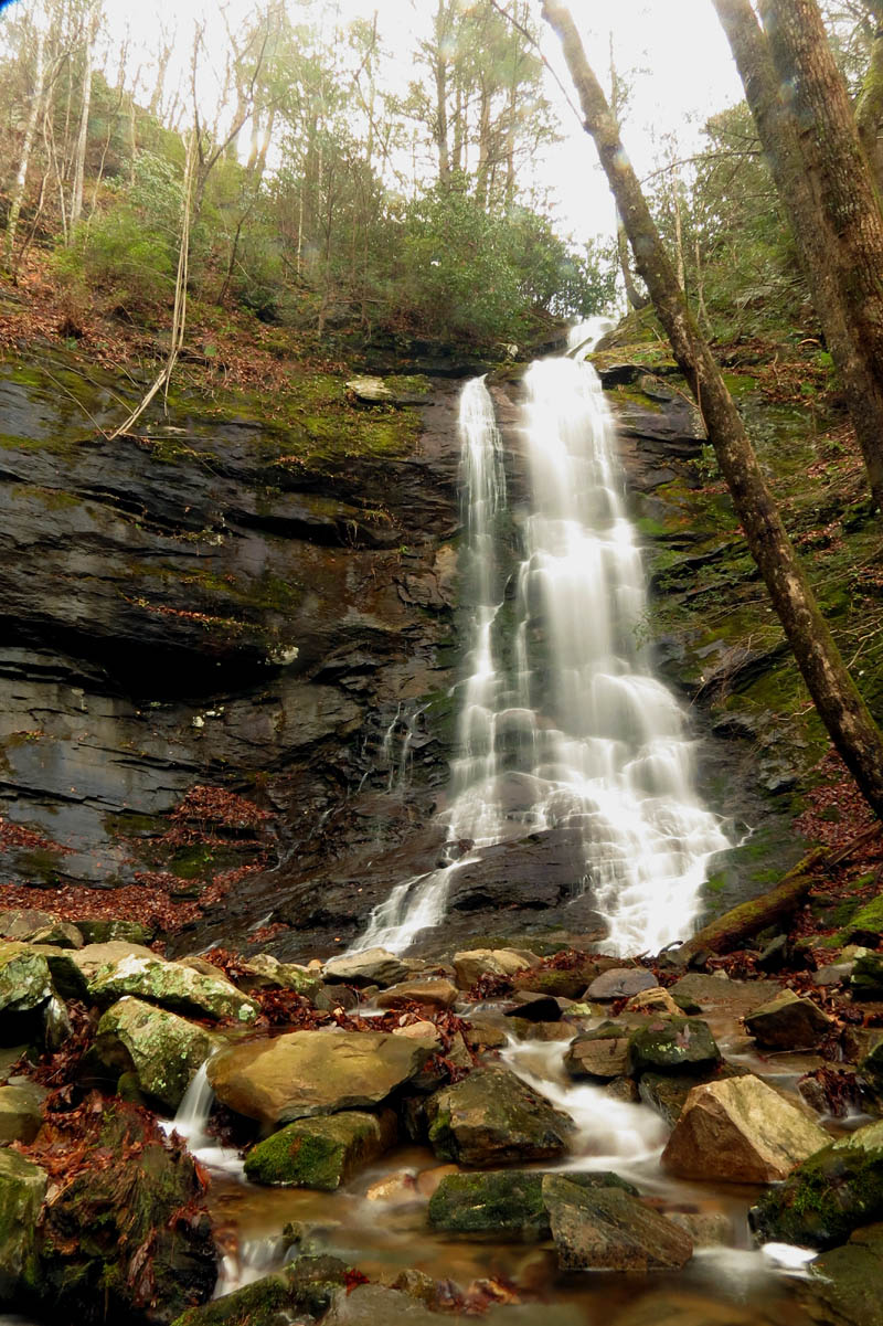
Upper Sill Branch Falls
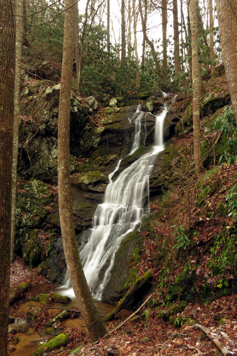
Upper Sill Branch Falls
It did not take long to get cold so we did not stay for a long time as it felt warmer to be moving again. Backtracking we quickly made our way back down to the trail that leads to the lower falls and climbed that short little hill to them. More water there of course since there are a few small streams that join in between the upper and lower falls so it made for a few good pics there as well.
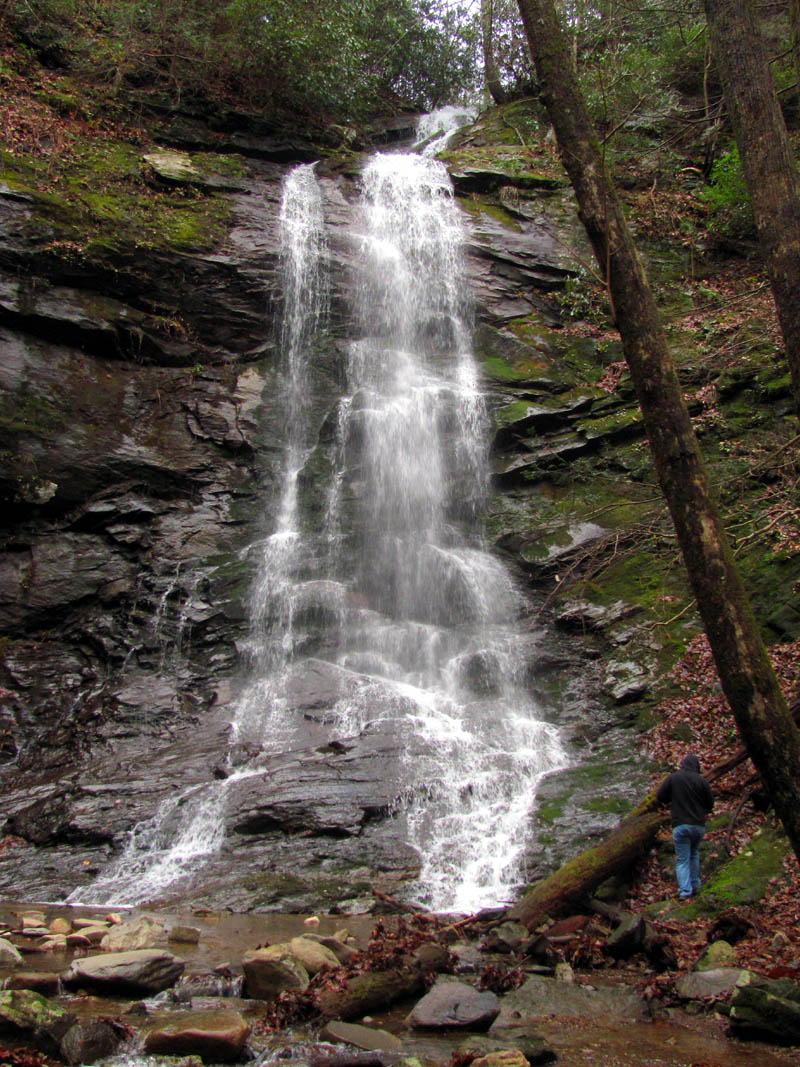
Daniel at the base of the Lower Sill Branch Falls
Lower Sill Branch Falls
Daniel shooting close ups of the lower falls
Lower Sill Branch Falls
Lower Sill Branch Falls
On the way out I showed Daniel where the small falls is hidden near the lower falls trail head where the North and South Fork creeks converge that most people walk right over and never know its there. After a few pics there we made our way back down the main trail stopping only to shoot some small cascades before reaching the vehicle. We were all thoroughly chilled and ready for the warm car heater but it had been another great day to be in the woods and meet some very cool new friends.
Small falls tucked away near the trail head of the lower sill branch falls
To see the complete collection of pics of all the falls along Sill Branch, please visit the Photo Gallery here.

 My name is 'RAT' and I love the mountains and waterfalls of the East TN. area where I live and I hope you enjoy this blog about my outdoor adventures.


Leave a Comment