


Devils Creek – 12-10-2011
Although I had recently visited the Devils Creek area in February of this year, my waterfall addicted friend Dave Aldridge had been antsy for us to take him there to see the multitude of waterfalls that form as the creek flows out the lower part of the steep and rugged gorge. Although it was a very chilly Saturday, my friend Bol’Dar and I decided that since Dave was available for a hike and since the water levels were at a respectable level from some recent rainfall, that we would take him to the waterfall mecca that only few people have seen. As I have mentioned before, these falls are protected from having very many visitors due to their inaccessibility not to mention they are not very well known and there is not any information available about them on the internet. Having found them some twenty odd years ago during a trip to Lost Cove, we have been visiting them infrequently ever since. Starting around 9am from Hairntquarters, we were hiking up the tracks by 10am. PLEASE NOTE: It is very dangerous not to mention illegal to walk on railroad tracks !!!! If you choose to do this, please do so at your own risk !!!!
Upper Devils Creek Falls
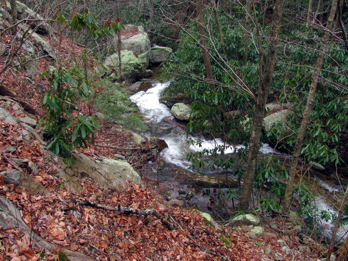
It was a cold, foggy morning as we hiked the tracks beside the river making our way into the gorge. The first thing we came across was a dead cat lying on the tracks that was missing his head. I do not know how something as agile and cunning as a cat can get run over by a train (if this is what happened) but it is a reminder just how dangerous this area can be. I have seen many dead deer along this route before. The river was flowing very good as was the first creek (Mine Branch) which enforced our belief that the water levels would be adequate for all the falls we would be seeing on this day. By the time we made it to the second creek (Long Branch) we encountered our first train. This was a good place as we were able to easily take refuge beside the creek on level ground without having to scramble up a steep bank or down over large boulders and loose rocks to the river to await its passing.

Morning fog rising from the ridge above the river
Walking briskly to keep warm and avoid trains we made good time and were already past the big rock some call the ‘swirly hole‘ and passed the third creek (unnamed) and had already passed by all the rock cliffs high above on the Unaka Mountain side. There are too many cliffs to mention on the opposite side. After negotiating the last ‘blind curve‘ we got our first view of the small trestle that marks the entrance to the Devils Creek Gorge. We could see snow on the mountains above it. It was barely 11am when we arrived at the trestle having completed the two miles from the car in about an hour. The timing could not have been better as no sooner than we had dropped our packs and setup our tripods, another train came by.

First cascades and falls seen at entrance to Devils Creek
Dave was impressed by the four really nice cascades, each with its own pool, that you could see already from the trestle. By the time he got close to the fourth one which is a fairly tall, fast flowing chute that kicks up water in the air as it flows into a deep pool at the bottom, he was like a kid in a candy store! We decided that in order for each of us to get pictures of the many waterfalls as we made our way up the gorge, that one would go first and get ahead while the others waited behind in order to not be in each others way and to get some shots of the falls without people in them. Bol’Dar elected himself to go first. This worked out rather well as Dave and I are always slower anyway and I actually like getting some photo`s with people in them for contrast and size comparison.

First cascades on Devils Creek

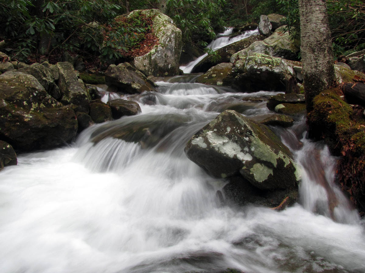
Second set of Cascades on Devils Creek
Third set of cascades on Devils Creek

Fourth set of cascades on Devils Creek
Making our way slowly up the creek past each set of falls, happy that it was not a bright sunny day but wishing it was a bit warmer, we ended up at the big, flat, table-like rock and cascades where I took the time to climb up on it and then down and over another difficult rock to get close up pics of them. Since it was Dave`s first time here, I suggested he do the same. After this spot the route more or less dead ends so, one must backtrack (as it is not possible to climb past these large cascades) a short ways to a short connector trail that leads up to the ‘high trail’ that takes you into the gorge high above the creek and all the stair-stepping waterfalls. Bol’Dar was already up there and shouting something down to us that I could not quite make out but, I was hoping that he could read my mind which was sending him signals to go to the upper falls first and then climb down to the creek and work our way down instead of the other way around like we did last time. By the time Dave and I reached the upper trail, Bol’Dar was already almost to the upper falls so apparently my ESP was working.

Fourth cascades on Devils Creek

Water rushing through the 'chute' of the fourth cascades on Devils Creek

Colorful rocks of the 'chute' that is the fourth cascades on Devils Creek

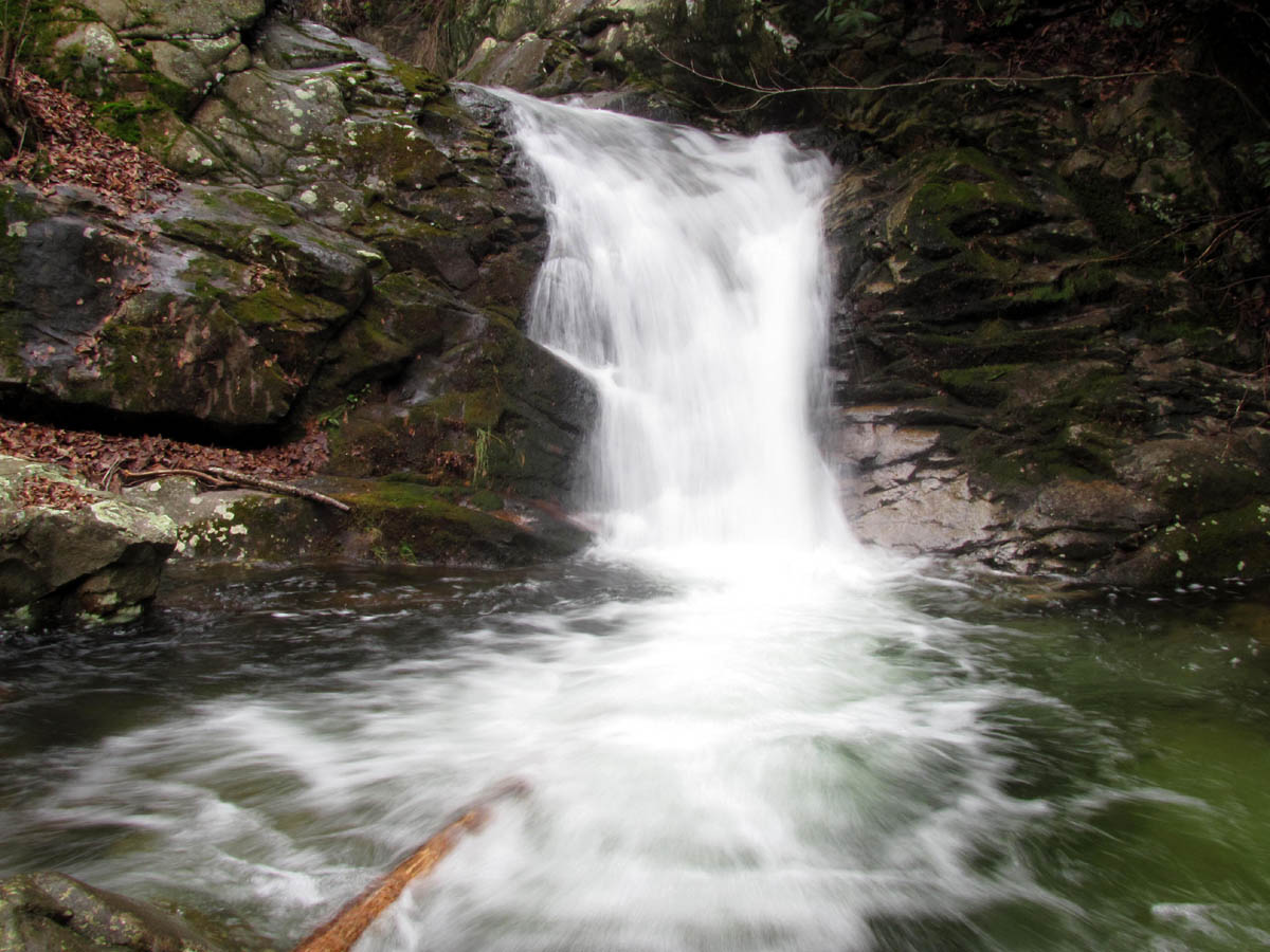
Cascade-like waterfall at the 'table rock'

Cascade-like waterfall at the 'table rock' (Photo by Dave Aldridge)
After stopping to get some pics of the various falls and cascades in the valley from above, I made my way towards the upper falls which you can begin to see from the upper trail. Bol’Dar was already at the top of the upper falls so I joined him there but then decided to go back and make sure Dave was able to negotiate the ‘tricky spot’ which is just before the upper falls. He had no troubles and was soon enjoying the upper part of the upper falls with us.

View of the Devils Creek Valley from just above the 'table rock'

View of the Devils Creek Valley as seen from above the 'table rock' with ridge cliffs in background

View of cascades in the valley below (Photo by Dave Aldridge)

Looking back at Dave as he makes his way along the high trail of the Devils Creek Valley

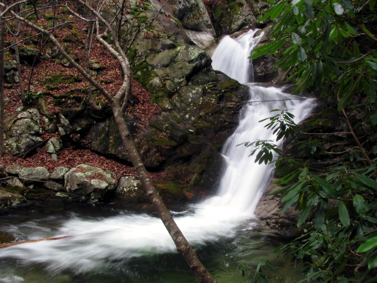
Double Falls we call the Upper Devils Creek Falls

Double Falls we call the Upper Devils Creek Falls

Upper Devils Creek Falls (Photo by Dave Aldridge)
After getting some shots from the top part of the falls it was time to eat lunch but I was too excited and opted to continue to just above the upper falls where the last few notable cascades are before stopping for my lunch. I ate mine while the others were checking out those cascades.

Coming out onto the top of the Upper Devils Creek Falls

Top of Upper Devils Creek Falls and next Cascade above them

First Cascades just above the top of the Upper Devils Creek Falls

Dave Aldridge taking photo`s of the first cascades above the Upper Devils Creek Falls

The first cascade above the upper Devils Creek Falls as it flows into the narrow chasm before going over the top of the upper falls

Second set of cascades above top of the Upper Devils Creek Falls
Third set of Cascades above Upper Devils Creek Falls with view of the last and largest Cascade in the background

View of the fourth and last cascade above the Upper Devils Creek Falls

Last Cascade above Upper Devils Creek Falls

Last Cascades above Upper Devils Creek Falls

Part of the last cascade above the Upper Devils Creek Falls

Close up of part of the last cascades above Upper Devils Creek Falls
The view from the top above the upper falls shows just how steep and rugged the Devils Creek Gorge really is. After this we went back below the upper part of the falls and went down to the base of the lower part of the falls to get the view of that angle which I must say is most excellent. Dave used his Hypsometer (laser device that measures height) and determined these falls were approximately 40 feet tall. He also took a GPS location reading for them but we will not be including any of that information here or on the TN Landforms website as due to their location, inaccessibility, and it being illegal to hike on railroad tracks, not to mention the danger, difficulty, and liability involved in going there from any direction, it is apparent why these falls have not been listed or publicized previously and I will respect that at this time.

Zoomed view of the upper half of the Upper Devils Creek Falls

Zoomed, delayed shot of the upper half of the Upper Devils Creek Falls

Lower half of the Upper Devils Creek Falls
Lower half of the Upper Devils Creek Falls

Lower half of the Upper Devils Creek Falls and next cascade below it
We spent some time at the upper falls as they are a spectacular sight to behold before making our way downstream past the many small falls and cascades. There are too many to mention, each with its own unique characteristics and I do enjoy photographing all of them. It takes awhile to accomplish this and along the way you will come across a piece of bent narrow gauge railroad track in the creek. This does raise ones curiosity as to how it got there and more so the amount of force it would take to bend such a strong piece of iron. I must assume there was once a short set of tracks above there possibly used for logging as was common in this area many years ago and it somehow ended up in the creek bed and washed down during floods getting bent in the process. That is my theory anyway. Maybe its not a railroad track at all ? I am open for suggestions !
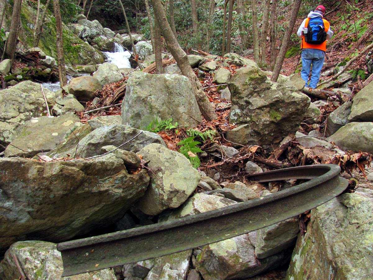
Bent piece of iron found in Devils Creek

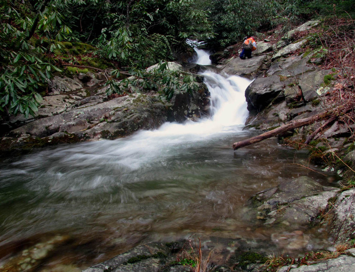
First set of Cascades just below the Upper Devils Creek Falls

Second set of Cascades just below the Upper Devils Creek Falls

Second set of Cascades below Upper Devils Creek Falls (Photo By Dave Aldridge)

Third set of Cascades below the Upper Devils Creek Falls

Third set of Cascades below Upper Devils Creek Falls

Fourth set of Cascades below Upper Devils Creek Falls

Fourth set of Cascades below Upper Devils Creek Falls
Moving on downstream, past the many small falls and cascades, we eventually ended up at the top of the cascades at the big ‘table rock’ where we had backtracked from on our way in and it was now time to scramble up the steep, rocky hill back to the upper trail in order to get back to the tracks so we could begin the trek back to the vehicle. I took some pics of the last cascades there and watched as Bol’Dar made the climb look easy, while Dave and I waited for our turn (in case any rocks were sent tumbling our way). I followed suit and after some heavy breathing and sweat I managed to ‘dig down‘ and join him there where we could both then watch Dave as he made it with no trouble. I hope I can still climb like that when I am his age.

Looking back at the last few cascades just before reaching the ones at the 'table rock'

Last cascades just above the 'table rock'

Top of the last cascades before the 'table rock'
Looking down on the cascades and the 'table rock' as I begin the climb out of the Devils Creek Valley

Dave climbing out of the Devils Creek Valley
The light had changed since we started so we took a few more pics of the falls at the trestle area and ate a snack before heading back down the long river gorge. We were making good time and would be out before dark. It had been a cold but tolerable day with only our fingers being cold having to expose them in order to operate the camera. Looking back towards Flattop Mountain we could see the top was frozen like a Winter wonderland now that the fog and clouds had lifted allowing that view. The return trip was uneventful other than the passing of one train which this time forced us to climb down the rocky bank to the river below which can be a bit unnerving. The surplus of old, rusty train parts lying around there and the large black areas of spilled coal are plenty of proof that there have been accidents there before. I did remember to show Dave the railroad’s method of making culverts for creek crossings. In one place they have cut the ends of a tanker car and laid it sideways in the creek and put the tracks right over top of it ! Southern ingenuity at its finest.

A cool collection of mosses and rocks on the high trail

Last minute pics of the Cascades at the start / end of the Devils Creek Valley

Last min pics of the Cascades at the start / end of the Devils Creek Valley

View of the frozen Flattop Mountain

Another view of the frozen Flattop Mountain over the river gorge

Old tanker car used for culvert under tracks
The sun was setting on the rocky outcrops found on the Unaka side above the river as we passed under them. We stopped to check out the entrance to Long Branch as there is a small cascade there beside a large area which is apparently used for hobo-camping. I plan to come back here one day to follow the trail and creek further up the hollow to see if any more cascades or possible waterfalls are there. We made it back to the car before dark and I was happy to be off the tracks. It had been another wonderful day in the mountains spent with good friends and I can’t wait to do it again, hopefully soon.

View of rocky overlooks on part of Unaka Mountain

Small Cascade at the entrance to the Long Branch Hollow

Whitewater along the Nolichucky River Gorge
For more pics of the Devils Creek area please visit our Gallery here.

 My name is 'RAT' and I love the mountains and waterfalls of the East TN. area where I live and I hope you enjoy this blog about my outdoor adventures.


One Comment to “Devils Creek – 12-10-2011”