


Fork Ridge Trail and A.T. Hike 9/4/2010
Due to the fast approaching annual RAT birthday hike date (9-9-2010), it was decided that we (Bol’Dar, my son Tyler, and myself) would go to Jerry Cabin (known to us as Sam’s Cabin) to check the flow of the spring there. It is usually a fair indicator of how the area water levels are and it is also a great section to hike. I had not been there since the birthday hike of 2008. It was Bol’Dar’s suggestion to hike in from the North Carolina side by way of the Fork Ridge Trail. This is a direct route to the A.T. right near the cabin, but it is very steep and at least two miles that feels more like four. I guess I needed a test to see how I was going to do on the upcoming week long hike so I agreed to this madness ! It had been at least 20 years or more since I last set a boot on the Fork Ridge Trail and then it was always going down it. I had never climbed it until now and I doubt I will be climbing it again any time soon.

View from the Grasslands 9-4-2010 (now weed and brier lands)
Getting a fairly early start, we drove to Carmen, North Carolina and found our way to the Shelton Laurel/Big Creek area, passing by Mill Creek and then Dry Creek to where the pavement ends and you have to drive across the creek. It was all just as I had remembered, with little change which is a rare thing these days. After almost two more miles and two creek crossings, we found the trail head [where I presume Bear Creek enters Big Creek]. There was a large camp set up there with some nice folks that were staying for a few days. We had no trouble finding the trail we were looking for off to the right and so the climb began. I was pleasantly surprised just how nice the trail was and there were obvious signs of good trail maintenance. It was actually much better than parts of the A.T. that we would be hiking on later that day. The first part is not terribly steep but climbs steadily following the ridge but, the second part gets really steep in places and seems never ending. Surprisingly there are a couple places that actually go downhill on the way up! Despite what the maps show, I could swear it is longer than two miles but I guess it is the elevation gain that makes it feel this way, however it seems just as far going back down.
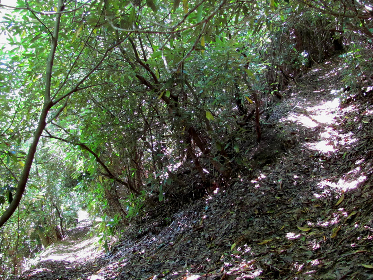
Steep Switchback on the Fork Ridge Trail
It took us almost two hours to reach the top where the Fork Ridge Trail intersects the A.T. As always, Bol’Dar got there first and was resting as Tyler and myself trudged up the last 100 yards that is really steep. I was happy to finally be on the A.T. where it is more level and much easier to hike. Every time I put my boots on this section I can hear my dear friend Sam Waddle’s voice saying, “You’re walking on Holy Ground now boys!”. It wasn’t far from there to the cabin and I couldn’t help but think that Sam was looking down on us and if he was, would not like what he seen, as his old trail section is nothing like it was when he cared for it. The trail is much narrower and the cabin no longer has a yard. It is completely grown up all around it and you can’t even see the shelter until you get right up on it. The briers are way over head high and definitely a good habitat for snakes. Sam always kept it cut back, groomed even, like the yard at his house and it was one of the most beautiful places on the trail, unlike what it is now.
This saddened us because we helped Sam a lot during the last 12 years of his 26 years as a trail maintainer up until his passing on Feb. 1, 2010 (He had actually been coming to the mountain since he was 7 as his grandfather had a cabin at Big Butt and Sam did trail work years before becoming a member of the CMC). I was with him on his final trip to the mountain. He took a lot of pride in beautifying his section, as did we but, the maintainers since then have certainly not done much of anything, even the weeds have not been cut this year. There are places you have to beat your way through. It seems they no longer pay anyone to bush-hog the bald grasslands and the trail across there is really overgrown. I have contacted the CMC to find out why. The access road was getting really rough a few years back and it may be that the tractors can no longer make it up the mountain safely. The Forest Service is strapped for funding during these tough economic times and they also wish to keep access to this area to a minimum to protect it, which may also play a part in this. I really hate to see the open meadows disappear. Perhaps they could bring the goats from Roan Mountain over to this location ?

Rat and Tyler at Jerry (Sam's) Cabin 9-4-2010

Jerry (Sam's) Cabin taken 9-9-92
After a break at the cabin, and filling our water bottles at the spring there, we continued North up the mile or so long, gradual hill to the grasslands. There was a huge blowdown to walk under. I was amazed how overgrown everything was. If it wasn’t for the tracks made by four-wheelers that have been trespassing through there, it would be rough going. We could barely see the deer pond at the edge of the open area. It had been a cool morning but was now a hot and hazy day so getting any good photos was not possible. There was the usual bear scat and the bee nest which had been dug out by the bear. It was hot out in the open so we did not spend much time there and continued onwards across the fields towards our destination we had decided would be Big Rocks and Big Butte at the high point of Coldspring Mountain (4,838 ft.)
Just after the grasslands we came to the Sarvis Cove Trail, but the trail head is so overgrown you can hardly even see the sign. This was the way we used to come in with Sam from his Jeep so many times before. He kept it as nice as the A.T. The trail from there passes through some rocks and laurels but is now infiltrated with weeds and pickers. We stopped at the ‘crack rock‘ where Bol’Dar attempted to climb it (like he did years before), but he ended up falling instead. Luckily he was not seriously injured. He apparently did not take time to become one with the rock and this is not a rock to get hasssty with.

View from the grasslands 9-4-2010

View from grasslands (early 90`s)

Tyler at the Grasslands 9-4-2010

View from Grasslands in early 90`s
From there it was up the hill to the Howard Bassette memorial grave site. I can always tell when I am near the top at this time of year by the bright red berries in the Mountain Ashe tree there. Sam Waddle scattered his friends ashes and placed a stone there back in 1988. This part of the trail was extremely overgrown and you can barely see the grave stone. The view from this high knob that Sam always kept cleared, has also grown over making it hard to see any views. This to me is disrespectful and I was once again deeply saddened and at this point was actually angered.

Howard Bassette Memorial 9-4-2010

Rat and Ryan at the Howard Bassette Memorial 7-10-1995

View from the Bassette Memorial Site 9-4-2010

Rat and Bol'Dar at the Bassette Memorial 12-26-1991 (checkmark is Sam Waddle's house)
We paid our respects and moved on to the rocky gorge which was so overgrown in places that we could not find the spot where a nice view can be had by climbing up on a certain rock, so we missed it. We stopped at the Big Rocks overview where we had a long break, eating our lunches and taking some pics of the views from there. Someone has stolen the nice wooden sign Sam had made and placed near there. Too bad it wasn’t as secure as the survey marker.

View from Big Rocks on Coldspring Mtn. 9-4-2010 (photo by Bol'Dar)
It was hot being exposed on the rocks and the view isn’t what it used to be with all the trees that have grown in recent years, so we moved on to the nearby field at Big Butte. We decided that due to the poorly maintained trail that we would follow the old four wheel drive road back to the grasslands. This was much easier walking so we made good time getting back there. We stopped under the shade tree at the high point to rest and take a few pics before heading down to the cabin once again. Taking another break there, refilling our water bottles, and recalling the many memories we have of this area, we then hiked South back to the Fork Ridge Trail to begin the knee-knocking descent back down to where we started. It did not take as long to get back down, but I was hurting going up and I was hurting even more going back down. We did make it out before dark and overall it was a good hike with great weather and a nice warm up for the upcoming annual birthday hike. Total miles this day was at least 8+.

Colorful Fungus

 My name is 'RAT' and I love the mountains and waterfalls of the East TN. area where I live and I hope you enjoy this blog about my outdoor adventures.


One Comment to “Fork Ridge Trail and A.T. Hike 9/4/2010”