


Mountaineer Falls – 4-14-2012
Ever since the Appalachian Trail was relocated in the Buck Mountain area (between highway 19E and Dennis Cove Road) a few years ago, I have been wanting to hike it but, have just not made it a high priority on ‘the list. I have been on some parts of it when going to the Jones Falls and Splash Dam Falls from Elk River Falls (Big Falls) recently but have yet to walk the whole thing. Although I still have not done that, I did go with my hiking friends Dave and Bol’Darto see the Mountaineer Falls and new shelter located there on April 14, 2012. It was a bright sunny day, not conducive for waterfall photos but was a great day to be in the woods nonetheless. We allowed Dave to be our leader on this day as he had already been there and knew a nice shortcut down to the shelter and waterfalls from the old Walnut Mountain Road where a nice old forest road leads quickly down to the AT not far from the shelter. It did not take long at all before we found ourselves there, where we met a long distance Southbound hiker from New York City. Although the water levels were not at flood stage or anything, they were slightly higher than normal so the small falls located right along the trail there were enjoyable.
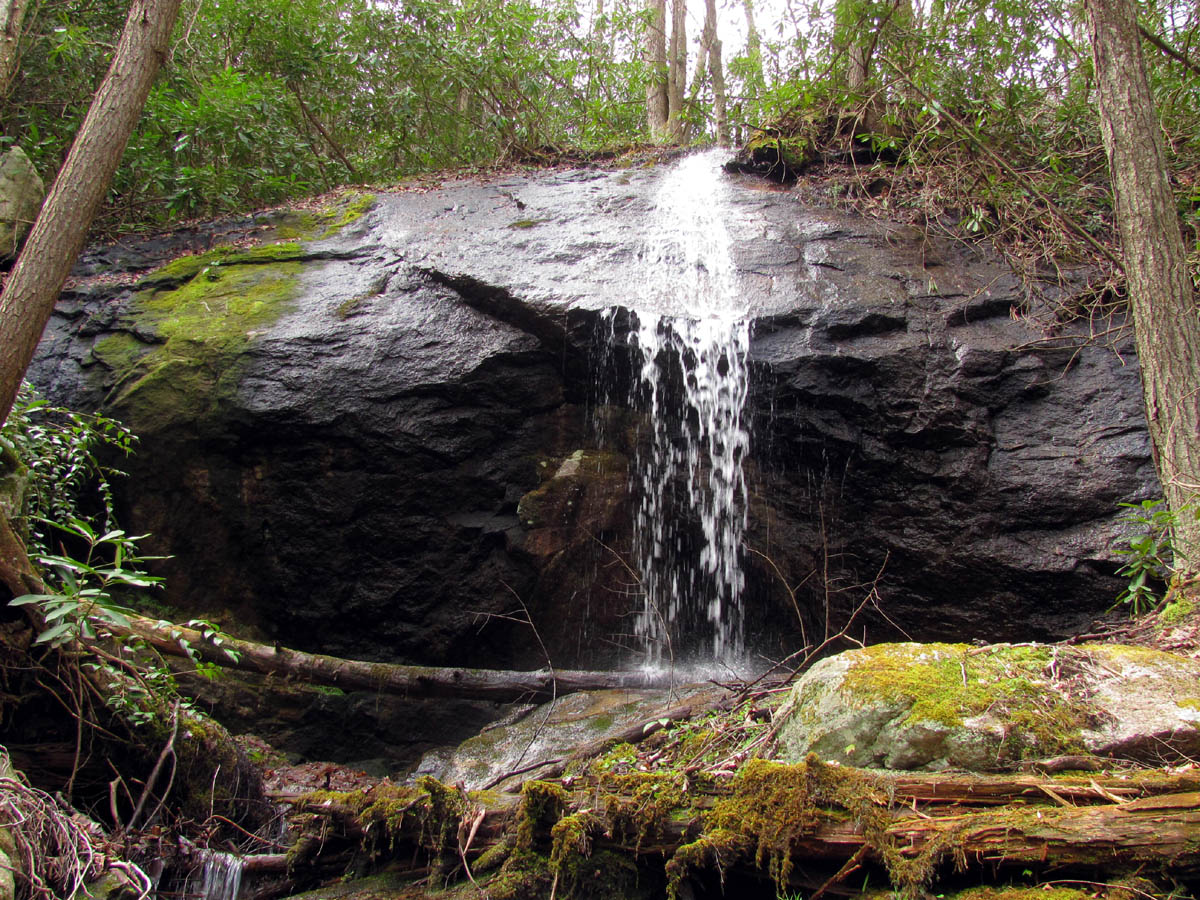
Mountaineer Falls
There is a blue blazed loop trail that goes from the AT around by the top of the falls and over to the shelter and back to the AT which we used to check out the top of the falls. They are only about 20+ feet high but are still worth seeing when there is water flowing over them. Most pictures I have seen of these falls have very little water on them so I would not complain too much of the lack of clouds this day. After looking off the top we went down to where the AT crosses the creek below them and took some pics from that angle. We met a nice lady hiker and her dog while we were hanging out there.

View from top of Mountaineer Falls

Smalls falls just above and seen from top of Mountaineer Falls

Mountaineer Falls
It seems Dave had an ulterior motive to bringing us to this area as he was wanting to see if there was any trails leading down this stream as he had discovered a ‘mystery falls‘ on a recent trip to the Twisting Falls area that was fed by this creek only a mile or so below the Mountaineer Falls. Research had revealed that there was most likely no trails and it would be a bushwhack from hell to get to the top of those falls from anywhere yet this did not sway Dave (or us as it turned out) from looking. It did not take much investigation to figure out there was no easy way down this creek and it would be way too rough to even try it so we decided the next course of action would be to go back the way we had came and cross the ridge over into the next hollow known as the Slide Hollow, as there is a ridge just before that hollow that would lead down to another unnamed creek that the Mountaineer Creek would eventually join before making its way down to the ‘mystery falls‘. There is a trail shown on the topo map and we did find it, but it has been a long time since anyone has traveled this way and it was quite overgrown in places.

Mountaineer Falls

Mountaineer Falls

Mountaineer Falls
Being given a false sense of security by some orange and pink flagging (never, I repeat, never, follow these !!!) we headed down this trail of doom not knowing how it would end up but having a feeling that it would not be good. It was not that bad in some places but it did have its bad spots until we eventually were able to find the unnamed creek and the place where the Mountaineer Creek joins it. At least at that point we were sure of where we were ! This was a flat, open area that was very swampy where the creeks came together. Just over from it we found the old road continuing further down the mountain, where we discovered a large area of deep sawdust. This was truly in the middle of nowhere and trees had overgrown it for some 30 or more years and we were all very surprised to see so much sawdust still there in one place. We would later learn by Dave talking to an older local man that there was once a portable sawmill there back in the logging heyday that had long since been moved out. It seems this was a common practice back then as this local person had a job of moving them when he was a young man. This was very interesting and informative. We also learned from this person that there is a much easier way down to the end of the ridge where one can more easily make it over to the mystery falls ! This would end up being the old forest road we took that morning to access the AT by as it continues on down the ridge and is in great shape where it ends just parallel to where we wanted to be. Too bad we did not know that before we bushwhacked down into this overgrown laurel hell.

Orange flagged 'trail'

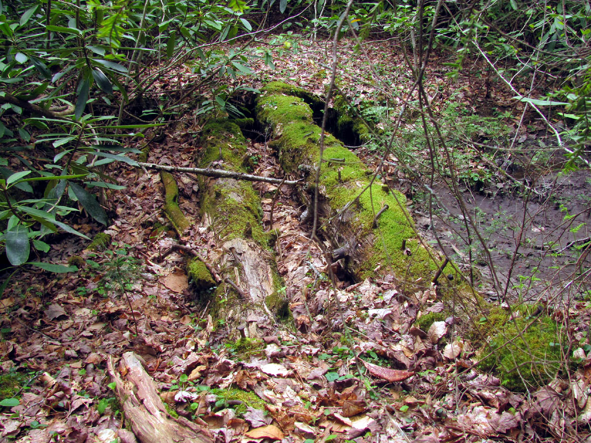
Old sawdust pile found in the large open, swampy area where the two creeks converge
Remains of an old bridge long after the boards rotted away leaving only logs and nails

Pretty purple flowers
I am not sure why we kept going after the sawdust pile as the trail disappeared into more laurel hells from that point on where I had to crawl on my belly to get through them. Maybe it was the fact that we had come so far already and were really not that far from where the falls would be but, either the going got too rough or we became too tired or perhaps it was the thoughts of knowing we had to climb back uphill through everything to get back that made us stop. Plus it was getting late in the afternoon. We had hoped to find the connecting trail over to the Slide Hollow in hopes that would be a much easier loop back but it became obvious that it was not going to happen so we stopped for a long break before heading back up the long, overgrown route we had came down on.

More pretty purple flowers

Back on the AT
It was slow going back and it had became quite sunny and warm making the trek even harder. It was a long way back to those orange flags and I was one happy hiker when I finally seen the last one where we had started. Dave and I had to stop many times on the way up so Bol’Dar was the first to make it there. We took a long rest and snack break once we were back to the AT trail intersection was. After this the walking was so much easier. It makes one appreciate a well maintained trail for sure. It was less than a mile back to where the AT crosses the old forest road we used to shortcut down to there that morning and we could look down that road and see how nice a road it was and after checking the map we could see that would be the way to go to find the mystery falls for sure. Of course we regretted doing the bushwhack but was too tired to complain however, it was decided at that time that Dave would no longer be able to make the decision on where we would hike to without [as Bol’Dar put it]: “first submitting a plan to the planning committee, so the medical committee and the grievance committee doesn’t need to get involved retroactively” ! Maybe one day we can get the time and energy to try once again to locate the top of the mystery falls, but it wont be any time soon and I expect it will be a fall or winter trip. For now, I will rest and try to recover from this exhausting trip while the next adventure is planned.
To see more pics of the Mountaineer Falls, please visit our Photo Gallery here.

 My name is 'RAT' and I love the mountains and waterfalls of the East TN. area where I live and I hope you enjoy this blog about my outdoor adventures.


2 Comments to “Mountaineer Falls – 4-14-2012”