


Simmons Branch Falls – 12-26-2015
The access to the trail head for these falls was blocked off a few years ago by a landowner who owns property adjacent to them. He does NOT own the land where the falls are as that is all on US Forest Service property however, the USFS road that leads into the area does cross a very small section of his land. That road was discontinued many years ago by the Forest Service after a new road was built and was only opened for hunting season which was also stopped a few years ago as well. Of course the government has an easement there and will always be allowed to access it over the private property yet, the general public is not so lucky which has somehow permitted the landowner to block all access to it. I have heard first hand reports of him coming out with gun in hand and impolitely forcing people to leave and only one instance of someone being allowed to park there and access the route to the falls. Although that type of behavior is uncalled for, I can understand his frustration as in recent years there has been so much popularity in waterfalls spread by social media, and websites listing all the known falls and their map coordinates, etc., that masses of people were parking on his land at the USFS gate which resulted in mud holes and lots of trash being thrown out there. So, rather than attempt to speak with him to hopefully get access (which I was told would be futile) I opted a few years ago to find another route to the falls that did not require crossing any private property. After researching property ownership maps I was able to locate the perfect route to the falls that was not much longer or more difficult. Having hunted and explored all over the area there for many years when I was younger aided in my being able to find the perfect route to take. I have been a few times since then and it seems a small handful of others have also been traveling this route as well. It goes over state owned property which connects to the USFS land and apparently there have been issues as I noticed on this trip they have put up bright yellow property boundary markers to clearly show where state property stops and the private property begins which is a good sign as I take it to mean the state does not mind hiking over their property. I hope no one does anything to cause them to block that off because any other way in to the area would require a MUCH longer hike, so long in fact that it may not even be possible for many to accomplish on a day hike.
Upper Simmons Branch Falls
It was only a few months ago that my good friend and fellow mountaineer Larry Jarret aka The Roan Mountain Jedi, had informed me that he had been rudely ran off from there by the landowner and asked me about my newly found route to get around it to reach the falls. I promised him that I would show him the way as soon as it was possible. There is not usually a lot of water flowing down the Simmons Branch so it is imperative to wait until after some rains or during wet seasons to even bother going there. Larry also informed me that these waterfalls were the only ones he lacked seeing to complete his seeing all the listed waterfalls between Scott County, TN. and the Smoky Mtns. to the Virgina and North Carolina state lines. This of course is quite an accomplishment and I was eager to help him check this last set of falls off the list. It was not until a couple months later that the conditions would be sufficient enough to warrant this trip as we did get some soaking rains and the forecast was for a fairly cloudy day. I notified Larry and he was all for it so on the day after Christmas he, and myself met up at Hairnt Quarters that morning and took one vehicle to my new trail head where we met up with Bol’Dar to begin our journey to the Simmons Branch Falls.

The moon going down just at sunrise. I took this while I was waiting on Larry to get to Hairnt Quarters

Making our way across the ‘stealth ridge’ we came across this pipe. I must assume from its location on top of the ridge that is is an old air vent pipe for one of the many mines that were in this area a long time ago. Great care must be taken when hiking this area as it is very possible to fall into an old air shaft. I know where some are that have opened back up and caved in that you can actually see down into the black abyss.

Old steering wheel found along the old jeep road
Moving quickly into stealth mode being quiet and with purpose we made our way over the steep hill keeping just above the private property line and down into the valley where we would pick up a shortcut down to the old road well above the danger zone. From there we would avoid the lower route although I am sure it is not on private land as I know a much better route that would take us to the top of the lower falls. It is tricky due to a maze of old overgrown trails and log roads but, it is much easier if you know the right turns, and there are many. In no time we were standing above the lower falls about to descend down and around the vertical rock cliffs there. Following my old ninja trail we made it safely to the base of the falls. The water level was higher than I had ever seen it and it was cloudy enough to get some usable pics.

Side view of Lower Simmons Falls as seen from the cliff above

Looking back at Bol’Dar and Larry as we negotiate around the base of the cliff to get to the falls

Looking up at the cliff we just came down
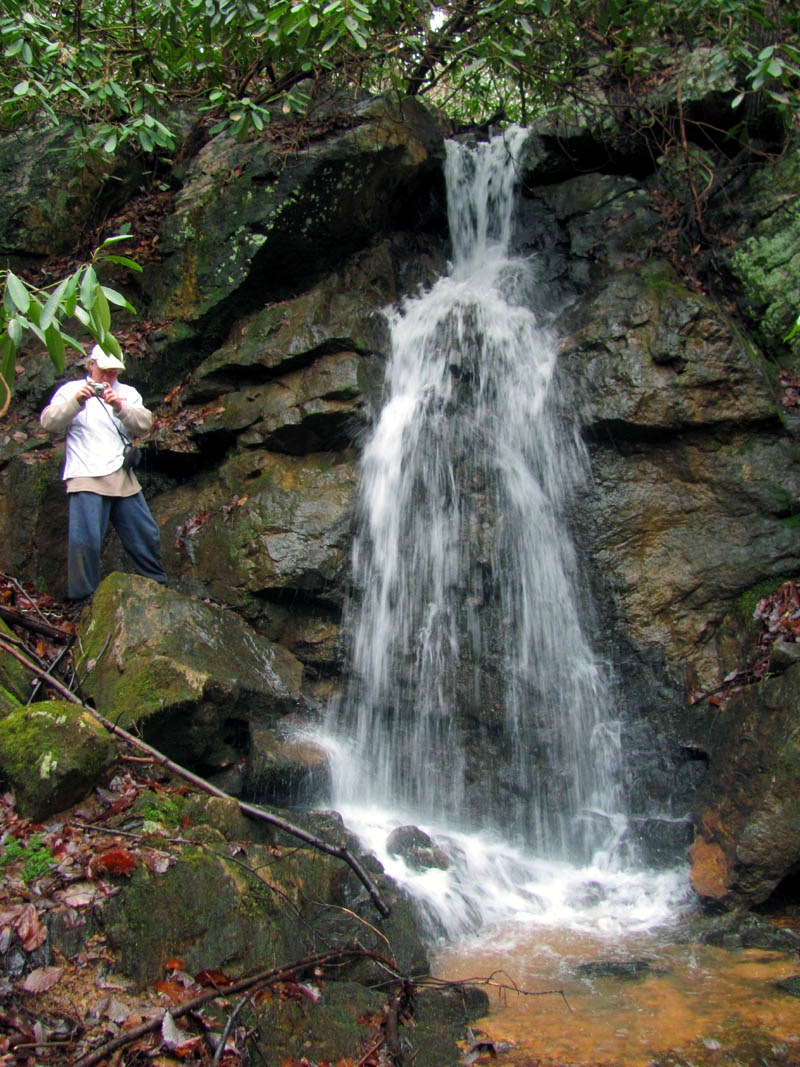
Bol’Dar getting some shots of the lower Simmons branch Falls

Larry demonstrates the art of Camel Servicing at the lower Simmons Branch Falls

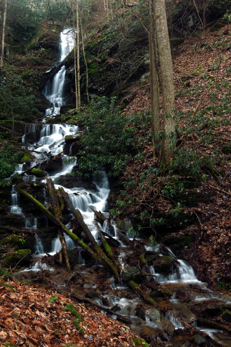
Lower Simmons Branch Falls

Lower Simmons Branch Falls

Lower Simmons Branch Falls

Lower Simmons Branch Falls
Lower Simmons Branch Falls
There was actually too much water for me to get any really good delayed shots with my larger camera as I simply do not have the right equipment or talent to do so but, the following shots are what I was able to obtain:

Lower Simmons Branch Falls

Lower Simmons Branch Falls

Lower Simmons Branch Falls

Lower Simmons Branch Falls

Lower Simmons Branch Falls

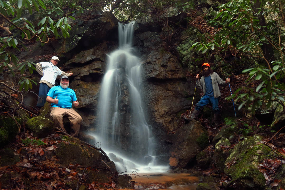
Group shot at the lower Simmons Branch Falls
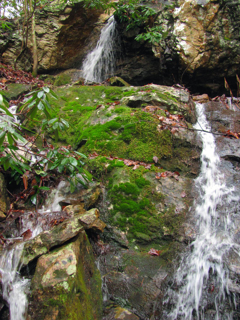
We were in no hurry as it is not a long hike so we spent as much time as we needed there before deciding to climb back up by the cliff. I noticed that the feeder falls that come in from the left of the base of the lower falls on a different water source was roaring and I enticed the others to follow me over there to poke our noses into the thick laurels to see what they had to show. It is rare that there is much water on them but, this day would be an exception as they were rocking and rolling hard ! I have never seen any good pictures of them (other than the one on TN Landforms site) and I am happy we took the time to check them out. The conditions were as near perfect as they could get and we took our time getting up close and personal with her as we climbed every square inch of them getting some of the best shots of the day ! These are a rare and highly unique falls that provides numerous angles and opportunities for many different shots which we took full advantage of as we climbed to the top and then higher, back to where we started above the lower falls.

The Feeder falls are completely hidden by Laurels even when you get this close you barely see them but, we could hear them on this day due to the high water flow !

As you get behind the laurels you can start to see these magnificent feeder falls. Larry was excited and was already there !

Feeder falls at Lower Simmons Branch

Feeder Falls

Feeder Falls

Feeder Falls
Larry on a puckering perch loving life at the feeder falls

Feeder falls
Upper part of the feeder falls

Upper part of the feeder falls

This part of the feeder falls has the illusion of coming out of a cave !

Upper parts of the feeder falls

Upper part of the feeder falls

Isolated shot of the upper part of feeder falls

Isolated shot of the upper part of feeder falls

Isolated section of the feeder falls where it seems to come out of a cave above ! I got this as I climbed up them.

Making my way higher up the feeder falls. it just gets better !

Top part of feeder falls

Top part of the Feeder Falls as seen from the other side (Photo by Larry Jarret)

Upper part of feeder falls

Upper part of feeder falls

Looking down the feeder falls from the upper part

To climb above and around the top of the feeder falls requires going up through these rocks and bear holes
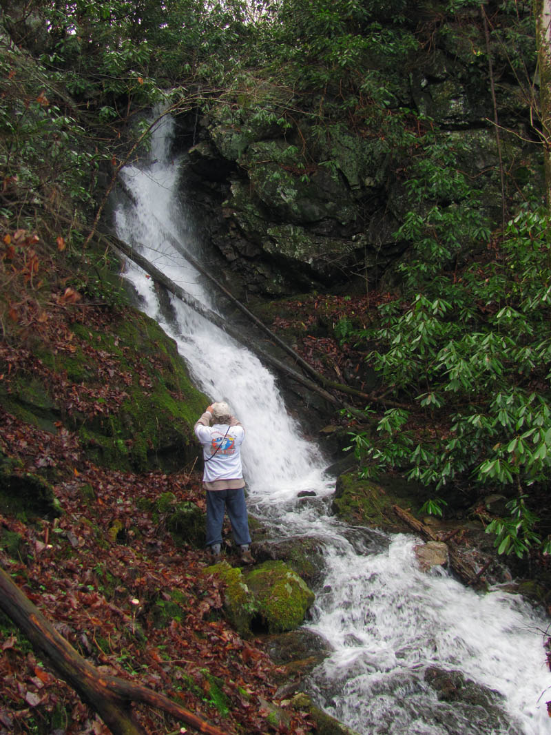
From there it is down to the creek again to follow the Simmons Branch Valley until the middle falls are reached. These are hidden until you actually get right upon them. It is said that Cherokee Indian maidens frequented these falls for bathing purposes as it is possible to easily sit on each of its three tiers. I have yet to get a good picture without bright sun of these falls until this trip. We had picked a great day to visit them.

There are lots of these in the mountains around here. It is a broken steel cable from the old logging days. When they broke one they usually left it laying.

This is looking back at Bol’Dar and Larry in the Simmons Branch Valley just above the Lower Falls

Making our way towards the Middle Simmons Branch Falls. You can start to see them in the distance now

Getting closer to the middle falls
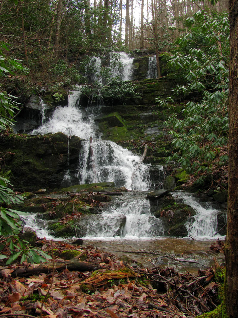
Middle Simmons Branch Falls

Middle Simmons Branch Falls

Middle Simmons Branch Falls

Middle Simmons Branch Falls

Middle Simmons Branch Falls

Middle Simmons Branch Falls

Middle Simmons Branch Falls

Middle Simmons Branch Falls

Middle Simmons Branch Falls

Group shot at the Middle Simmons Branch Falls (I am invisible, sorry)

Lowest drop of the middle falls, side view

Me at the bottom of the Middle Simmons branch Falls (Photo by Bol’Dar)

Closer side view of the lower drop of the middle falls

Me at the base of the Middle Simmons Branch Falls (Photo by Bol’Dar)

Another side shot of the lower section of the middle falls.
I did not climb directly up the falls and shoot each level as closely as I usually do, mainly in part to the high water flow but, instead I climbed up the steep right side to reach the nice log road that hides above it. This road leads towards the upper falls but, dead ends in the creek before reaching them. It is a very steep and difficult climb up the left side to reach the only viewing perch of the falls. There are some nice drops below the upper falls but, I would wait until we left to photograph them on our way out. I think I slid backwards as much as I was able to climb forward but, I finally reached the old log where the best view of the upper falls lies. I had to rest awhile before I could even begin shooting pics !

Lower drop of the middle falls as I begin my climb up this side of them

Climbing higher this show the bottom 2 drops of the middle falls

Middle drop of the middle falls

Middle and upper drop of the Middle Simmons Branch Falls

Center drop of the middle falls. There is no bad angle of these falls ! This is perhaps my favorite to shoot.

Center drop of the middle Simmons Branch Falls

Center drop of the Middle Simmons Branch Falls

Center drop of the middle falls
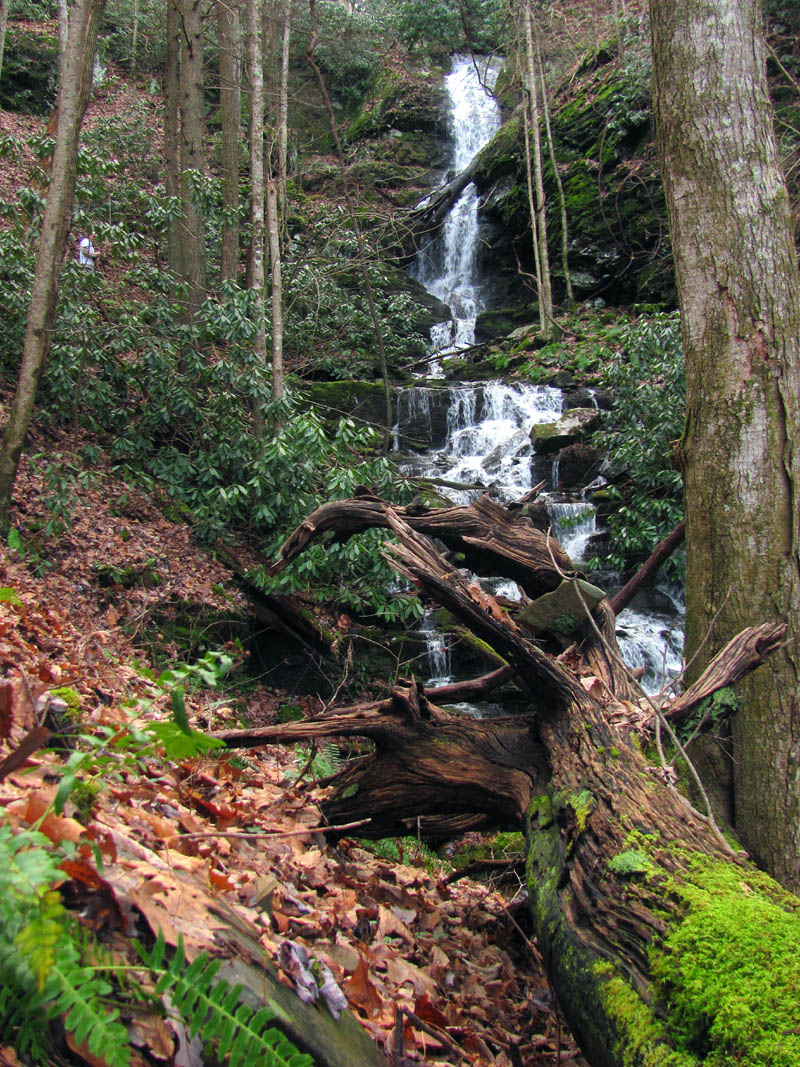
The upper falls are very tall at over 100 feet easily if you include a small drop at the top that you cant really see unless you climb up there. It is not an easy climb and this would be the first time I visited these falls that I did not make the climb up. Larry opted to not climb to the top as well and we watched as Bol’Dar climbed about half way up to give us some scale for a few of our pics. We hung out there for quite some time taking advantage of the cloudy conditions and high water flow. Eventually it did become time to go so we made our way slowly down the very slick descent to the creek where we could get some shots of the smaller falls that are found there.

After climbing up from the middle falls to the log road that hides above them you can now start to see where the upper falls are in the distance

A small falls located below the upper falls

Larry is so excited that he is ahead of me on his way to the upper falls that can now be seen in the distance. The log road ends and it is a very steep off trail route to reach them

There are few very nice small falls just below the main upper falls. I would get some better shots with the larger camera on my way out. You can see the uppers in the distance

Looking down at what I call the Green Moss Falls as I was climbing up towards the upper falls, I noticed a dead raccoon laying at their base.

My first view of the Upper Simmons Branch Falls
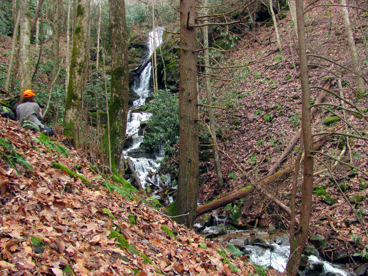
Larry had already found the best puckering perch for viewing and photographing this mighty waterfall

Bol’Dar soon joins Larry at ‘the log’ where the only place to sit on this incredibly steep mountain side is possible. I have had many a nap on that log.

Upper Simmons Branch Falls

Upper Simmons Branch Falls

Upper Simmons Branch Falls

Upper Simmons Branch Falls

Upper Simmons Branch Falls
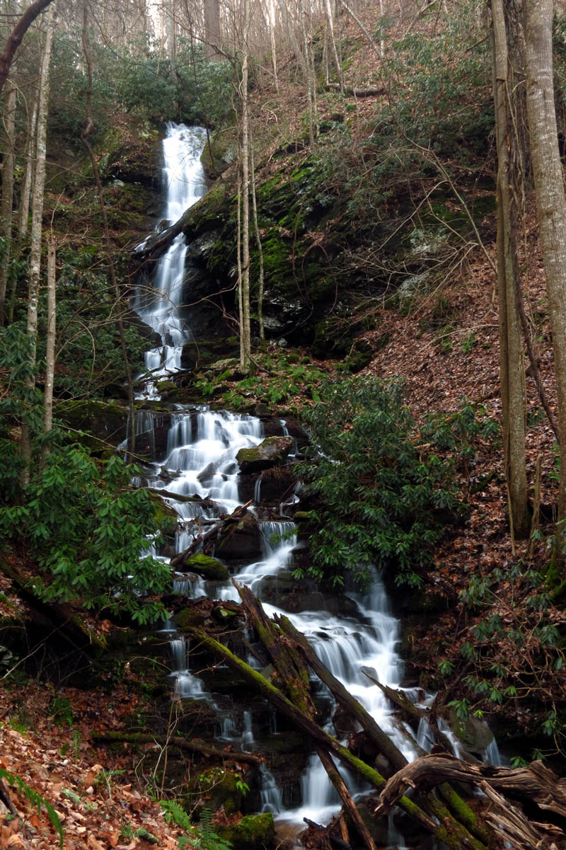
Upper Simmons Branch Falls

Upper Simmons Branch Falls

Upper Simmons Branch Falls

Upper Simmons Branch Falls

Upper Simmons Branch Falls (There are some large and very nice rock cliffs high above the right side of these falls)

Upper Simmons Branch Falls (there are some nice rock cliffs hiding among the trees and laurels above the left side of these falls)
Upper Simmons Branch Falls

Upper Simmons Branch Falls

Upper Simmons Branch Falls

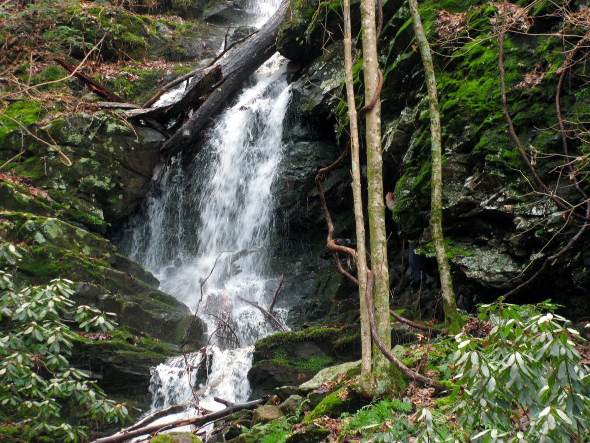
Lower part of Upper Simmons Branch Falls

Middle part of Upper Simmons Branch Falls

Another shot of the middle part of the Upper Simmons Branch Falls

Upper part of the Upper Simmons Branch Falls

Zoomed shot of the upper part of the Upper Simmons Branch Falls. If you look close you can see another 10 foot falls hiding above these that can only be seen by climbing to there

Zoomed shot of the middle part of these gorgeous falls

Zoomed shot of the middle and lower part of the falls

Zoomed shot of the upper part of the falls as the light continued to improve

Upper Simmons Branch Falls
Bol’Dar did climb a good ways upon them to get some close up pics of the various sections of the falls. Of course I took pics of him doing so to add some scale as to the height of the falls which I will include here for your viewing pleasure:

Bol’Dar making his way up the steep, wet slope along the left side of the falls
Bol’Dar climbs up the left side of the falls

Bol’Dar`s view of Larry and I as he climbed up the falls (Photo by Bol’Dar)

Bol’Dar about halfway up the upper falls

Bol’Dar on the Upper Simmons Branch Falls

Bol’Dar adding some needed scale to these upper falls

Bol’Dar saying hello to an old friend

Upper part of the falls (Find Bol’Dar ! )
Now can you find Bol’Dar ?

Find who ? Me ?? (said Bol’Dar as he stepped out of the tiny hobbit hole hidden on the side of the falls)

Bol’Dar checking out the upper falls. The light was so good that I wished I had a better camera !

Bol’Dar on the upper falls in the best conditions I have had at these falls

Group shot near the base of the middle part of Upper Simmons Branch Falls
At one of the drops below the upper falls we found a dead raccoon laying right beside the falls. One has to wonder what led to his demise and why there but, it is a perfect example of why you should never drink unfiltered / untreated water no matter where you are as there is no way of knowing what might be in the stream above you.

Dead raccoon found at the base of what I call the Green Moss Falls

Close up of the poor unfortunate coon

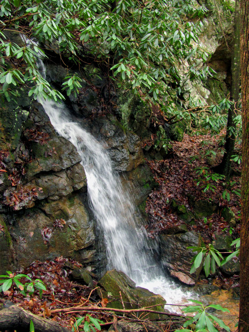
Side view of the newly named Raccoon Falls

Side view of Green Moss aka Raccoon Falls

Another side view of these beautiful falls

View from below Green Moss/Raccoon Falls

Looking at the Green Moss/Raccoon Falls with another small drop below them and the upper falls in the background

Taking advantage of the excellent lighting below the green moss falls with the upper falls in the background
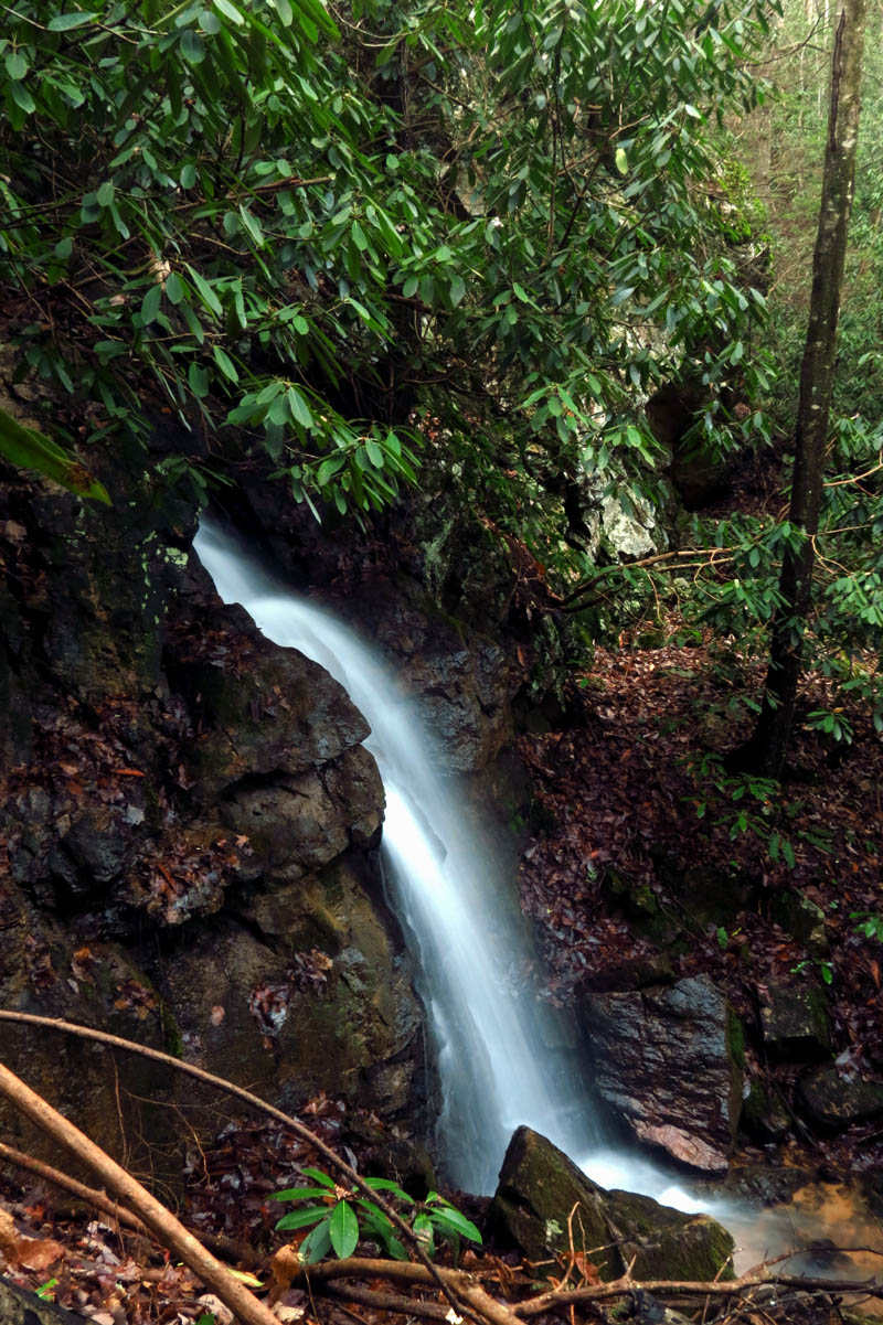
Further down there is another nice small drop that photographs well. I spent some time there getting what I could before catching up with the others that were farther downstream already.

Side view of the next drop found down below the Green Moss Falls. This might have been one of the best pics I took all day.

Another side view shot

Another of the same falls. This is one of the most photogenic drops have seen

I took many pics of these small falls

The next drop down below the upper falls as we make our way out. You can still see the upper falls in the distance

Another shot of the next drop found on the way down from the upper falls

View looking over top of this next drop towards the upper falls.

Another shot of the same falls only this time with my larger camera. I have never seen them display such beauty before.

Another shot as I was mesmerized by her beauty

From this angle you can see the Green Moss Falls and the upper falls above this gorgeous display of water veils

There is no bad angle of these falls, it just gets better !

Trying different exposures because these falls are worth it !

Like I said,, it just gets better and better !

My last shot of these falls before I had to pry myself away and catch up with the others
Taking the old log road all the way back out as it passes high above the middle falls not only makes it easier and quicker but, also gives a different perspective on the middle falls. I enjoy all views of these as they are very spectacular.

A tree with a small butt on it

Looking down on part of the Middle Simmons Branch Falls from the log road above it on our way out

View of the top two tiers of the three-tiered Middle Simmons Branch Falls

Middle Simmons Branch Falls

Zoomed view of the lower drops of the Middle Simmons Branch Falls

Looking back at the Middle Simmons Branch Falls from the old log road above them
We had plenty of daylight left so we took our time enjoying the hike out to the old road where we had plans of showing Larry the ‘bonus falls’ which hide over on what is known as the South Branch of Simmons Creek. We found them and made the steep descent down to reach the base where they are hidden in a deep grotto of rock and thick laurels. Small but most awesome I think Larry was as impressed with these as he was with all the others we had seen on this day. We spent a significant amount of time there soaking in all the beauty before making the challenging climb back up to the old road.

Cool tree that hangs off the route we took to get over the ridge to reach the South Branch of Simmons
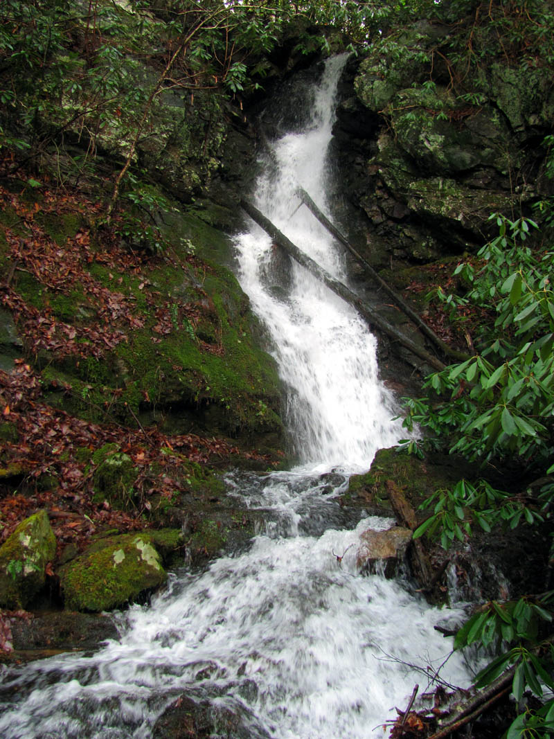
South Branch Simmons Falls

South Branch Simmons Falls
Side view of the South Branch Simmons Falls

South Branch Simmons Falls

South Branch Simmons Falls

South Branch Simmons Falls

South Branch Simmons Falls
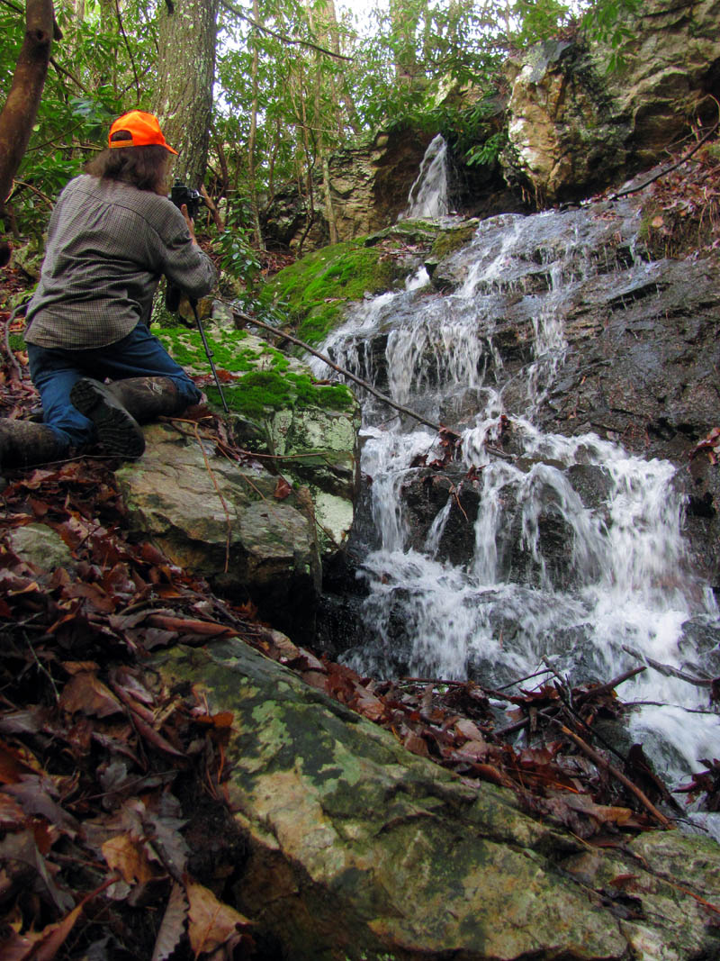
Bol’Dar adding some scale to the falls

A celebratory RAT-Gnome pose at the South Branch Simmons Falls (Photo by Larry Jarret)

South Branch Simmons Falls

South Branch Simmons Falls

South Branch Simmons Falls in the best conditions I have ever seen them in

South Branch Simmons Falls

South Branch Simmons Falls

South Branch Simmons Falls

South Branch Simmons Falls

South Branch Simmons Falls
Group shot at the South Branch Simmons Falls
Once back down the old road there would still be one more hill to get over before skirting back above the private property and down to the vehicles so, it was back into stealth mode for that. What an incredible day it had been with excellent conditions at all five waterfalls. We also celebrated Larry`s achievement of having now seen all listed waterfalls between Scott County TN, including the Great Smoky Mountains, and to the NC/Va state lines. It had been a very successful and special day in Nature. I was glad I could be a part of helping it come to fruition for him and I am already looking forward to the next adventure. Until then,,,,,,

 My name is 'RAT' and I love the mountains and waterfalls of the East TN. area where I live and I hope you enjoy this blog about my outdoor adventures.


Leave a Comment