


The Great Channels of Virginia – 10-19-2014
After hearing about the channels for years and seeing recent pictures of this amazing place, I finally got the chance to go there. Thanks to my friend Jason Horton who organized a trip there which I was able to attend. The only bad part of it all was that Jason got sick at the last minute and was unable to go ! There were many that attended including John Forbes, Shane Estep, Jeff Forrester and family, and a few others that I can`t remember their names (sorry). The Channels are located on the Southern slope of the Clinch Mountain with parking locations along the Brumley Gap Road and from Hayters Gap which is where we started from. The Channels State Forest is 4,836-acres and within 721 acres of that area is dedicated to the Channels Natural Area Preserve under the provisions of the Natural Area Preserve Act of 1989 to be managed by the Department of Forestry in partnership with the Department of Conservation and Recreation.

The Great Channels of Virginia
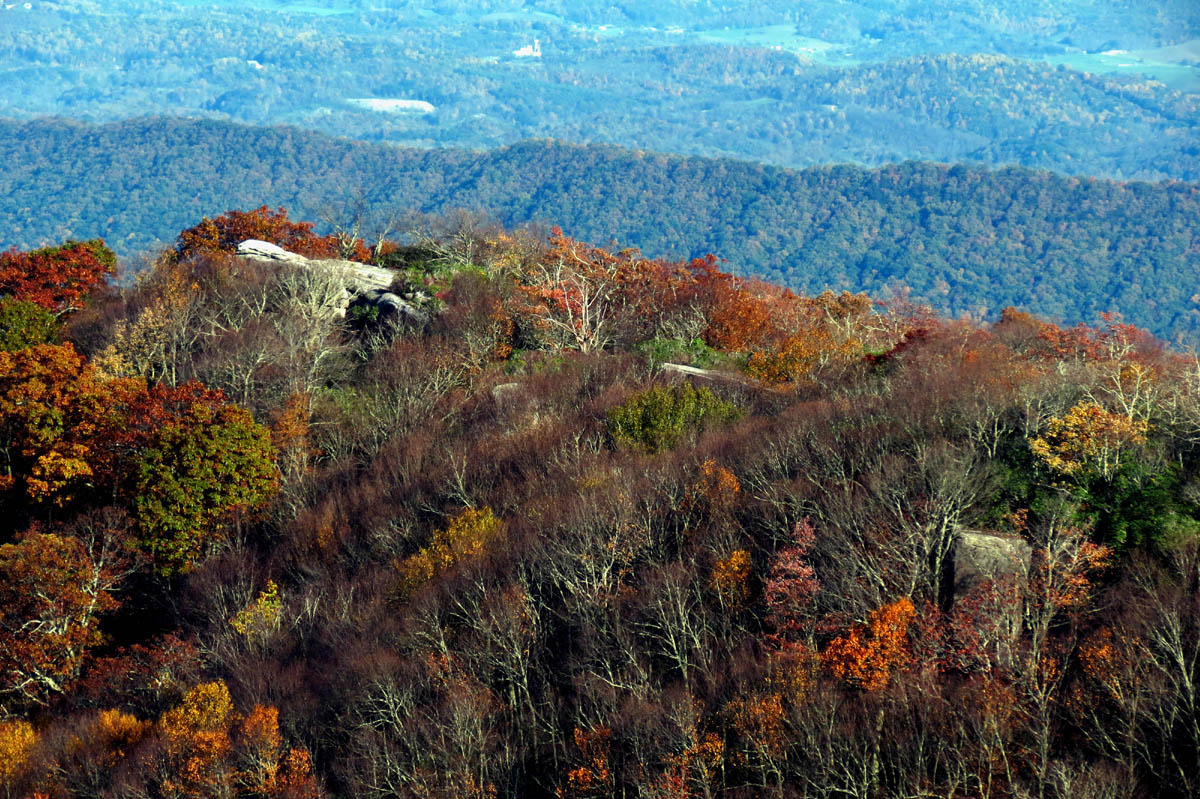
The Great Channels of Virginia are located at the crest of the mountain and are impressive formations of 400 million year old sandstone outcroppings. According to geologists these were most likely formed while the high elevation sandstone cap was under the impression of permafrost and ice wedging during the last ice age. These forces shattered and enlarged joints in the sandstone caprock. The highest elevation there is just over 4200 feet and there is a diversity of environments to be found there from cove hardwoods to northern hardwoods along with rare and imperiled plant species.
The Great Channels of Virginia
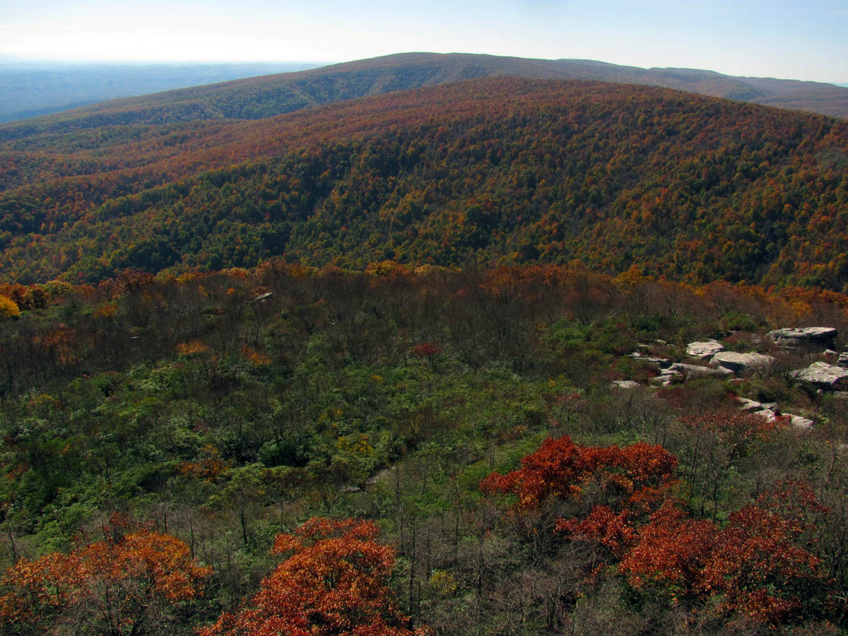
The route from Hayter`s Gap is a 6+ mile round trip starting at 2,025 feet and ending up at 4,180 feet where you will come out on Middle Knob. Once there you will see incredible views which explains why there is an old fire tower there. Make sure it is a clear day when you are there are the views are most impressive. The Fall colors were very good on this day and because of this there were a lot of people on the mountain. It is a 3+ mile climb on the Brumley Mountain Trail to the top where there is a short spur trail that leads up to the old retired fire tower and the great channels. It had been a chilly morning but, I was shedding layers and breaking a sweat by the time I reached the top.

Now entering the channels. John Forbes takes the lead !

The Fall colors were good

The old road trail leading up the mountain towards the channels

The trail quickly gains elevation as it follows the main ridge up. I got this zoomed view of House and Barn Mountain which is a long way off in the distance above Rosedale, Va. like going towards Claypool Hill, Va.

The 3+ mile trail continues climbing up and up,,,

The old retired fire tower was a welcome sight to see
We took some time to rest and eat snacks while we enjoyed the immense views the high knob has to offer. The bottom stairs have been removed from the old tower (built in 1939) and a ‘do not climb‘ sign is there to discourage climbing it but, this does not stop some of the more crazy, carefree, adventurous, and daring type individuals from doing so anyway………………… I must say the views are breathtaking to say the least.
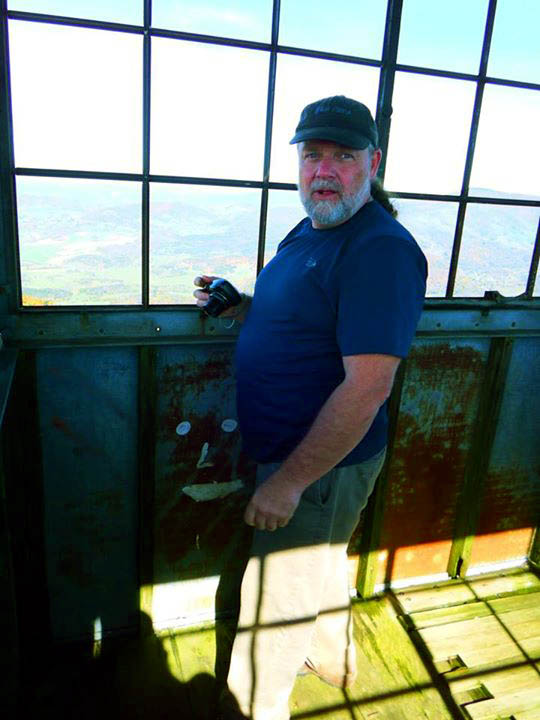
Photo by John Forbes


John playing like a gazelle over one of the channels beside the tower (Photo by Shane Estep ?)

John and Shane beneath the tower

Sun thru the tower

This is one of the highest towers I have ever been to
Not even halfway

The view (this would be looking towards Lebanon, Va, yeah those little white buildings out there)

Looking basically kinda North

The color was nice,, that’s Russell County down there ! I am thinking that is Pine Mtn on the Va/Ky line out in teh distance but I am not 100% sure of that.

This is looking more towards Rosedale, Claypool Hill etc,,, That is Beartown Mountain in top right as looking over Corn Valley and that is House and Barn Mountain in the far distance (top center)

Having driven up hwy 19 many times on my way to Richlands Va, i was in awe at seeing all of that stretched out below me as seen from so high above ! Mesmerizing the BIG picture is !

This would be looking back towards TN, I am thinking that is the Little Mountain and Walker Mountain ranges and I am sure you can see Holston, The Humps of the Roan and Mt Rogers in the very far distance if you knew which ones were which,,,

Looking over the secondary channels towards the Little Mountain Range

Looking Southeast ?

Looking slightly northwest to westerly you can see Brumley Mountain prominently as you look over top of the Great Channels

The colors were really nice

This is looking Easterly over the old fire wardens shack which is near the tower, you can see the end of Beartown Mtn, and Flattop and Brushy Mtns with Walker Mtn range over from them. I am sure there is a lot more if only I knew what I was looking at

Starting to pan more Southerly, wondering if that is Mt Rogers out there,,,? (top right)

Corn Valley, Beartown Mtn,,, (big one) and the little mtn at the end of the plowed ground is Webb Mtn and in distance beyond it is House and Barn Mtn (top center)

Slightly zoomed shot over Corn Valley towards Beartown Mountain

Looking towards Flattop Mtn

Closeup zoom of Beartown Mountain

Amazing view
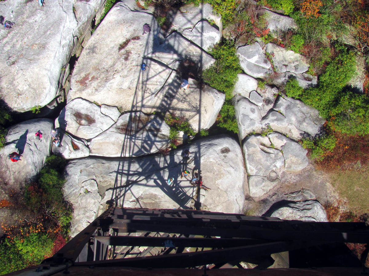
After we left the fire tower area by following the trail down to the channels, we went out onto what John called ‘the rooftop’ of the channels where you can actually walk around on the tops of the huge rocks of the channels and look down into the 45 to 50 feet deep chasms below. Some of our group were already down there looking up at us !

Out on the rooftop of the channels

View from the rooftop of the channels

John sitting on the roof with his feet dangling almost 50 feet above someone`s head !

John and I looking down into one of the main crevasses at another member of our group taking a picture of us ! This is about 45 feet in height.

View from the rooftop of the great channels

Gotta love those lipstick red bushes !

You really do have to watch your step here or you might plummet 50 feet into a crevasse

Just one of the many crevasses

I am trying to imagine the last ice age making this

Shane Estep standing on of the many flat rocks that lie across the crevasses like a roof, and loving it !

Jeff Forrester and family
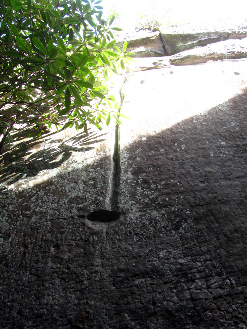
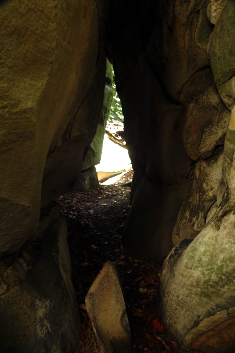
From there you will then make your way down and around to actually enter the Channels. A maze of narrow paths that go between, around, over and under huge sandstone monoliths. This is definitely one of the most unusual rock formations found in the Appalachians. This area was formerly under private ownership and not easily accessible but a man named Charles Kennedy fought to have this special place protected and opened to the public. It was initially purchased by the Nature Conservancy until the State of Virginia purchased the land in 2008. It is now a State Preserve. Please observe care when hiking there to make sure it is kept available to us for generations to come. Upon the entrance to the channels, there is a perfectly carved music note. I knew right then that this place was meant for me to be there.
Music note carved in the stone

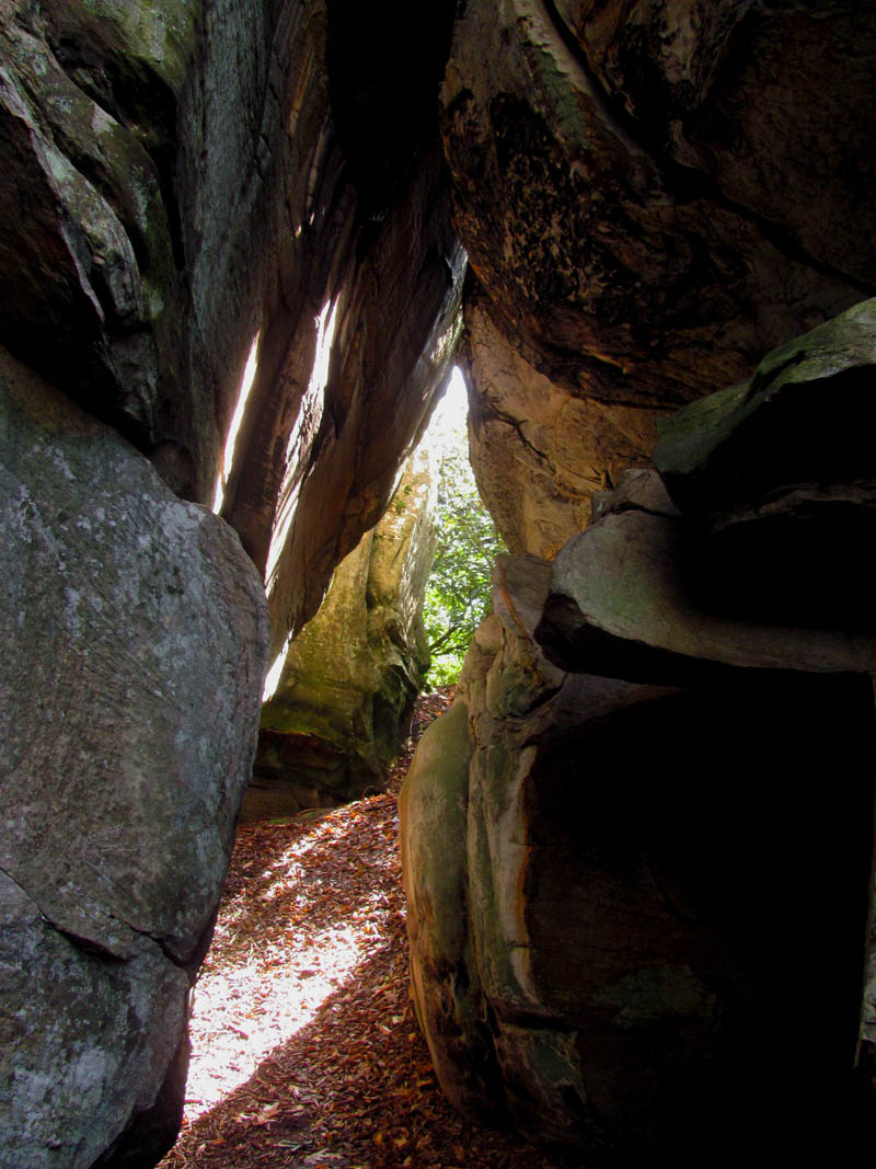
John Forbes leading us down into the netherworld of the channels,,,

Down into the channels we go !

It immediately becomes awesome !

Wow factor immediately goes to 100 % !

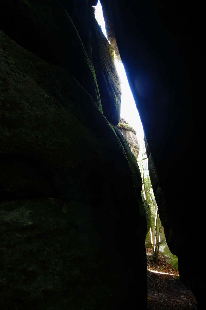
Some of the cracks are very tight, others are not,,

Skinny man crack

The rock formations and the cut marks in them is art in the most natural form. So much beauty here. Was really hard to get clear pics though, too bright on one side and too dark on the other,,

I did the best I could,,, I am a hiker who takes pics not a photographer who hikes !

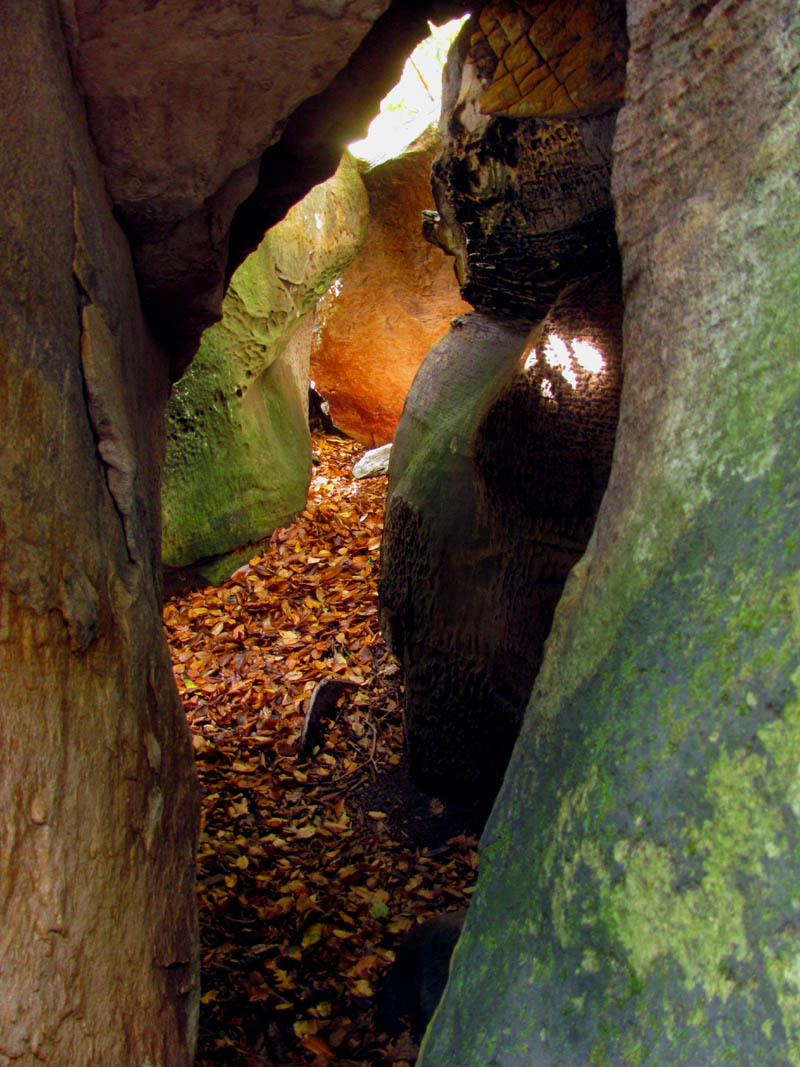
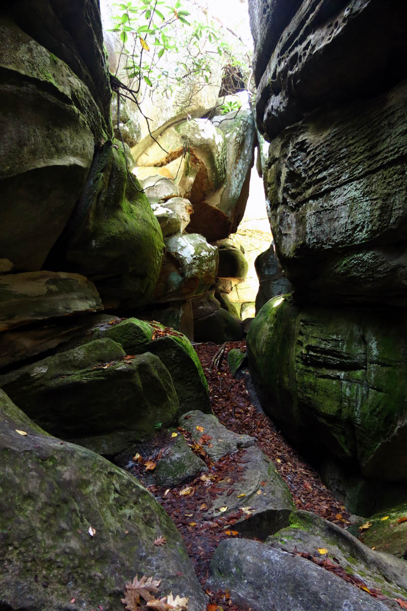
These passages are like a maze and keep going in all directions.

So many different textures,,,

It is amazing what ice and pressure can do to rock

There are some places that are very wide, but it quickly narrows

So many layers, and colors,

I can not recall hiking in a place as cool as this !

You never know what lies around the next corner,
Making my way through the channels like a RAT in a maze !

Gnome under a rock ! ‘Stop and Smell The Roses !’
The great channels

I love the rock textures here
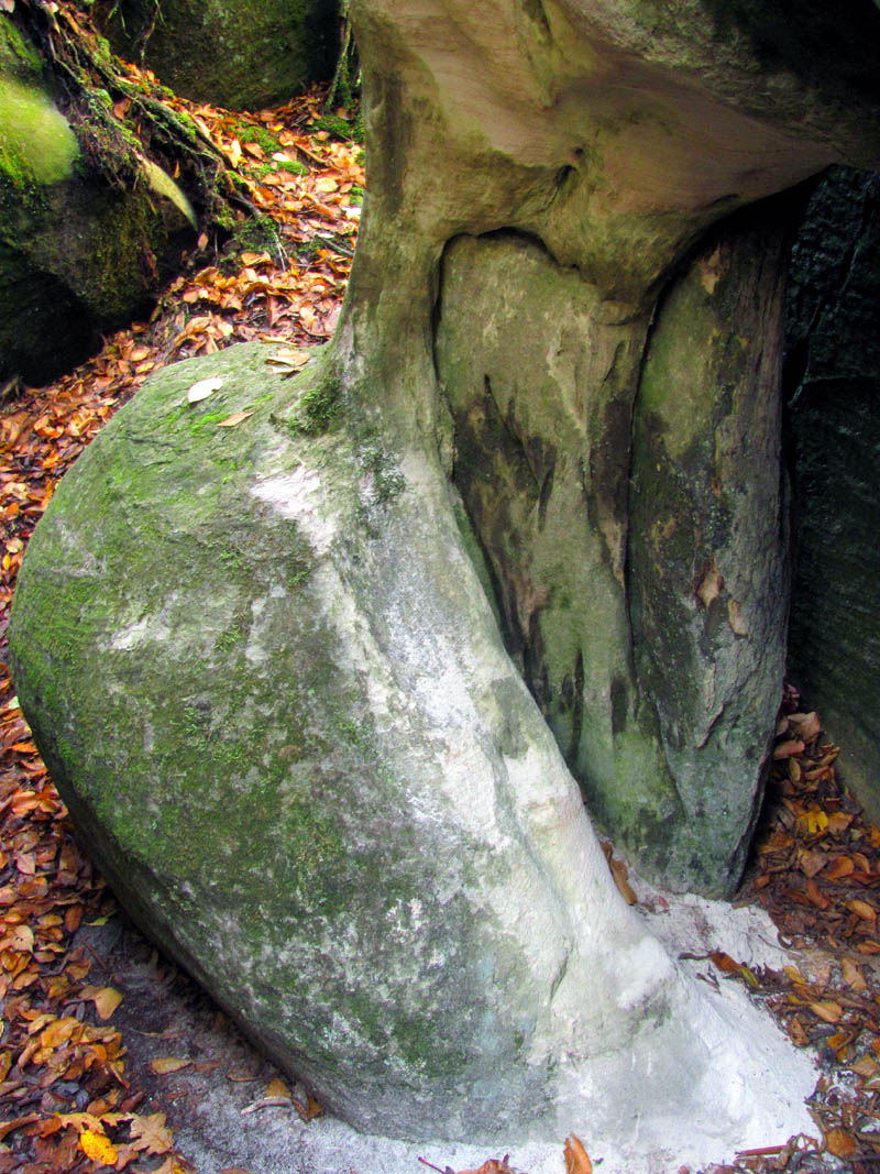
I call this the dinosaur bone rock because it looks like a bone of a huge dinosaur leg ! That is petrified wood on the inner right side.

Petrified wood

Notice the cut marks in the rock

Circular rock patterns

This rock is cut so sharp it has a knife like edge ! It looks like another dinosaur fossil !
Continuing through the maze of cracks and crevices of this unique underworld there are some wide passes and some very narrow that even I could not squeeze through and many in between sizes, all of which are very colorful and a real pleasure just to stare at. It is however, hard to get photographs of especially on a bright and sunny day like it was during our visit there. I plan to come back here again in the near future on a more partly cloudy day in hopes of getting some better shots. John showed us a very narrow passage that we all were able to barely squeeze through that was quite invigorating. I was happy that I was able to fit in such a small space. This is like caving without the need of a headlamp.

Halfway through the tight squeeze, still on the backside of the rock obstacle yet to come to get to the larger end,,,

The larger end of the tight squeeze crack ! (You can see how much smaller it is behind us where I had to crawl on my belly to fit )

Coming out the larger end of the tight squeeze crack with Shane,, this was taken with a flash as it was too dark without it

Before you can get to this larger end of the narrow channel, you have to crawl on your belly then climb over a large rock obstacle as you can see Shane negotiating behind me. Again, this shot required a flash as it is very dark

John and Shane standing under the huge ‘diamond shaped rock’ that is wedged into the roof of the crack

The HUGE house sized diamond shaped rock that was obviously precariously placed there by the receding glacier. Unreal.

Not a good picture but I am trying to show the enormity of this diamond shaped rock that is above our heads

The other side of the HUGE diamond shaped rock

Beware of man eating rocks here !

Continuing through the channels

Every turn there is more to see
Looking under the diamond shaped rock towards part of our crew

The great channels

I was able to snap a pic of a young boy jumping across one of the crevasses on the roof of the channels while I was down below
Low belly crawl

Amazing playground
You can easily spend all day right here

I would love to see what a real photographer could do here
Just one of the many cracks there are in the channels

The great channels

I love this place !

The Channels

The Channels

The channels

The many rock layers of the great channels

Anyone see the skull top ?

Wandering around for hours in these great channels

John doing a one legged balancing act in a high place deep in the great channels

Shane Estep

Another attempt to show how large the diamond shaped rock is

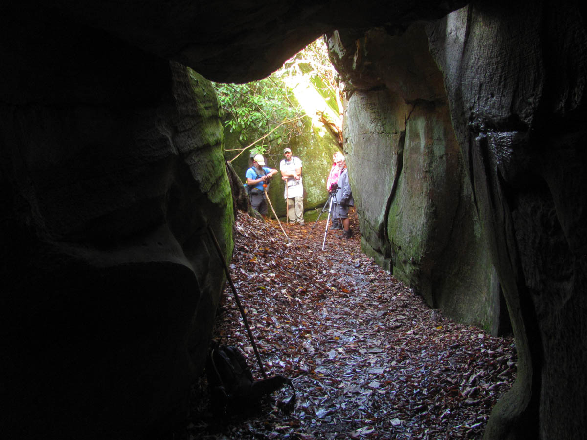
Group shot

John Forbes defies gravity !

The great channels
We spent quite a bit of time exploring around these channels but, eventually we went back up top and over to the fire tower and took some time to explore the other side of the channels which is a lesser known area on the other side of the tower. The views are great there as they are everywhere on top of this knob but, I can see why not many would go to the secondary channels as it is much more difficult to get down in them to access the bottom. They are at least 40 to 50 feet deep and would require ropes to get down into and not sure they all connect. Thanks to an adventurous member of our group, we were able to find a way down into the deep, dark abyss by climbing straight down into a black hole which John and I were eager to do.

Standing on the secondary channels (Photo by John Forbes)

View from the secondary channels. That is me in the far distance

Shane and I standing on the rooftop of the secondary channels
View from the secondary channels

View across the secondary channels

Rock hopping across the secondary channels

The cracks of the secondary channels are tighter and not easily accessible. You would not want to fall here.

Looking up at the tower from the secondary channels

Do not be fooled by the small looking tops of the secondary channels. These rocks are at least 40 to 50 feet tall just like the others.

One must be more careful on the secondary channels as there is more growth covering them as they are not as exposed. Some of the cracks are too wide to jump over

John on the secondary channels

Black hole we found that we hoped wold lead us down to the floor of the secondary channels

John disappearing down into the dark hole. He was following another member of our group. Sometimes it is not safe to play follow the leader !
This ended up as a dead end at a crevice that was too tight for even John to pass through but, it sure was fun being down in the bowels of the secondary channels there. It was so dark I could not see how to adjust my camera without a light and had to use a flash to make the pics even show up.

John at the butt end of the crevasse

John at the dead end on the floor of the secondary channels

Exploring the floor of the secondary channels after climbing down into the dark hole

Looking up at the way back out of the hole where we had came down. Yes it is at least 50 feet to climb this back to the top of the secondary channels

John almost out of the crevasse we climbed down into of the secondary channels

Me climbing out of the crevasse of the secondary channels

Me climbing out of the crevasse of the secondary channels,, this time with flash
After climbing back up out of this dark hole, we spent some more time up top enjoying the views as the sun was dropping lower in the sky before it came time to hike the 3.5 miles back out. I can not wait to come back to this incredible place and I have a feeling it will be soon as John Forbes and I have our sights set on a huge rock outcropping located on a nearby ridge that we are dying to stand on.

Airplane looking rock that John and I have vowed to stand on soon
As you can see there are lots of huge rocks to go bouldering on throughout that ridge

One last shot of the view of Beartown Mtn. across Corn Valley before I headed off the mountain

Just as the trail leaves the ridge there is this gnarly tree and it just happens to be growing over some petrified wood which used to be a tree !

Under the trees roots is petrified wood , it looks and feels like stone

Making my way back down the ridge road trail. I will be over at that knob soon,,
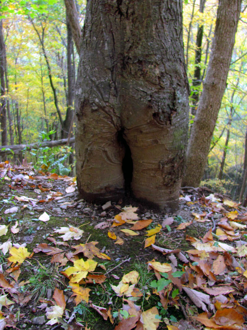
Cute little butt tree

Going back down the old road trail as the sun is setting
The hike back would be much easier than the hike up as it was uphill all the way so I would be on cruise control going back down. It is very nice old road trail and the beauty found in this area makes it a very pleasant hike in any season. There is an old log cabin near the bottom that I am told was used by the previous caretakers before there was public access to the area. I tried my best to get some decent pics of it before we made our way back down to the car.

Log Cabin

Log Cabin

Log Cabin

Log Cabin

Log Cabin

Fall color beside the old log cabin
It was almost dark by the time we reached the vehicle and what a day it had been. This trip will definitely be remembered as one of my all time favorites and I can not wait to come back here again. Until next time,,,,,,

Reflection

Lambs Ear I found growing beside the road at the trail head

 My name is 'RAT' and I love the mountains and waterfalls of the East TN. area where I live and I hope you enjoy this blog about my outdoor adventures.


Leave a Comment