


Whitehouse Mountain Cliffs / John Forbes Trail Day #100 – 11-20-2014
I was recently bestowed the privilege and honor of planning a hike location for my good friend John Forbes to celebrate his #100 day of hiking in 2014. This was a goal he set for himself at the start of the year and it was quite an accomplishment so it was only fitting that the hike for that day be equally as impressive. Knowing that John prefers hikes that are not for the average hiker but, instead would be considered more extreme, sometimes bordering on insane, this hike would have to be of epic proportions. It was for this reason that I chose to lead us to the summit of Whitehouse Mountain, then down the incredibly steep off trail ridge that leads down to the top of the cliffs there that I aptly named ‘Stonehenge’ some 30 years ago. (You must see them from the ‘High Road‘ to understand why I chose that name) Of course the journey would not end there but, rather just be getting started as I would continue to escort everyone in the group across the top of the cliffs and then down to the base and walk across the foot of the mighty monoliths to beyond the other side to experience the full effect this area has to offer. The descent down from there is also a hike within itself. This is the prodigious story of that unforgettable day,,,,,
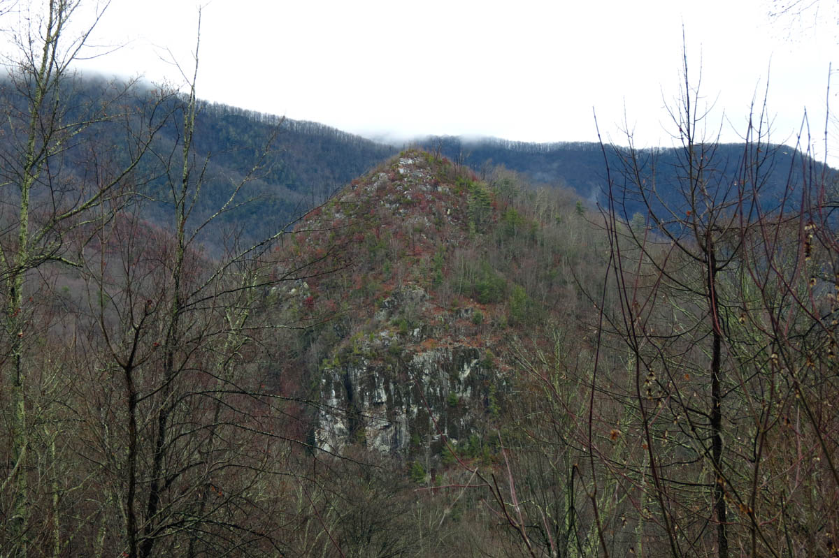
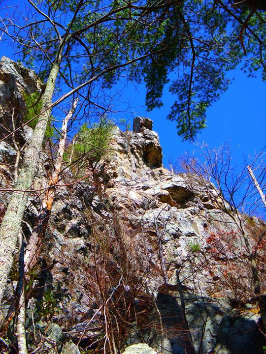
Whitehouse Mountain and Cliffs
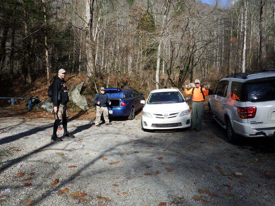
On this ceremonial adventure I would have the pleasure of hiking with not only the man of the day, John Forbes, but also I would be reconnecting with the one and only Jason Horton aka ‘Bigfoot’ whom I had not hiked with since our first meeting back on March 15, 2014 when I took him on the legendary ‘waterfall tour‘ only we went in reverse which is much shorter and eliminates a lot of hiking but, misses out on so many more waterfalls. To top that I would also have the delectation of meeting and hiking with Thomas Mabry aka ‘The Honey Badger’ who like myself is known for his extreme off trail adventures many of which are in the Panthertown Valley area of North Carolina. The four of us would meet and begin our journey at the trail head in Rocky Fork around 10 am that morning.
And so it begins,,,, (Photo by John Forbes)

The beginning of the hike along the old road into Rocky Fork (Photo by Jason Horton)

Snow dusted road into Rocky Fork
There was some light snow on the ground so it was chilly yet, not unbearably cold however, there would be some wind later that would make it colder and as our friend Bol’Dar had stated the night before; “It is not a day conducive for being on the cliffs” ! We would prove that to be a false statement and he would end up regretting not being present for this excursion. The water was flowing high in Rocky Fork creek as we stopped long enough to check out the Triple Falls there.

Triple Falls on Rocky Fork Creek
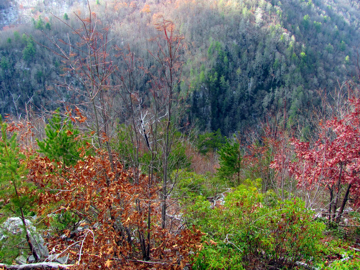
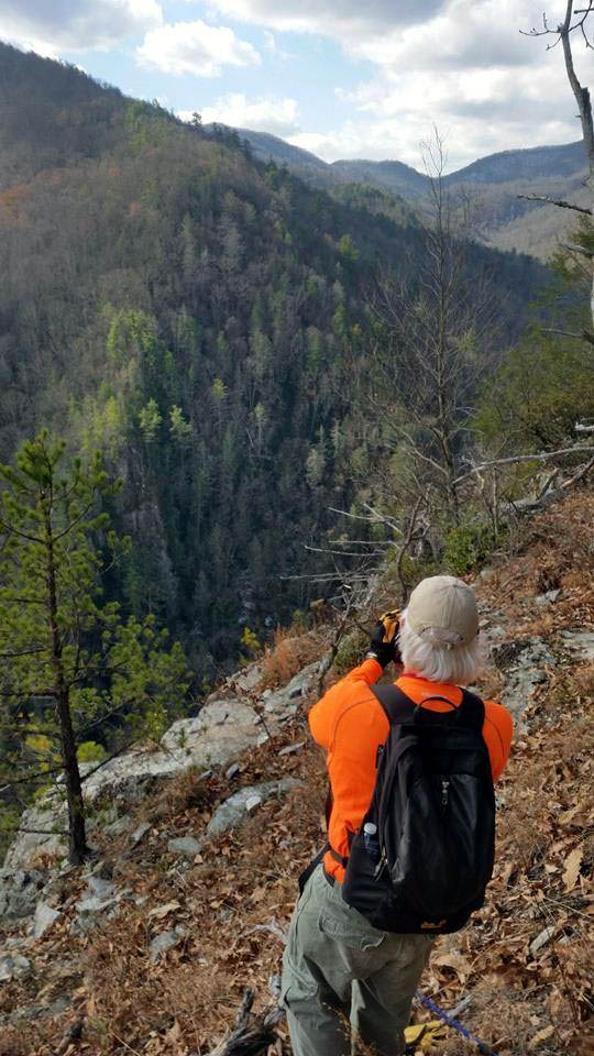
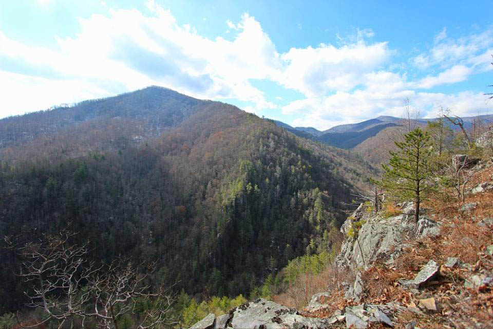
Not far up the road I would show my guests their first glimpse of Stonehenge which is basically only visible when the leaves are down and also the Flint Mountain Cliffs on the other side which face the cliffs on Whitehouse Mountain only lower yet, no less impressive. I am positive that at one time many eons ago they were both connected.

Peak of Flint Mountain Cliffs (shot over Jason`s head, or at least I thought it was ! )

Admiring the Flint Mtn. Cliffs (left to right: John Forbes, Jason Horton, Thomas Mabry)

Flint Mtn. Cliffs (Photo by Jason Horton)
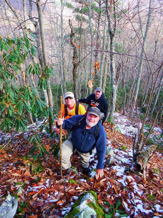
Leaving the road on the not so well known trail that leads to the gap behind Whitehouse Mountain we would begin the slow climb on the old forest road that snakes its way through the secret hollow there. It would not take long to reach the gap where I would discover some fresh mountain cat tracks on a log in the snow. After this first climb we would take a short break there before the next leg of the campaign.

Making our way up one of the steeper parts of the trail to the gap (photo by Jason Horton)

Snow covered road leading up to the gap

Rarely am I ever the first one to anything so I was lucky to get this shot of the crew climbing into the gap
When I first came to this gap a few years ago, there was not any trail from there to the boundary trail on the main ridge of Whitehouse Mountain but, rather it was just a faint trace of which way to go and ended up being a steep bushwhack straight up through the growth and laurels to reach the cut out and well marked forest service boundary trail. Now there is actually a detectable trail there since so many now know of this exclusive place and there are actually a few colored ribbons here and there to mark the way. I will never understand why people do this unless it is to help them find their way back perhaps ? As I can not imagine anyone wanting the masses to know about such places especially one as dangerous as this. Anyhow, we made short work of the steep and very slick, snow covered ascent up and over to the red blazed boundary trail as I huffed and puffed my way looking forward to a water and rest break at the survey markers.

Taking a rest while climbing the steep and slick, snow covered hill out of the gap to reach the boundary ridge trail high above (Photo by Jason Horton)

I am happy to be on the boundary ridge trail, in the sun and see it is not covered with much snow (Photo by Jason Horton)

RAT having some fun with the oddly marked trees along the boundary trail (Photo by John Forbes)
I was happy to see the sun had melted the snow off the incredibly steep ridge trail that leads up to the summit of Whitehouse Mountain. This is a crazy steep climb and there are a couple of false summits as you make your way towards the top. We took our time and soon started getting some visuals as you gain some serious elevation in a short distance.

Climbing the steep boundary trail (Photo by John Forbes)

Jason, Thomas, and RAT near one of the false summits along the boundary trail (Photo by John Forbes)
Almost to the top of the first false summit along the steep boundary ridge trail (Photo by John Forbes)
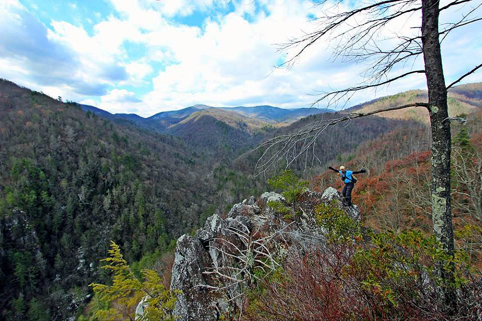
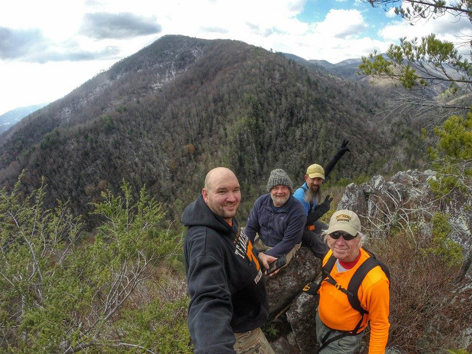
Before long we would all be standing on the small pyramid shaped summit of the mountain where jubilation would immediately fill the air. We took some time here to absorb the breathtaking views, take pics, make videos and get a group shot before leaving the summit down the opposite side which is required to reach the cliffs.

Group shot on the summit of Whitehouse Mountain (Photo by Jason`s Go Pro)

View of Rocky Fork from the summit (Photo by Jason Horton)

view of Rocky Fork from the boundary trail near the summit (Photo by John Forbes)

View from the summit of Whitehouse Mtn. Looking towards Flint Mountain (Photo by John Forbes)

Jason on the summit, anxious to start down to the cliffs behind him. This is looking straight at Flint Mountain

View of lower Rocky Fork from the summit. The low point in the distance is Flint Gap on the Appalachian Trail with Coldspring Mtn to the right of that.

View of upper Rocky Fork from the summit of Whitehouse mtn. Looking towards Coldspring Mtn (far left) , Buzzard Rock (center), and part of Wilson Knob (right)

View of Wilson Knob from the summit

View from the summit. Frozen Knob is just behind the big knob in the center. It is actually the highest point around here but from this angle it is hidden behind the knob. That is Higgins Ridge on the right

Looking towards the visitor center on I-26. You can see Temple Hill (far left) No Business Knob, Flattop Mtn, Spivey Gap, Little Bald, and the ridge leading up to almost Big Bald. (Photo by Jason Horton)

Here I am pointing out several of the things you can see from the summit (Photo by John Forbes)
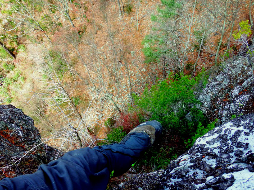
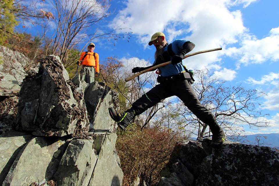
After taking some time to point out exactly what all you can see from the summit, we began the treacherous descent to the cliffs. There is no trail. It is just a matter of staying on the spine of the ridge and finding the path of least resistance through the scrub growth and briers, being very careful with each step as it is all rock and most of it is loose and gravely which can cause a twisted ankle or fall easily. Slowly and carefully I led the way down until we reached one of the cliffs above the main cliffs where I always stop to rest but, mainly take in the different views that location has to offer. It also allows everyone to regroup as the descent from there becomes more tricky and it is a good idea to stay together and close to the leader. I also pointed out where I got my first glimpse of the ‘Shrine Rock’ or ‘Dragon`s Tooth’ as I sometimes call it.

Looking back at the summit as we begin the descent
Looking down the spine of the ridge which is the route down to the cliffs

Jason went down before us to get some pics of us on the summit as we began our descent (Photo by Jason Horton)

Leaving the summit,, time to go DOWN,,,, (Photo by Jason Horton)

Making our way down the steep ridge line (Photo by Jason Horton ? )

Jason Horton somewhere along the descent route. Just look at that view of Rocky Fork behind him !

Looking back towards the summit during the first part of the descent. (Photo by John Forbes?)

Thomas ‘The Badger’ Mabry keeping his ankles in check while descending the loose, rocky ridge (Photo by John Forbes)

I was able to capture this rare Appalachian Mountain Honey Badger lurking in the habitat on the steep slope of Whitehouse Mountain

If you look closely you can make out a Sasquatch hiding behind that old burned out tree. We did not dare tease him with any slim jims or beef jerky.

Me and the Honey Badger taking some pics while we rest on the way down the ridge to the cliffs

I made it down to the smaller cliff which is just above the main cliff tops so we could take a good break there as it is an awesome spot and also to get the group together for the final descent down to the main cliffs. (Photo by John Forbes)

Coming out on the ‘resting cliff’ which is a killer place to hang out and get some visuals and prepare for the final descent

View from the resting cliff looking down towards the main cliff tops. See if you can find the ‘Shrine Rock aka Dragon`s Tooth’.

A very happy John Forbes monkeying around in a tree at the edge of the resting cliff

John and Thomas posing on the long spine that juts out from the resting cliff (Photo by Jason Horton)

John on the tip of the long finger that sticks out from the resting cliffs, with amazing views of Rocky Fork behind him.

Small part of the resting cliff as we make our way down it (Photo by John Forbes?)

STEEP descent from the resting cliff. You must be VERY careful here between the resting cliff and the top of the main cliffs !
It was becoming windy at this point being exposed on the steep and barren ridge making our way down the cliffs to obtain our front row seats on the edge but, this did not stop John from climbing a tree like a monkey after a banana which offered a perfect photo op before we continued down the last stretch of rocks that would lead us right to the brink of the vertical part of these prominent rock towers. Having seen the Dragons Tooth, Jason could not wait and passed us all up in haste to get to it. It was a jaw dropping experience for he and John as they climbed around on the cliff edges like kids on a new playground. I was pleasantly impressed with Jason`s ability to overcome his fear of heights on this day. He would need that for what was to come.

Approaching the edge of the main cliffs

Nearing the cliff tops. Heading out towards the way down to the Shrine Rock.

Jason Has found the Shrine Rock aka Dragon`s Tooth

Jason makes his way down to the Dragon`s Tooth (Shrine Rock)

The Shrine Rock aka Dragon`s Tooth that sits on the vertical edge of the cliffs

A happy Jason sits atop the Dragon`s Tooth with Thomas the honey badger below perched precariously on the edge of the edge

Thomas chills out on the Shrine Rock as he rests his back against the Dragon`s Tooth

Jason straddles the Dragon`s Tooth. Can you tell that it is windy ? (notice his beard)

Looking back up towards the resting cliffs

Some of the amazing Tree Ents that reside on the steep slope near the cliff tops

Looking back the way we had came down

The far right side cliff that sits by itself. This is separated from the main cliffs by a large crack as it is a narrow spine of rock that is the same height of the main cliffs but is unique with a shape all its own. It is vertical on 3 sides and the Monkeyhead Rock is on the front side looking out over the valley
John was especially taken with the separate cliff that is located on the far right side of Stonehenge that lies across a huge vertical crack which has isolated this narrow spine of rock to itself. It is connected at the back but even there is a sizable crack that one must jump over to obtain access to this imposing rock formation. Even then it is not level rather, is slanted up steeply which is fine for the jump over. It is the coming back that is harder. Of course this was instantly something that John just had to do and is something that I am sure that no other being (aside from birds) has ever done before. Bol’Dar and I had contemplated it many times but, never took the time to do so as we tend to stay on the safe side and use a rope. John made it look easy as usual and soon was straddling the top of the narrow rock like a cowboy breaking a wild stallion.

John: “Hey, what`s that big spiny cliff over there ? Reckon I can climb that ? “

Closer view of the spine rock cliff across the crack

John makes a beeline for the spine cliff

Carefully making his way down to the spine cliff

Examining the crack he must cross to access the spine cliff. This is not as deep but it is much larger than it appears plus take notice that it is not at all flat on either side but instead is steeply slanted

The approach is so steep that he must turn backwards and lower himself down to the edge while holding on to small pine trees. Keep in mind the return trip will not afford that luxury.

Testing the waters. This ended up not being an option as he would end up jumping with both feet across the void.

Re-assessing.

Crossing the crack

After successfully crossing the void to reach the cliff, he now finds himself on a much steeper rock than this picture displays

A very happy John Forbes. I think this was the highlight of this hike for him !

John atop the spine cliff. I think this is the best picture I took on this entire adventure. This shows just how steep and narrow this cliff really is. It is hundreds of feet vertical on each side so falling is not an option.

John looks off the far side. it is a long way down !

Riding longer than 8 seconds on the spine cliff.

Jason sits on the edge of the adjacent cliff across ‘the crack’ looking over to John who is standing on the high point of the spine cliff

Here you can see the might crack between the main cliffs and the spine cliff

John takes in the views as he straddles the spine cliff
John`s view off his left side of the spine rock cliff while straddling its peak. You can see the start of the steep boulder garden that lines the left side of the cliffs. (Photo by John Forbes)

Now, how do I get off this thing ?

Look mom ! No hands !! (If you knew how windy it was at this time, you would know how dangerous this stunt was)
John carefully balanced on the narrow top of the spine rock cliff (Photo by Jason Horton)

Great shot of the view from the main cliffs (Photo by Jason Horton?)

The monkeyhead rock sits on the front part of the spine cliff. John is above, on tip top of this cliff.

Close up if the monkeyhead rock
We spent a considerable amount of time on the cliffs edges since the total distance of the hike is short and there would be plenty of time to go slow (for safety reasons) and take it all in. Jason faced his fears and between the previous Flat Creek Falls honey badger adventure and this Stonehenge quest, is now no longer as scared of heights. We took turns sitting on ‘the rock’ that is the leading edge of the cliff, and the ‘Shrine Rock’ getting pics as best we could in the bright sun before we all stepped back to a level place just above it all to have a celebratory drink to commemorate Johns special #100 day. This would be some of my mountain elixir, a form of ‘spring water’ of the highest proof carried within an Aquafina bottle that we would pass around until it was gone. This would also serve a dual purpose to calm any remaining nerves that might cause issues when we would be climbing down the cliffs and across the base.

Johns view of us from the spine rock cliff looking across ‘the crack’ (Photo by John Forbes)

Another angle of Johns view from the spine rock cliff (Photo by John Forbes)

John`s view of Jason sitting on the edge of the main cliff as seen from atop the spine rock cliff (Photo by John Forbes)

Close up of the crack (photo by John Forbes?)

View looking over top of the spine rock cliff (Photo by John Forbes)

Cool shot of the monkey head rock (Photo by Jason Horton ?)
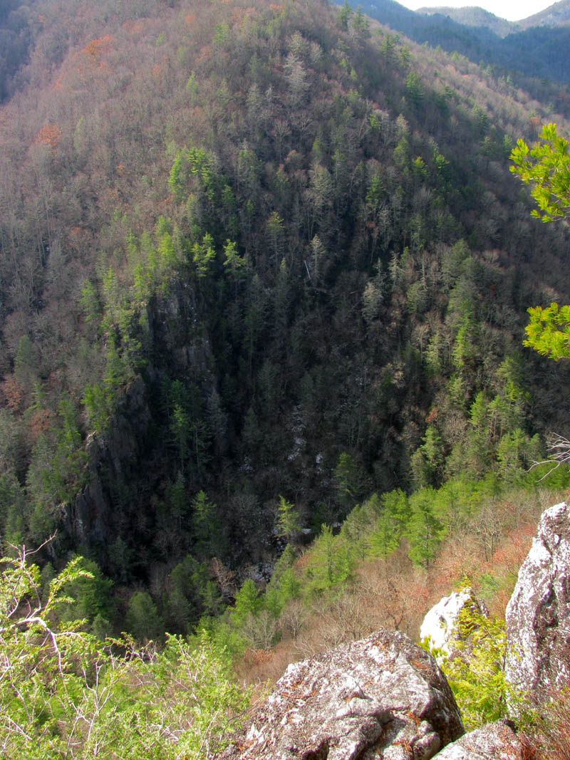
Looking across at the Flint Mtn Cliffs from the edge of the cliffs

A man and his rock (Photo by Jason Horton)

Hanging out on the Shrine Rock (I am leaned against the Dragon`s Tooth rock) (Photo by Jason Horton)

Jason trying his best to make the Shrine Rock look smaller (Photo by John Forbes)

Jason sitting on the edge of the main cliff just below the shrine rock (Photo by John Forbes)

RAT telling some kinda story while only inches from death on the cliffs edge with John Forbes ! (Photo by Jason Horton)

View from the main cliff top looking away from Rocky Fork towards I-26, that is Little Bald and Big Bald and the profile of the AT from left to right (photo by John or Jason , sorry I dont know which !)
Group shot on top of the main cliffs (on top the shrine rock) (taken with Jason`s Go Pro)

Thomas the Honey Badger sitting on the cliffs edge below the Dragon`s Tooth rock (Photo by John Forbes)

Honey Badger relaxing on the Shrine Rock
John crossing the large crack from the Shrine Rock back to safer ground. I am not sure how someone with legs as short as mine can accomplish this ! (Photo by Jason Horton)

Since I am too fat to fly through the air like John, this is how I crossed the crack from the Shrine Rock to safer ground ! (Photo by John Forbes)
After the celebration there at the cliffs edge, I pointed to a low overhanging rock and asked Jason if he thought he could go under that, and to my surprise he was tall enough to step around it ! This would land him on a narrow ledge at the base of a cliff above us and only a few feet of very slanted loose soil between us and the edge of the vertical drop of the main cliffs. I would take the lead from there to get everyone safely across the cliff tops to the next vantage point where I would get to first in order to take pictures of the rest of the group as they followed suit.

Making my way across the cliff tops to the next cool vantage point while the rest of the crew waited for the photo op (Photo by John Forbes)

Me standing on the edge (Photo by Jason Horton) That is Big Bald in the distance.

RAT living life on the edge of Whitehouse Cliffs (Photo by John Forbes)

The crew huddling close to the upper side of the cliffs after just leaving the shrine rock area which is around the corner behind them

Now you can see why they are huddling so close to that rock ! The Cardinal head Rock (or woodpecker as I sometimes refer to it) now comes into view

A view over Johns head of me making my way out across the cliff tops to the next vantage point (Photo by Jason Horton)

John and I standing on the top of the cliff looking back across to where we had been before. It puts it in better perspective of just how high these cliffs are from this vantage point (Photo by Jason Horton) (The last couple times I was here there were red straps tied to this tree that were obviously being used for rappelling. They are gone now)
The Honey Badger getting a shot of the Flint Mtn Cliffs across the way (Photo by Jason Horton)
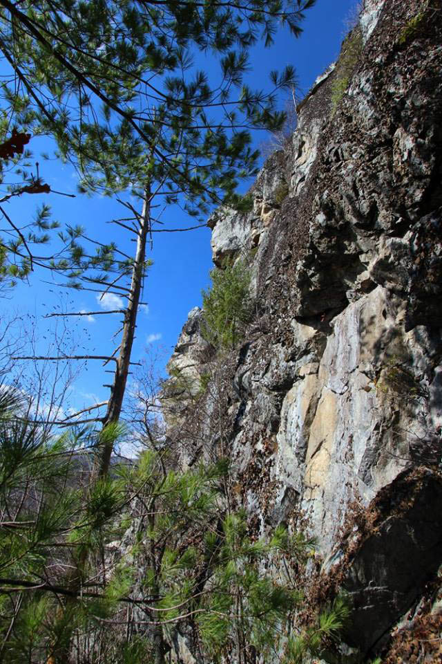
Looking off this part of the cliffs is just as extraordinary if not more so than the other part as it adds the view across the top and part of the sides of the vertical rock which also includes a part of the cliffs that I call the ‘Cardinal Head’ rock or ‘Woodpecker’ rock. This triangular shaped rock has much air under it, actually three times over as you soon see when you stand beneath it. It is awe-inspiring to say the least.

View across the cliff tops across the valley towards the Flint Mtn Cliffs. The Cardinal Head Rock is prominent (Photo by Jason Horton)

Looking across the cliff tops (Photo by Jason Horton)
The view never gets old here. And Flint Mtn is larger than you think ! (Photo by Jason Horton)

Awesome picture of our view from the cliff tops. Correct me if I`m wrong but, I think this one was shot by Thomas Mabry ?

View of the Rocky Fork Valley across the cliff tops

From this vantage point you can get a clear view looking out the lower Rocky Fork Valley with an unobstructed view of Big Bald and Little Bald in the distance

We took some time to hang out here and enjoy the awesomeness of it all (Photo by John Forbes)

RAT pointing out the way while we celebrate with the high test Aquafina (Photo by John Forbes)

Apparently I was telling some kind of a story (Photo by John Forbes)

Apparently it was a funny story ! Of course we were still under the effects of the premium grade Aquafina at this point. A good time was had by all. (Photo by John Forbes)
From there one has to climb back up some to avoid sharp drop offs that lie ahead which enables getting to the other side of the cliffs where an immense boulder garden flows like a river of talus down the edge of the cliffs almost all the way to the road below. Going down this is not easy as the rubble comes in all sizes and shapes. Some is loose and one must pick his footing very carefully. There is also always the fact that you can send a large stone plummeting down onto someone below you so much care must be taken when choosing the routes down this. No one had any issues in doing so and we soon found the landmark I use that identifies the strategic place where the base of the cliffs can be reached.

Why can`t we go this way ?? (getting ready to step out onto the steep river of rock)

Looking up at the rock river we are going down (Photo by Jason Horton)

Making our way down the steep river of rocks that border the side of the cliffs

Carefully negotiating the super steep slope of loose rocks. Trying to imagine that at one time all of this was attached to the cliffs high above us. (Photo by John Forbes)

The camera can not do justice tot he steepness of this rocky slope. We call this Hillbilly Rock Surfing

Jason surfs his way across the rock river to get back to the cliffs once we get near the exit to the base

Jason doing the Hillbilly Rock Surf (Photo by John Forbes)

Finding the right spot to leave the loose rocks at in order to be able to reach the base of the cliffs (Photo by John Forbes)
From there I chose a route slightly too high as I did on my last trip here which ended us up on our hands and knees climbing over a large knoll covered in laurels and briers and a steep drop back down to the correct plane that leads over below the ‘Cardinal Rock’ and the Dragon`s Tooth’ and eventually to ‘The Crack’. If you choose too low you will be below some ledges that are too steep to climb back up so this is really the only alternative. As soon as John caught sight of the crack he took off like a pebble from a slingshot and was soon standing under it looking up in amazement. Shortly afterwards he contorted his body into a crab-like state and climbed some twenty or more feet straight up ‘the crack‘.

Finding the only safe route to the base of the cliffs

There is NO level ground beneath the cliffs. This tiny ledge is the only way to get there safely and there are some ups and downs to get around some obstacles

Jason making his way across the base of the cliffs about to enter one of the only real overgrown spots (Photo by John Forbes)

Thomas carefully making his way along the base of the cliffs (Photo by John Forbes)

Thomas the Honey Badger making his way over the steeply inclined ledge to get to the overgrown spot (Photo by Jason Horton ?)

Jason coming through the overgrown spot on the narrow ledge (Photo by John Forbes)
The view Jason is getting (photo by Jason Horton)

Jason looking up from there,,, (Photo by Jason Horton)

Jason and I standing under the cliffs about halfway across (Photo by John Forbes)

making our way along the base of the cliff. You can see we are almost under the cardinal head rock

Looking up at the cardinal head rock,, only a small section of these mighty cliffs

I can see the burnt tree that stands in front of the crack

My first shot of the Indian Chief rock

Almost directly under the cardinal head rock. This one has triple air under it !

Looking up at the cliffs is amazing

View across the base of the cliffs (Photo by Jason Horton)

Continuing across the base of the cliffs. (Photo by Jason Horton)

Excitement builds,,,,, (Photo by Jason Horton)

Standing beneath the cardinal head rock part of the cliffs (Photo by Jason Horton)

Getting closer to the crack and the Indian Chief (Photo by John Forbes)

Group shot courtesy of Jason`s Go Pro !

Sasquatch trying to find some level ground at the base of the cliffs. It is a rare commodity there

John sees the crack and literally starts running towards it !

John staring up into the crack wondering how he is going to climb it

A very happy John Forbes about to climb the crack thinking, “Can this day get any better ? “

The Honey Badger making a beeline for the crack (Photo by John Forbes ?)
The upper part of ‘the crack’ is several feet wide as it separates the one narrow spine cliff from the main cliffs, but down at the base of the cliff it becomes very narrow and actually touches. It is really invigorating to stand in it after having stood above it trying to look down into it which requires hanging over the edge of ‘the rock’ on top above it, or being on the narrow spine cliff where John had ventured out on. It is all quite amazing to any that have seen it.

Thomas standing in the crack

The Badger badgering

The man of the day, John Forbes standing at the entrance to the crack with the Indian Chief Rock behind him

And so the climbing of the crack begins

John gets higher on crack

John on crack

Jason stands at the foot of the crack giving some scale to John`s high perch above

Now, How do I get down from here ?

This root grows over and down beside a rock at the foot of the crack. It looks just like the stone.

My view looking back the way we had came. I am standing beside the burned tree directly in front of the crack. To see exactly where this spot is please click HERE !

John in ‘the crack’ (Photo by Jason Horton)

Group shot of us in ‘the crack’ (Photo by Jason Horton)
We spent some time here getting pics from this unique spot also taking a nice group shot when I happen to see some movement below us. I was surprised to see two guys climbing up towards us from below. I never expected to run into any other humans at the base of the cliffs as I was sure no one goes there but, these guys just happen to be rock climbers and had somehow heard of the cliffs and had been climbing on them. If my memory serves correct, it was Ronnie and Nate ? It was Ronnie who looked up and pointed out a new looking carabiner that he explained was drilled and mounted permanently way above our heads. I was impressed with his good eye and knowledge of such things.

This is one of the best shots I have seen of the left side of the cliffs (Photo by Jason Horton)

Close up of the Indian Chief`s face – you can see the leaves blowing up the cliff from the up-drafting wind that was blowing hard all day long – (Photo by Jason Horton)

After hearing what I thought were voices, I looked down to see these two guys climbing up from below. That was a first for me. They claimed to be climbers and said they had climbed these cliffs before. They had dropped two large packs allegedly full of climbing gear just around the corner from us that we did see when we left this spot before they got tot hem and went down to the road before us.

Chatting with the two guys who came up from the bottom, Ronnie and Nate ? (Photo by John Forbes)

Talking to the climbers (Photo by Jason Horton)
The only bad thing that happened on this trip was while we were at the crack. It seems I laid my hiking stick down in the wrong place and a Bigfoot stepped on it and broke it. It was my fault as it is just an old piece of wood that my friend Bol’Dar found on my AT trail section and gave to me to replace the previous one he had given me that broke after many years of faithful use and I laid it on the ground too close to where we were standing. I will miss it but I will see it again one day as I pieced it back together and stuck it in the ground propped against the burned black tree at the crack.

Sad RAT with a broken hiking stick (Photo by Bigfoot)
Can we have another angle on that camera guys ?

Sad RAT and his broken hiking stick beside the burned tree. (Photo by John Forbes)
OK, just one more in memorial of my deceased stick:

RIP hiking stick (Photo by Jason Horton aka Bigfoot)
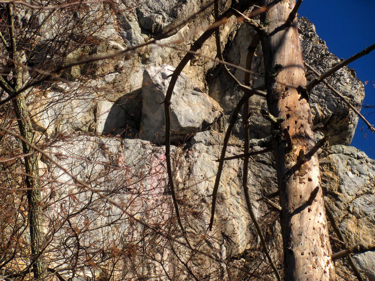
We would hang out a bit longer at ‘the crack’ before dropping down a click which is needed to continue along the base to reach the opposite side of the cliffs. I wanted to show everyone the other side of the spine cliff and the ledge near its top where a huge triangle shaped rock sits loosely on that ledge. Once we reached the opposite side I also pointed out the pink looking rock that is streaked within the cliff just below this fascinating triangle rock and it was about that time the climbers caught back up to us and their large packs they had dropped earlier, and Ronnie explained that he thought the pink rock was feldspar. He is most likely correct and I had wondered for a long time now exactly what that was.
Making our way on a lower route to get to the other side of the cliffs (Photo by John Forbes)

Getting below the crack so we can progress to the other side of the cliffs

Making our way under the spine rock cliff

Going around the far side of the cliffs.

Standing on the other side of the cliffs. As I mentioned before there is a steep bed of boulders on both sides of the cliffs. Here we have reached the one on this side. That is the spine rock cliff we are now on the far side of. It looks much fatter at the bottom and you can not see the monkeyhead rock that sits atop it nor can you see way farther up where it narrows to form the spine where John was sitting earlier on this day.

Looking up at the base of the spine rock cliff as we make our way under it (Photo by Jason Horton)
If you look closely you can see the huge triangle shaped rock that is sitting on a ledge high on the base of the spine rock cliff above us as seen in these pictures:

Standing at the base of the spine rock cliff looking up at the interesting ledge where the triangle rock sits. Under that rock is the pink colored feldspar veins.

Looking up at the strange triangle rock on the ledge of the spine rock cliff from the base (Photo by Jason Horton)
Closeup of the triangle rock and pink color below it

zoomed shot of the triangle rock and pink below it
Just so you have a better reference as to where this rock is located in relation to what you have already seen in this blog, I will share a few shots I took from a different location that reveals this odd rock formation a little better:

You can see the rock sitting on the narrow ledge of the spine rock cliff which is the one on the far left hand side of the cliffs. It does not look triangular as this is looking straight on it and that side is turned and can only be seen from the left side of the cliffs

Zoomed shot of the rock on the ledge. The pink is starting to show as well. You can also see trees growing in the upper realm of the crack as it gets wider and a closer view of the cardinal head rock with the triple air beneath it !

Zooming in closer on the rock. As I said you can not see the triangle side as it is facing left where the shadow is but the pink feldspar ? is showing up good in this one !
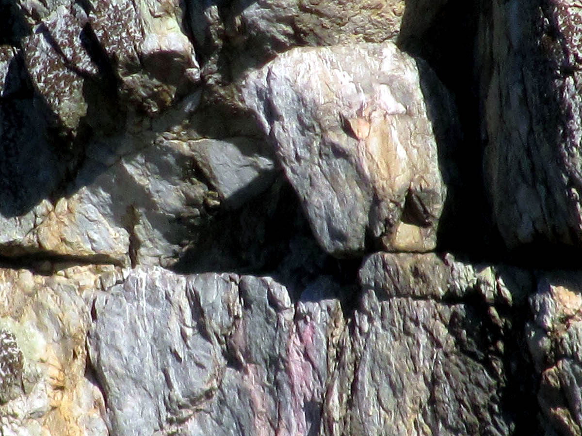
This is my max zoom capability. Blurry but I was after the pink rock.
On this side of the cliffs there is another river of boulders, a talus field of sorts that we would use to descend down to the road below. (If you could see the ‘big picture‘ you would see there is small talus vein on each side of the cliffs.) I had done this once before on a previous trip here by myself when I had to retrieve a jacket I left behind on a trip a week before that however, I veered more back to the left to avoid the tall rocky cliffs that drop off right at the road. On this trip we would go straight down which indeed did bring us out right on top of the highest one ! Luckily I found a hidden ninja trail of sorts that led us over and around the edge to a more suitable place to get down yet, it did require a steep ‘slide for life’ that worked out well for all but one of us. I was down first and had plans of photographing the others but, when Jason came down he got ahead of his feet and ended up doing a cartwheel of sorts landing flat of his back in the road. It happened so fast and I was so surprised by it all that I stood there and was unable to even click the shutter button ! According to the Badger`s gps app, he clocked an impressive speed during his slide, a badger record for now. John being short like me had no chance of outrunning his feet and came out unscathed.

One last look at the cliffs before the descent down tot he road (Photo by Jason Horton)

Saying goodbye to the Whitehouse Mountain Cliffs, aka Stonehenge, aka the Mount Rushmore of the East

The river of rocks that would be part of our way down. it is a lot farther down than it appears. It is a long way tot he valley floor below (Photo by Jason Horton)

Another angle of the rocky way down (Photo by John Forbes)
The climbers had donned their packs and were making haste off the mountain most likely to make sure they would not get hit by any rocks we may dislodge on our way down

Looking back at the cliffs as we slowly make our descent (Photo by John Forbes)

A good view looking back, you can see the spine cliff rock with the crack between it and the main cliffs (Photo by Jason Horton)

Looking back as it is a place you just hate to leave

Taking a break on the way down. This shows some of the diverse terrain encountered on the way down. One thing in common is that it is all STEEP ! (photo by Jason Horton)

Hanging out on some large boulders on the way down (Photo by John Forbes)

I am not sure what is going on here but it does show more of the crazy rugged terrain on the way down

Can you say steep boys and girls ? This is about where I saw a bear on a previous trip.

Lots of rocky barriers to work around on this descent

Taking a break at one of the many huge burls in this area (Photo by John Forbes)

More of the extreme terrain along the descent

There are many of these hidden cliffs found on the way down as you get closer to the road. You must be VERY careful to not walk right off of them.

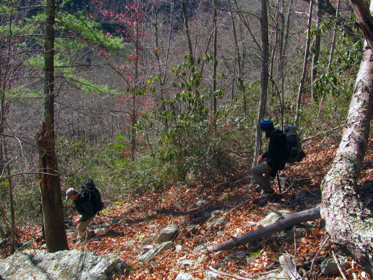
After getting around a large cliff, we had to negotiate down through this growth on a very steep bank. I was the first down to the road after a long slide for life. If you look close you can see the rest of the crew as they make their way down,,,

Looking back at the crew after my slide to the road
Once I found a route down the highest cliffs that border the road, it required a slide for life type of exit. This next series of pics shows the results:

First up, Jason,,,

Gaining momentum quickly,,,

Top view of Jason`s slide from the ‘live action’ cam (Photo by John Forbes)

Jason , crash and burn ! (Photo by John Forbes)

Jason lying flat in the road,,, (Photo by John Forbes)

Finally I was able to push the shutter button. Jason is unscathed.

Next up, John Forbes,,,,,

John ended in a running position and it was over as soon as it had began

And for our final contender, Thomas, the Honey Badger,,,

Decides to use the butt method,,,

Reaching top speed,,

Crossed the finish line with perfect form !
From there is was just a matter of walking the road back to the vehicle stopping only to admire the creek, the Flint Mountain Cliffs, and the triple falls of course. It had been an incredible adventurous day of ‘epicity’ that would take several days if not weeks/months/years for the adrenaline levels of intense excitement to diminish back to normal levels. We would be talking about this hike for some time to come.

Just below the cliffs there are triangular shaped rocks like seen on the cliffs. I have noticed many of them in this area. It must have something to do with the type of rock it is and how it breaks into that shape,,,This one is in the Rocky Fork creek right near where we came out below the cliffs

Close up of the triangle shaped rock

There is another one, once you start looking you see them here a lot,, I have looked in many other areas and do not see this,, something to make ya go Hmmmmm,,,,,
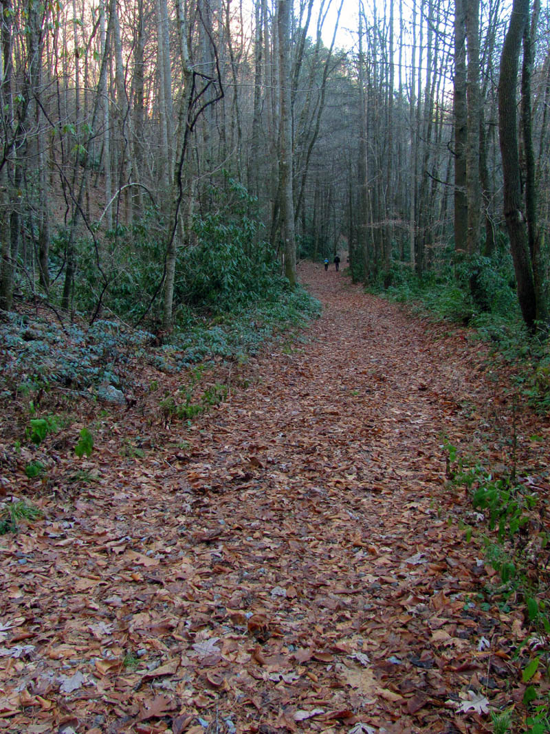
Walking out the old road in the lower Rocky Fork valley. That is Jason and John in the distance.

Thomas and myself walking out the final stretch of the old road in Rocky Fork (Photo by Jason Horton)

Rocky Fork Creek

Triple Falls on Rocky Fork

Nothing like ending the day with a waterfall. Triple Falls on Rocky Fork Creek
Once back at the vehicles, we said our goodbyes to the Honey Badger as he had to get back home and could not go with the rest of us to the post hike grub out which would be held at Clarence’s in Unicoi which has some excellent food. We were all still vibrating with excitement and it was apparent that John was extremely pleased with the trek I had planned out for his one hundredth day in the mountains for 2014. I was equally as pleased to know that I was able to accomplish this task. You are welcome John !

Waiting on our food at Clarence`s, obviously discussing how awesome the day had been (Photo by Jason Horton)
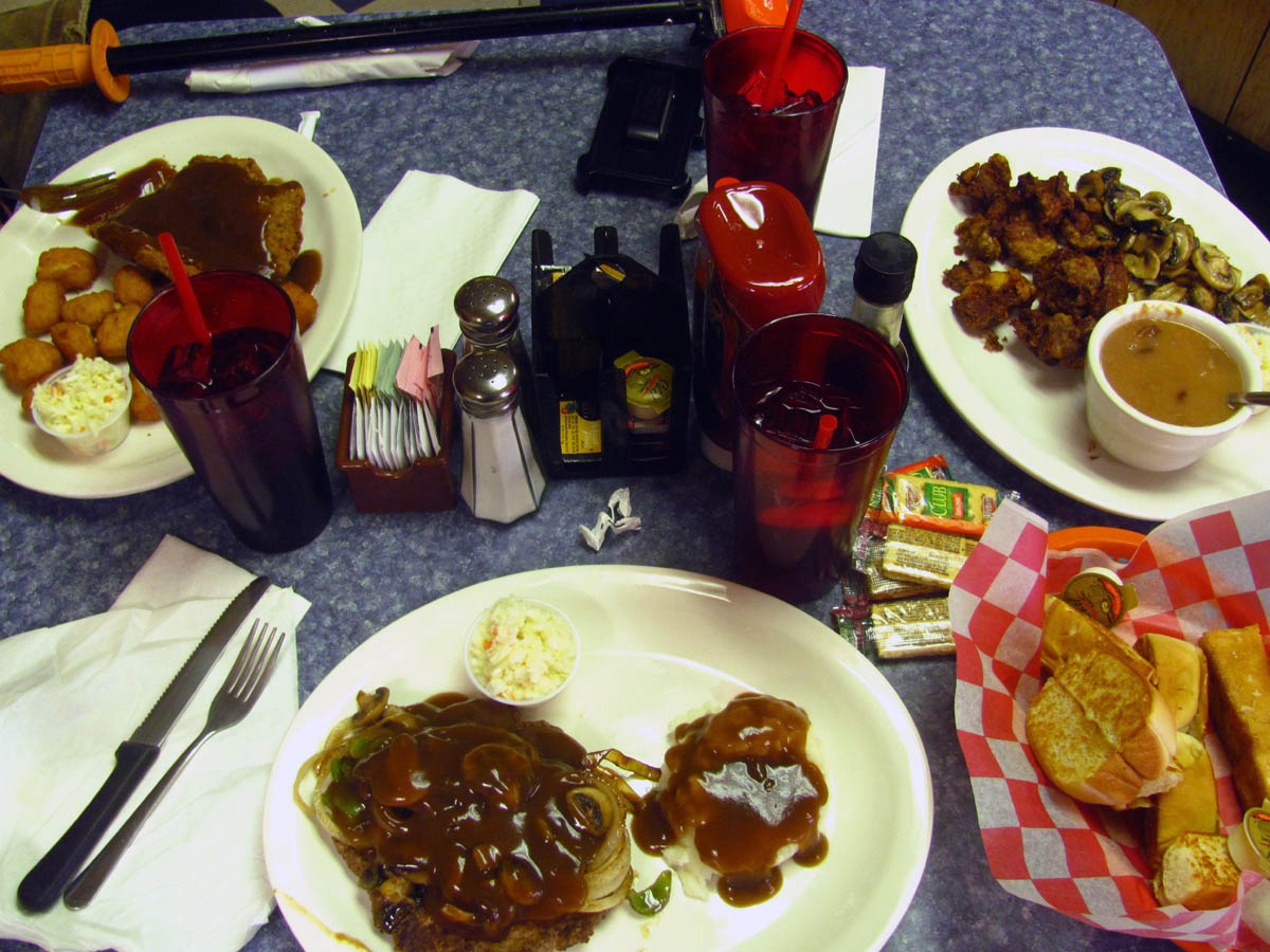
Post hike grub = John got his usual chicken livers, I got steak smothered with onions, peppers and gravy (sorry I ate a salad before I thought of taking a pic) and Jason got country fried steak. Yum Yum !

Mine was so good I had to take a close up of it !

 My name is 'RAT' and I love the mountains and waterfalls of the East TN. area where I live and I hope you enjoy this blog about my outdoor adventures.


Leave a Comment