


Whitehouse Mtn. / Cliffs (Stonehenge) – 12-31-2011
It was predicted to be a beautiful December day with warm temps so my friend Bol’Dar and I decided we would go back to the cliffs on Whitehouse Mountain that we call ‘Stonehenge’. This time we would be accompanied by Joe Parrot, an old friend whom we had not heard from in at least 15 years. If you read my blog from 12-3-2011, you will recall that we had actually thought of Joe while climbing the Middle Spring Ridge Trail, wondering what had happened to him. Low and behold he showed up at the Rat`s Hole several days later ! We all met at Hairnt-quarters around 9 am and after stopping for coffee we started our adventure at the trail-head in Rocky Fork by 10 am. The sun was starting to rise above the ridges as we made our way up the old road beside Rocky Fork Creek that had very impressive water levels which made the cascades very enjoyable to see and photograph. We noticed some recent bulldozer work and patches of new gravel along the road and someone had a truck and small trailer parked inside the gate. We later heard a four wheeler making several trips back and forth through the valley and by the time we made it to the summit we heard a rifle shot. It was assumed that someone with a key to the gate was hunting on the last day of deer season. After checking out the cascades I pointed out the place where I had been wanting to venture up the hill at, that I had calculated would be the best place to reach the bottom of the Stonehenge Cliffs. At that time Bol’Dar just shook his head as if to say “Well you COULD get there that way, but you`d have to dig way down’ !
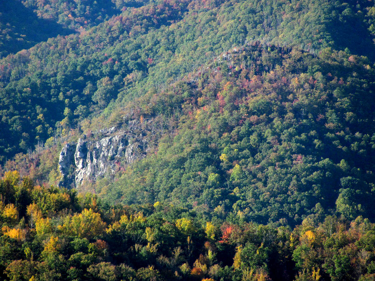
Whitehouse Mountain and Cliffs aka 'Stonehenge'
Bol’Dar knew of my desire to be at the base of the cliffs and I was already talking about finding a way down from the top because I felt that it was possible. It did not take long to reach the turn off to the seclusive valley that leads up to the gap below Whitehouse Mountain and I could see some new ribbons had been hung there along with some fresh tracks. I had to wonder if my last blogs on this area had been attracting more people to hike there. Although I do promote hiking and enjoying Nature and the outdoors, it can be a bad thing to attract the wrong kind of people as there are those that do not have the right appreciation for it that will not respect it and end up trashing it. There is also another important factor to consider which is the fact that we do pursue some places that can be very dangerous for those who are not experienced enough to do so. This is one of those places as one slip or wrong step on the cliffs could be your last.

Cascades on Rocky Fork Creek

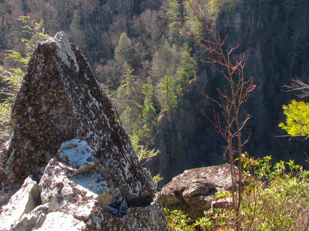
Cool looking rock on a rock
It was turning out to be a beautiful morning just perfect for hiking although I was already worried about the bright sunshine washing out the quality of the pics I was planning to take but, the sky was a brilliant postcard blue with white fluffy clouds which would make an excellent backdrop for the shots taken from the summit. It did not take long to reach the gap and we did pass a few more of the new striped ribbons someone had placed there and I could see new orange ones leading out of the gap straight up the hill towards the boundary trail that runs the crest of the ridge that leads up the backside of Whitehouse Mountain above. It was apparent that someone had been marking the way which spiked my curiosity. We took a water and snack break at the gap before beginning the steep climb up through the trail-less laurels towards the boundary trail however we did not follow the orange tape as we always traverse the hill instead, creating some switchbacks to make it not such a hard climb and come out at a lower point on the ridge trail. After this the going would still be steep but it is easier since there is an actual trail to the summit. It was good to see the red paint and boundary signs.

Nearing the top of the steep, narrow ridge on the boundary trail

Steep, narrow ridge of the boundary trail
The ridge becomes very steep and narrow as you ascend higher and it is rockier near the top. There are a few tricky spots where one must maneuver around some blow-downs and rough spots but it does not take long to reach the summit. The top is rather small as it is actually a point like the top of a cone with super steep sides all around. I was very surprised to see this strange alien object protruding out of the top of the mountain, sticking up into the air all covered in bright pink and orange ribbons. It was some sort of survey tool that was staked down in the ground with a threaded brass thing on the top of it. I am unsure why it was left there but I later learned that another 1200 acres of Rocky Fork had been purchased so perhaps this was part of surveying that parcel ? We took a break there for a while to take in the incredible 360 degree views and to catch our breath after the steep nonstop climb to get there. I could tell that Joe was very impressed with the views and was glad he came along,,,,at least until we pointed down the hill and informed him we were going down there !

View of Erwin looking back from near the summit

Strange survey pole found on the summit of Whitehouse Mountain
I took several photo`s while resting on the tip top as the views were spectacular. It was so clear we could even see the ‘Buzzard Roost‘ overlook at the far end of the Rocky Fork Valley that sits at the top of the Middle Spring Ridge Trail that comes up the backside from Horse Creek. (See Zoom Shot) I had been wanting to go back there for some time now and I am sure that trip is making its way towards the top of ‘the list’. While we were standing on the summit taking in the ‘big picture’, we heard a loud rifle shot from near the head of the lower valley in the direction of Flint Gap. It was not long before we heard the four wheeler going back and forth way down below. It is amazing how much you can hear from up there especially the loud roaring of the creek. Before long, we donned our packs and began the tedious descent down the steep, rocky ridge towards the cliffs.

View towards Coldsrping Mountain from the survey pole
I will attempt to show you the panoramic view from the summit:

View towards No Business Knob and Flattop Mountains

View towards Flattop Mtn. and Spivey Gap (center) with Little Bald Mtn. (right)

(left to right) High Rocks, Whistling Gap, Little Bald, Big Bald

Big Bald (top left) to Sam's Gap (top right) (sun killed pic, sorry)

Flint Mountain and Flint Gap (right)

View over the Rocky Fork Valley of Flint Gap and Coldspring Mountain

Better view of the Rocky Fork Valley towards Coldspring Mountain

View towards Big Butte (left) and Wilson Knob (right)

View of Wilson Knob and Frozen Knob

Wilson Knob, Frozen Knob and Higgins Ridge (left to right)
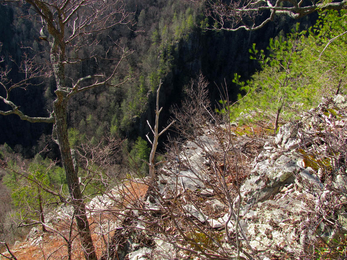
After several minutes of finding the path of least resistance down the steep, rocky scramble, we eventually came to the first level spot where a large rock ledge is located that one must carefully get around and down to continue to the larger cliffs below. There are some gnarly trees in this area and a small spot where a patch of sphagnum moss grows that is very pleasant to see however I was disappointed to see a cigarette butt and an empty Sprite can laying right on it. My sadness soon turned to anger and I had to wonder if my publicizing this area was responsible for that person being there. This was another place to take a rest break as one does not want to get hasty from this point on. You can almost see the tops of the cliffs below from this point and the ridge continues to narrow down to a point with steeper drop offs and cliffs on each side. I pointed out the odd rock formation I call the ‘Dragon’s Tooth‘ that sits on the sheer edge of ‘Stonehenge’ that can be seen from this point. It is a ‘shrine-like‘ oddity that has really peaked my interest since I first laid eyes on it and I have a spiritual-like experience every time I visit it. I was starting to see some concern in Joe`s eyes as he gazed at the steep rock drop offs below us.

Looking over the edge towards the cliffs,,,yep, we're going down that ! (If the Earth was flat, this is what the edge would look like)

Looking back towards the summit as we begin our descent down the incredibly steep ridge towards the cliffs

Looking towards the cliffs from one of the large rock ledges
Lucky for him we have already found the safest and basically only route to get down these sheer rock cliffs making our way back and forth from one level to the next until eventually you are standing before the edge looking down in awe. We consider this a very special place and despite the treacherous terrain it does have some very old Ents who seem to be the guardians over it. We spent a lot of time here but this time Bol’Dar did not venture out over the crack to the rock that sits on the very edge below the ‘Dragon`s Tooth’ as he claims he felt it move the last time he sat upon it. I decided to climb out on it anyway as I feel more connected to the mountain from there and also get some good pics from that vantage point. Bol’Dar instead ventured out on the right side to get some views of the one cliff there that is isolated from the others with the cool looking white monkey head at the top of it. I then mentioned that I wanted to explore the ledges to the left to get some side views of the cliffs and to see if there was possibly a way to reach the wooded ridge that lies out beyond the cliffs in that direction as I felt that would be the only possible way down. I had seen a small ledge that went under an overhanging rock that I said I was going to check out next so, Bol’Dar went out there while I was taking pics from the top of the cliffs while Joe found a resting place a safe distance away from the edge !

Making our way down from the large rock ledge

Quick look to the left (towards Little Bald) while climbing down from the large rock ledge
Rock ledge drop offs found just before the top of the cliffs

Almost to the top of the cliffs

Ever so close to the edge

The 'shrine-like' rock oddity I call the 'Dragon's Tooth' that sits on the top of the cliffs

Closer up on the 'Dragon's Tooth'

Looking past and to the right of the 'Dragon's Tooth' on the edge of the cliffs

Looking further right to the cliffs on the far right side
After Bol’Dar returned we climbed back up a ways from the edge and had a snack break while we discussed his findings and what we were going to do from there. Bol’Dar reported that he had found a ledge trail that led safely over to another cliff on the far left side that had a good side view of the cliffs so I definitely decided I was going out there for sure. I was asking if he had seen any ways to go further to the left in hopes of finding a way down and he said it might be possible but some more exploration was needed. I was ready to go so I followed Bol’Dar crawling under the rock overhang, out the narrow ledge below one cliff and above another which took us over to the next cliff. It was awesome and the views were killer ! I don’t think Joe was too keen on being there at that point especially with all the talk of ‘going down from there’ ! (I can’t say I blame him either as it did look like a suicide mission without ropes!) As I was taking pics and checking out this new angle, Bol’Dar went on out to the left in search of a route to get us over past the next several rocky obstacles in order to reach the steep wooded ridge line we could now see getting closer which I knew we could use to go down to the base of the cliffs and then on down to the road. Of course it was beginning to appear much steeper below the cliffs than it looks from the top of the cliffs. It actually appears almost level looking straight down from there but as we would soon learn this is not the case.
On my way down past the 'Dragon's Tooth' rock to stand on 'the edge' rock !

Stepping over the crack to stand on 'the edge' of the cliff

Standing on the edge of the abyss looking down and over to the cliffs that sit across from 'Stonehenge'

Looking to the right from the rock that sits on 'the edge' just below the 'Dragon's Tooth' rock

Leaning even further over the edge you can see the 'Monkeyhead Rock' that sits on the edge of the right side cliff

Closer view of the 'Monkeyhead Rock'

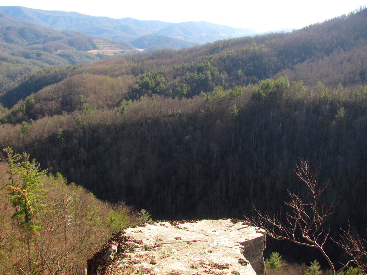
The view of the Rocky Fork Valley and Coldspring Mountain from the top of the cliffs

Living on 'the edge' (viewing Flint Mountain and Flint Gap)

More of life on 'the edge' of the Stonehenge Cliffs

Looking back up at the backside of the 'Dragon's Tooth' rock from 'the edge' rock
Bol’Dar was gone for a while and upon his return he was on top of a cliff that was way above us ! It seems he had taken a wrong turn at Albuquerque and ended up coming back on a higher route ! He quickly made his way back to where we were and informed us that he was almost certain that we could reach the treeline from there with only a few more cliff ledges to negotiate. That’s all it took for me, I was in, however ,we had left our hiking sticks back at the top of the cliffs. Joe was reluctant to attempt going down our proposed route and he did try to talk us out of it, but after seeing we were committed he gave in and even volunteered to go back and get our hiking sticks for us! (Thanks Joe !) After his return we began making our way closer and closer to the wooded ridge line that would hopefully be our way down. It looked so close at this point but yet due to the super steep and rough terrain was still far away.

Narrow gateway used to get around the corner to the next set of cliffs

Following Bol'Dar along the narrow ledge to get to the cliffs on the far left side of 'Stonehenge'

Continuing along the narrow cliff edge

Almost to the next cliff top !

View from the newly discovered cliff (notice the Cardinal Birdhead-like' rock)
Walking out onto the newly found cliff top (Sam's Gap in the distance)

Looking back to where we just came from (look closely for the 'Dragon's Tooth' rock at the top through the pine tree)
There were huge cliffs above and below us and it was obvious we were on the only passable ledge that would lead to where we needed to be. There were a few more gnarly Ent-like trees guarding that part of the mountain as well. One hindrance at a time we slowly progressed closer to the treeline. After we had cleared the last of the cliffs we came to a large boulder garden that lined the draw between the cliffs and the wooded ridge. It was a huge washout area that seemed to lead all the way straight down to the bottom. Not wanting to climb down through the unstable rocks, we crossed them to get over to the treeline where it would hopefully be easier to travel. From there we got our first side view of the Stonehenge Cliffs. I was amazed not only at that sight but also at seeing the terrain we had just came through. I could hardly see the ledge we had used to come through all the cliffs as they all seemed to blend together at that point.

Looking at the way we must go to get to the wooded ridge-line

Looking towards the wooded ridge-line (notice the gnarly Ent-tree marking the way)

Great view of Little Bald and Big Bald Mountains over the wooded ridge-line

Bol'Dar standing on one of the cliffs above us while scouting for the way over to the wooded ridge-line

Making our way carefully past the Ent-tree getting closer to the wooded ridge-line

Looking up at some of the cliffs above us on our way to the wooded ridge-line
The 'boulder-garden' wash area found beyond the last cliffs

Crossing the steep, rugged 'boulder-garden'

Looking back at the way we had just came wondering how it was possible !

Looking back after finally making it to the wooded ridge
We were definitely committed to going this way by that time so we started our new adventure down the steep ridge on the opposite side of the rocky washout area. Looking back and up we could see this rocky drainage area went all the way to the top of where the wooded ridge meets the cliff ridge. The further down we went, the more views we were seeing of the cliffs. This was from an angle I had never seen before and had only dreamed of seeing so I was quite excited. It was not long before we became adjacent to the bottom edge of the cliffs so we crossed over the now much wider boulder garden in order to get over to the base of the cliffs. There was a dead tree shaped like a telephone pole there that marked the spot. It was a deep orange-red color that I thought was very unique. It was there that I learned that despite the illusion from above, it is not anywhere close to being flat below the cliffs. Bol’Dar and myself took some time to check this out but Joe wanted no part of it and he continued down the steep, rocky, drainage area as it was obvious he was ready to be out of that zone and back on the road below ! He ended up going out the right side of the rocky area where we had chosen to go down the left side so we did not see him again after that until we all met later on the road below. I was in awe of being at the base of Stonehenge and spent quite a bit of time just staring up at them in bewilderment.

Side view of the cliffs during our descent

Side view of the cliffs during our descent

Side view of the cliffs and the Rocky Fork Valley

Bol'Dar making his way past the 'orange colored tree' towards the cliffs
Start of the base of the cliffs

Looking up from the base of the cliffs

Side view of the cliffs with Rocky Fork Valley / Coldspring Mountain in background

Another side view of the cliffs

Side view as we continue our descent

Looking up at the cliffs (you can see the 'Dragon's Tooth' sticking up near the top right)
The sun was starting to get lower and it was soon time to find our way on down to get to the road. We went back across the rock garden and continued descending with no sign of Joe. We came across some large rocks that more than likely were part of the cliffs above at one time. I could only imagine what a commotion that must have made when they tumbled down the steep slope from above. There were no signs of anyone ever being there before which is unusual as almost everywhere I have ever been there have been at least some remnants or signs from some previous era. Apparently this hill is just too steep, overgrown, and rocky for anyone to have any business going to? We did find a deflated Mylar balloon from a Chevy dealer laying among the rocks that had obviously landed there after plummeting from the heavens at one time. I could not help myself from continuously looking back at the cliffs that were now looming higher and higher above us as we quickly lost elevation on our descent.

Looking up at the cliffs from below (you can see the 'Dragon's Tooth' rock at the top)

View of part of the cliffs from below
Looking back at the cliffs as we descend

Looking back as we continue down and away from the base of the cliffs

Looking back at the cliff towers from below

View of the cliffs during our descent away from them through the long 'boulder garden'
We stayed to the left side of the rocky area following the treeline down but not wanting to venture too far out to the left as we knew that would lead to a drop off of another cliff that can be seen from the road. After more steep descending, and the seemingly endless boulder garden, we eventually came into a less rocky, more woods-like slope where we could then finally see the road below us. As soon as we popped out on it I looked to the left and sure enough we were right at the place where I had stated earlier that if I was going to climb up to the base of the cliffs, that would be the place ! Coincidence ? I think not ! But now, where was Joe ? I let out a war-hairnt that could be heard for miles and Joe called back from further up the road and soon we had a visual of him walking towards us. This had turned out to be a great adventure. We had went to the summit of Whitehouse Mountain, down to the top of the Stonehenge Cliffs, and then was able to climb down to the base of them and come out on the road. I was content as we walked out the road on the new gravel before dark stopping only to take some more pics of the cascades and the old homestead site near the trail-head. I know I will be coming back to the base of Stonehenge again and hopefully before the warm weather and snake season begins.

Rocky Fork Creek as seen on our way out just before dark

The cascades on Rocky Fork Creek (as seen just before dark)

The cascades on Rocky Fork Creek (as seen just before dark)

The cascades on Rocky Form Creek just before dark

The old homestead site at the trail head of Rocky Fork
To see the complete collection of photographs of this area please visit our Gallery here.

 My name is 'RAT' and I love the mountains and waterfalls of the East TN. area where I live and I hope you enjoy this blog about my outdoor adventures.


Leave a Comment