


Margarette and Bailey Falls – 10-27-2017
Continuing to check more waterfalls off Tyler`s list we chose our next adventure to be Margarette Falls in Greene County, TN. A local favorite named after Mrs. Margarette Cordova ( formerly known as Shoot Creek Falls and Mull Creek Falls ) as I recently learned of this history from a friend and local historian, Ben Gentry who was raised in the area. We would be meeting our friend Tommy ‘Bol’Dar’ Warden there but, since we arrived ahead of him we began the journey without him. We got an early start though, the sun was already starting to shine above the ridges when we got on the trail. I was hoping we could make it to the main falls before the sun got on them to be able to get some decent pics. That is hard to do as there are so many smaller falls along the way ! The water levels were almost perfect so I did take the time to stop and set up for at least two of the smaller falls.

Group shot at Margarette Falls

Trail to Margarette Falls. There were a few early signs of the Fall colors.

One of many small falls along the way

Another exposure of the same falls using my pocket cam without a tripod.

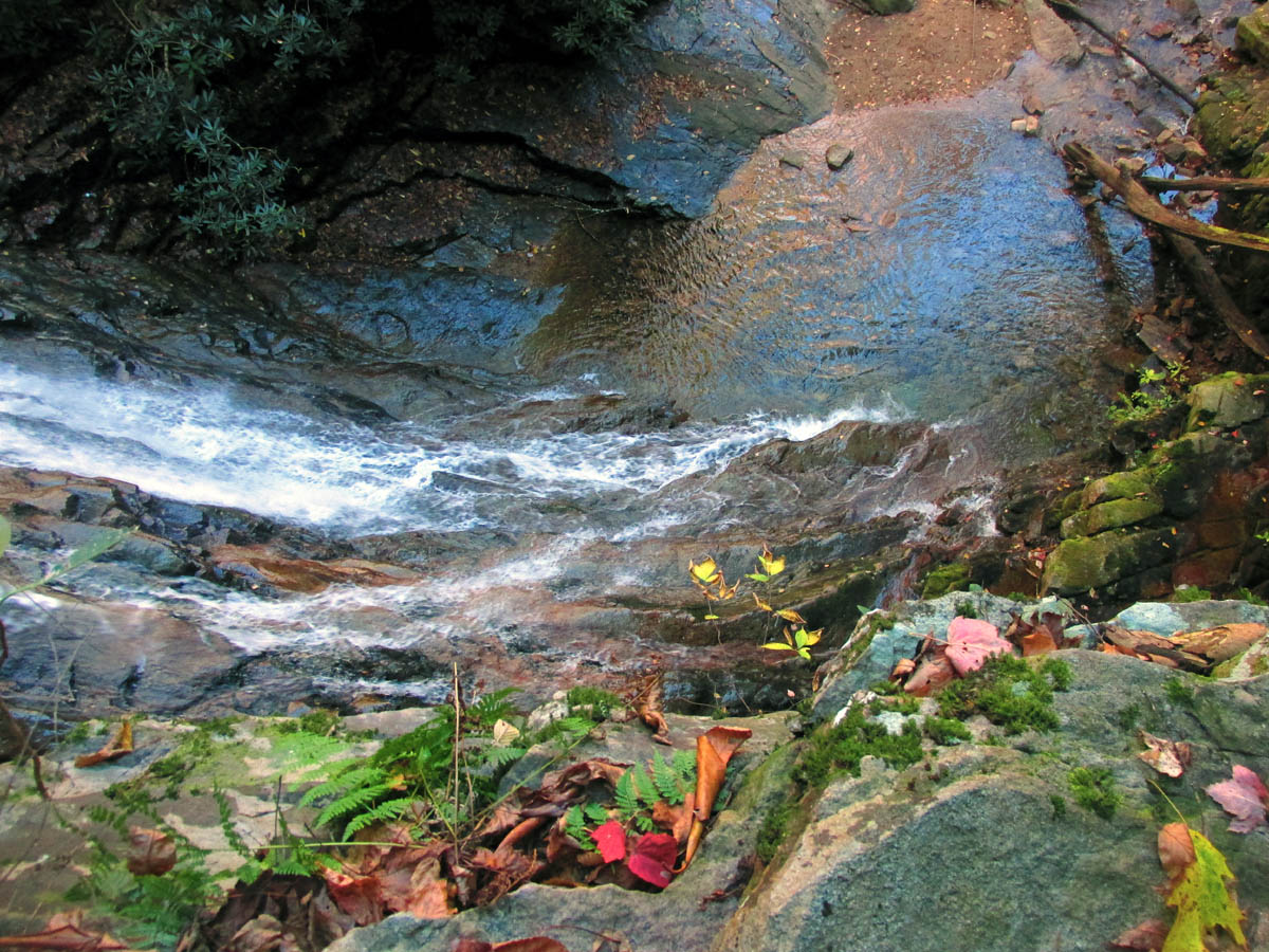
Long, narrow cascading part of the creek along the way to the falls

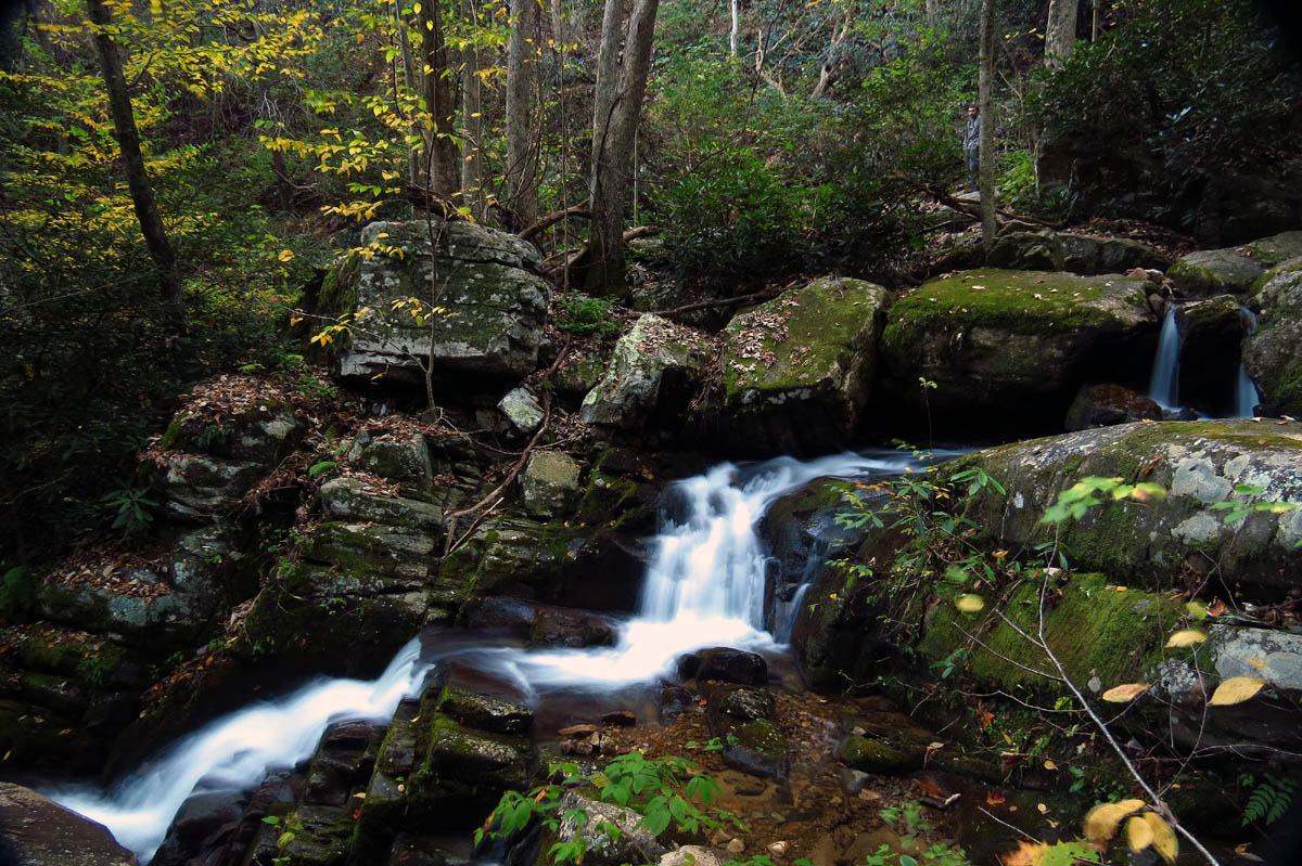
One of the larger drops along the way but, I did not take the time to climb down to these as I wanted to get to the main falls before the light got too bright.
As you get close to the falls you will see some amazing vertical cliffs on the left. I need to come back and take Tyler to the top of them sometime in the near future. I have not been up there in many years. The views from there are impeccable. Not far from them is a really nice small falls I always take the time to setup for.

Awesome cliffs along the way to the falls

Some early Fall colors showing. If you look close you can see the trail as it follows the rock steps up the left side of that huge rock.

Side view of the nice falls I always stop for. Used my pocket cam here with no tripod.

This is one I always take the time to setup my larger camera for.

Closer view with larger cam

Another small falls I took the time to shoot with my larger camera

Tyler on the trail as we follow along beside the huge, vertical cliffs on our way to the main falls.
Another shot of these nice little falls. I like the fact that Tyler was in this one.

I love these cliffs. I can`t wait to get back on top of them.

Nice little split falls with the point of the cliffs in the background

Wide shot of the small split falls, with cliffs and colors in the background

Coming around one of the main points of the cliffs

View of the high points of the cliffs near the falls

This cliff top is nearly right above Margarette Falls. I have this on the list to take Tyler to soon,,,
We made it to the falls before the sun did and about the time I got my larger camera out, Tommy had caught up with us ! The light was not too bad so we got some pics while we could.

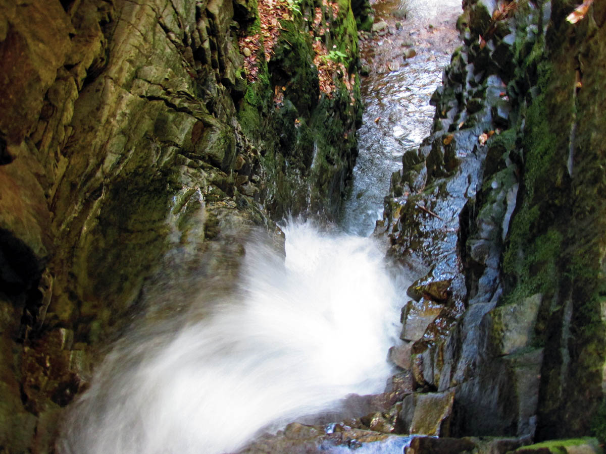
Margarette Falls

Margarette Falls

Margarette Falls

Margarette Falls

Margarette Falls

Margarette Falls

Margarette Falls

Margarette Falls

Margarette Falls
After I got my pics from the base I decided to climb up the left side of the falls. It is very steep and always slick so you must be extremely careful when doing so. Many have fallen there and sustained serious injuries and even death. I was able to get some decent side profile views of the falls and some from the top.

Side profile view of the falls

Margarette Falls

Margarette Falls

Side view from near the top

Side view of the falls

Margarette Falls

Margarette Falls

Side view of the top of the falls from the tip top !
Looking down from the top of the falls

My view of Tyler and Tommy from near the top of the falls !

Side view of the top part of the falls

Side view looking down

Looking farther down from near the top of the falls

Side view Margarette Falls

Margarette Falls (perhaps my favorite pic of the day)

Eye level with the top of Margarette Falls

Top of Margarette Falls. You can see the rock wall on the opposite side that you must get around to continue beyond these falls.

Close up isolated shot of the tip top of Margarette Falls

Close up isolated view of the top of Margarette Falls

Me gettin` some air at the tip top of the falls. Tyler and Tommy look small from up here !

Me Gnomin` on high at Margarette Falls ! (Photo by Tommy ‘Bol’Dar’ Warden)
From there we climbed up the steep right side of Margarette Falls where there is a fairly large vertical rock wall that you can photograph the top drop of the falls from and then manage a way around it to get to the top of the falls. Going near the top of the falls is extremely risky in part to the slanted rock that is slick when wet and the fact that there is nothing to hold on to. There is really no reason to be there. We continued beyond it on our way to Bailey Falls. (Named and listed by Wendell Dingus in 2005)

Looking over at the top of Margarette Falls from the opposite side

Side view from the opposite side

Tyler waiting on me to finish taking pics from the opposite side of the falls so we can get around this rock wall to continue on towards Bailey Falls !
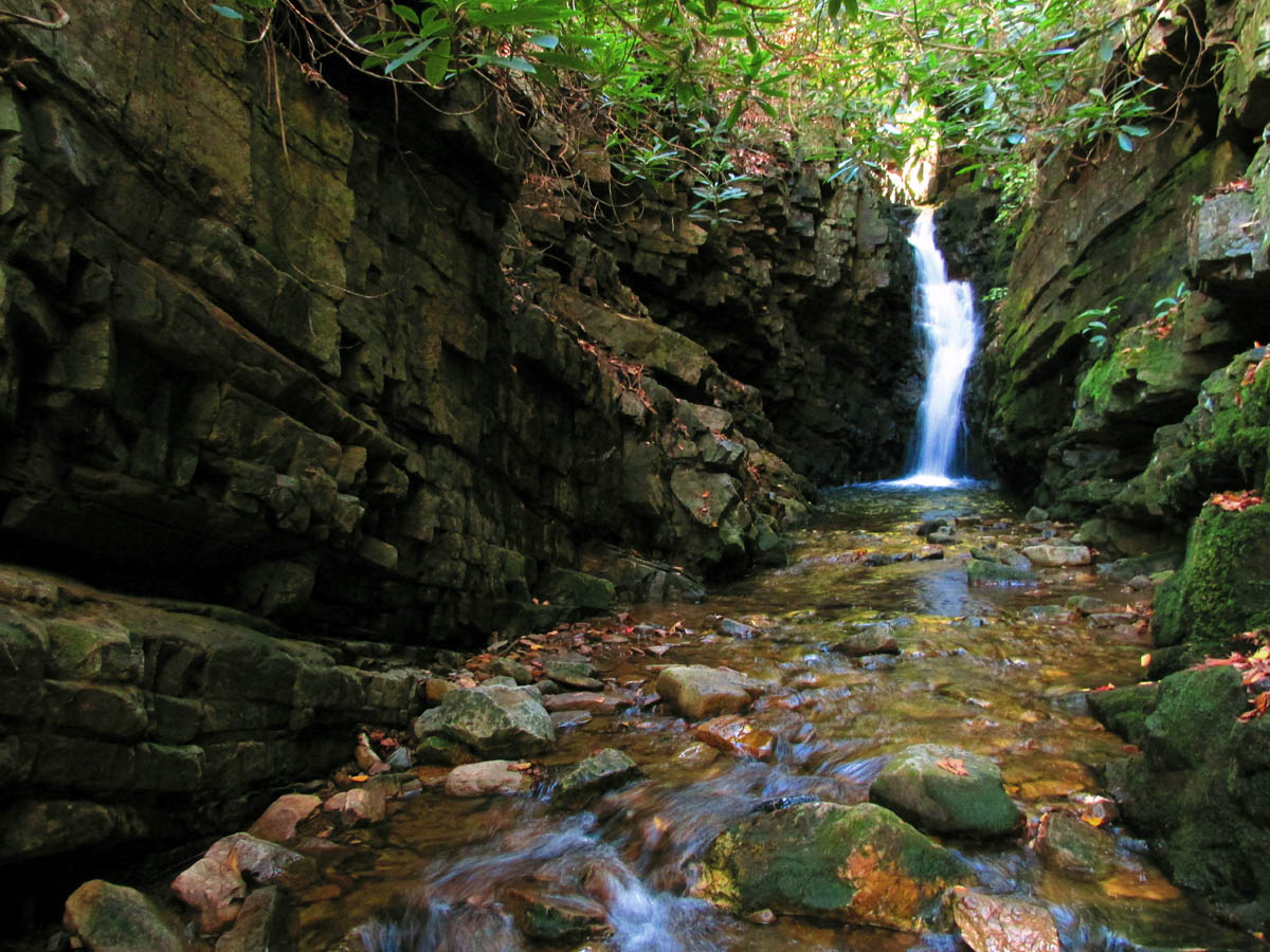
Just beyond the top of Margarette Falls there is another creek (unnamed) coming in on the right (if going upstream). There is a small set of waterfalls there that most people call Glen Falls but, according to the previous GPS waypoint / listing of those falls on the Tennessee Landforms website from a few years ago, those are NOT Glen Falls ! (although they should be !) I know this because my friend Dave got the waypoint off the site and put it into his Garmin and we had to go way up that creek to find it ! However, the picture shown on Landforms (also taken by my friend Dave Aldridge) is of the falls you see here and not the one the GPS point referred to. We (Dave and I) have bushwhacked that creek from there to its end and documented the falls listed as Glen Falls and others that are farther upstream on that branch. They are only a falls during high water flow and it is such a rough off trail route that I do not recommend wasting your time going there. My friend Dave Aldridge and I documented all the falls up that way on a previous trip including Glen Falls and then climbed up to the Bullen Hollow Trail for our return to avoid coming back through that gnarly hell.
*****UPDATE !!! I have just checked the TN Landforms site and I am happy to see the GPS waypoint for Glen Falls has been corrected to be the falls you pass by along the way to Bailey Falls ! This is good news to me and should end any confusion going forward.

Falls above Margarette Falls now known officially as Glen Falls !

Falls above Margarette Falls now known officially as Glen Falls !

Falls above Margarette Falls now known officially as Glen Falls ! (taken with pocket cam without tripod)

Falls above Margarette Falls now known officially as Glen Falls !

Falls above Margarette Falls now known officially as Glen Falls !
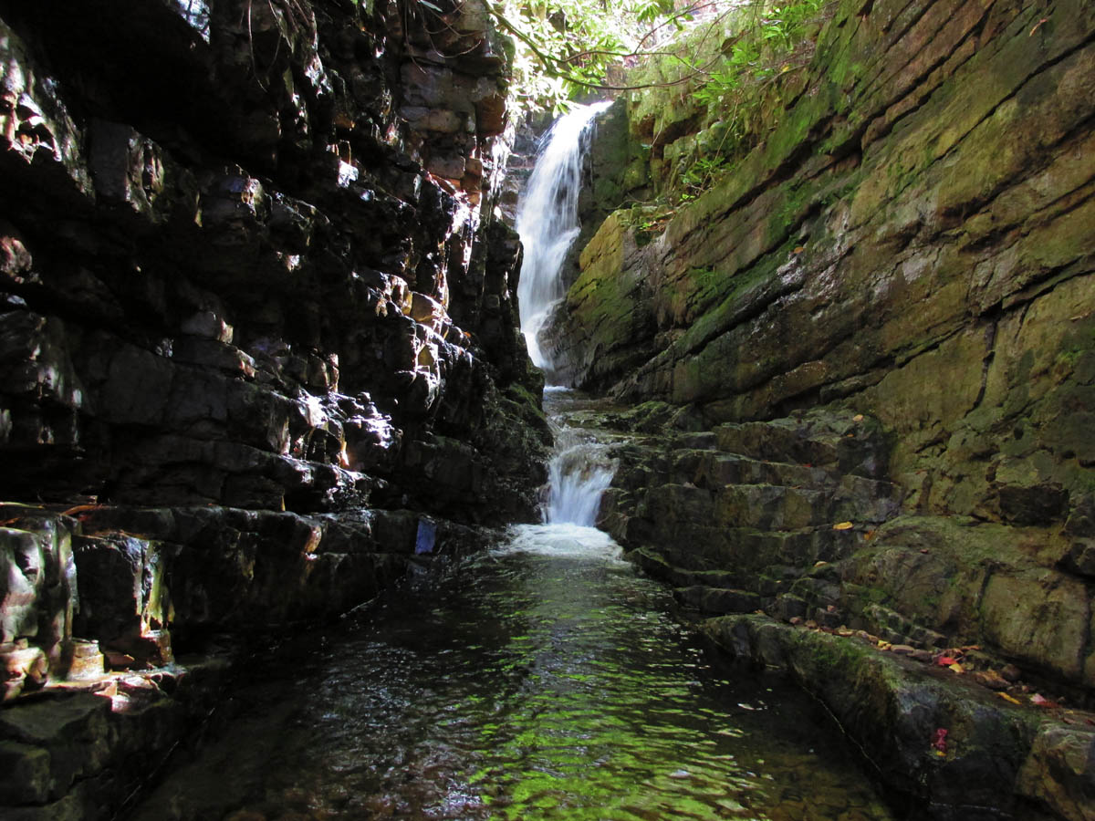
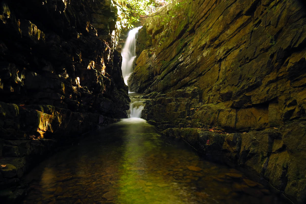
From those falls (now known as Glen Falls) you are completely in the creek from there on until you reach Bailey Falls. It soon becomes basically a slot canyon with vertical sides which is what makes Bailey and Upper Bailey falls so unique. Tommy brought a spare pair of shoes so he could walk in the creek but, Tyler and I managed to rock hop and kept our boots dry the entire time in and back. We made it to Bailey Falls just before the sun broke through the laurels.

Once above Margarette Falls this is part of the creek. The slot canyon begins.

View looking back after going a ways into the narrow canyon upstream from Margarette Falls

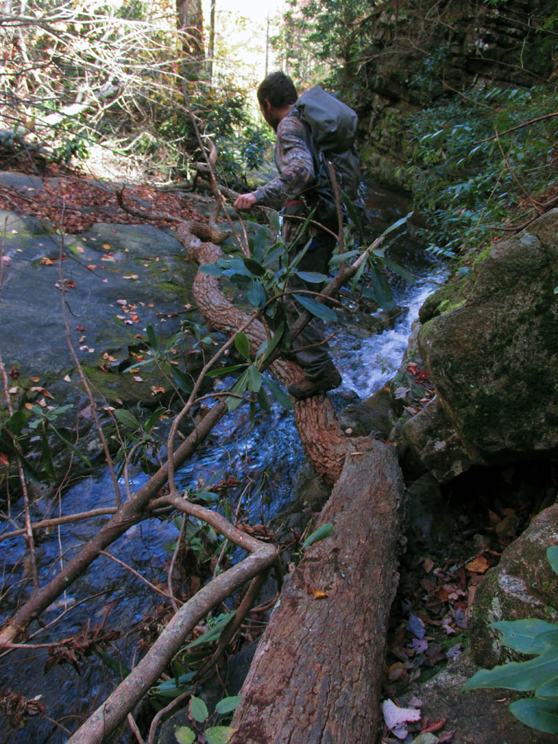
Tommy ‘Bol’Dar’ Warden leads the way up the creek. Al most there, if you look ahead at the tree laying down over the canyon, that is where we would be setting up at cameras (under it) to get shots of Bailey Falls !!

Up ahead I see Bol’dar setting up to take pics of Bailey Falls. Right under a fallen and broken tree !!!

Tyler finds a place to keep his boots dry while Bol’Dar gets his shots of Bailey Falls. During high water there is no way to stay out of the creek here.

Bol’Dar at Bailey Falls

Bol’Dar atop Bailey Falls. These falls are listed at 50 feet. Of course it is obvious that is an exaggeration as they are barely half that. Even if you add upper Bailey Falls to it you would be lucky to get 45 feet total.
Bailey Falls

Bailey Falls and its gorge-ous slot canyon

Bailey Falls (you can see a small part of upper Bailey falls above)

Bailey Falls aka Lower Bailey Falls

Bailey Falls

Bailey Falls

Bailey Falls (lower)

Bailey Falls (lower)

Bailey Falls

Bailey Falls

Bailey Falls

Bailey Falls (Tyler still keeping boots dry and Bol’Dar on top of the falls)

Bailey Falls

Bailey Falls (you can see a small part of the top of Upper Bailey Falls)
After getting what shots we could at Bailey Falls, we then climbed up to the Upper Bailey Falls. These are larger up close than they appear from below and equally as beautiful. Nestled at the back of another slot canyon it helps to set the scene for another awesome waterfall. Unfortunately by the time we got up there the sun was fully on the falls so getting good pics was not going to happen. I did my best anyway.

Upper Bailey Falls
Upper Bailey Falls

Tyler stands at the top of Bailey Falls (lower)

Top of Bailey Falls (lower)
Looking down from the top of Bailey Falls

Upper Bailey Falls

Tyler getting up close and personal with Upper Bailey Falls. The cool part was how he got on that ledge without getting his boots in the water ! (he climbed the rocks closest to the camera without any foot holds ! of course coming back will be harder !)

Tyler at Upper Bailey Falls

Tyler at Upper Bailey Falls

Upper Bailey Falls
Upper Bailey Falls

Upper Bailey Falls

Upper Bailey Falls

Upper Bailey Falls

Upper Bailey Falls

Upper Bailey Falls

Upper Bailey Falls as seen from the top of Lower Bailey Falls

Upper Bailey Falls as seen from the top of Lower Bailey Falls

Top of Lower Bailey Falls

Lower Bailey Falls as seen from the top
We hung out there for a long time enjoying the beauty and serenity of the area before heading back down. We took our time hiking back out the slot canyon and down by Margarette Falls as it is rough going and it would be easy to get hurt. Soon we would be back on the main trail and on our way back to the vehicles.

Some early Fall colors against a sharp blue sky

Some more early fall colors seen from nearing the end of the slot canyon (still above Margarette Falls)

Tyler crossing a ninja log walk over the creek just above the tip top of Margarette Falls seen just beyond him. Very slanted and very slick rock he has to land on the other side !
Tyler making it look easy just before it came my turn

Another quick view of the top of Margarette Falls as we make our way past it and begin the steep climb down.

Following Tyler and Bol’Dar down the steep side of Margarette Falls
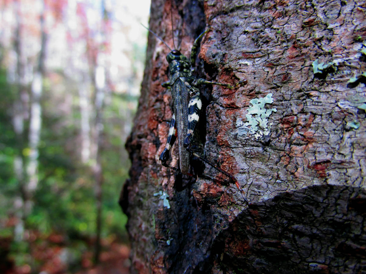
Grasshopper

Cool tree and colors at the cliff point below the main falls
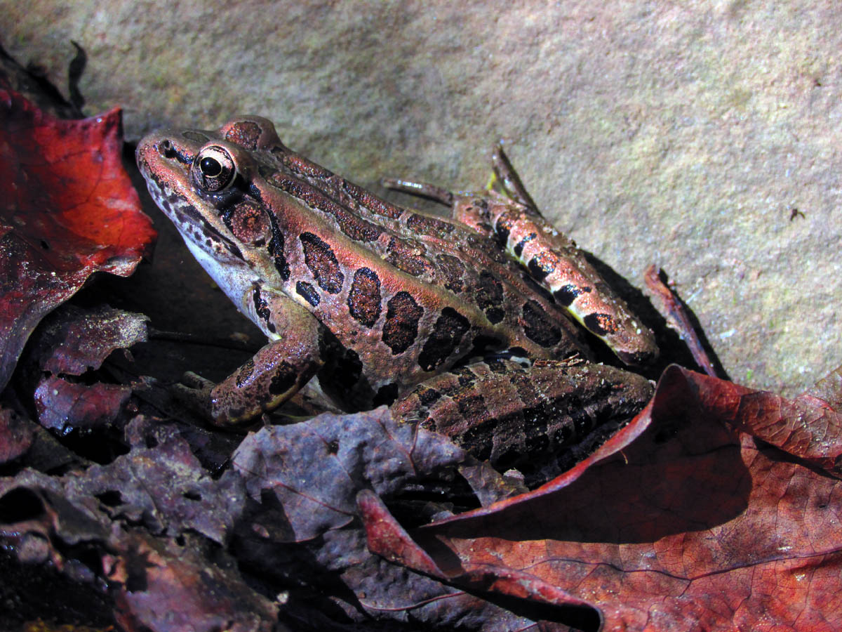
Frog

Frog
By the time we got back near the parking area it was late afternoon yet, we passed at least a dozen people and their kids and dogs etc., on their way to the falls. I know this area is heavily visited all the time by all types of hikers but, I must wonder why the ‘touristy mall walker’ types with bunches of very young kids wait until after 4 pm in the evening to begin a hike like this ? Oh well, we had a great time as always and got to check off some more falls from Tyler`s list. We were already thinking of what the next adventure might be. Until then,,,

Group shot at Margarette Falls

 My name is 'RAT' and I love the mountains and waterfalls of the East TN. area where I live and I hope you enjoy this blog about my outdoor adventures.


Leave a Comment