Margarette, Glen, and Bailey Falls – 5-28-2011
It was a warm morning in late May when my waterfall loving friend Dave Aldridge and I decided we would try and get to Bailey Falls [since his earlier attempt in January had fell just short of them due to the cold, icy conditions that day]. That would not be an issue this time as it was very warm and everything was now green and the water levels were still fairly high. Bailey Falls are located above and upstream from the well known Margarette Falls so, we started out at the trail-head located off Shelton Mission Road and began hiking up the Margarette Falls Trail (#189). On the drive there while passing between the Horse Creek and Camp Creek areas we noticed some of the massive storm damage from the recent tornadoes that came through there in April and we could not help but wonder just what kind of shape the trail would be in and if any trail work had been done already. We had not gone far when we came upon a large downed tree across the trail but fortunately we were able to walk under it. We did not encounter any more damage the rest of the day and we were pleased to find the area had been spared the brunt of the storm.
The trail to Margarette Falls is a well maintained trail for the most part and passes by several small falls and cascades which we took time to stop and enjoy each and every one of them.
I had not been here in at least 20 years so it was like a brand new experience for me. I was impressed with the new footbridge that had recently been constructed. I had heard about it in my friend Bol’Dar`s hiking blog, [trailstealth.com] as he had accompanied Dave on his last trip here back in January. After passing by more cascades of all sizes, and nearly completing the two mile hike, we came to the high rocky cliffs that are just before the falls. These are very impressive and some are over 200 feet high (according to Dave`s hypsometer) but not easily photographed when the leaves are on however here is a pic of one of them taken by Bol`Dar in January. As we approached the base of Margarette Falls, we noticed two girls sitting there enjoying the beauty of the surroundings. It turns out they were from North Carolina and one (Ashley) is a professional photographer (and I use the term lightly as she takes the best pictures I have ever seen) and the other (Nicole) is her friend. Seems they had pretty much been to just about all the falls in North Carolina and were just starting to explore for ones here in Tennessee. I set up my tripod and began taking pictures while Dave took care of the PR with the girls. After a snack it became time for us to climb around the falls and continue on our quest to find Bailey Falls.
Ashley was very excited over hearing about more waterfalls and it was agreed that they would tag along with us on our adventure. There was another couple with a small child and their dog that arrived at the falls right as we were leaving. Climbing around Margarette Falls is not too dangerous when not frozen although there is a sizable rock ledge at the top that one must negotiate around and over. Some inconsiderate humans had made quite a mess just before this point and I was lucky to see it in time so as not to step in any of it. Then there is the top of the falls where it is best to not mess around the slanted rock faces there as many have fell from there causing great injury and even death. Of course since it was dry I ventured as far out as I could to get some pics from the top of the falls but I am very careful and make sure to always have a hand hold on to something secure. The others continued on and were waiting for me just ahead.
It seems there is always more to waterfalls at the top of them than can be seen from the bottom and the same holds true for Margarette Falls. There is more small falls and a long narrow chute of water in between them and the top of the falls. You can then see more cascades you must go round and then there is even more cascades and a nice set of 12 foot falls coming in from the right on a different creek from the Bullen Hollow direction. These are thought to be Glen Falls and by all practical purposes they should be, however according to the GPS point given by the TN Landforms website, they are NOT and the actual Glen Falls lies much further up that hollow ! We would worry about that later.
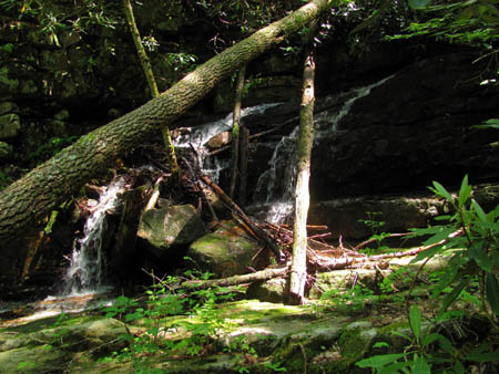
We crossed the creek there making our way around those falls and following the main creek onward (note: there is no trail) towards where Bailey Falls was supposed to be located. There were instantly some large rock obstacles to contend with and then the creek passage narrowed down to the width of a small one lane road. The sides became steeper and rockier with near vertical sides making it necessary to hike right in the creek if one was to continue further. After a few more large rocks and downed trees to climb over, I finally got my first visual on what I thought was the falls so I hollered back to the others ( I was leading at this point since Dave was staying back with the girls to make sure they were ok with the rough terrain but I assure you, they were doing fine and needed no supervision!). From that point it became a long grotto with solid rock sides, very tall on each side with hardly nothing much to stand on so I basically had to just wade right in the creek but it was well worth it once I reached the actual base of the falls. You cant really get right up to them as the water becomes rather deep and there is basically no easy way to climb these falls from this point as you can see from the photos.
Bailey Falls is a double falls of sorts as there is an upper part that falls first and then in a short distance it falls again down the taller main part of the falls. They are some of the nicest waterfalls I have ever seen. All waterfalls are unique in their own way and these are no exception. I hope to one day approach them from another direction on the ridge in order to see the upper part of the falls and what may lie beyond them. We spent a lot of time here amazed by the tall, green rock formations and the astonishing one of a kind beauty of the area. It was hard to get any good pics (for me at least) as the sun was shining brightly on one side of the falls and very dark on the other, plus the upper part was also exposed to the bright sun. I will definitely be coming back here and hopefully on a more cloudy day.
I could have stayed there all day but it was getting late afternoon and Dave and I was tossing around the idea of venturing up the other hollow to find the actual Glen Falls. The girls said they needed to be heading back as they had to drive back to North Carolina. We slowly made our way back out the way we had came and parted ways at the small falls as they proceeded back down Margarette Falls while Dave and myself climbed around the small falls and made our way up that draw. There were some cascades and small falls just above the entrance above the small falls, and another long, narrow water chute, but it was quickly discovered that there was no trail from there and from the looks of it, there never has been!
After making our way a short distance traversing some steep side-hill through some gnarly growth, I stopped to study the map and it seemed that the actual Glen Falls would not be much farther and it was also apparent that the Bullen Hollow Trail was just above us so we thought we could continue through the bushwhack, find the falls and then climb up to the ridge and take that trail back for a loop and not have to return back through the crap and down Margarette Falls and out that way. This looked doable and much easier on the map compared to what it actually took to accomplish it !
It was a slow go, but a determined water-faller will push himself beyond the limits to get to his goals if at all possible. Of course this is what gets one into trouble a lot of times ! The going was extremely rough and we had to constantly climb higher and higher on the steep side-hill to get around multiple obstructions as going up the actual creek was impossible due to laurels, growth and blow-downs. The hollow then started curving to the right and it was also narrowing which is a good sign for waterfalls but, there was a huge sinkhole we had to go around forcing us even higher up the mountain above the creek. After that it was a little easier but still no trail but, we did find a small cascade-like falls there. Since Glen Falls is listed at 8′ and there was no picture available of them, with only a GPS coordinate to go by, we could not know if these were it until Dave checked his GPS. Luckily he got a signal there and it was determined these were not it.
We could see it was gaining more elevation and since we had already come too far to turn back, and not wanting to go back through all that bushwhack again, we continued onward until we finally came across another small falls which we verified was the GPS reading given by Wendell Dingus on the TN Landforms website. This had to be Glen Falls as per this coordinate although it was certainly not worth the trouble we went through to get there however, it is more easily accessible from the Bullen Hollow Trail if you know exactly where to go down at. It is steep but short and sweet that way and you can hear them if the water is up but I still would not recommend doing it as they are not all that impressive. Maybe during the winter months it would be more feasible.
After a long rest and a snack break there, we continued up towards where we knew the Bullen Hollow Trail was, following the remnants of an old logging path that was nearly impassable with growth and downed trees. I checked the map again and realized the trail had to be just above us so I took off straight up like a wildcat and hit a level ridge and within a few feet popped right out on the Bullen Hollow Trail. I have never been so happy to be on a trail in my whole life ! I hairnted loudly down to Dave to tell him to come on that I had found it.
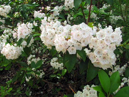
It was not long before Dave found me there drinking water and resting my now worn and haggard body. We were happy to have made it and began the two mile journey back down to the trail intersection with the Margarette Trail where we had started. The laurels were blooming and it was like walking through a huge flower garden. After a short ways, the trail veered to the left as it met back up with the main hollow below and we could then see the tops of the huge cliffs that loom high above Margarette Falls located way down below. It was then apparent that they actually continue even higher than what you could see from below them. As I turned to look back I just happen to notice that I could also see Blackstack Cliffs (located along the A.T. near Jones Meadow/Viking Mountain area) off in the distance. We could also see Bearwallow Gap along the A.T. off in the distance above us. I thought that was pretty neat and I managed to get a few zoomed photos of them as that is another one of my favorite places. We were also able to see the distant valley below.
The Bullen Hollow Trail formerly was a motorcycle/horse trail years ago when I used to hike a lot in this area but is now a foot trail only. It is still very rough and rocky in places but, we soon made it back down and was making our way out the level trail to the trail-head. We did meet an old fellow and his dog on their way in for a camping trip whom we had a short conversation with. We discovered he was the partner of the Greenville, TN. lawyer whom one must get permission from in order to gain access to the trail to Painter Creek Falls, which was a good thing as we now know who to call and what the number is as that is a trip we have been planning for quite sometime now. Although we were both very worn out from our dauntless bushwhack, it had been a very good day of hiking and we did find Bailey Falls and Glen Falls and had met some really nice folks in the process and isn’t that what it’s all about ?
To see more photo’s of Margarette and Bailey Falls, please visit our Gallery.








 My name is 'RAT' and I love the mountains and waterfalls of the East TN. area where I live and I hope you enjoy this blog about my outdoor adventures.


One Comment to “Margarette, Glen, and Bailey Falls – 5-28-2011”