


Panthertown Valley – 9-10-2014
After being on ‘the list’ for such a long time, I finally got the opportunity to go to the Panthertown Valley to do some much anticipated hiking. I only recently heard about this area a couple of years ago via social network and have been wanting to go there ever since. It is sometimes referred to as ‘The Yosemite of the East’ as it covers over 6700 acres of high elevation forest service land that is quite spectacular and now becoming very popular among all types of outdoor enthusiasts. There are numerous waterfalls here along with incredible panoramic views from the granite cliffs, the headwaters of the Tuckaseegee River and the East Fork of the Little Tennessee River, as well as many diverse environments of rare plants and wildlife species.
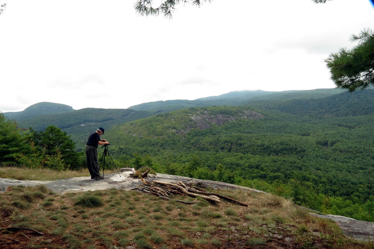
Dave taking pics of Panthertown Valley from the Blackrock Mountain Overlook
I will first provide a brief history of the area:
It is doubtful that any permanent settlement ever existed here due to the difficult terrain and challenging accessibility but common sense tells us that Native Americans hunted and fished almost every other valley in the area. Like many other places that use the name ‘Painter’ this was an old pioneer term that actually means ‘Panther’ to which Panthertown Valley is no exception as it was called Paintertown which was local for Panthertown due to the wildness and no doubt the number of panthers (Eastern Cougars) that lived in the area.

More of the Panthertown Valley as seen from the Blacxrock Mtn. Overlook. It is not possible to get it all in one picture !
The land was sold from a private developer (R.G. Jennings) during the roaring 20`s and was logged heavily after that which is where many of the main roads and trails came from. After the logging was done, like many other places in the Appalachians, the land was ravaged by wild fires followed by flooding rains causing heavy erosion and wiped out most of the remaining vegetation. Of course mother nature recovered from all of that. During the 1960`s a private development company bought the land to convert it to a private, upscale complex with a lake and a golf course but luckily this did not happen. There are huge thickets of white pines that indicate that Christmas trees were planted in the 70`s but were never harvested and can still be seen today.
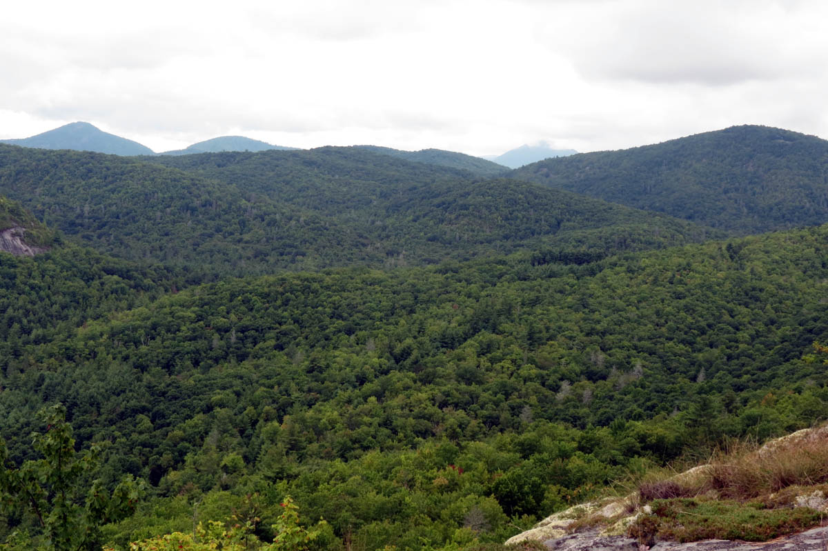
Panthertown Valley as seen from Blackrock Mtn. Overlook
In 1987 Duke Power (now Duke Energy) bought the valley in order to build a high-voltage transmission line down its East side. This was fiercely opposed by many but it could not be stopped. After it was built the land outside the power lines right of way was sold to the Nature Conservancy who later sold it to the forest service. To quote the hike North Carolina website “Many of the trails were created by the late Carlton McNeill in the 1990’s, who lived just outside the valley until he passed away in 2007. He was considered by many to be the unofficial caretaker of Panthertown. He loved the place so much that he is solely responsible for clearing many of the foot-paths leading to some of our favorite destinations there.”

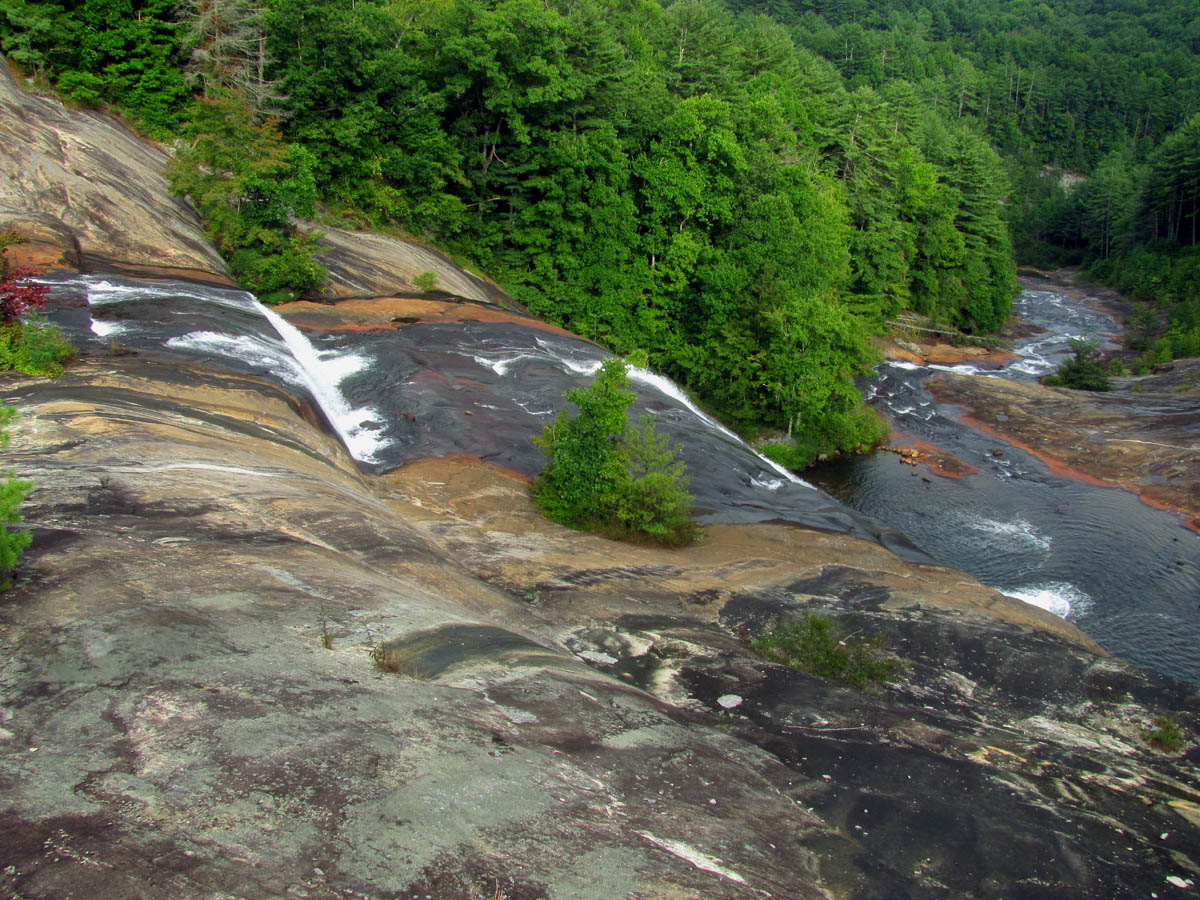
Panthertown Valley – zoomed view from Blackrock Mtn. Overlook
On this, my first trip to the area, I did hike one of his trails which is now named in his honor called ‘Carlton`s Way‘. This goes from the Blackrock Trail below the cliffs there and connects to the North Road Trail. We started our journey at the Saltrock Gap Trailhead where we first hiked down to the Salt Rock Overlook to get the wow factor of my first view of the valley. I did say wow! We then backtracked to the trailhead where we picked up the Blackrock Spur Trail to get to the Blackrock Trail which took us up to the Blackrock Mountain Overlook. This is one of the only trails that you will actually start out on that goes uphill as most all others begin by going down into the valley to which it is always uphill coming back at the end of the day which makes this a more difficult place to hike. The views from the Blackrock Mountain Overlook were very impressive to me.

Looking at Big Green Mtn (The Great Wall of Panthertown) from the Blackrock Mtn. Overlook

Slightly zoomed view of Little Green Mtn. (and cliffs) as seen from Blackrock Mtn. Overlook
From there we found the trail down the steep descent which eventually leads to the power line road trail but, just before that intersection we picked up the Carlton`s Way trail to the right which we took to get under the overlook cliffs and connect to the North Road Trail. Going right on that trail we soon connected with the main Panthertown Valley Trail.
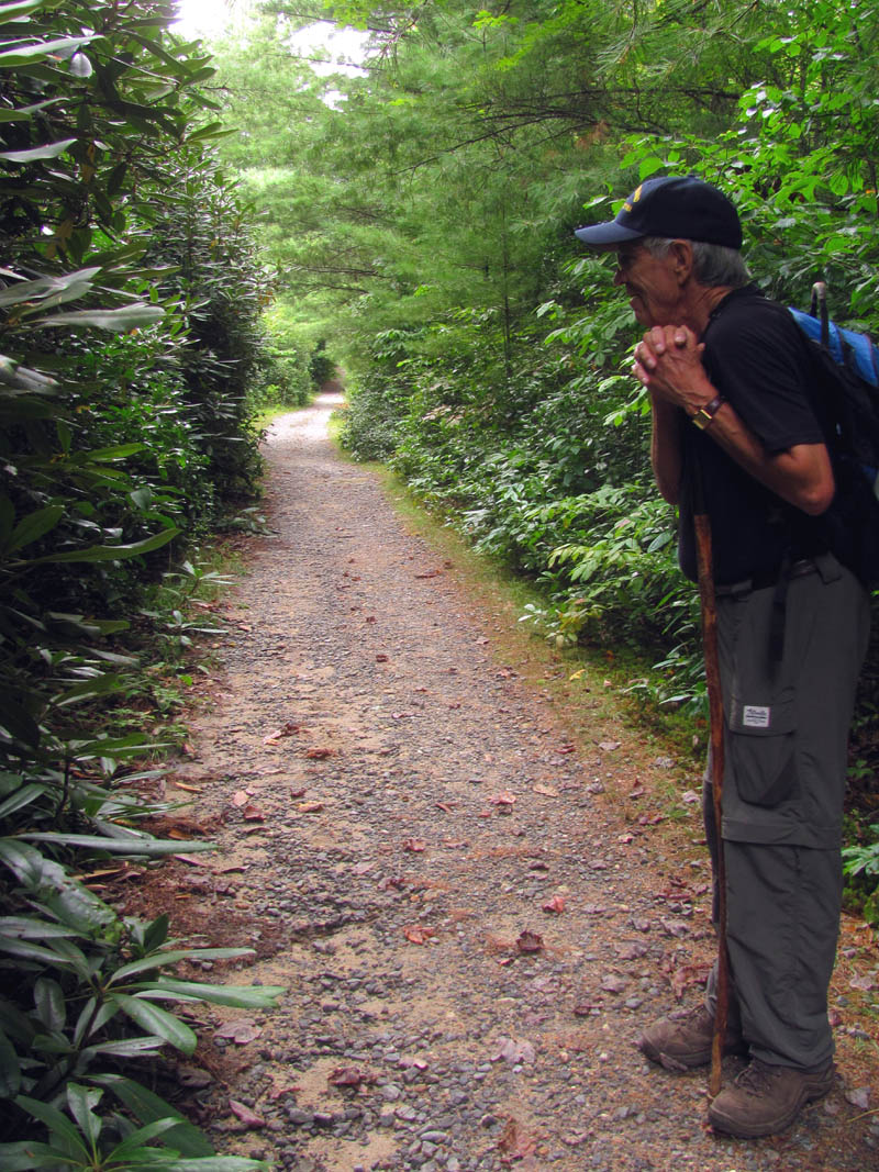
Dave on the Panthertown Valley Trail
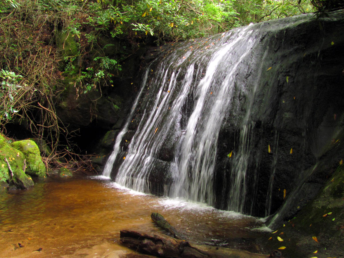
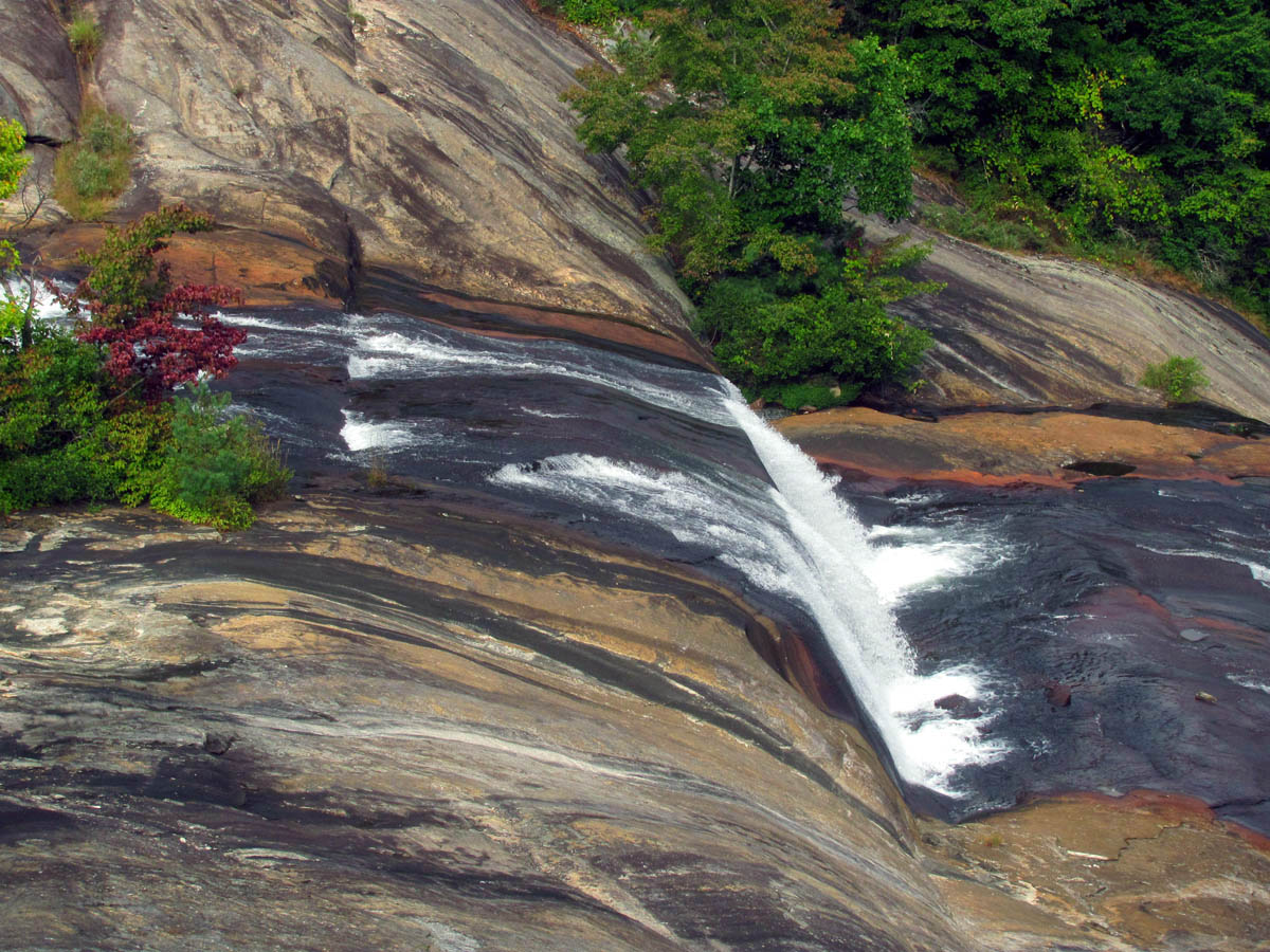
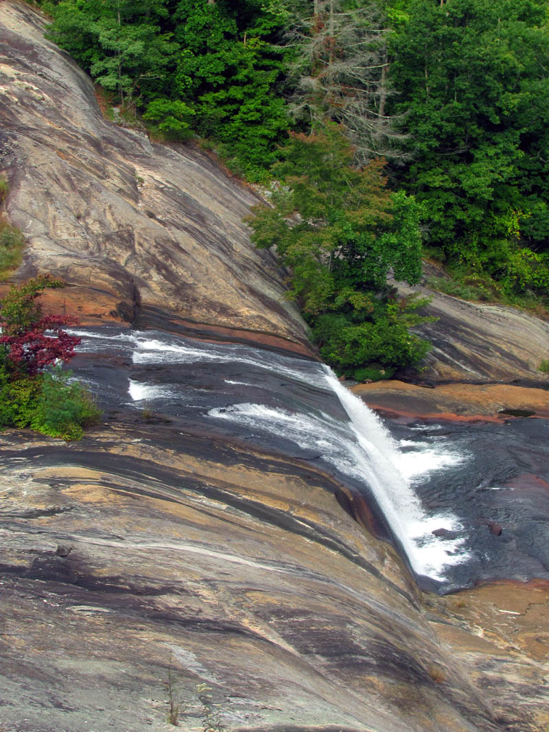
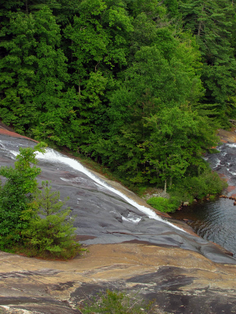
Going to the right again we followed this to our first waterfall of the day, Frolictown Falls. These falls are not very tall but they make up for the lack of height with their beauty. To read about how these falls got their name, please visit Todd Ransom’s page here . Here we met back up with a dad and his very cool kids that we had met earlier that were doing an overnight trip.

Frolictown Falls
Frolictown Falls
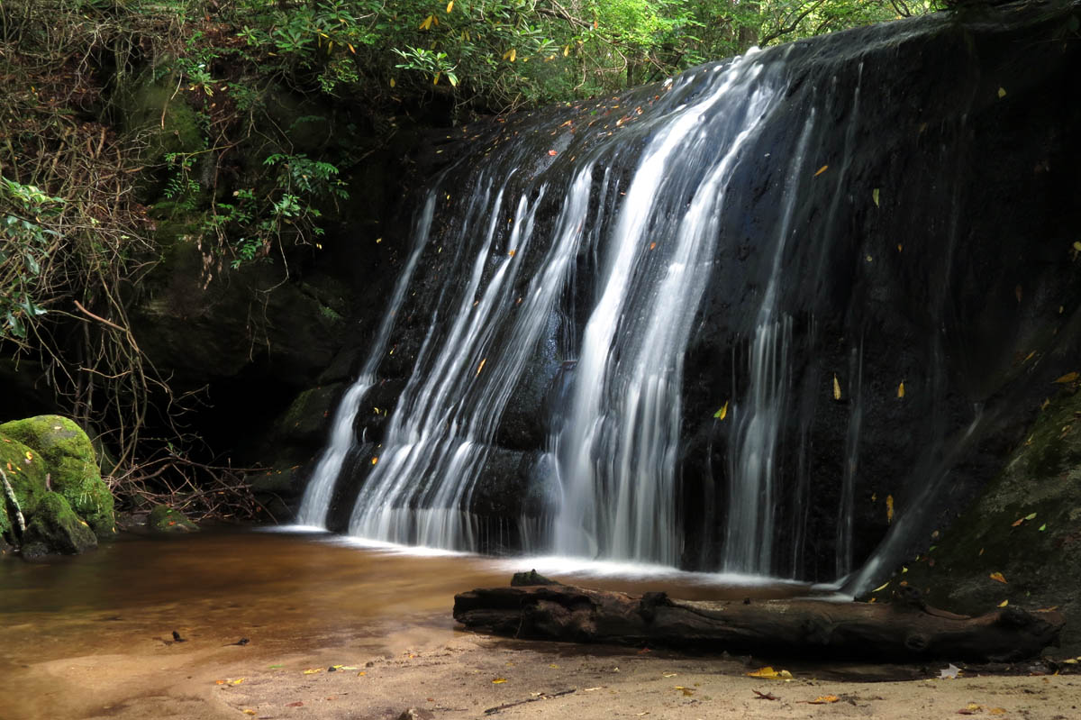
Frolictown Falls

Frolictown Falls
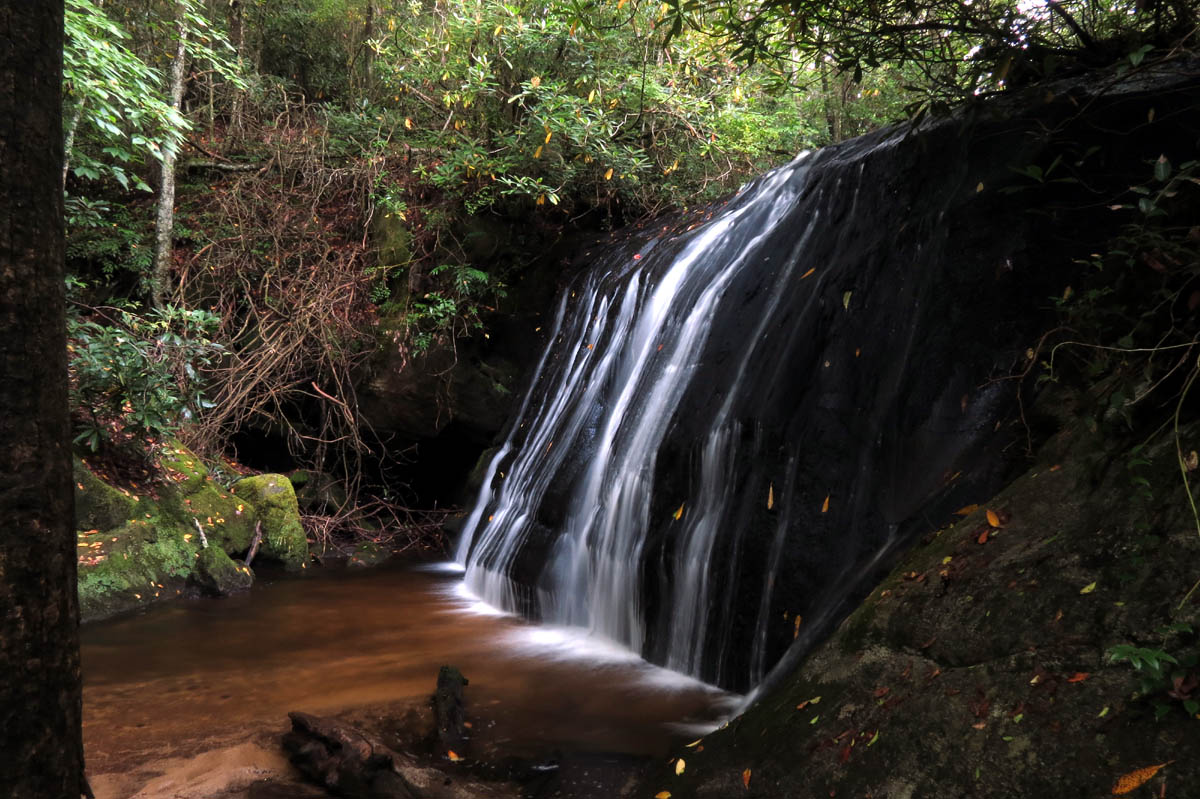
Frolictown Falls

Frolictown Falls
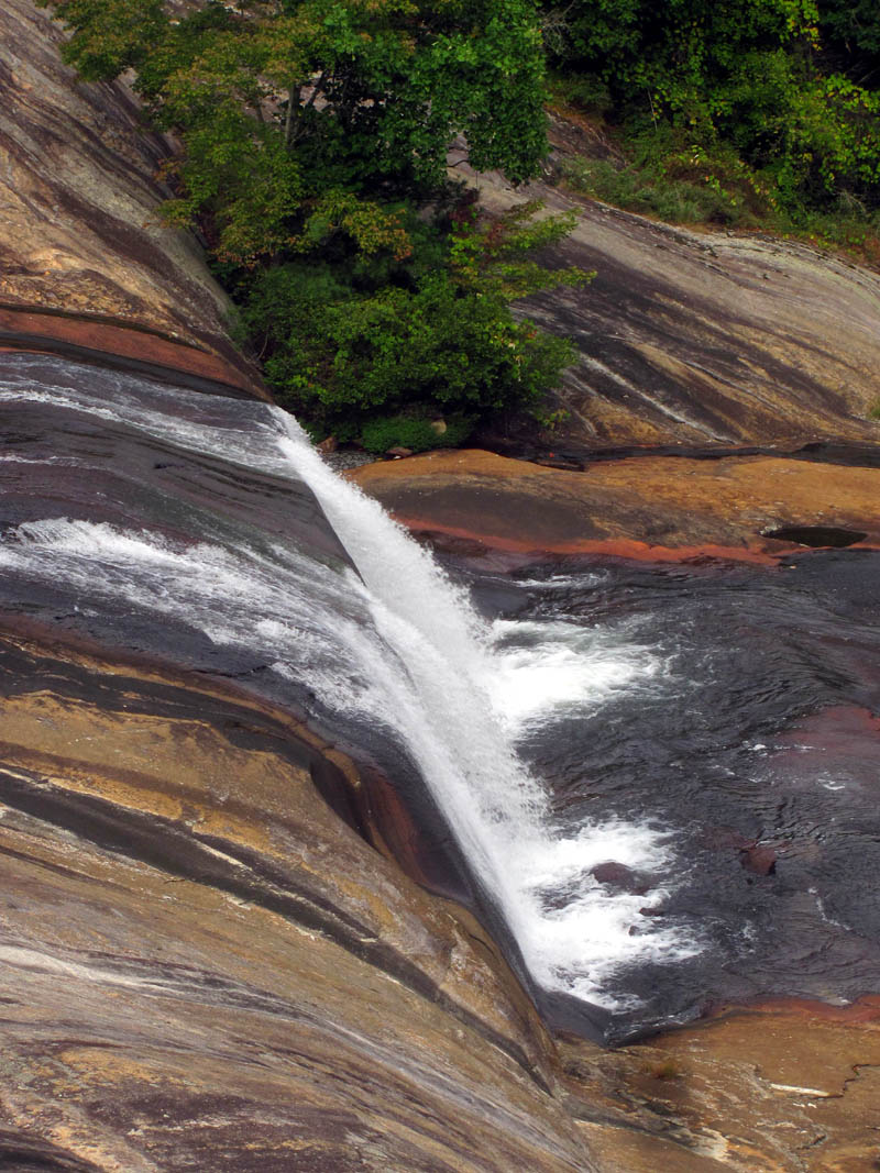
After getting what pics we could get of Frolictown Falls, we continued on the same trail a short distance up to Wilderness Falls where we climbed down to the base of them to get what shots we could. These are hard falls to photograph especially during bright sun. They are tall and impressive and definitely worth the trip. I am sure they will be much nicer during late Fall and Winter time.

Wilderness Falls

Wilderness Falls
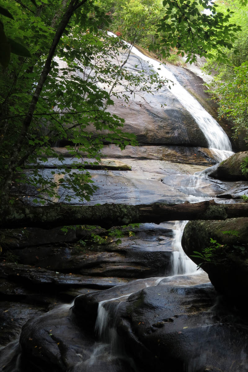
Wilderness Falls
Wilderness Falls

Wilderness Falls

Wilderness Falls
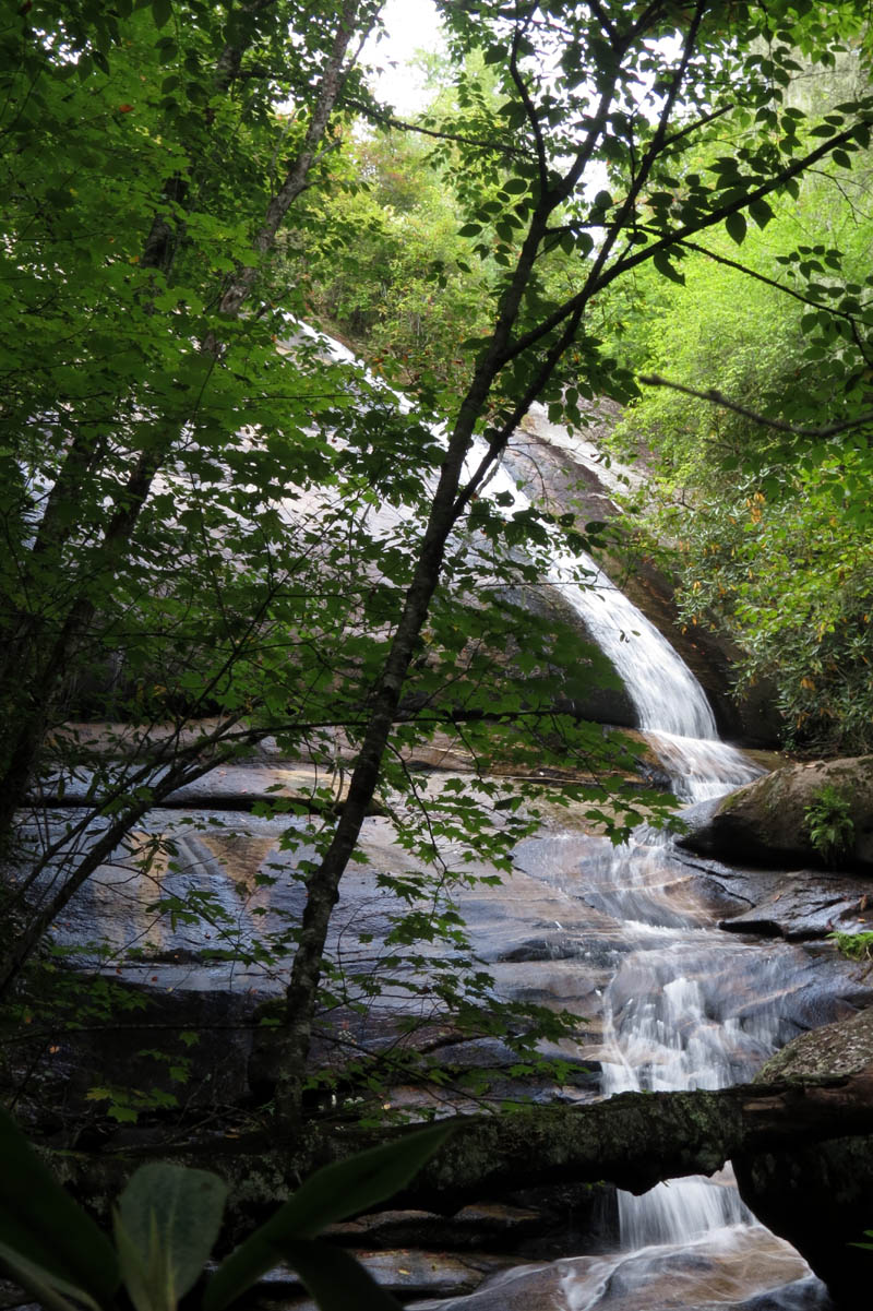
Continuing on, the trail becomes rather steep as it continues and soon we were above the falls where I found a small unmarked side trail, that led out to a cliff where I got a nice view looking over at the Blackrock Mountain Cliffs we were on top of earlier. I continued farther as I heard water and found the top of Wilderness falls. There was a steep trail that started at the bottom of the falls that came out right at this spot. Just beyond that was a large uprooted tree that prevent me from walking right out into the creek that flows over the top of Wilderness Falls. I cautiously peered over the edge to see the water. It was nothing like I had imagined from the bottom. There is more to the falls above in the form of a long and steep cascade. It is not flat on top as it appears from the base so one would not want to stand there.

View of Blackrock Mount Cliffs

Top of Wilderness Falls
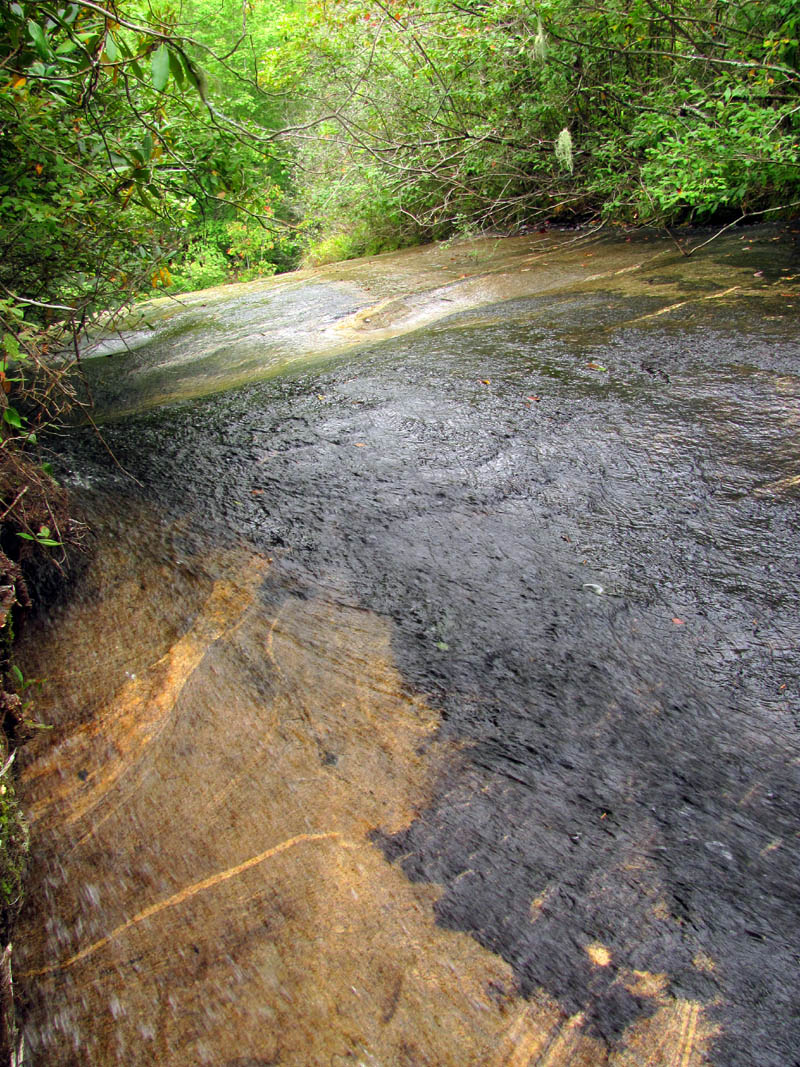
Top of Wilderness Falls
The trail gets less steep from there and soon it joins the gravel road (main Panthertown Valley Tail) that leads back to the Saltrock Gap Trailhead where we started which completed our loop for that day. My first experience of the Panthertown Valley had been an awesome one and I knew then that I would be coming back again and again to continue exploring and seeing the many sights it has to offer.

Trail beyond the top of Wilderness Falls
On the way out we stopped at Toxaway Falls which is beside the road and is actually the spillway where the water is released from Toxaway lake. They are rather impressive but with the bright sun it was hard to get any good pics and it would be nice to get to the base of them but it looks all private to me so would require some extra effort.

Top of Toxaway Falls

Toxaway Falls

Part of Toxaway Falls
Toxaway Falls
Zoomed part of Toxaway Falls
Part of Toxaway Falls
Zoomed part of Toxaway Falls
Lower and highest drop of Toxaway Falls

Lower part of Toxaway Falls (I would love to get a shot from down there)
We also took the time to run up to Looking Glass Falls before it got dark and luckily there was not anyone there so I got a few pics there of these very nice falls that are also right beside the road and usually crowded with people.

Looking Glass Falls

Looking Glass Falls

Looking Glass Falls

Looking Glass Falls
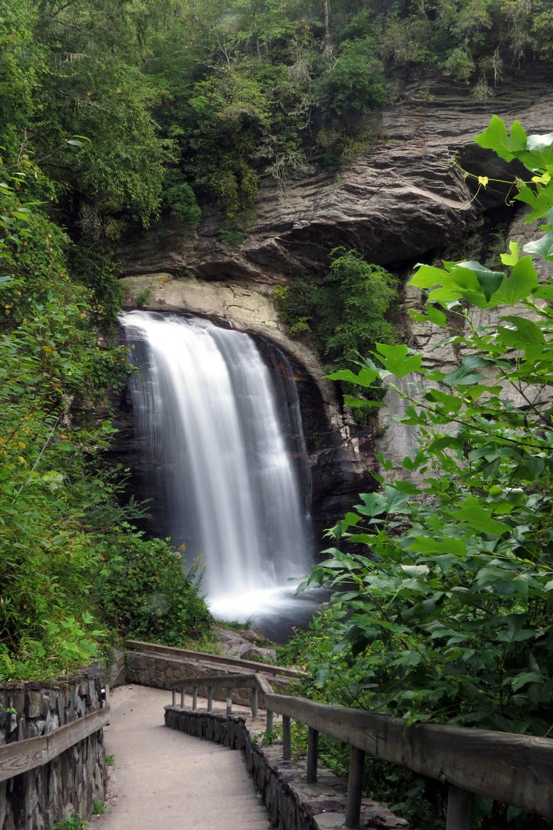
Looking Glass Falls (I hated to include the walkway as it takes the wild out of it but, these falls are beside the road and the steps seem to actually compliment this picture)
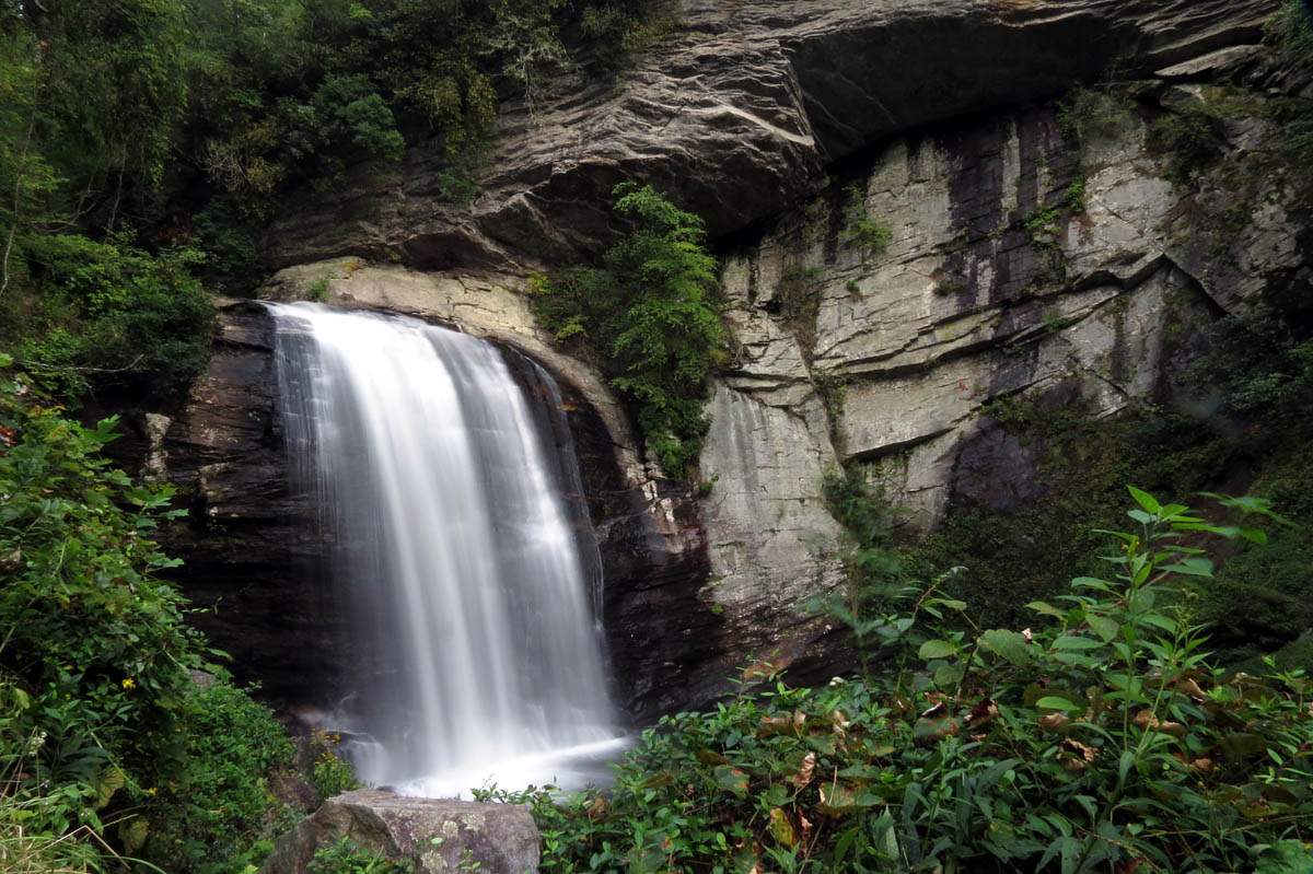
Looking Glass Falls
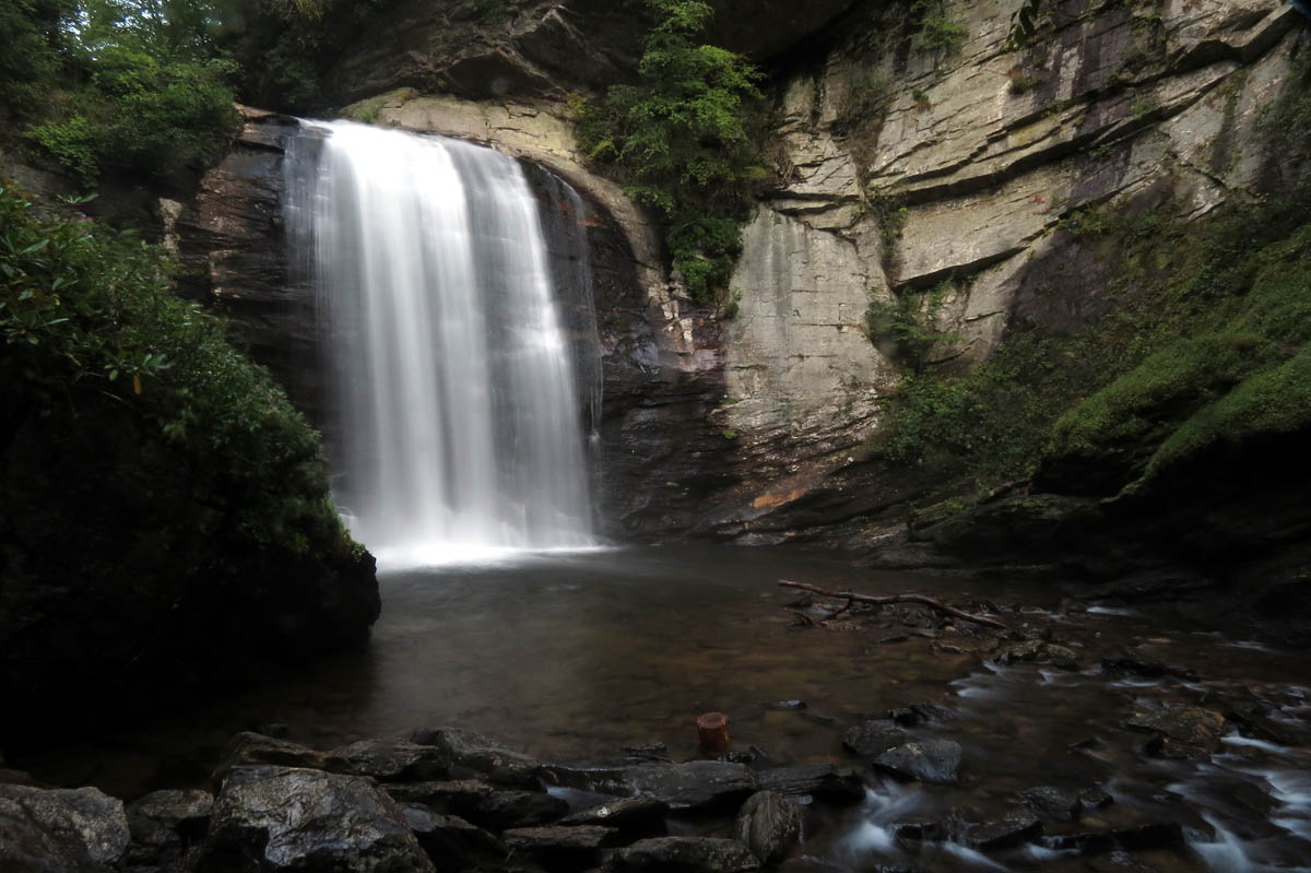
Looking Glass Falls
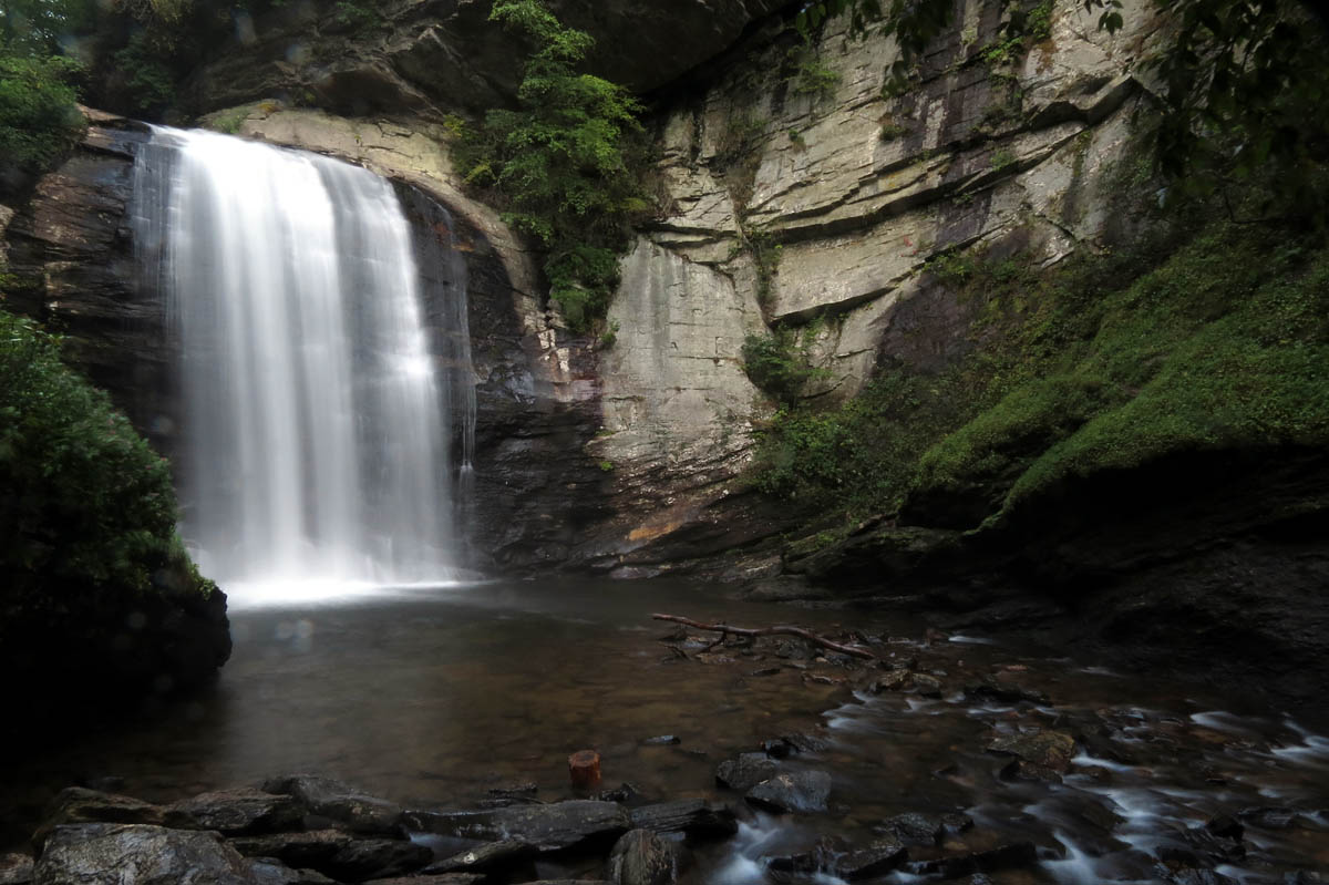
Looking Glass Falls

Looking Glass Falls (with water on my lens)
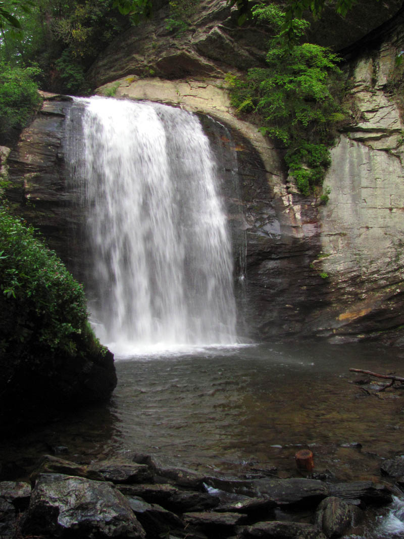
Looking Glass Falls
We left there and although it was nearly dark, we drove up the road to Sliding Rock Falls where of course there was no one there as it was closed for the day but, it was a bit too dark to get any usable pics so, I will have to come back. Normally this place is packed with people making their way up beside the handrail and sliding down the falls.

Sliding Rock Falls

Sliding Rock Falls

Sliding Rock Falls

Sliding Rock Falls

Sliding Rock Falls
Once we got back to Brevard, NC we stopped at the Hawg Wild Barbeque joint to get our post hike grub on. The food there is top notch. I was so hungry I forgot to take a picture of it ! I can not wait to come back to this area again and continue exploring the wet and wild Panthertown Valley.
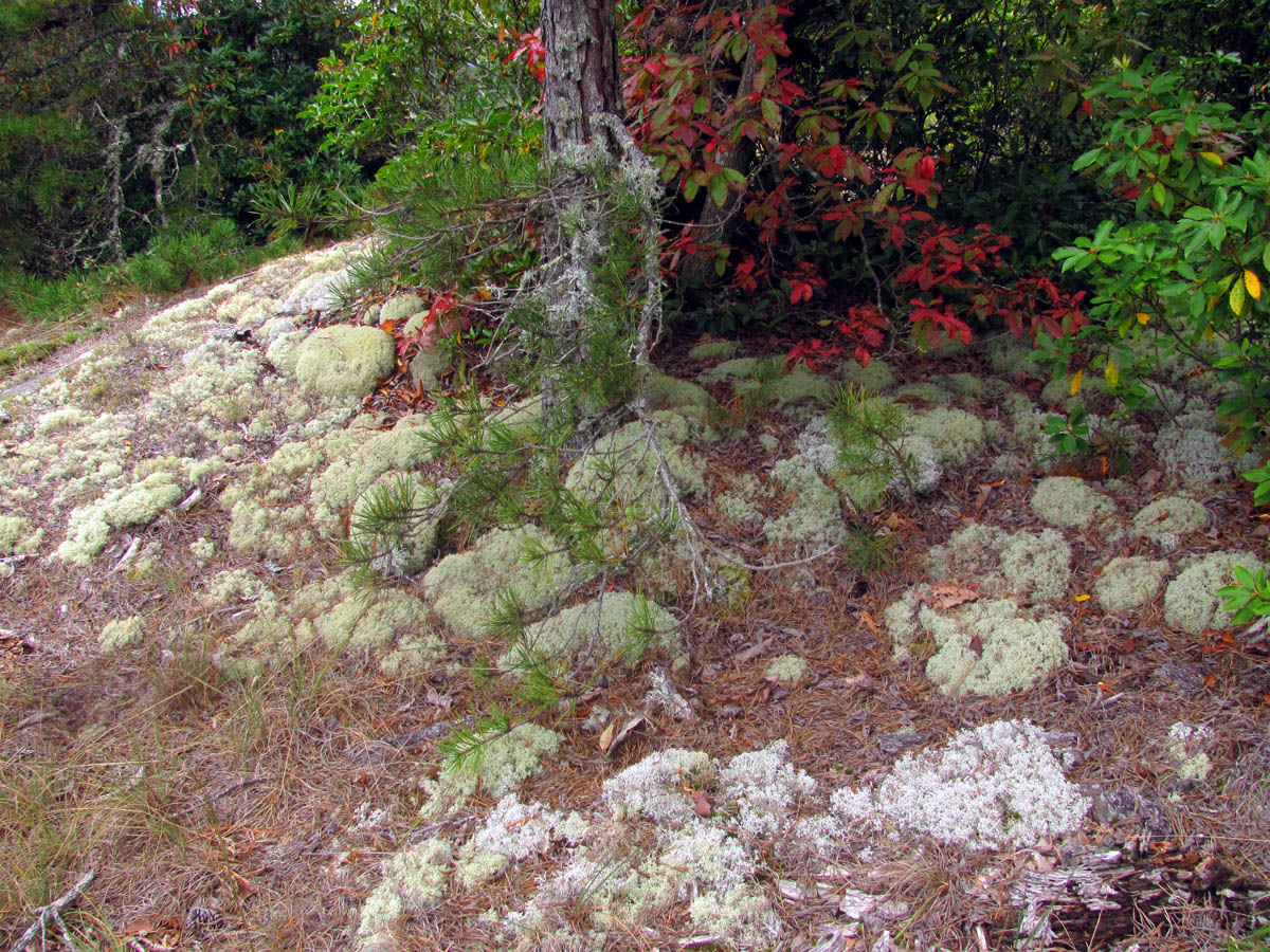
Some moss on the Blackrock Mtn. Overlook

 My name is 'RAT' and I love the mountains and waterfalls of the East TN. area where I live and I hope you enjoy this blog about my outdoor adventures.


One Comment to “Panthertown Valley – 9-10-2014”