


Flat Creek Falls (Panthertown Valley) – 9-18-2014
After being bitten by the Panthertown Valley bug on my first trip there about a week ago on 9-10-2014, I knew I would be going back there soon and often. My second trip was again with my friend Dave Aldridge who wanted us to see a very large and maybe one of the hardest to get to waterfalls there called Flat Creek Falls. Luckily for me some fellow waterfall friends of mine had just been there a couple weeks before so I was able to get some very good information from them. You can read about their insane adventure on Jason`s blog here (scroll down to Monday, August 25, 2014). On this trip we would begin our adventure at a different trail head at the end of Rock Bridge Road which is on the other side of the valley from where our last trip started. The journey begins by crossing the Flat Creek right out of the car and finding the Old Trestle Road that was used back when the narrow gauge railroads were hauling logs out of the area many years ago.
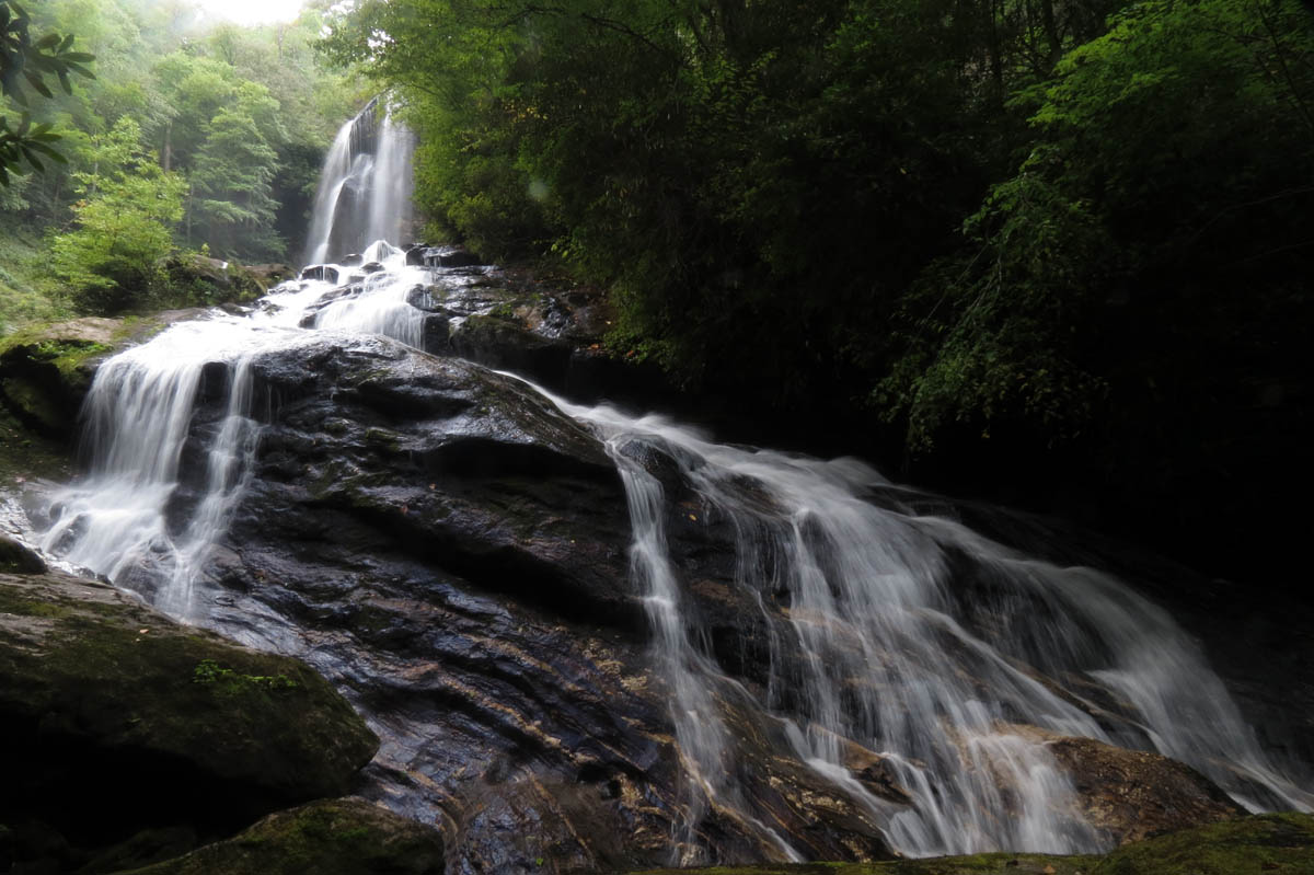
Flat Creek Falls (lower half)
We did not take the time to go see Hidden Falls which is on a side trail close to the creek crossing here as we knew it was going to be a long hard day to reach Flat Creek Falls and back. We will save those for another time. The trail is not that bad but you can tell that this is one of the lesser traveled trails in the valley. There are some intersecting roads and paths so it does help tremendously to have detailed instructions on how to reach these falls before you go. The trail is on the old trestle path and does have a few difficult places where the trestles are long since gone but, for the most part it is easy to follow and eventually comes out on a larger and much more open old forest road.

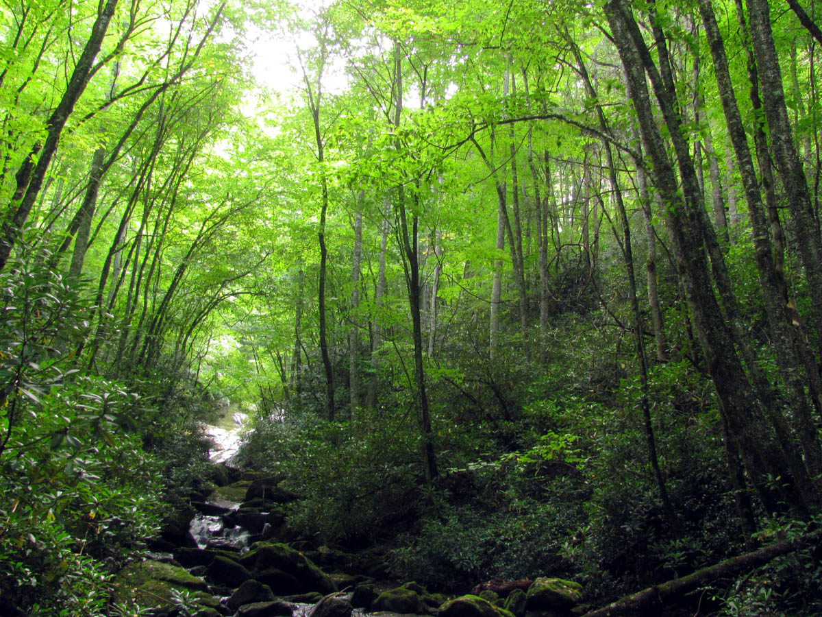
Getting close to Panthertown Valley
We did see plenty of fresh wild hog tracks where they had rooted up the road in places but, luckily we did not encounter any along the way. It is at least 2 miles or a little over to get to the top of the falls and you do have to find an unmarked side trail and walk out and down to them. This was the first time of several that I was happy to have been given details on how to get there beforehand. Once we found the side trail we soon found ourselves standing at the edge of oblivion high above the top of the falls. I can not stress enough how dangerous this part of the falls is. I do not recommend taking any children here or inexperienced hikers and even then would not suggest going anywhere out on the top of these falls other than the overlook above them. Even there I would exercise extreme caution as a fall from there would result in tragic results.

Dave getting some shots from the top of the falls

Uppermost drops of Flat Creek Falls

More drops at the top of Flat Creek Falls as the water makes its way down to the vertical drop

These drops are much steeper than they appear

Last section of the top half of the falls before it drops over the edge of the vertical part and goes out of sight

Looking at the top edge of the vertical part of the falls from the overlook at the top of the falls

Zoomed shot of the top edge which starts the lower and vertical part of the falls
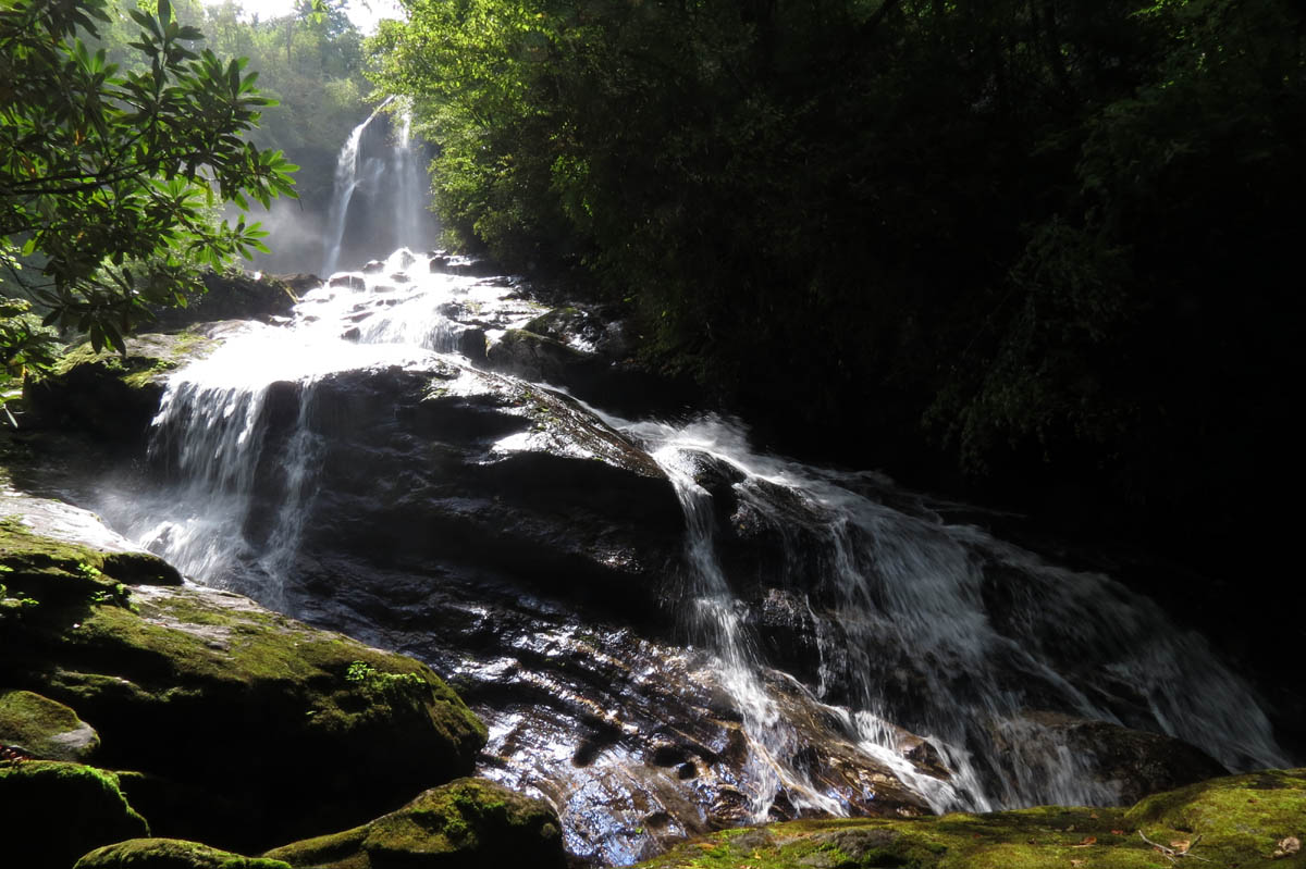
The top part of the falls is a long, steeply slanted, cascading type of falls with two significant drops before it reaches the top of the vertical part of the falls measuring some 200+ feet down where the falls then disappear from sight over that edge as seen from this vantage point. Have no worries though because there is an additional 200+ feet of falls that you will see IF you can reach the base which does include the 95 foot vertical part of the falls ! We hung out here at the top overlook while we waited on some clouds to hide the bright sun but, that was not going to happen on this day.

Trying to show the steepness of the drops at the upper half of the falls

I am still trying to imagine going down this as my friends did on a recent trip here,,,,

There is almost 200 feet of drop to the upper half of these falls

It just keeps going and going until it reaches the sheer drop off point,

The drop off point !

This is the very top of the falls

Standing on the tip top of the falls

Standing out on the top of the falls (below the overlook)
The overlook as seen from standing out on the top of the falls

You can almost see how steep it is here,,,, not a safe place to be

Cooling looking tree at the top of the falls
I did find my way down to stand on the actual bare rock of the top of the falls and checked out the first couple of drops there and I really wanted to explore farther as it was dry enough to do so but, since it was only Dave and I, it was far too dangerous to risk doing so as one slip or misstep here would mean certain death. I had Dave pass me his camera down so I could try and get a swirly picture there but, I was not very successful at it. We went back up the side trail to the main trail and continued following it to reach the base of these mighty falls.

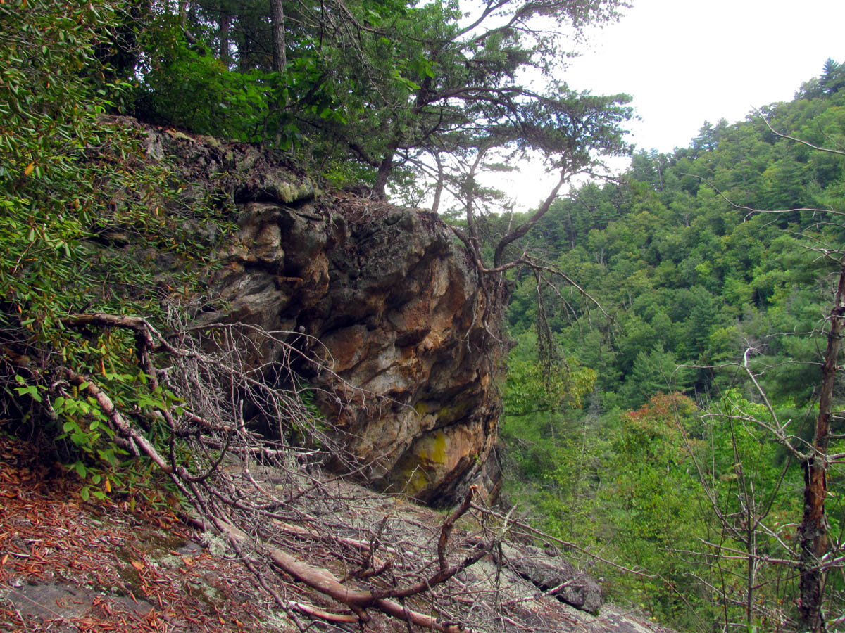
You will see plenty of these along this route

Side trail off the main road that follows the boundary that will eventually take you DOWN to Flat Creek well below the base of the falls. The old road continues and I think comes out at the lake
This old road does go into private property for a short ways but is right beside the forest service boundary line so it is apparently ok to hike here. We could see a lake off in the distance and heard boats which I must assume is Bear Lake which Flat Creek eventually flows into. There is a significant amount of downhill to reach the creek below the base of the falls along with a couple of right hand turns so it does help to have detailed directions and a good map to which I must thank my friend Jason Horton for providing both for me.

Dave negotiating one of the many creek crossings

The trail is not very good in some places but better in others as you make your way upstream

cascade we found just before the base of the falls (this is where I got the swirly on the way back)

Another shot of the cascade before the base of the falls
Once we reached the creek again, it is a ways upstream to get to the base of the falls which will include a few creek crossings, some blow downs, and some apartment sized rocks once you get to the falls. I knew it was going to be a long, uphill hike back but once I stood at the base of the falls, I knew it was so worth it. The sun was still blistering bright so getting any good pics was not going to be possible although we stayed there a lot longer than we should have in hopes of maybe a passing cloud or two.

The last rock hop to reach the base of the falls and an example of how bright the sun was going to be when we got there

Almost to the base of the falls

We could see the heavy mist coming off the vertical part of the falls before we got to them
I was itching to climb up to the vertical part of the falls but with only Dave there I could not chance it as it would definitely be a risky venture to do so and I would want to have others with me that are able bodied and stupid as I am to do such a thing ! I will definitely be coming back here in the future.
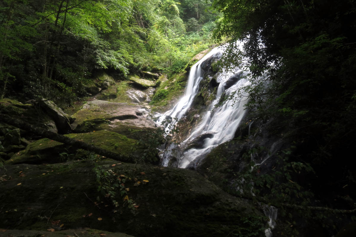
Lower part of Flat Creek Falls under intense bright sun light !!

Dave looking up at the falls praying that a cloud would come over. The only thing the sun was good for was illuminating the heavy mist that comes off these falls

I love the very bottom of the falls,,,,,

Zoomed shot of the vertical part of the falls

Flat Creek Falls

Flat Creek Falls

Flat Creek Falls

Flat Creek Falls

Flat Creek Falls

One of the best shots I was able to get of the vertical part of the falls

Lower half of Flat Creek Falls – this is over 200 feet !!!

Lower half of Flat Creek Falls

Lower half of Flat Creek Falls

The only usable shot I got with my pocket cam of the vertical part of the falls

It`s hard to show just how tall these falls are or how large the rocks are we are standing on there but, this shot helps,, Dave standing at the base,, took this with my pocket cam,

Looking down the creek from the base of the falls, taken with pocket cam ,, these rocks are HUGE !
Base of the falls as I was leaving
We hung out there as long as we could waiting on the sun to give us a break before heading back out the way we had came. I did manage to get a decent swirly just below the falls which was not there on the way in. This proves my theory that the water flow is constantly changing.
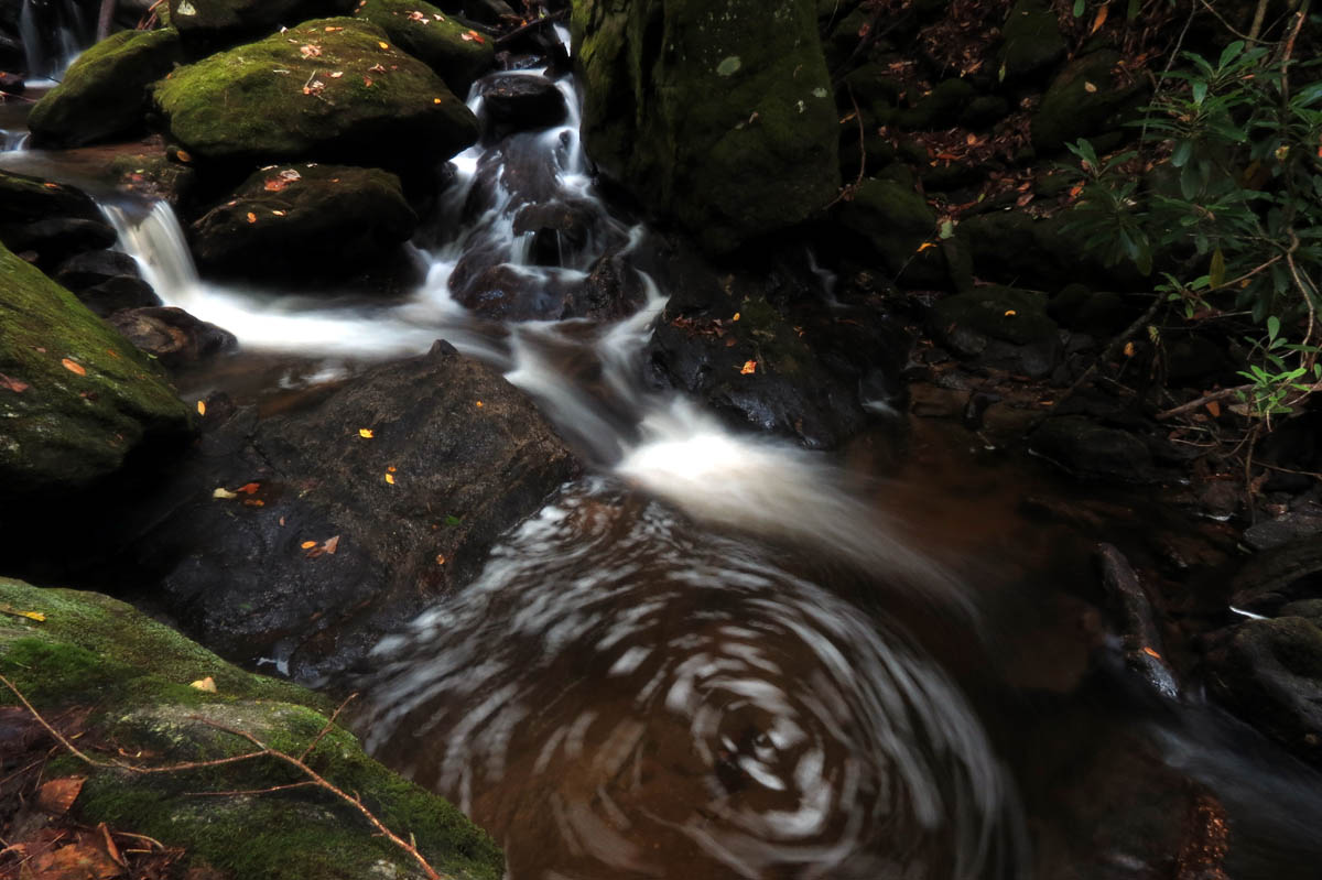
My swirly shot

My swirly shot

My swirly shots

My swirly shots

My swirly shot
We took our time going back up all the hills we had came down to get there taking several breaks along the long route back but I was happy when we reached the old trestle road and we were able to get back to the car before it got too dark.

Dave making his way through one of the fresh blow downs along the trail along lower Flat Creek
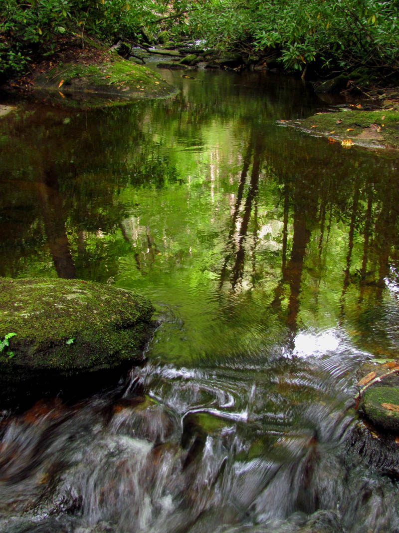
Reflections at one of the creek crossings along Flat Creek

Dave slowly trudging back up the long, steep incline of the old road within the private property on our way back from the base of the falls. There are some very large trees here.

The old trestle road in low light as we got closer to the end of the trail

One of the last hills on the way back to the car. Hard to imagine there was a nice log road/railroad here at one time
The best part of all was that we made it to the Hawg Wild Bar B Que joint just a few minutes before closing (8pm) and they let us in and locked the door behind us so we were able to get our post hike grub on before the long drive back home. What a long and hard hike this has been but was a most awesome adventure to a most awesome waterfall that I will definitely be coming back to as soon as I am able.

 My name is 'RAT' and I love the mountains and waterfalls of the East TN. area where I live and I hope you enjoy this blog about my outdoor adventures.


Leave a Comment