


Upper Upper Upper Upper Upper Dick Creek Falls – 11-22-2014
After my last trip to the newly discovered falls of upper upper dick creek on 11-8-2014 where we fell considerably short of reaching the uppermost falls at the head of the valley, I was determined to come back and get to those elusive falls. After consulting with my friend Larry Jarret who was the one who discovered the four new falls that reside above the known Upper Dick Creek Falls earlier this year, it was agreed that due to the distance and extremely rugged terrain, that it would be best to do this trek from top down going one way. Another factor would be the decreased amount of daylight hours since it now gets dark by 5:30pm. Even during Summer where the days are long, I would not advise going there due to the large number of venomous snakes that thrive in this area that is not visited by humans ever. It was a cold day with temps right at freezing all day so there would be no danger of seeing any reptiles on this adventure. We began our quest by dropping a vehicle near where Dick Creek empties into the North Indian Creek near Limestone Cove and proceeding to take a second vehicle to near the top of Unaka Mountain (Photo by Bol’Dar) stopping only to pick up Bol’Dar at the Rocky Branch trail head parking lot.
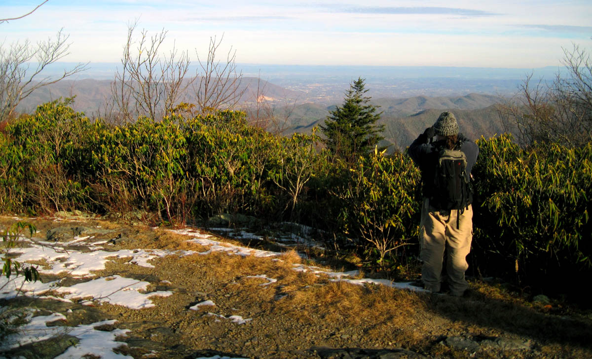
RAT taking in the view at the Horseback Ridge Trail Head (looking towards Johnson City) Photo by Tommy ‘Bol’Dar Warden
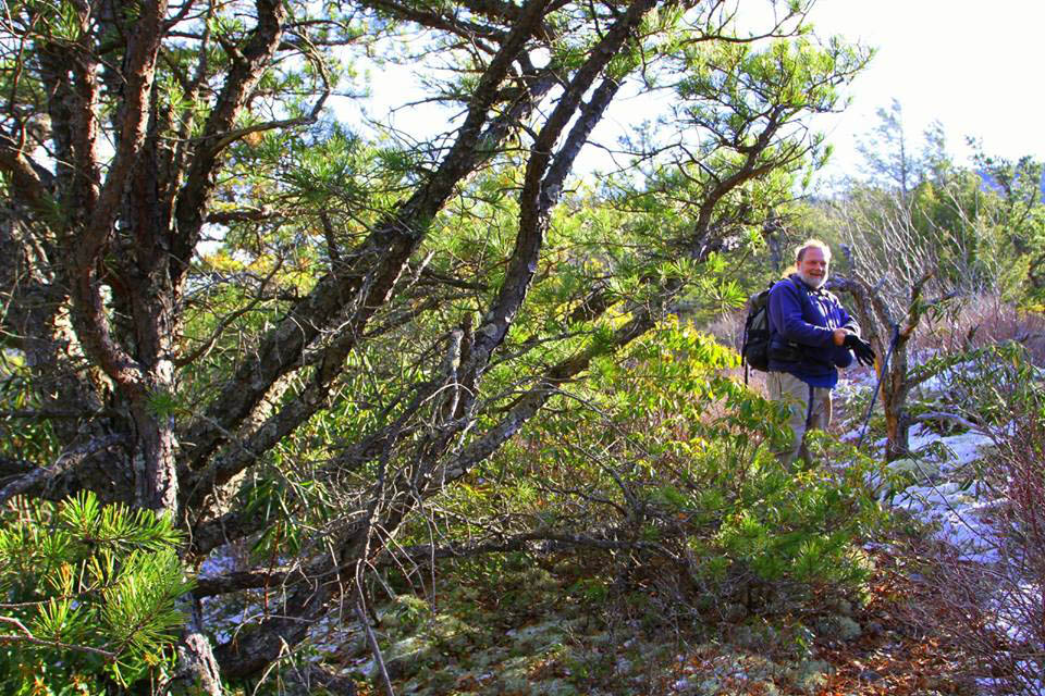
I would be accompanied on this odyssey by friends and fellow hikers, Tommy (Bol’Dar) Warden (Photo by Derrick Hamrick), Jeff Dean (Photo by Derrick Hamrick), and Derrick Hamrick (Photo by Derrick Hamrick) . We left Derricks truck (photo by Bol’Dar) on top and began our adventure by going down Horseback Ridge. It was a clear morning but, there was some snow and ice which required a four wheel drive. There were some decent visuals from the ridge but it was cold and the wind was constant making it feel much colder. We wasted little time heading down the rocky Horseback Ridge.

View of where Rattlesnake Ridge meets Unaka looking across the head of Dick Creek Valley from the Horseback Ridge Trail

Slightly zoomed, view of Rattlesnake Ridge looking across the Dick Creek Valley. Those large mountains in the background would contain everything from Sugarloaf Knob and Flint Mtn. (left) to Coldspring Mtn. (center) to Rocky Fork, Lower Higgins, and Mill Creeks (right)

Looking over Dick Creek Valley you can see the lower regions of the Rattlesnake Ridge with some of Erwin and out in the distance would be over Rich Mtns to Embreeville and Sampson Mountains with the Nolichucky River valley beyond. You can actually see Bays mtn and Clinch Mtns beyond that with the naked eye when standing here on a clear day

Looking over Rattlesnake Ridge towards Erwin. if you look closely out in the distance you can see some of the high knobs of Sampson mtn sticking up

Looking off Horseback Ridge to the right you can see Bol’Dar`s house in the valley below ! That would be Stone Mountain (closest) with Little Mtn and part of Iron mtn in the background
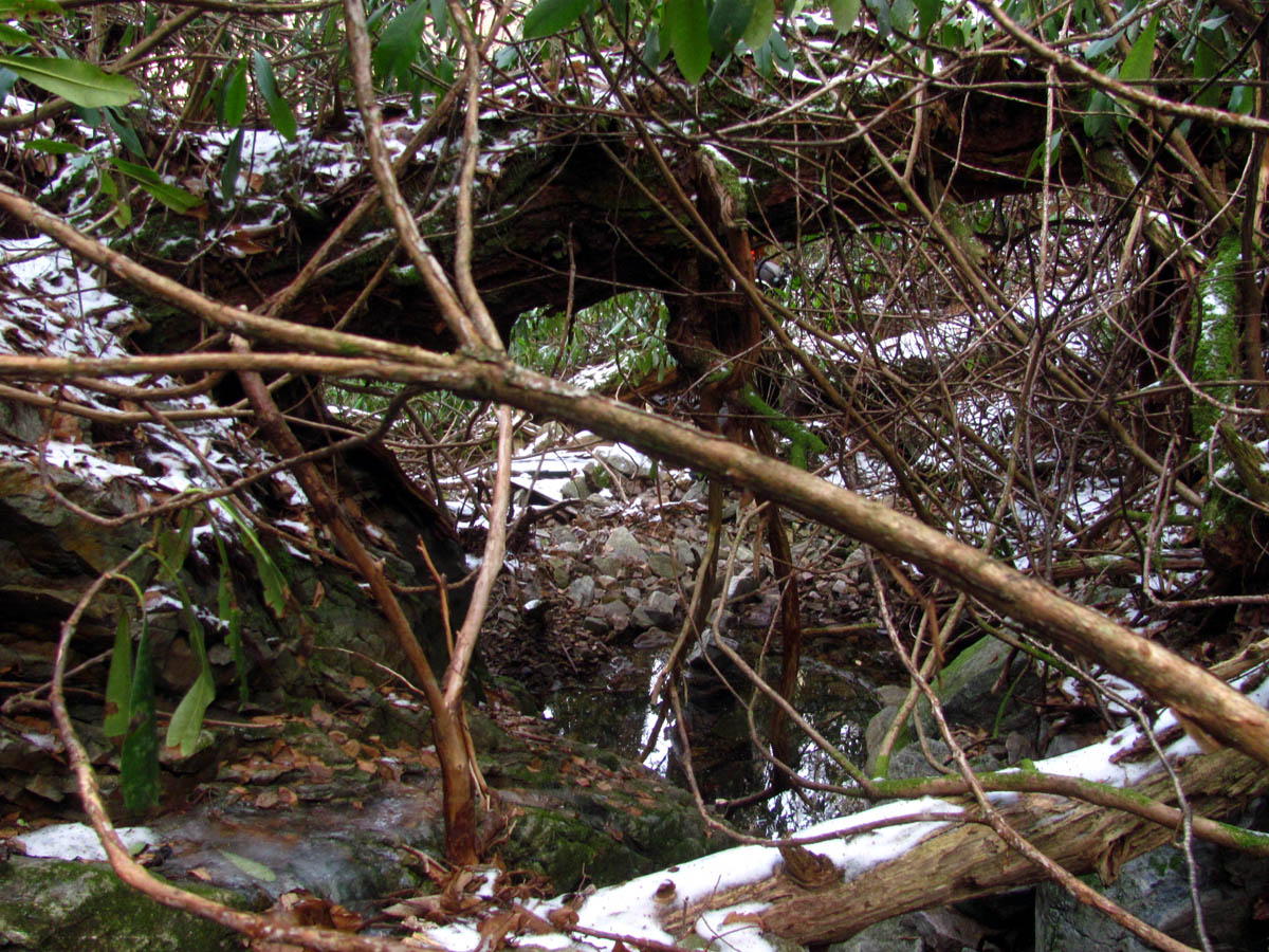
If you have ever been on this ridge you will know it is narrow and loses elevation at a fairly fast rate as you travel between two walls of impenetrable laurels as it makes it way down the rocky spine. This ridge is not often traveled very far from the road as it really does not come out anywhere significant so after a quarter mile or more it becomes more overgrown and by a half a mile down there are some spots where it is starting to disappear altogether. In those places one has to forge the way through following the lower animal trails trying not to get off to the wrong side where it begins to widen out as some finger ridges develop. The laurels on the left side where we needed to go down are just too thick for even a rabbit to squeeze through until after about a mile down where there is one small place that a ninja passage is hidden. My friend Larry had marked this for me so I knew I was in the right spot to begin the arduous descent.

RAT pointing out something from the ridge trail before we began the descent (Photo by Derrick Hamrick)

Bol’Dar pointing : ” Hey ! I think I can see my apartment from here ! ” (Photo by Derrick Hamrick)

RAT pointing out stuff,,,”Yeah, we`re going down there ! ” (Photo by Derrick Hamrick)

Jeff Dean pointing : “We`re going down there ? Really ? You`re kidding right ? ” (Photo by Derrick Hamrick)
C’mon guys ! This way ! It`ll be fun ! MUHA HA HA HA ! (Photo by Derrick Hamrick)

Hi Ho, Hi Ho, it`s down the ridge we go ! (Photo by Derrick Hamrick)
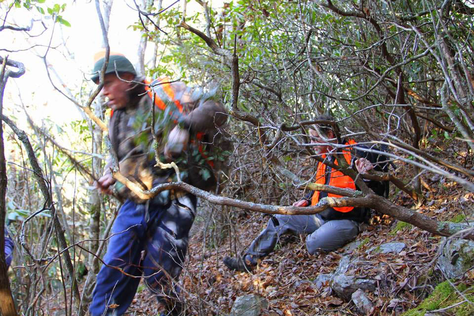
Under normal conditions you would be able to hear the waterfall way down below but, on this day there was a constant wind blowing across the ridge from the valley below that drowned out any chance of hearing it so we were on our own. Not knowing the exact location of the falls, and being armed with only the knowledge Larry had given me, we followed the path of least resistance down the incredibly steep ridge side trying our best to keep to those directions as best we could. This was not an easy task to put it lightly, as there are few open areas aside from crawling on your belly to allow travel down to the lower realm of the Dick Creek Valley. Derrick was the first to bleed but we would all eventually earn that merit badge several times over before we ever reached the bottom.

Bol’Dar and Jeff looking at each other as if to say “Did you know it was going to be like this ?”

First blood ! (Derrick)

crawling through the laurels on the steep descent

One of few places where you could actually see through the laurels

You must be extremely careful on these type of descents as there are many hidden cliffs and sheer drop offs hiding within the growth such as this one. You would not want to go over this unexpectedly

Going out to the left and down to find a way around the drop off
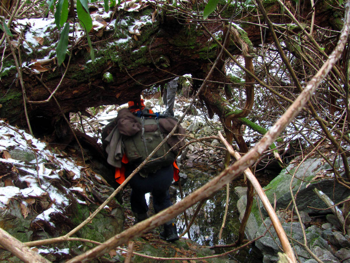
We meandered our way out and down still unable to hear anything below due to the wind, finding very few open areas but, instead found many briers and laurel hells scattered with dozens of huge blow downs that we would have to go under and over. By the time we reached the actual creek the laurels had become so thick you could barely get through them. It was like the forest was consuming us and there was really no end in sight. It is a LONG way down to reach the creek at the bottom ! The next series of photos are courtesy of Derrick Hamrick who did an excellent job capturing this extremely steep and very rough descent until his camera quit working:

Small rock cave we found just off the ridge trail at the very beginning of our descent (Photo by Derrick Hamrick)

Making our way down, down,,down,, (Photo by Derrick Hamrick)

There were several of these rock obstacles to go over. They came in all sizes from small to huge sheer cliff drop offs. (Photo by Derrick Hamrick)

Words and pics just can not justify how tough it was going down this hill ,,, (Photo by Derrick Hamrick)

The obstacles were of many varieties and were never ending (Photo by Derrick Hamrick)

Looking for the path of least resistance (Photo by Derrick Hamrick)

RAT pointing something out. (I do this a lot !) (Photo by Derrick Hamrick)

I was in this position a lot during this steep descent. Sometimes its the only way to get through the laurels (Photo by Derrick Hamrick)

Yes there were briers , lots of them,,, (Photo by Derrick Hamrick)

Continuing to negotiate around the endless opposition (Photo by Derrick Hamrick)

It is said that spending too much time in endless laurel hells causes hallucinations. Now I believe it. (Photo by Derrick Hamrick)

Steep laurel hell hallucinations (Photo by Derrick Hamrick)

It was like the forest floor was swallowing us. What seemed like solid ground would sink leg deep with most steps. (Photo by Derrick Hamrick)
Sometimes ya had to just sit down for minute. I think Jeff was trying to make the hallucinations stop. (Photo by Derrick Hamrick)

“Damn, we gotta go through that ? ” (Photo by Derrick Hamrick)

Bulldozing our way to the bottom,,, (Photo by Derrick Hamrick)

It only got worse, it never really got better,,, (Photo by Derrick Hamrick)

The entire time it was like the forest was consuming you. It was quite a mental and physical challenge because it lasted so long. There are not many people who could endure a challenge such as this. (Photo by Derrick Hamrick)

I was still up, or, down in this case, for the challenge but the morning was still fresh. My patience would be tested before this day was over. (Photo by Derrick Hamrick)

Becoming one with the laurels, or at least trying to (Photo by Derrick Hamrick)

One of the many times I took a fall (Photo by Derrick Hamrick)

Recovering from the fall (Photo by Derrick Hamrick)

I was not the only one who fell going down the hill (Photo by Derrick Hamrick)

Bol’Dar taking the lead (Photo by Derrick Hamrick)

Getting closer to the bottom but even though you could see that it was close, you never seemed to get there,,, (Photo by Derrick Hamrick)

So close but yet so far away (Photo by Derrick Hamrick)

Approaching the lower regions but still the steep descent seemed to go on forever,,, (Photo by Derrick Hamrick)

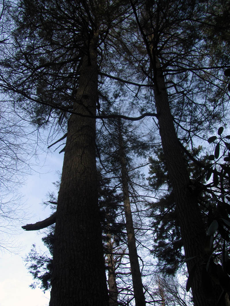
There are some very large Hemlock trees when you finally reach the bottom (Photo by Derrick Hamrick)

Drowning in an ocean of laurels,,, (Photo by Derrick Hamrick)

This would be one of the only times I would have the map out (Photo by Derrick Hamrick)

Finally we had reached the creek at the bottom. I am sure I am looking back at what we had just came down thinking, “I can`t believe we just came down that !” (Photo by Derrick Hamrick)
Not knowing if we were above or below the falls (although I was pretty sure we were above them) we had no choice but to scout upstream to make sure because, we did not want to go through this much torture and be below the falls and have to backtrack to find them. This would prove to be a misfortune as we were indeed above them and going upstream was no better than going down and we soon seen the water disappear completely as we slowly crawled our way through some of the roughest going I have ever done to reach the head of the Dick Creek hollow. Bol’Dar climbed up the last steep incline to get a view of the butt end of it all to make certain there was no falls there. After that we retraced our steps back through all that crap just to find it got even worse as we continued our way downstream towards the falls.

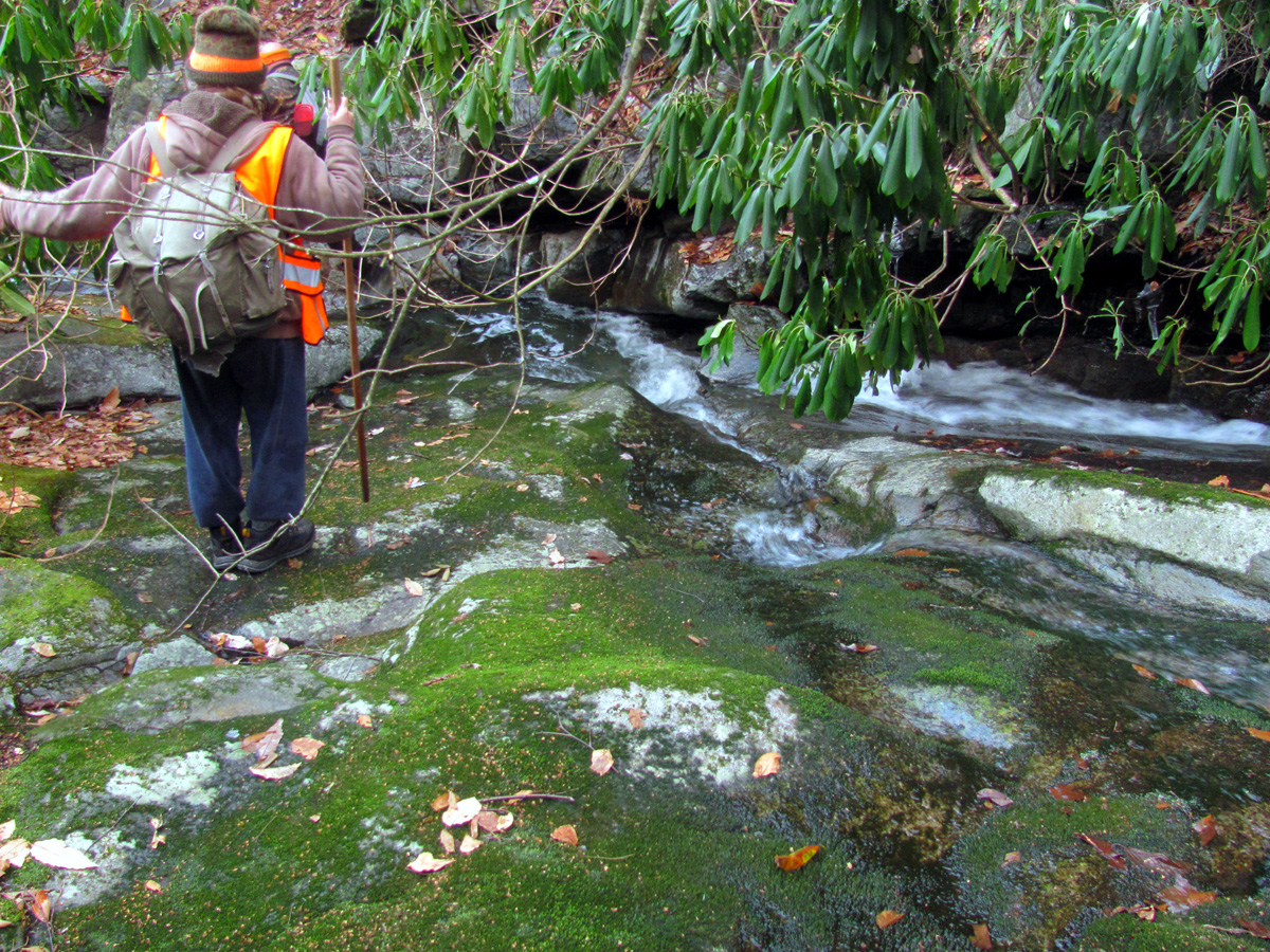
This is where we came out at along the creek. Of course we had to go upstream to make sure we were indeed above the falls. It looked much clearer than what we had just came through but trust me, it was still very difficult moving anywhere in this valley

Heading upstream (Photo by Derrick Hamrick)

Going upstream would prove difficult (Photo by Derrick Hamrick)

Almost immediately the water disappeared and we found ourselves in a dry creek bed. Bol’Dar climbed up to the highest vantage point to get a view up into the butt end of the left fork of the Dick Creek Valley to make sure no waterfalls or anything worth seeing was there

Bol’Dar`s view of us from the high vantage point at the butt end of the valley (Photo by Bol’Dar)

Now that we had confirmed that the falls were downstream from us, we set our sights in that direction. Yeah right,,, very rough going,,,

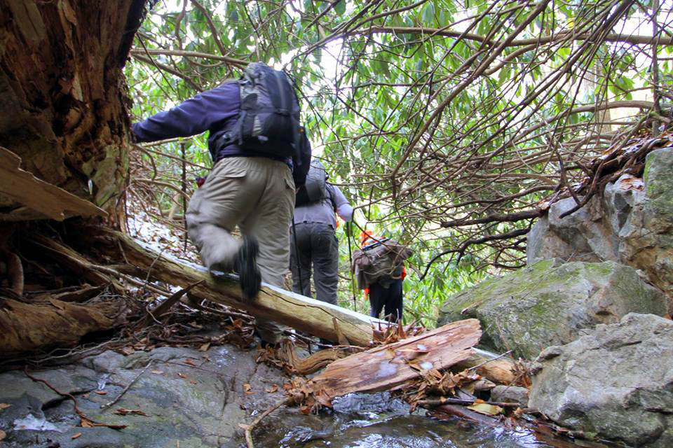
Derrick making his way downstream

Since there was really no way to proceed on either side we had no choice but to go right down the creek. This was still extremely tough to do

There are some large Hemlocks in this area of upper Dick Creek

Not a good picture but it shows the size of the hemlocks that grow right our of the creek bed although the creek is dry in this upper region but just below here the water comes out of the ground and starts flowing
Looking up at these tall hemlock trees
Reaching the point where there is water. Huge blow downs line the entire valley we would deal with them all day.
Bol’Dar going under the huge tree laying across the creek where the water bubbles out of the ground

Continuing down the creek, Derrick capturing the journey

Climbing down the first of many drops above the falls we were looking for

The view from my seat in the creek, looking down.

This was beside me while I sat there.
Making our way down a steep drop in the upper dick creek realm where I am sure no man has set foot in many decades (Photo by Derrick Hamrick)

This had to be done slowly and carefully due to the slick wet and iced over rocks (Photo by Derrick Hamrick)
There is really no way to describe the grueling hell that is the uppermost region of the Dick Creek Valley and pics can only show a few feet at a time so they can`t do it justice either but, I can tell you that it is one of if not the hardest and for certain the longest, bushwhack that I have ever done. The laurel hells are nearly impassable, and full of downed trees, briers, and under foot is rocks covered by years of mosses and leaves which you end up post holing into up to your crotch in with nearly every step. You can not get out of it by going higher on the hill as it is the same stuff there, and usually going right down the creek is easier however, not in this case as it is just as thick and that only adds the larger, slick boulders to climb down which has water flowing and on this day would have lots of frozen ice making it very slick. Going just a few feet took what seemed like forever and drained your energy beyond imagination. It would take us over an hour to go barely a quarter mile to reach the top of the Upper upper upper upper upper Dick Creek Falls.

Sliding on ones behind was sometimes the safest way (Photo by Derrick Hamrick)

Major obstacle blocking our way as it got really rough as we neared the top of the falls

More of the same on the right bank so no going that way

There was a cliff to the left so there was only one choice,,, (Photo by Derrick Hamrick)

Taking to the high side to try and get around the cluster of downed trees near the top of the falls (Photo by Derrick Hamrick)
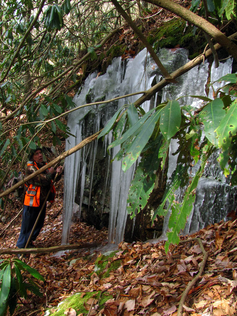
We came across this huge group of over sized icicles while negotiating high above the cliffs of the falls. You can see how tall they are above Bol’Dar`s head.

Amazing ice

This size of ice is the result of many cold nights and slight melting each day

Taking my turn posing in front of the ice. The look on my face is not a smile as I am looking down at the steep tangled mess that was between us and the bottom of the falls (Photo by Bol’Dar)

I was trying to catch the light through the ice

I took a lot of pics of this ice while I prepared myself for the final drop down to the falls.

My first glimpse of the falls

Looking back at what we had just came through. This is right beside the falls. Take a good look to envision just how tough it is to travel here

Making my way down to the base of the falls. Not easy.
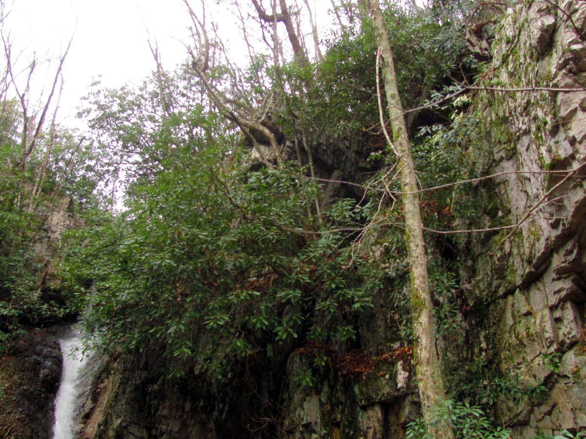
It was really obvious when we got close to the top of the falls as looking ahead you could see the huge drop off. There were several very large downed trees scattered all around it edge with many other smaller ones underneath. It looked as if a bomb had been detonated there. With sheer cliffs on both sides it was quite a task to get down to the base of the falls. The entire time completely shrouded in laurel hells and walking on loose boulders that were well hidden beneath the moss, ferns, and forest carpet from ages gone by. Getting over the blow downs and down to the base was extremely difficult and I was happy to finally be standing on some level ground and to have reached the falls which was the main objective of this very difficult mission.

Finally I had made it and was standing on level ground at the base of the falls. Whew !

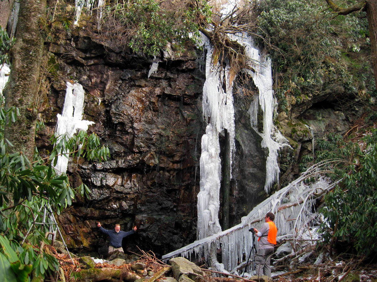
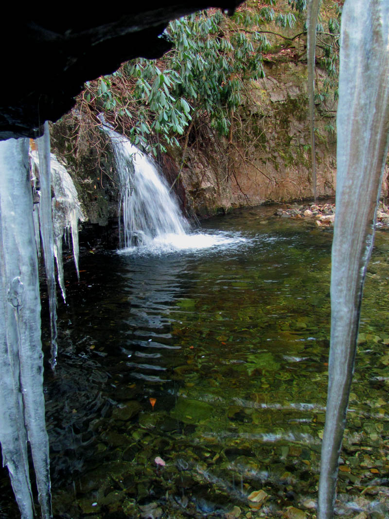
The Upper Upper Upper Upper Upper Dick Creek Falls

The upperest falls on Dick Creek

This is my favorite of all the pics I shot, it has the best capture of water, ice and has a reflection ! Uppermost falls on Dick Creek

Upper x 5 Falls on Dick Creek

Jeff and Derrick checking out the awesome falls. I felt bad for Derrick with his camera not working as soon as we arrived. That was like taking a kid to a candy store, taking all the candy out of the containers and putting into a big pile in the floor, setting the kid on top of the pile and telling him he cant eat one bite of it. Had to be tough.

Bol’Dar getting some shots while Derrick attempts to measure the height of the falls. My guess is 30 to 35 feet high.

Two huge Pine tree Ents that guard over the falls

Uppermost falls of Dick Creek. The roots hanging over are part of the devastation of several downed trees just above the top where we were at earlier. That is what knocked the two over the edge that are standing vertical there still.
The worst thing to happen there was Derrick`s camera decided that it would stop working. He was unable to take another picture for the rest of the trip. This was extremely disappointing as he is the best photojournalist you can ask for and would have gotten some incredible shots however, it was not meant to be on this trip. We took a long and much needed break at the base of these amazing falls while we ate some snacks, licked our wounds and, took some pictures of the frozen falls. There was not a lot of water flowing at this time but the amount of ice made up for it. The light was getting bright so I was unable to get any high quality pics which I have become accustomed to by now.

Side view of the uppermost falls on Dick Creek

Side view of the uppermost falls of Dick Creek

Base of the uppermost falls of Dick Creek

Lower part of the falls

Rat and Jeff staring up in awe at the Uppermost falls of Dick Creek. The size of that root cluster is unbelievable. (Photo by Bol’Dar)

Trying to get a good shot (Photo by Bol’Dar)
Since it was too cold and too hard to get under the main part of the falls due to the ice, I had to do the Hillbilly Baptism under some heavy drips on the left side of the falls. I actually got very wet doing this ! (Photo by Bol’Dar)

Bol’Dar doing the Hillbilly Baptism under the heavy drips of the falls
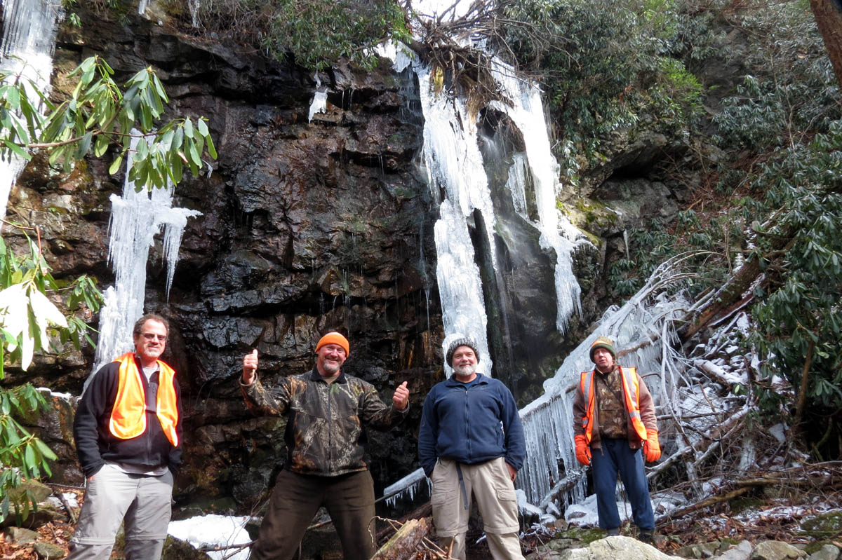
Group shot at the upper upper upper upper upper falls of Dick Creek (Photo by RAT)
Before long it came time to continue on our journey following the creek down towards the other falls that were yet to come. Had I known just how difficult this would be, I would have climbed right back up the hill to the ridge where we started ! And I do NOT say this jokingly, I am dead serious. After making this trek I can NOT fathom going from the bottom to these uppermost falls and then have to go back through this to return. That would be a miserable and very long if not an impossible day. The laurels were so thick that you could not get through them on either side of the creek which left the only alternative of going right down the gut of the creek although they were so thick there you could barely even see it except in a few rare spots. Being right at freezing temps, the rocks were very slick, many glazed with ice like freshly frosted doughnuts making it very treacherous to climb down. There were some very large rocks and some very slanted ones as well. The going was extremely slow.

Looking back at Jeff and Derrick as we make our way down the gut of Dick Creek

Looking back up where I had just came from,,

This is an important picture,, looking back up the creek where we had just came from the uppermost falls on Dick Creek, in this shot you can see the ridge finger (center) in the background. That finger is what separates the left and right forks of the head of Dick Creek. The falls are up the left fork. Did I mention laurel hells ?

Continuing down the creek,, laurels to the right of me,,,

laurels to the left of me,,,,

Laurels in the middle,, laurels everywhere ! This is looking down the creek. It is solid like this for over a mile and a quarter. The only way it is even possible is right down the creek and even it is solid laurels and many other obstacles. It never breaks open for more than a few feet the entire way.
Jeff had his glasses slapped off his head numerous times and eventually one of the lenses came out and the frame bent so he was hiking blind more or less for the majority of the way down. It would be well over a mile of the roughest, gnarliest, bushwhacking that I had ever been on before it ever improved any at all. It took us over 3+ hours to go this distance if that tells you anything. You can hardly call it hiking as most of it was fighting laurels and other growth all the while trying to keep your balance across huge rocks that were slick with ice while trying to stay out of the deep parts of the creek. Unfortunately for me, I was unsuccessful at doing the latter. I digress,,,,,
Ice covered rocks at a small falls along upper Dick Creek
We continued on slowly but surely through the tangled up mess of laurels and downed trees mixed with everything in between still forced to stay directly in the creek as the sides were still very much worse making the progress take forever. There are several really beautiful places along the creek, a few cascades and small falls that are very enjoyable yet it was hard to enjoy them due to the amount of energy, pain, and discomfort that is required to get there. One such place we aptly named ‘Randy Falls’ as I had the misfortune of falling backwards into a four foot deep pool at the bottom of them. I was making my way around the left edge which was a slanted and very slick rock beside the deep pool when my foot slipped and I had to put all my weight suddenly on a arm sized tree that I was holding onto which snapped loudly sending me backwards into the ice cold stream. It was over in seconds yet, the fall seemed like an eternity to me and I could have written an entire book along the way. So many thoughts went through my head before impact of the water. First of which was an expletive ! Others were along the lines of, this is going to be very cold,,, oh man this is a deep hole, I`m going to get soaked,,, I am going to be very wet and very cold, followed by procedures of what I would have to do once I got out of the water in order to not get hypothermia and be able to walk the LONG distance still yet to come,,,, how hard it would be to rescue anyone anywhere in this upper part of the valley as a helicopter basket would not penetrate the laurels (not that there is helicopter of that ability anywhere near East Tenn.) and there is no way any amount of humans could carry someone out, it was just not possible,, thinking how the water was going to kill my pocket camera and hoping it would not hurt my big camera in my pack, knowing it would be submerged first,, the feeling of embarrassment of falling in front of everyone,, I even had time to think about how sad I was that Derrick`s camera was not working as he would have gotten about 50 shots of me falling and getting out that would not be captured,, so many things in such a short time. Of course all of that came to an abrupt halt when the water came around my ears and over my face as I sank to the bottom of this icy abyss. It knocked the breath out of me and I was slightly disoriented but, was able to hold what breath I did not have long enough to look up and see the light on top of the water some four feet above me so I instantly stood up and climbed out of my ice bath to a drier place to stand where I would have to quickly get out of my wet clothes and see how wet my spare clothes were in my pack which also went to the bottom with me.

Randy Falls

Part of the deep pool I fell into

It was that rtree I was negotiating around when a limb broke (you can see the broken stub near the roots if you look closely) as the laurels forced me away from the tree when the tree I was holding on to broke sending me backwards into the deep pool.

Randy Falls. You can see the pool is deeper to the left and to the right side where I fell in at,, its only shallow in the center !

Wringing the water out of my jacket (Photo by Bol’Dar)
I wrung out as much water as I could and changed into my other shirt, socks and jacket that I always carry in my pack which were damp but, better than nothing as I hoped to stay as warm as possible. It would not be required to build a fire as I was able to sustain a tolerable body core temperature but, I needed to get moving again so after I got a pic or two of the falls where I fell, yes amazingly my camera was still working, we would continue the arduous task of continuing downstream.

More slanted rocks and pools, You can see the size with Jeff in the shot

This pool had a really cool rock covered in ferns

This is one crack rock I could never say no to

Derrick making his way across the slick slanted rock

Looking back over the crack rock

Continuing onward through the never ending sea of laurel hells

One of the rare open spots of the upper realm of Dick Creek. This shows how beautiful the creek would be if the laurels were not hiding it
Derrick making his way down one of the rare open areas of upper Dick Creek

We seen a lot of this along the way

Bol’Dar enjoying the ice overhead and the rare open area before, as you can see, the creek goes back into the thick laurels

Derrick and Jeff at one of the many small falls along upper Dick Creek

There was lots of this all day

Bol’Dar passing under one of the many large downed trees across the upper Dick Creek

Bol’Dar`s view of us from under the downed tree (Photo by Bol’Dar)

Huge rock channel the water has carved out over many years

Beautiful falls that I now wish I had taken the time to get my big camera out and shoot with a tripod but I was just too cold after falling in the creek

Another shot of these nice falls. You can see icicles and the stair stepped ledge

Doing the best I can with my water soaked pocket camera without a tripod

Still trying with my hand held camera

Trying my best to hold still but it was not easy. My feet were numb !

Just a cool split in the creek

Derrick beside one of the truck sized rocks in the many channels of upper Dick Creek. Jeff is trying to see without his glasses.

Bol’Dar has an icy hand !

There were maybe three short open areas without laurels or blow downs in the creek bed during the entire mile and a half,, this was one of them.

Looking back

Continuing on there were just more and more laurels to the left of us,,,

and again, more and more laurels to the right of us,,,
After what seemed like forever we finally came to what is now known as ‘Bicycle Falls’. Believe it or not in the middle of all of this impenetrable wilderness, totally inaccessible and has been for many decades, almost to the end of the valley, there is a mountain bike, complete, lodged between some boulders in the creek. It has bright pink cables and brake levers (they were most likely red before the sun faded them out) , and at one time this was a fairly nice bike. There is of course no explanation on how it got there as anytime in the last 30 or 40 years it would have been absolutely impossible to even carry it into this location from any direction. Had it fallen from the sky for any reason, the wheels would surely have been damaged and they are more or less perfect. The only damage is where the creek has flooded which has resulted in lodging it between the rocks and peeled both tires and inner tubes off it as they still hang from the rear frame there. It is quite an amazing sight to see and very surprising. it was completely coated in thick ice so it is kinda hard to see it in the pictures I took but, here is one that my friend Larry Jarret took this past Summer when he discovered it that is much better.

Complete bicycle in the upper Dick Creek taken this summer 2014 (Photo by Larry Jarret)

There is a complete bicycle in there, complete with pink cables. it is missing nothing.

You can see that all tires and tubes have been stripped by the flood waters from both rims and hang attached to the rear frame in tact

Looking close you can see the front tire, pink cables and other outlines of the frame

Bicycle Falls. From below you can barely see it if not for the tire hanging over the rock

Closer shot of Bicycle Falls

Close up of Bicycle Falls
Despite our hopes and prayers of easier terrain, there was only more and more of the same laurel hells, downed trees, huge boulders and growth of all sorts. No old log roads exist that I could see which I found very odd, although they could be there and just be overgrown where you can not see them. It would require too much effort to climb up and look so we did not bother. After about a mile and a quarter and three hours of really hard and exhausting scrambling, we finally came around the corner to an open area which I recognized instantly as the spring where we had turned around at on a previous trip here. I was elated. I had never been so happy to see a place in my entire life as I knew the way from there and knew that the laurels were basically over and it would be MUCH easier going from that point on not to mention I now knew exactly how far it was to get out. We took a long break there to rest, eat some snacks and I worked on drying out some more. At this point my feet were numb and my boots felt like two cinder blocks of ice.
Bol’Dar making his way down an icy flat area of upper Dick Creek right after Bicycle Falls about to go back into laurel hells

I made my way across the slick flat rock, looking for moss to stand on

Back to the relentless laurels. Looking ahead I recognized what I thought was the ridge that I had seen from the other side on my previous trip here where we had turned around at the spring there. This would be true but sadly it took us at least an hour to go from right here to just beyond that ridge !!!!

After almost 4 hours of tunneling our way through thick laurels down the belly of the creek from the uppermost falls of Dick Creek, we finally made it to the clearing at the old spring. I was elated as was the rest of the crew as I assured them it was much easier going from here on out.

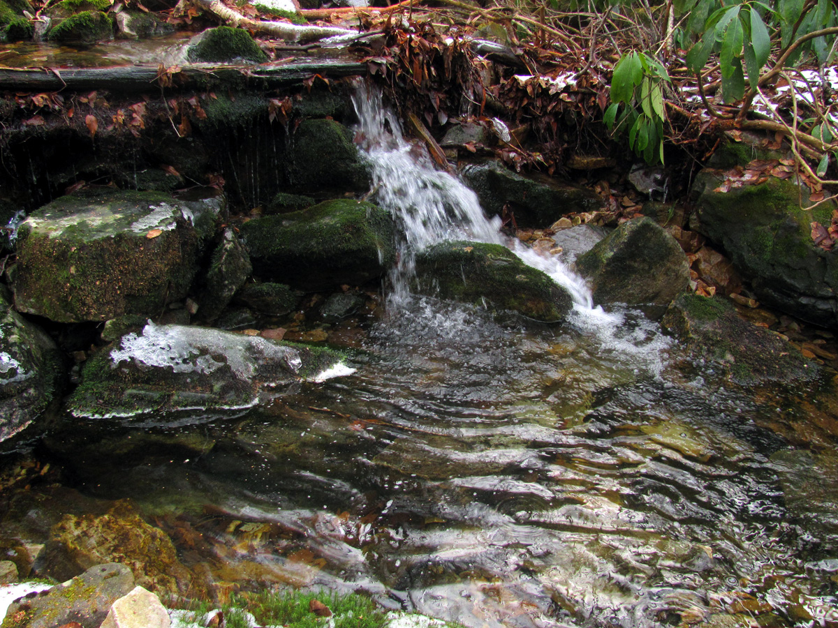
The spring. Such a welcome sight for my tired eyes to see
After a long break at the old spring, we were much rejuvenated especially knowing the going would be incredibly easier now and the belly crawling laurel scrambles were over. We would be able to actually hike in an upright standing position without getting poked from every direction. It was getting late and the temperature was dropping quickly so, I had to move on as my core temperature was on the edge of being too low. I recognized the route from my last trip here and led the way quickly to the first small cliff where I had to find the right crevice in order to be able to drop down on to reach the next set of upper falls. These are the smallest ones but, by no means are they insignificant. We spent the minimal amount of time there we could to get some shots before moving down to the next falls. I regret that I did not get my big camera out and I would have given anything to make Derrick`s camera work again.

Upper upper upper upper Dick Creek Falls

Upper upper upper upper Dick Creek Falls
Side view from under the overhang at the upper upper upper upper Dick Creek Falls

Side view from under the overhang of the upper upper upper upper Dick Creek Falls

Side view from under the overhang of the upper upper upper upper Dick Creek Falls. After seeing this I wished I had took some with my big camera but, my feet were just too cold to take the time

View from the other side of the upper upper upper upper Dick Creek Falls

Icicles around the upper upper upper upper Dick Creek Falls
From there it did not take long at all to make our way down yet another secret ninja trail of an even larger cliff to reach the base of the next set of upper falls which is a very attractive feature. Here we spent more time as there is so much beauty to take in and everyone except myself had not seen these before so it was quite a treat. I told them the best was yet to come so after several minutes we continued downstream.

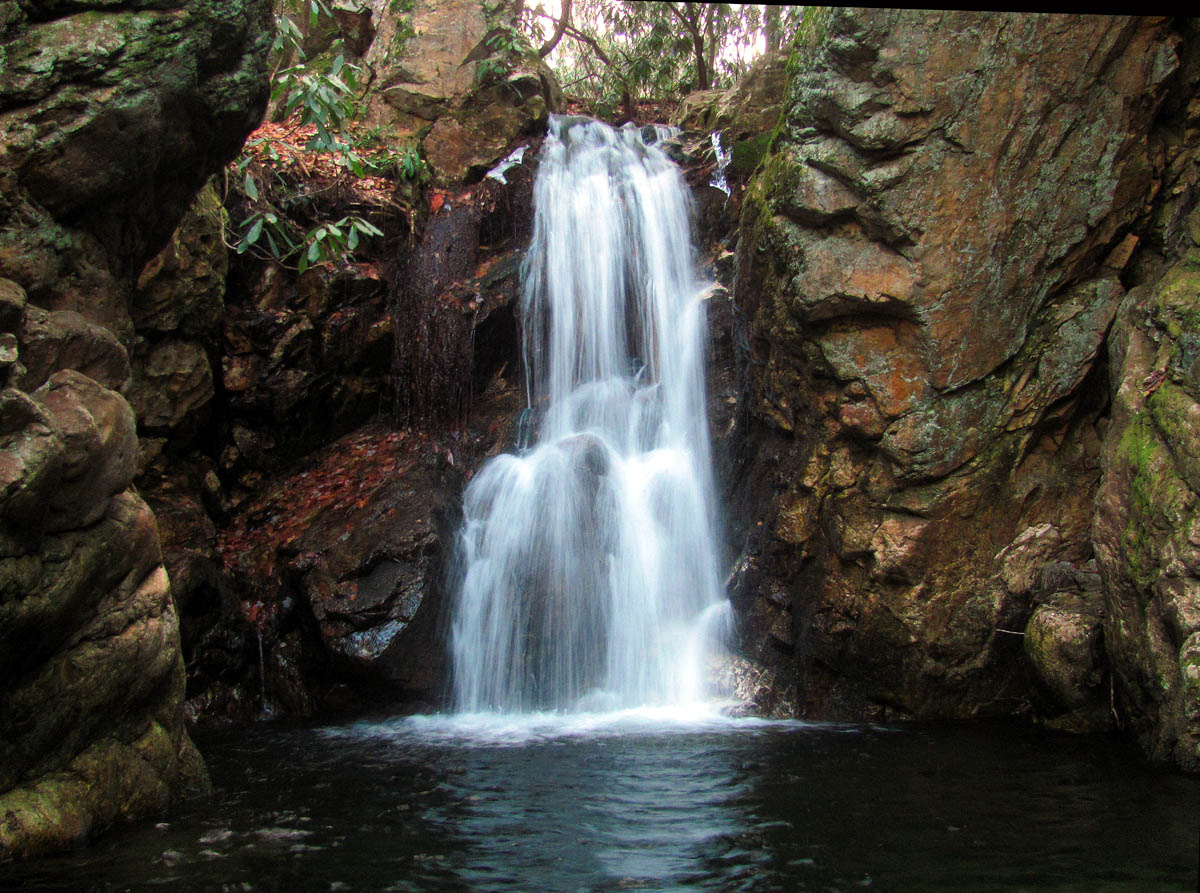
Upper upper upper Dick Creek Falls

Upper upper upper Dick Creek Falls

Upper upper upper Dick Creek Falls

Upper upper upper Dick Creek Falls
It was hard for me to recall the best way to go from there as we had actually came up one way and went back another on my previous trip there. I decided on the left side and I was glad I did as we came out right on top of the falls without having to negotiate anything bad. Bol’Dar and I sat on the tip top of the narrow cliff spine which sit beside the main upper falls that we affectionately called ‘Totem Pole Cliff’. It is at least 50 to 60 feet vertical and the view of the top part of the falls and the valley below is quite spectacular. Derrick and Jeff continued down the left side cliffs to reach the base of the falls where they were in awe of her size and beauty.
You can see the small, pointy, cliff top hiding in the laurels just above and to the right of the top of the Upper upper Dick Creek Falls

The Totem Pole cliff beside the Upper upper Dick Creek Falls

Looking up at the Totem Pole cliff

Bol’Dar standing atop the Totem Pole cliff at the top of the upper upper Dick Creek Falls

Bol’Dar sits atop the Totem Pole cliff at the top of the Upper upper Dick Creek Falls

View from the top of the Totem Pole cliff looking down at the upper upper Dick Creek Falls

Looking over at the tall cliffs on the other side of the Upper upper Dick Creek Falls from our seat atop the Totem Pole cliff,, you can see we are about eye level with the top of them.

My view of the falls from the cliff top

Looking down from the top of the Totem Pole cliff. (Find Jeff Dean)

Jeff Dean looks small from our view off the cliff

Bol’Dar enjoys sitting on top of the Totem Pole cliff

Bol’Dar sitting on the point of the Totem Pole Cliff

Looking over Bol’Dar`s head to Jeff Dean taking our pic down below !

Me and Bol’Dar on top of the cliff at the top right of the Upper upper Dick Creek Falls (Photo by Jeff Dean)

Zoomed shot of me and Bol’Dar hangin` out on the highest part of the Totem Pole Cliffs (photo by Jeff Dean)
I did find a much easier way down on this trip than on my previous venture here which I will use from now on when going up and down these magnificent falls. Bol’Dar who was obviously still feeling adventurous, decided to go down a short cut using what I call as ‘the crack’ which is just behind the ‘Totem Pole Cliff’ to get to the bottom. Within a couple minutes we joined the others at the base where we spent as much time as we could before moving on downstream hoping to be able to get back to the vehicle before total darkness.

Upper upper Dick Creek Falls

Upper upper Dick Creek Falls

Upper upper Dick Creek Falls

Upper upper Dick Creek Falls

Upper upper Dick Creek Falls in all her glory

Upper upper Dick Creek Falls

Upper upper Dick Creek Falls (I love the reflection in front of the snow and ice on this one)

Upper upper Dick Creek Falls

Upper upper Dick Creek Falls
My feet were still numb and very cold otherwise I could tolerate the rest of my body being cold and wet especially when I was moving. We made it to the known Upper Dick Creek Falls in a short time but, did not spend any time climbing down to the base for any pics as it was getting dark fast and we still had at least three miles to go. The hiking would be much easier from there and we did not stop again until we reached the Lower Dick Creek Falls where we took only a few minutes to get a pic or two before moving on down the old road.

Upper Dick Creek Falls

Upper Dick Creek Falls

Upper Dick Creek Falls

Lower Dick Creek Falls

Lower Dick Creek Falls
Lower Dick Creek Falls
It was dark by the time we reached the end of the road so I got out my headlamp to find the creek crossing to get over to the private field that would get us to the concrete bridge where we had parked and thus eliminate having to wade across the deep North Indian Creek. I was happy to reach the car even though I knew we still had to drive all the way back to the top of Unaka mountain to retrieve Derrick`s truck, at least I would be warmer and would not be crawling through laurels ! We dropped Bol’Dar off at his car at the Rocky Branch trail head and then continued on to the Red Fork road that was iced over and covered in snow still in many shady spots. Jeff’s rig did good with the AWD so we did get to the top without much issue but, I drove us back down as Jeff was still using only one half of his glasses and does not see as well at night. This is compounded by fatigue so I felt comfortable in doing the driving only his low fuel light had been on for quite some time so I was hoping we did not run out of gas !

Jeff Dean and RAT checking out a huge overturned tree between the Upper upper and Upper Dick Creek Falls (Photo by Bol’Dar)
There was some slick moments on the way back down but, we made it and the three of us stopped at Clarence`s Restaurant in Unicoi to celebrate our successful day and get our post hike grub on. It had been one of the hardest hiking days of my career but, overall had been very rewarding now having bagged all the upper falls that Dick Creek has to offer. The uppermost falls are exquisitely wild and I may see them again one day but, I am fairly sure I will not ever do that 1+ mile between them and the other upper falls again as it is just too hard and I would certainly not recommend it between May and October due to the amount of venomous snakes that call that area home. I will reserve any future trips to those falls from top down and back. That is a really tough day in itself but, easier than coming out that long Jurassic valley by far. I can not suggest to anyone but, maybe one or two people at most that I know to go either way to the uppermost falls as it is just too difficult and dangerous and I would not want to be liable for sending them there so am sure many people will never see these falls aside from pictures. My legs were scratched bloody and turned black and blue over the days following this hike as it would take me awhile to heal from this one. I have done worse before just not for this distance making this the hardest bushwhack I have ever done. I will leave you with a picture of some Quail we seen along the road on the start of this incredulous journey,,,,, Until next time,,,,,,,

A pair of Ruffed Grouse on Unaka Mountain
To see more pics of these falls and many others, please visit the Photo Gallery.

 My name is 'RAT' and I love the mountains and waterfalls of the East TN. area where I live and I hope you enjoy this blog about my outdoor adventures.


Leave a Comment