


Wilderness Falls – 5-25-2017
After nearly a month without any hiking, it was definitely time to get back into the woods ! With water flowing at decent levels, I chose another waterfall off my son Tyler`s list to take him to. This time we would be going to Wilderness Falls (previously called ‘The Triplets’) which is a trifecta of three falls on a nameless creek in a remote area of Clark Creek, discovered and named by my good friend and long time hiking buddy, Tommy ‘Bol’Dar’ Warden. All three falls are completely off trail and getting past the extremely vertical terrain of the middle falls is very difficult and is not advised. Most people who attempt these hike up from the bottom and go past the lower falls to the base of the middle falls and back out and then try their best to find the upper falls from the top down which I can tell you, they are very hard to find ! Only a very few hard core, experienced, off trail hikers have climbed or descended the middle falls. I have personal climbed and descended both sides and on this day I would be going my favorite route which is from the top down. With threats of afternoon rain showers we got an early start and hoped for cloudy but, dry skies.
Lower half of Upper Wilderness Falls
Starting out on the Longarm Branch Trail we would have several creek crossings to negotiate, all of which at higher than normal flow so we expected to get wet eventually. We did manage some unique crossings that kept us dry but, in the end there would be some minor moisture involved. Going top down also meant getting to see an additional waterfall being the Upper Longarm Branch Falls. Tyler had already been there before back when he went with us on the Waterfall Tour Reunion hike in 2009 but, it is always a nice falls to see especially during high water flow. It did not disappoint us on this day.

Tyler making his way across the swollen creek via a log !

Some two story high rocks right beside the Longarm Branch Trail. It is really all about the rocks isn’t it ? This one we called the Buzzard Rocks a long time ago,,,

Longarm Branch Trail beside the large rocks. We used to call this the buzzard rock about 30 years ago.

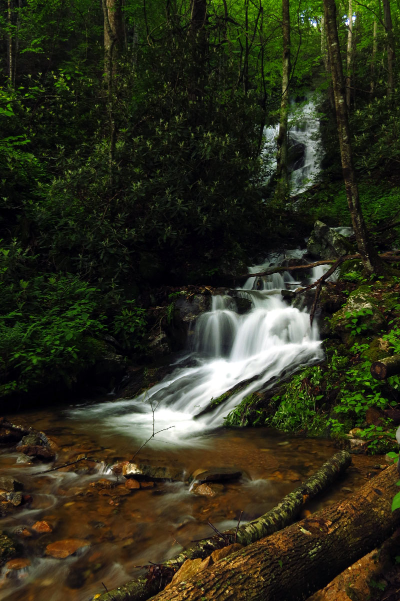
Lower part of Upper Longarm Branch Falls

Lower section of the Upper Longarm Branch Falls

Lower part of Upper Longarm Branch Falls

Lower part of Upper Longarm Branch Falls

Lower part of Upper Longarm Branch Falls

Lower part of the Upper Longarm Branch Falls

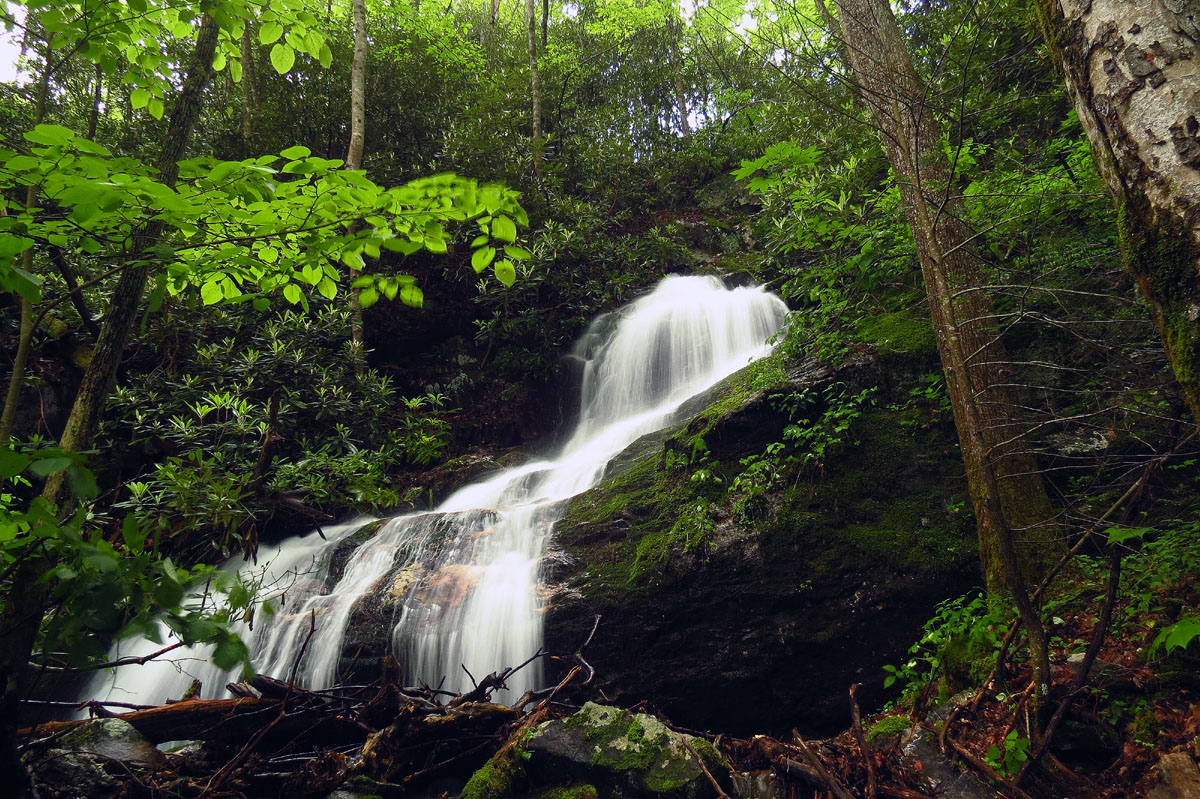
Upper Longarm Branch Falls
Upper Longarm Branch Falls

Upper Longarm Branch Falls

Upper Longarm Branch Falls
Continuing on the Longarm Branch Trail to above those falls and beyond, I was eventually able to show Tyler the various ways to get to the Upper Wilderness Falls. We opted for the easier short cut version and soon we found ourselves descending steeply holding on to the laurels to keep from sliding down the upper part of the upper falls. I do regret not taking the time to get some shots with my larger camera but, I do have some decent ones from previous trips so, we used the time instead to simply enjoy this amazingly wild falls. The top section drops over 60 vertical feet on about a 45 degree angle as it cuts its way through the rock and splashes over a huge log about halfway down the chute before if flows over the top of the lower part of the upper falls which is a more vertical type 60 foot high double drop falls. Overall height is well over 100 feet with both sections combined as per Dave Aldridge’s hypsometer.

Looking down the upper half of the Upper Wilderness falls. This is actually as high or higher than the lower more vertical drop yet it is hidden within the laurels and really can not be seen at the same time as the lower part of the falls. It is a continuous falls so adding the two together is at least 120 feet in vertical height.
Here you can see where the lower part of the upper half of the falls disappears over the edge of the top part of the lower half. Like I said, it is one continuous falls at least 120 feet high.

One small section of the upper part of Upper Wilderness Falls.

Looking at the lower section of the upper half of the Upper Wilderness Falls.

Looking up at the upper section of the Upper Wilderness Falls. That log is much larger than it appears !

Closer shot of the previous image
Getting down to the base of the falls from the top section can be tricky if you are not aware of the secret ninja trail and even then great care should be taken as it is always wet and slick. I led the way and to Tyler`s surprise we went right down the creek left side of the falls and were soon standing at the base looking up at this wild and untamed marvel. There was a strong breeze blowing off the falls due to the nice amount of flow which made it impossible to get any non blurry pics of the leaves along the side of the falls but, that is a small price to pay for this much beauty. We hung out here for awhile to get some pics and just take it all in.

Coming down to the base of the Upper Wilderness Falls

Looking up from the base of Upper Wilderness Falls.

Base of Upper Wilderness Falls

Lower half of Upper Wilderness Falls. This section is just over 60 feet high.

Lower half of Upper Wilderness Falls

Lower half of Upper Wilderness Falls

Lower half of the Upper Wilderness Falls. i think this is the only image I got where the leaves were not completely blurry from the wind of the falls !
Lower half of the Upper Wilderness Falls

Lower part of Upper Wilderness Falls

Upper Wilderness Falls (larger cam)

Upper Wilderness Falls (larger cam)

Upper Wilderness Falls (larger cam)

Upper Wilderness Falls (larger cam)

Tyler at the base of the lower half of the Upper Wilderness Falls (larger cam)
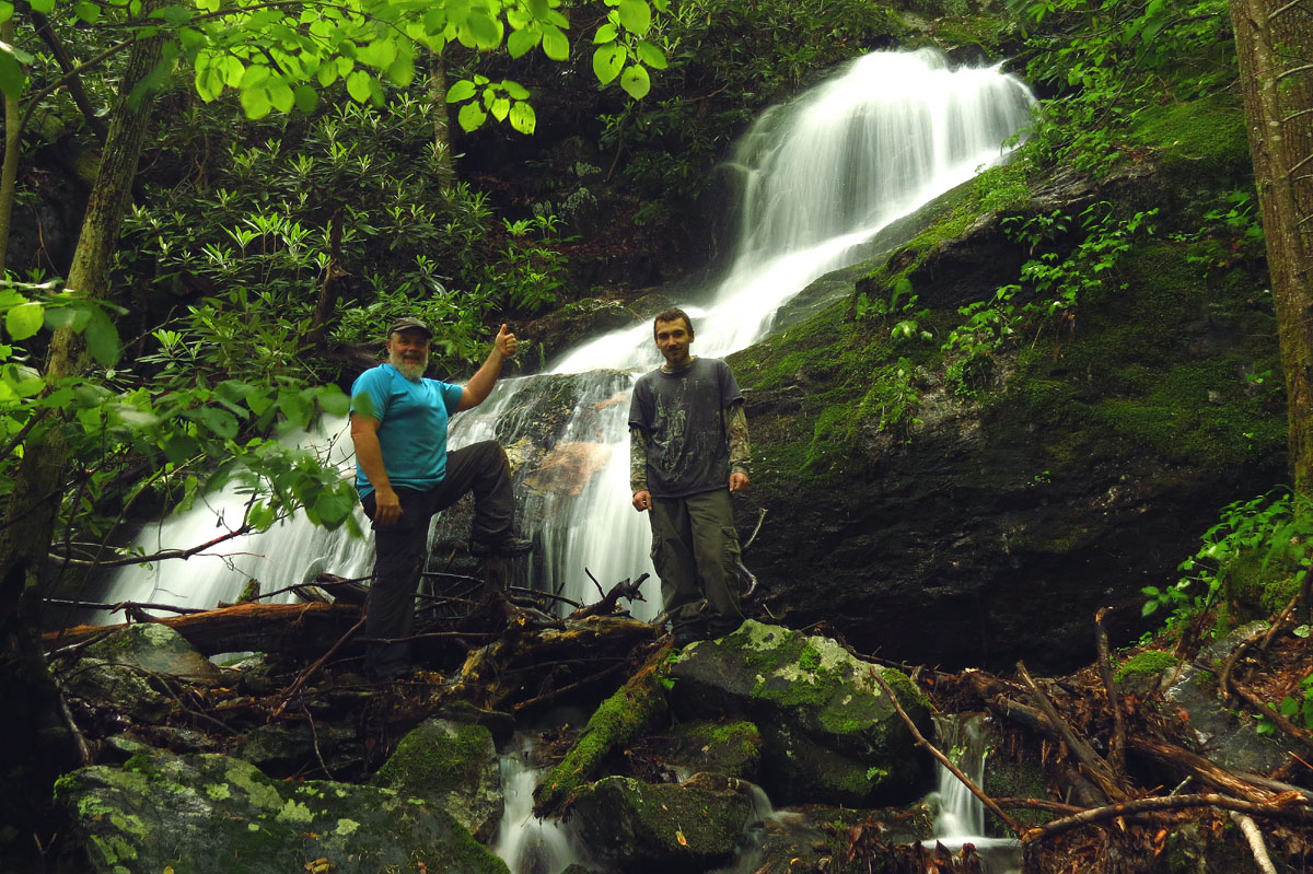
Our group shot at the base of the lower half of Upper Wilderness falls
From there the fun really begins as continuing downstream on the creek left side (easier than going down creek right) soon brings you to the vertical descent of the middle falls. There are rock formations and a few cliff out dead ends so there is only one passable route and it is not easily recognized esp. this time of year when the growth is substantial. I had to draw from some old memories of previous trips to find the actual route. You have to go out and back as anywhere near the falls is sheer vertical rock . The steep bank out from it is always wet and the shale type rock is very loose and hard to get any traction on. If you were to start sliding here you would be in serious trouble as there is not enough woody growth to hold on to and the last drop is vertical and consists of rock so you would get hurt. Luckily by taking our time and me being able to find the safest route we zig zagged around and down to the base of the middle falls. I actually found a metal water bottle that someone had lost either on a climb up or an descent down so someone had a good time there recently !

Steep terrain between the upper falls and the middle ones. Where that daylight is where it seems you fall off the edge of the Earth, that`s because it does, that`s the top of the middle falls.

View of the Middle Wilderness Falls as seen from the nearly vertical descent on the creek left side.

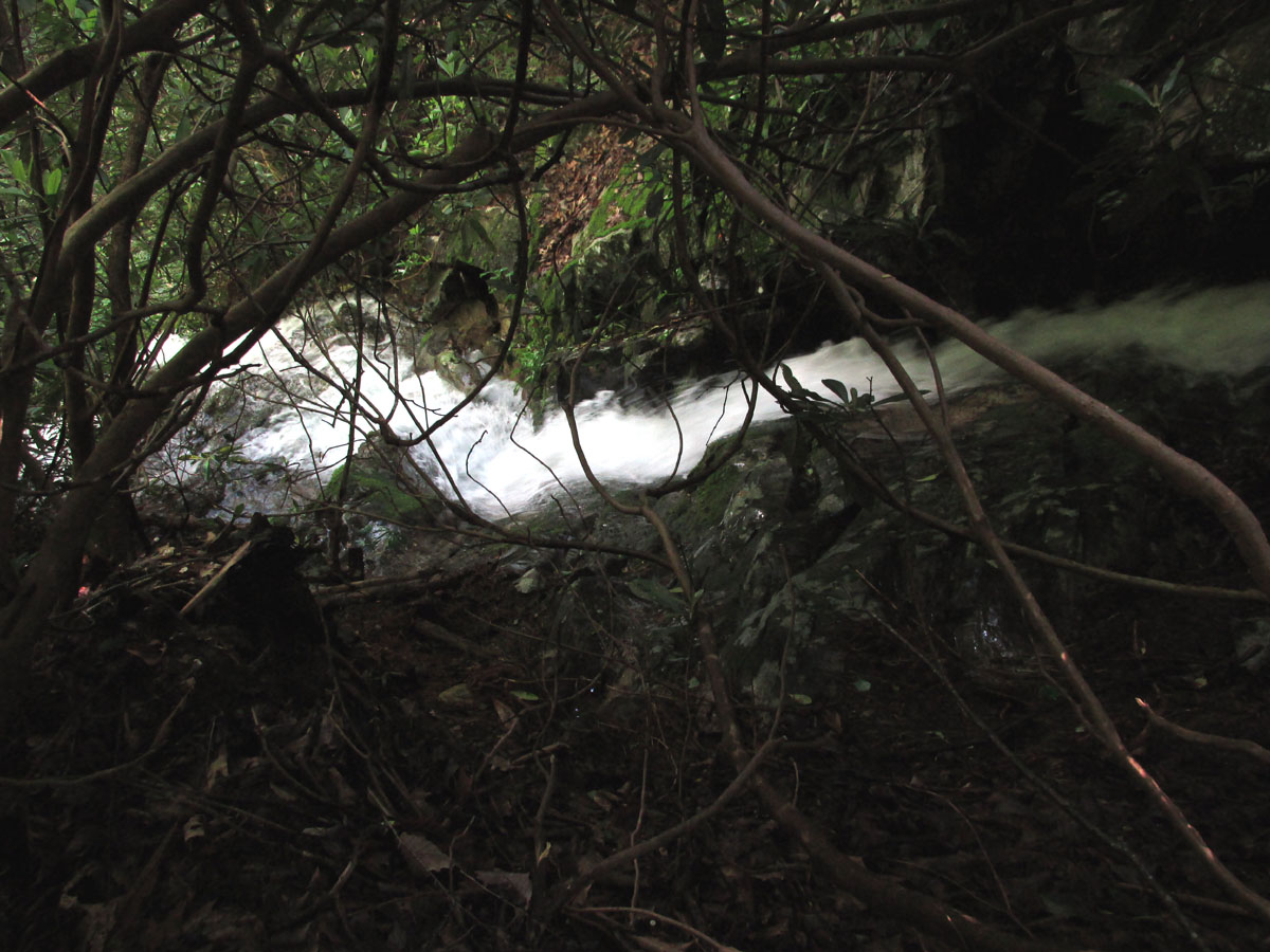
Slowly getting closer to the base of the Middle Falls. it is hard to get shots from here as it requires holding on with both hands !
Coming out right at the base of the 90 foot vertical drop of the Middle Wilderness Falls meant we would have to make our way across to the other side to creek right as it is not possible to continue down creek left. There is also not much level ground and the spray off the falls will soak you in a short time. I snapped a couple of shots as we got across as quickly as we could and then once out of the heavy spray I set up my larger camera to see what pics I could get from there. I would climb up the steep creek right side to get some side profile shots and a few more as we made our way slowly down towards the many other lower drops of the middle falls as well.

Quick shot from the base of the Middle Wilderness Falls

Another quick shot looking up at the 90 foot vertical drop of the middle falls as we make our way across the base to the other side.

Looking up at the 90 foot tall behemoth that we call Middle Wilderness Falls

Finally on the other side, this is looking back across the base from where we had just came from.

Base of the Middle Wilderness Falls

Isolated view of one side of the middle falls

Finally far enough away from the Middle Wilderness falls to get them in one frame !

Middle Wilderness Falls

Middle Wilderness Falls

Middle Wilderness Falls (larger cam)

Middle Wilderness Falls (larger cam)

Middle Wilderness Falls (larger cam)

Perhaps my best shot of the Middle Wilderness Falls as this was the only one that there were not some blurry leaves caused by the constant wind off the falls !

Side profile of the Middle Wilderness Falls. Of course you can not fit the entire falls into one frame !

Side view of the Middle Wilderness falls

Side view

Side view (larger cam)

Side profile view of the Middle Wilderness Falls (larger cam)

Side view (larger cam)

Last shot of the Middle Wilderness Falls before moving down to the lower drops of it. (larger cam)
Going down from the base of the middle falls is also steep and very slick as the small loose rocks are hidden under all the leaves and small growth so there is little traction here either. It is obvious however, which is the best way to go to get down to the other parts of what I consider to be an extension of the middle falls although, each drop is worthy of being a separate waterfall. This old picture of Dave and Tommy from a previous trip displays the steepness. I did my best to get a decent pic of each drop as we made our way down and as you can see in the images that each drop is just a continuance of the middle falls. The entire series is well over 150 feet feet in height. While we were checking out the lower drops of the middle falls the wind was picking up and the skies were darkening. Although this was good for picture taking, it was not good in the fact that we knew we would be getting rained upon before the trip was over.

Looking back at the Middle Falls you can see how the drops below are still part of the main falls. There is no level ground from the base of the falls until way below where this image stops.

Another shot showing the first few drops just below the middle falls

This angle is the best I can get to show how the Middle Falls do not stop at the top 90 foot vertical drop that it keeps going non stop over numerous drops which is what we measured to get the 150 foot listing.

One of the many drops of the Middle Wilderness falls. You can see the previous 90 foot vertical part above.

One of the many drops of the middle falls

Side view of one of the many drops of the middle falls

Side view (larger cam)

Side view (larger cam)

Another drop of the middle falls. You could spend all day shooting just these multiple drops below the main vertical falls !

One of the main lower drops of the middle falls (Larger cam)

One of the largest and nicest drops below the vertical part of the middle falls (larger cam)

It is hard to photograph all the multiple falls connected to the main middle falls above but you get the idea !
After the last drop of the middle falls it had indeed began to rain lightly so we did pick up the pace on our way out. This is possible due to the terrain becoming a bit more forgiving as you get farther away from the middle falls area. We stopped just long enough to get a shot or two of the Lower Wilderness Falls before packing up the camera gear and making our way out the rest of the Wilderness Valley.

The Lower Wilderness falls (larger cam)

Lower Wilderness Falls (larger cam) it was windy and raining at this point
By the time we reached the Longarm Branch Trail the rain was a bit more steady but, luckily it never got really hard although we did get a bit wet. The advantage of that meant we could now bust the numerous creek crossings wide open without having to worry about staying dry ! With a now quicker pace it did not take long to get back down to the Lower Longarm Branch falls and then the Jeep.

one of the creek crossing where an old culvert had washed out

One of the many creek crossings. I used to drive over this one on an old log bridge. You can see the remnants of the logs on each side in this pic if you look closely.

Longarm Branch had already risen in the short time since the rain started

Longarm Branch

Hiking out the Longarm Branch Trail in a light rain

Lower Longarm Branch Falls (looking back) just before we reached the Jeep.
It had been another exquisite day in Nature and another major set of wild waterfalls to check off Tyler`s long list. We were already looking forward to the next adventure. Until then,,,
To see more pics of these falls, please visit our Photo Gallery.

 My name is 'RAT' and I love the mountains and waterfalls of the East TN. area where I live and I hope you enjoy this blog about my outdoor adventures.


Leave a Comment