


Fall Colors, Clear Branch Falls, Devil Fork Falls, and More, 10-16-2010 & 10-17-2010
My son Tyler and myself were out enjoying the awesome Fall colors on 10-16-2010 and we ended up going to the Sam’s Gap area. We were not disappointed as the colors were really good there. We drove to the top and worked our way down stopping at all the cool viewing places. I love how you can see Big Bald and Little Bald right over from you. Also it is a grand place to see all of the Rocky Fork area including everything from Sam’s Gap to Flint Mountain, over past Wilson and Frozen Knobs on down to Cherokee and Buffalo Mountains. It really is quite amazing to see a large part of the ‘big picture‘. The sun was bright the entire week the leaves were in peak so, it made it hard to get quality photos but, the images in my head will live forever. Nature is profoundly beautiful beyond belief at times.

Cows and colors near Sam's Gap

Fall colors seen from Sam's Gap
On the way down the mountain I happened to look to my left and spotted a unique view of a rock cliff we call ‘Stonehenge‘ which resides in the Rocky Fork area. I had to turn around, go back, and come back down again to get the pictures. I stopped right on the side of the Interstate, but it was worth it. They are actually called Whitehouse Cliffs and they are on the side of Whitehouse Mountain just below Wilson and Frozen Knobs. After seeing them I somehow knew that I would be going to Rocky Fork sometime soon. I haven’t hiked there in years and it is one of the crown jewels of this area for hiking. There are so many places to hike to from there that it would take several years to cover it all, (I know this as I have done it !) and as I was told by someone I met on my first trip there, which route you take depends on what week you wish to get back on !

View of 'Stonehenge' in Rocky Fork (Whitehouse Mtn. Cliffs)
The next stop was the scenic look off across from Big Bald and Little Bald. They have finished the walkway to the top which is very nice. It was crowded with other ‘leaf gawkers’ but the views were incredible despite the intense sunlight.

scenic walkway

View of the Rocky Fork area
Making our way further down the road, we ended up at the new Visitor’s Center at the Flagpond exit. I had not seen it since its completion and let me say, it is very nice. You can see Big Bald and Little Bald right behind it.

Visitor Center on I-26 (Big Bald and Little Bald in background)
From there we took Clear Branch Road down to the old Asheville Highway to see if we could find the three sets of Clear Branch Falls there. They were easy enough to find being right near the road and even though there is not much water flowing right now, I still managed to get some fair pics of them. I will definitely be coming back here when there is more water and less sunlight to get better pics. Starting at the top we came to the upper falls first. They are nice and worth climbing down the steep, loose, embankment to get the pics. I can’t wait for more water and a cloudy day.

Tyler atop Upper Clear Branch Falls
Not far from the upper falls you will find the middle set of falls but, they are slightly harder to get down to, so with not much water to make it really worth it, I only took a couple pics from the road. I will be back again for better ones later.

Middle Clear Branch Falls
The lower falls are perhaps the best, they are definitely the tallest at around 40 feet, and you can see them from the road once you park and walk to them, however, the best angle is from the bottom which requires accessing private property. They are building a house there and there was no one to ask permission from, but there are not any ‘No Trespassing’ signs so we ventured to the falls, took the pics and left without being shot at. I would love to live there and have that in my backyard.

Lower Clear Branch Falls
We drove up Big Branch to see if we could locate the falls there but there was not enough water to even see but we did come across a small cascade. We were headed to Edwards Branch but realized we were running low on gas.

Cascades along Big Branch
It was getting late and I wanted to check out Unaka Mountain, so we headed there but it was too late as the sun was already setting and everything was reddish orange ! It was a great day to be out enjoying Nature and as always and I look forward to the next trip.

Sun setting on Unaka Mountain
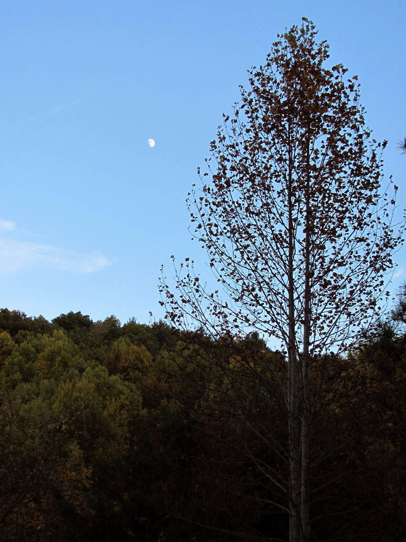
This would turn out to be the very next day ! I went out alone on that Sunday venture, back to the Sam’s Gap area only this time I ended up going up the old road to the top and back and also cruising up Rice Creek Road, another beautiful area alive with an abundance of Fall colors. There is a cool view of Big Bald from there. I even seen a ‘Bigfoot‘.

Moon over ridge in Rice Creek
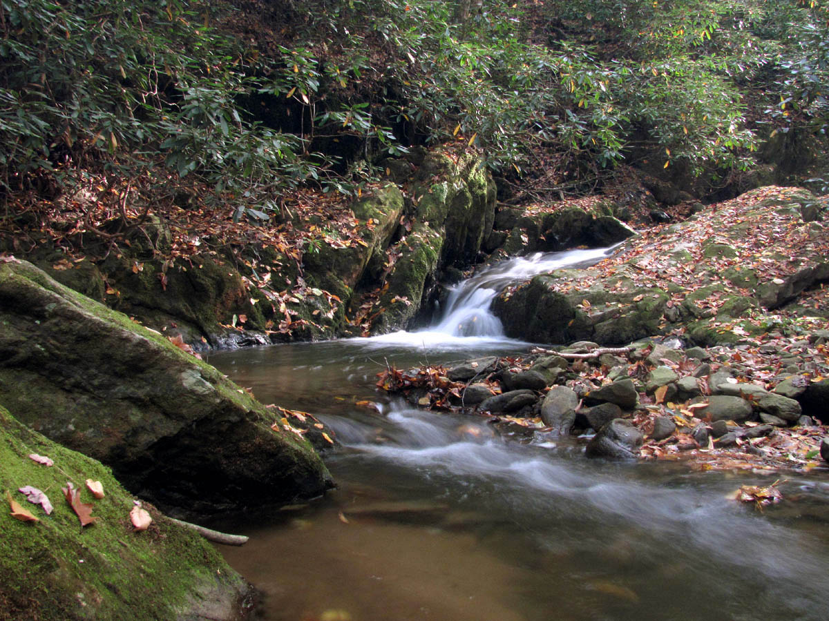
I have been wanting to locate the waterfalls along the Devil Fork Creek that are along SR 352 so I stopped there to see if I could find them. A short distance up the road you can see them way down below but, there is not easy access from there so I thought perhaps I could start at the bottom and work my way up the creek. (I was hoping for a trail) I parked at the church at the end of the road by the old Morril Motor factory and soon located where Devil Fork Creek joins South Indian Creek. This was not an easy crossing and I was not wearing my hiking boots ! I just decided that rather than risk falling in and getting my camera wet trying to rock hop across, that I would just get my feet wet and not worry about it. It paid off as there was a very nice set of cascades waiting for me.

Cascades along Devil Fork Creek

Cascades along Devil Fork Creek
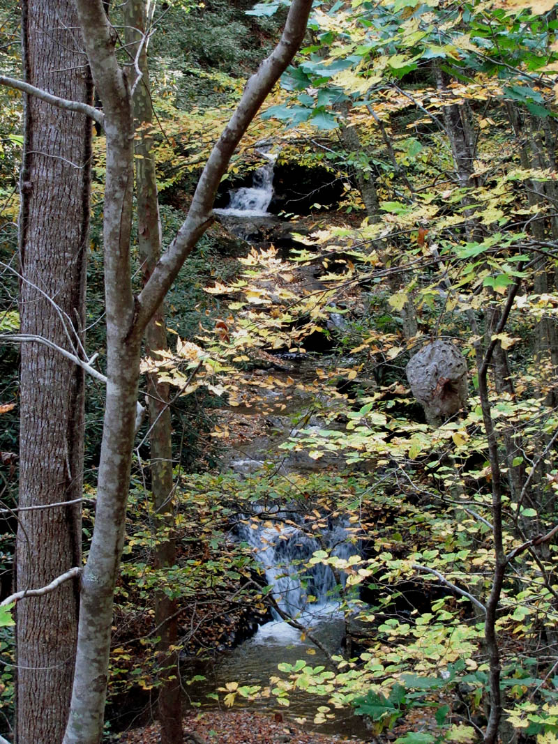
There was not really a trail leading up the creek but, I knew there were falls up there somewhere so I continued over logs, through thick laurels, garbage and rocks, until I came to yet another nice set of cascades.
Cascades along Devil Fork Creek

Cascades along Devil Fork Creek
Proceeding further, encountering even more obstacles, I came to a third set of cascades even nicer than the first two. The sun was low at this time and unfortunately right in my face and camera lens but I managed to find a position to get some pics.

Cascades along Devil Fork Creek

Cascades along Devil Fork Creek
Just past this cascade I found some larger rocks and more cascades. Assuming the actual waterfalls I was looking for was beyond these I decided that it was too late and I was too wet to continue on this day.

Cascades along Devil Fork Creek
I was not looking forward to going back the way I came, so I opted to climb this cliff-like bank to get up to the road and walk it down. (In hindsight, I should have continued on up the creek to the waterfalls!) It was a tough climb through broken glass, rocks and laurels but I finally made it and instantly looked down and seen the real waterfalls ! I was demoralized and started to go back down to them, but realized I probably would not have enough energy to make the climb a second time, so I made the decision to come back on another day when the light was better. I snapped a couple pics which included a large hornets nest and walked the road back to the car.
Devil Fork Falls (upper and lower)
There is a neat old house near the roads end and I seem to remember someone actually living there many years ago. I would love to have a house and property like this in these mountains. I was already planning my return to this area in my head which I am sure will be very soon.

Old House along Devil Fork Road

Old House along Devil Fork Road
I drove back by way of Rocky Fork and came down Edwards Branch as there are good views from there but it was getting too dark to take any good pictures.There is a graveyard there with a good view into the valley and over to Big Bald. There is another older cemetery above there but I did not have enough daylight left to make it worth going there.
Moon over Edwards Branch

 My name is 'RAT' and I love the mountains and waterfalls of the East TN. area where I live and I hope you enjoy this blog about my outdoor adventures.


Leave a Comment