Devil’s Fork Falls
After our trip to some of the lower Devil’s Fork Falls last Monday (Nov. 9, 2009) including Pine Ridge Falls (lower Devil’s Fork falls) and Josiah Falls (middle Devil’s Fork falls) it has been heavy on my mind to go back to the elusive upper Devil’s Fork Falls (Lilybeth and Devil’s Slide ) as I have not been there for nearly 20 years. Knowing that the water levels are still high from the recent tropical depression ‘Ida’, and that the warm weather might not last much longer this year, I decided to make the pilgrimage back to the place where the ‘Rat > Patrol’ clan used to make frequent trips to what we called the ‘waterfall tour’.
We used to start in Sill branch to see the lower falls there, then the upper falls, and the many other falls and cascades above those, all the way to the top of Rich mountain. We would traverse it stopping to eat lunch at one of the ‘California Fields” enjoying the brilliant views of Sampson and the surrounding mountains, then move down our secret shortcut trails to Devil’s Fork.
I knew I was no longer in physical shape to make such an arduous journey in one day (also knowing we would be getting a late start) so I opted to hike up Longarm Ridge trail to Devil’s Fork trail and go down from there. Although I expected the trail to be overgrown, little did I know that parts of the old Devil’s Fork trail would be devastated from pine bark beetle damage and would cause us much delays and strenuous to extreme hiking in order to reach our destination, as many parts of the old road trail were completely impassable.

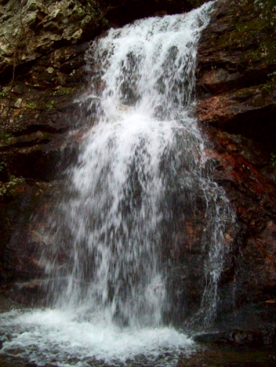
Lilybeth Falls (Upper Devil's Fork Falls)
Bol’Dar, my son Tyler, and myself, met around noon in Clark’s Creek at the lower Longarm Falls and proceeded to hike up the long rocky road (now horse trail) up past the upper Longarm Falls. We met a nice couple with their dog on the way, one of which was named Chuck Norris ! [I couldn’t resist asking him to do a push up and push the earth down instead of pushing himself up !] The weather was awesome for this time of year with clear, sunny, blue skies and 70 degree temps but, once we reached the turnoff at Devils Fork, that instantly changed to a much cooler, almost refrigerator like feeling as we headed into the dark hollow that leads down into the Devils Creek valley.
Almost immediately we ran into a few blow-downs and as expected the trail was overgrown and from the looks of it, has not seen any human travel in a long time. This on one hand was kinda sad but, on the other hand was kinda good knowing that only a handful of people even know about these falls or have ever seen them or would have the ability or desire to go through the extreme terrain it takes to get to them. Not to mention it is very dangerous traversing the many high cliffs that one has to negotiate to get down to each new level and waterfalls.

Lilybeth Falls (Upper Devil's Fork Falls)
As we made our way further we ran into more and more blow-downs. It wasn’t long before the way became very hard to maneuver and some parts were impassable causing us to either crawl on our bellies like a snake or go off the steep side-hill down and around and then climb back up to get around the meat-grinder-like strainers that were trying their best to prevent us from proceeding.
It wasn’t long before we could see the actual ‘meat-grinder‘ and the ‘Monkey-head Rocks‘ looming off in the distance where on a previous trip I had lost my pack and was crippled for weeks ! It was like it was taunting me saying “Back again ? Did I not hurt you enough last time ? ” !! About that time, a snag jerked my camera out of its pouch and catapulted it up into a thick pile of downed trees and debris where luckily we found it within a few minutes.This meant it was time to take a break and regroup.
The once familiar territory looked barren and strange as if a bomb had been detonated there. (those last two word-link/pics are of the exact same place !) It is amazing how much things have changed since we traveled this so many years ago, making the relatively short distance seem long, like an endless childhood summer. After sweating through the arduous journey through the pine bark beetle destruction and shedding some blood, we finally reached a lower level beyond the damage of those voracious tree eating critters, where the travel was somewhat easier.

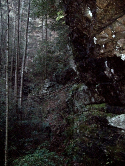
Downed trees on Devil's Fork Trail
The many tributaries of springs and creeks that eventually make up Devil`s creek were crossed, and we knew we would soon be to the end of any ‘trail’ and have to make our way down by the creek to the top of the upper falls. The upper Devil’s Fork falls, largest of them all, (Lilybeth ?) where from that point on the going would become a much more serious mode of travel on the old Rat > Patrol Ninja trails of old, that is, if they still existed after 20 years.
Things can change a lot in that amount of time and this was certainly no exception, plus my memory was not what it used to be but, somehow we made our way to where there was no more trail and you had to follow the creek down to the cliff edge above the upper falls. It was a good feeling to be at the old pine tree ( if youwant to see this from below click here and look at top right) looking over the cliff down at the falls and hearing the loud roar of the falling water as it plummeted down, pounding the rocks below, feeling the cool wind and mist coming up in your face just like a peppermint patty commercial.

Lilybeth Falls (Upper Devil's Fork Falls)
We rested here for a moment taking a few pics before heading down the secret ‘Rat-Trail‘ to the actual top of the falls. This is not for the faint of heart or the inexperienced hiker (Tyler can now attest to this fact) and I would highly recommend using ropes and safety gear along with having someone who knows this area well before attempting to descend these falls as they are over 100 feet high and have sheer vertical drop cliffs on both sides covered with wet slick leaves with very little to hold on to.
The edge of the creek where we accessed the secret trail had eroded from years of flooding and was now just sheer rock, slanted steeply down, but we carefully made our way down to the ledge at the very top of the falls. (can you see the ‘entity’ in that pic? There was no ‘steam’ or ‘fog’ in the air at that time !) Now the adrenaline was really starting to pump ! We hung out there for awhile taking more pics and admiring the magnificent rock strata.
Reminiscing of the many times we had been there before over the years (that pic is very old ! ), we then looked ahead wondering if the way down even still existed. We soon found out that it was like the first time all over again only harder, and we had to make a new way down which was more difficult and very risky due to the extreme vertical drop, wet leaves and hardly any stable places for footing or handholds.

Lilybeth falls (Devil's Fork falls upper)
Somehow we made it without any injuries and came out at the base of the falls. The loud sounds of the water crashing against the rocks at the bottom was exhilarating and the spray of the water cooled our faces. It was truly breathtaking. After what seemed like a short time of taking more pics and enjoying the wildness of it all, we had to make ourselves leave as it was getting late in the day and the light was beginning to fade quickly. I took one look back as we departed, seeing only a part of the falls glowing in the coming darkness.
Not far from the base of Lilybeth falls is another huge drop off where once again you take your life in your hands making your way down vertical, slick, rock carefully looking for a place to hang on to until you eventually reach the bottom of the enormous rock cliff.
We then carefully climbed the humongous, moss covered, slick boulders over to the next set of falls known as the Devils Slide.
It was beginning to get dark quickly down in this deep gorge-like ravine, so the pics of these falls would not be of much quality but nonetheless we captured the moment having seen it again for the first time in about 20 years. I wondered if we ever stopped to see these falls back in those days in our haste to fly through here on our way to the next falls (Josiah / middle Devil’s fork).

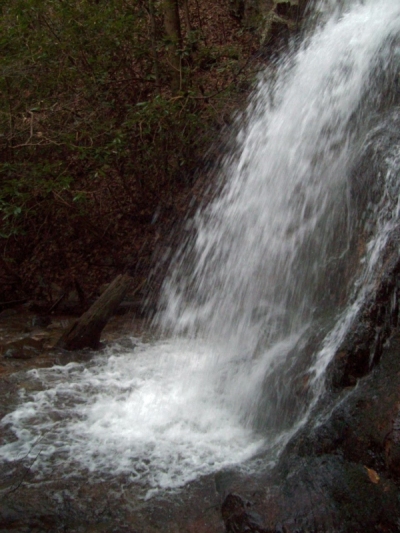
Devil's Slide Falls
Since the daylight was fading fast, we now had to move quickly. This was not a good idea given the rough terrain where any move could be your last. To be rescued from a place like this would be near to impossible. From this point there is definitely no trail and never has been. Even in the old days we had to just make our way down the creek the best we could dropping off yet another steep cliff down to where devils Creek converges with another good size creek coming in on the left. This is a very enchanting place where the swirling waters form one creek out of two, then in a short distance drops off the next set of falls (Josiah / middle Devil’s fork).
It was getting very dark at this point so taking pictures was futile yet we took them anyway. The next step of the adventure was even harder, not only from lack of daylight but, from lack of the old routes we used to take that had long since turned to stealth courtesy of Mother Nature. Climbing up and over the steep ridge to the left side of the falls looking for the old ‘slide for life‘ revealed that it was now blocked by a large blow-down , much overgrowth, and could end up being a ‘slide for death’ ! . (those pics were taken from the bottom on our other trip to there the previous Monday))
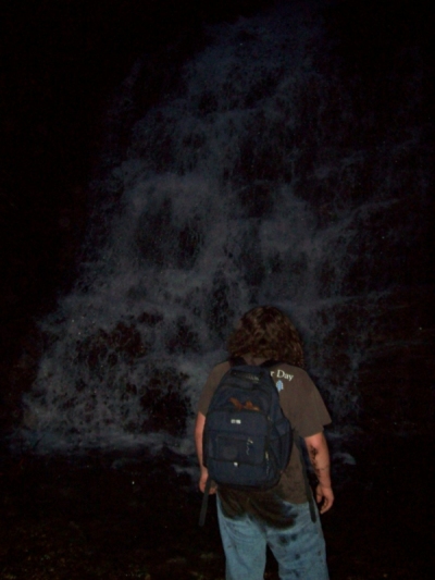
This made it nearly impossible to get to a place on the extremely steep side-hill where it was safer to slide down, however we managed to hang from one laurel branch to another like monkeys playing in the jungle until we finally made it to where we could slide down to the creek at the bottom of the falls. It was now very dark but we had finally made it to where we had been the Monday before at the base of Josiah falls.

Tyler in front of Josiah Falls (middle Devil's Fork Falls) at dark
This made the territory more familiar and somewhat easier to travel but we were very tired, wet, and muddy so we stumbled over the boulders to the place where you climb up to the trail which leads out the valley. I only took one more pic which was of the pink and blue twilight as it faded into total darkness. We eventually made it to the lower falls (Pine Ridge Falls) and had to climb across the top of them by headlamp which is just as dangerous as what we had already encountered.
No mishaps occurred so we made it back to the vehicles around 6:15 pm and realized that we had actually done pretty well to go where we did in that amount of time but still wished we had left earlier. I still blamed the pine bark beetles !
I have many other waterfalls and places I plan to go in the upcoming months so I doubt I will get back to this earthy paradise for a while but, it is definitely worth the major effort it takes to see its majestic splendor, as not many ever have or ever will and I feel privileged to even know of its stealthy whereabouts and the secret routes it takes to pass through them. This is definitely worthy of an “UMBA BUGUMBA” and I rate it a 10 on the difficult to impassable/extreme scale.
For more pics of all these waterfalls, please visit the gallery.
RAT


 My name is 'RAT' and I love the mountains and waterfalls of the East TN. area where I live and I hope you enjoy this blog about my outdoor adventures.


One Comment to “Devil’s Fork Falls”