Chigger Ridge / Buckeye Falls 3-12-2011
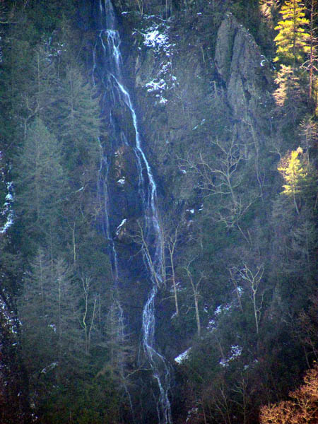
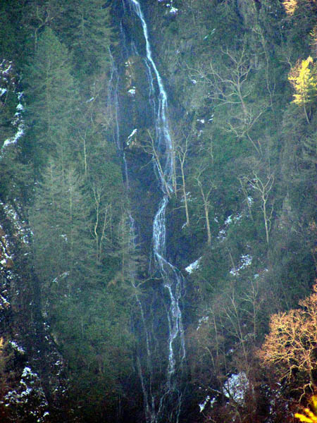
Ever since my first trip to Buckeye Falls some 30 years ago, I have wanted to stand on the highest part of Chigger Ridge in order to get the ‘Big Picture’ of Buckeye Falls in their entirety. We managed to get a really good close up of the entire falls from the adjacent left side ridge when they were frozen back in March of 2010, but after our recent trip to the base of the falls on February 26, 2011, I knew we would soon be fulfilling our quest to the vantage point on Chigger Ridge. This was finally accomplished on March 12, 2011.
Having been so close to it on many previous occasions from different directions several years ago but never being able to complete the journey due to various reasons, we had great knowledge of what it would take to get there. Regardless of which route you take, it is not an easy task but, there are some old ‘ninja trails’ that we know about that we hoped would still be there and make the journey more direct and less painful. Climbing the ridge from where it starts at the bottom in Clarks Creek would be the hardest not just because of the extreme steepness and length of it, but it is very narrow, rugged, and is now littered with dead pine trees courtesy of the pine bark beetles, not to mention much overgrowth of briers, etc, so that was definitely out of the question as I have had enough of the ‘meat-grinder effect’ ever since the lost ‘stealth pack‘ incident ! Coming down off the top from the boundary trail on the top of Rich Mountain between Bearwallow Gap and Wilson Knob is another possibility, however, it is very hard to find exactly which ridge is Chigger Ridge from there as it is not marked, there is no trail, and you can not get a visual from there as there are many ridges and faux ‘finger ridges’ all along it. I know which ridge is the right one but there are plenty of laurel hells between the top and where you need to be making it incredibly difficult beyond imagination to get through, so that was also out of the question. We chose instead to try and find the old hidden ninja trails hoping for not much devastation or laurel hells.
We began the expedition early that morning starting at the Longarm Branch trailhead. The water levels were still high so the creek crossings would be fun and there had been about an inch or two of snow in the higher elevations the day before, so we did expect to encounter that eventually but, it was going to be a warm and sunny day which unfortunately would make getting any good pictures impossible. There was a lot of water coming out of the mountain so Longarm Branch was raging and the lower falls were very nice. We decided to take a quick side trip over to the Pine Ridge Falls on Devil`s Fork before continuing up the Longarm Ridge Trail to get some pics while the water was high.
Just as we were about to take that turn off, we noticed a kind of Rat Patrol mark in the sky which to me, is always a good sign ! After spending some time at the falls, we began the long climb up the Longarm Branch Trail towards the upper falls there. It was hard to not spend too much time taking pics of the many cascades along the way due to the high water levels and sheer beauty of them all, but we had a long way to go so we made ourselves keep moving as best we could. We did encounter a rather large, fresh blow-down that would definitely be stopping any horse traffic for the day. Before long we did reach the upper Longarm Branch Falls where we took a fairly long break for snacks, water and photo`s. We did run into the first signs of snow before we reached the falls. There was a lot more water coming off the falls on this trip than there was the last time we were here but, the sun was not cooperating for getting any really good pics.
Continuing on the trail to above the falls we could get our first views of Sampson and the surrounding mountains as we were now starting to gain some elevation. We had to make a choice whether to take the shortcut up to the top or continue on the old road to Bearwallow Gap. Wanting to save my climbing energy for any obstructions we may encounter later, I opted to take the long way and keep to the easier grade of the old road. After passing by the turn off to Devil`s Fork, we soon ran into some snow in the more shaded areas but before long we arrived at Bearwallow Gap where it was time to eat lunch before continuing our journey. The gap is a place where many trails and roads meet.It is kinda like a 6 way stop. There is a ridge trail to the left (if you are coming up from Clarks Creek) which leads up to one of the fields along USFS #190, next is the actual road #190 which leads to many things ultimately ending in Bumpass Cove. The next road over is behind a gate that goes down on the opposite side of Rich Mountain which leads to Higgins Creek. Looking further to your right is the boundary trail that runs the high ridge of the Easternmost end of Rich Mountain which eventually ends on a road that leads to Wilson Knob. Beside it to the right, is an old dead end road that leads towards the top part of Longarm Ridge and eventually to near Chigger Ridge. This would be the way we would be going.
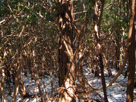
There was inch deep snow on the shady parts of this old route and it was a warm day so my old worn out boots were already becoming squishy on the inside. I had certainly hoped that we would not be hiking in any more snow this year but I rarely get what I wish for. It had been many years since I last hiked down this way and some of it was hard to remember but I did recall the days when one could drive quite a ways before the road ended. An old tire down in the woods reminded me of this. (close up) You could look back and see parts of Rich Mountain where we had just came from and before long we could see Sampson Mountain off in the distance as we were now well above it. The old road eventually goes uphill where it crosses over Longarm Ridge before going back down and dead ending close to Chigger Ridge. You can see the mighty ridge from the high point on Longarm Ridge, but once the old road ends and you find your way up the hollow where a small creek comes down, the ridge you are seeing to your right that you do have to climb to the top of, is in fact not really Chigger Ridge ! Of course we had to learn this the hard way. Once we topped this ridge, we found ourselves inside of a laurel hell which made getting any views impossible. According to the clawed trees and scat, the bears really like it here ! Thinking this was Chigger, we headed right, going down through the almost impenetrable laurel thicket. There was something about this ridge that just did not seem right and we would find out soon enough that this was not it.
Luckily, it did not take too long of fighting our way through this formidable encumbrance before we came to a bluff that dropped off the edge of the world where I knew right then, we could not possibly be on Chigger Ridge. It was like being blindfolded as far as getting any views off of that hill, but I did manage to find one tiny clearing where I could look to the East and see what I knew was the actual ridge we needed to be on just another click over from us. After studying the map more closely, I realized where we made our mistake as it seems there is a ‘spur ridge’ that goes off Chigger Ridge that just happened to be the one we came up on. Realizing what had to be done, we made our way back through the laurel hells, up to where we started and went the other way, further up the ridge.
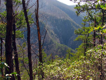
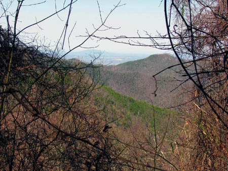
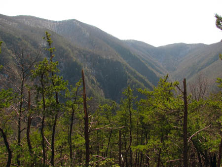
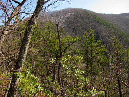
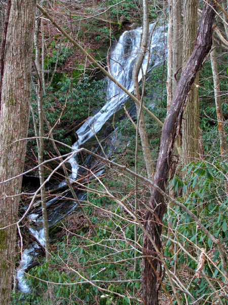
There seemed to be an actual ridge trail there and it was fairly easy to make our way up to a point to where we could then see was angling in towards the actual Chigger Ridge. We could see where we needed to be and Bol’Dar found a small animal trail off to our right which would prove to be a level short cut that took us right over to a sizable gap on Chigger Ridge. It could not have worked out any better and we made sure to mark this trail for future reference. It was a great feeling to finally be standing on Chigger Ridge. To the left of the gap, there was basically no trail, and it was nothing but steep uphill through thick underbrush and briers. You could see major laurel hells above as the main ridge made its way to the top towards the boundary trail. To the right was an actual trail out the ridge with few obstructions which is the way we headed. It was uphill as this is the way to the high point of Chigger Ridge which was our final destination. Almost immediately we started getting views off to our left of Wilson Knob and the Buckeye Falls area. The adrenaline levels were quickly rising. It only took a few minutes to make it to the high point where there was a small clearing on the left side and there it was in all its glory,,,, Buckeye Falls.
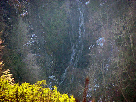
What a feeling of relief and accomplishment we had to finally be there. We wasted no time in going off the left side where there is an actual clearing allowing visuals of Buckeye Falls in its entirety as can not be seen from anywhere else. To stand there and see that was spiritual to me, and I was almost speechless to be looking down at, and over the top of, the left side ridge that leads into the Buckeye Hollow that we had climbed a year before which gave us a view of pretty much all of the falls but, not anything like the ‘big picture’ we were seeing now. I was in awe. I had to sit down and take it all in for a few moments before I could even begin taking any pictures. There was a lot of water still flowing off the falls which was a good thing, but the bad part was the bright sunshine made it nearly impossible to get any good pictures at all. This just meant that we would have to come back on a more cloudy, overcast day and now that we know the easiest way to get there, I am sure we will be back soon.
One thing I did not realize before now, was just how large the area is in between Chigger Ridge and the left side ridge of Buckeye. This would be the hollow to the left, just before the actual turn off to Buckeye Falls (from Clarks Creek) where we knew there was a small set of double falls we had found over 20+ years ago, but today you could hear the water down in there roaring almost as loudly as Buckeye Falls but, only because it was closer to us. The hollow apparently opens up after those falls and is rather large as it forms a huge bowl making its way to its dead end on a very steep part of Rich Mountain and the boundary trail above. I also did not realize just how steep the left side ridge of Buckeye was beyond the point we went to last year until I looked over and down at it from this vantage point. It becomes basically vertical beyond belief and looking over at it left me in amazement. There also seems to be more vertical rock face on its left side that appeared to have snow and frozen water on it. We also noticed an old log road with several switchbacks just below Wilson Knob that seemed to lead right down near the top of the falls. This will definitely require further investigation.
We spent a long time here enjoying this incredible place and the unbelievable views that not many have ever seen but, the day was growing long and it was a long way back so we knew we had to leave (although we did not want to). We took a bunch of pictures even though it was way too bright for any good ones but, we knew we would definitely be coming back here as soon as possible. We made our way back to the ridge line and marked the spot with pink and blue tape, and began the journey back down the ridge the way we came. You could see Rich Mountain where we knew the boundary trail was looming above us and I was happy knowing I did not have to climb that in order to get back to Bearwallow Gap, plus we were planning on a short cut down eliminating the need to go back that far. We followed the ridge trail back to the gap, and located our newly found connecting trail over to the spur ridge and back to the exit point where we went down into the hollow to the small creek and was at the end of the old road in no time since it was all mostly downhill. Somehow Bol’Dar ended up losing his hat and sunglasses but the sunglasses were found on the spur ridge after being stepped on and broken. Maybe one day we`ll find the hat.
After a short break, we started back on the old road. We could see the rest of Chigger Ridge off in the distance. There was still some snow left that had not melted in the shady spots. It did not take long to get back to the Longarm Ridge crossing point where I caught up to Bol’Dar as he was taking pics of a glass coke bottle. Not far after this point we took an old known shortcut off to the left which is an old log road that leads down a steep draw that eventually ends up back on the Longarm Branch Trail/Road just above the top of the Upper Longarm Branch Falls. This cuts out at least a mile or maybe more of road walking and saves a lot of time especially when going down it. It is really a nice hollow and a fairly easy trail to hike. We seen some cool stuff like a section of old, rusty, steel cable, some log fungus, a large, twisted grapevine that kept going and going, and some phallic mushrooms. Within a short time we were back on the road and at the Upper Longarm Branch Falls. The light was better on the return trip for taking pics of them.
By the time we passed the old Buzzard Rock and got down into the lower part of Longarm Branch, the moon was already out and it did get almost dark on us before we reached the vehicle. We were plenty tired by this time but what a memorable trip this had been. A 30 year quest had been fulfilled for me and I had finally seen the ‘big picture’ and all of Buckeye Falls from a very unique vantage point like none other, and I was already thinking about a return trip although the next big adventure, which was already in the planning, will have to come first.










 My name is 'RAT' and I love the mountains and waterfalls of the East TN. area where I live and I hope you enjoy this blog about my outdoor adventures.


5 Comments to “Chigger Ridge / Buckeye Falls 3-12-2011”