


Cobweb Falls (Virginia) – 7-16-2014
It has been awhile since my last blog as I am sure many of you have noticed. Actually 3 months and 14 days since I last set foot in the woods which was the Spring walk through / work trip on my section of the Appalachian Trail on April 2, 2014. For any of you that give a RAT`s ass, this was due to some physical issues with my back and hip pain and recently a torn/frayed rotator cuff. After three MRI`s, a few x-ray guided spinal injections and a lot of physical therapy, I am now getting back to hiking whether I am ready for it or not. My waterfall addict friend Dave Aldridge has also taken some time off due to a foot injury but we both decided to get together and take a short, easy trip to try an ease back into it hopefully to build up to longer trips eventually as we are able. I should be cutting weeds on my trail section but due to the shoulder injury I can not do that so I looked for a new waterfall to go see instead. Thanks to a new waterfall friend Mark Lackey, I was enlightened on how to get to what he calls Cobweb Falls (he says, “it sounds better than the mundane name: Big Creek Falls”). After seeing these falls for myself, I can see why they are called as such.

Cobweb Falls
From Johnson City it is a bit of a drive but, not that bad especially when you are in good company. Dave and Lou picked me up around 8:30 am (they were 30 minutes early and I was still running around half dressed and half ready to go since I worked until 5am) and it took us at least an hour and a half or more to get there. It was not hard to find following the directions Mark had given me and after turning just before Hayters Gap along the North Fork of the Holston River, we soon found the end of the road and the swinging bridge one must cross to get over the river where the trail to the falls is.

Crossing the swinging bridge
It was a postcard perfect day with blue skies and fluffy white clouds with cooler temps and less humidity than we have been having which was very welcomed. If only there had been more clouds we could have gotten better pictures but, as any good waterfaller knows, that rarely happens which just makes us have to come back again and again to get the most water flow and the cloudiest day possible.

Swinging bridge over North Fork Holston River under blue skies
This is a beautiful area and Mark had warned me of some overly friendly bees near the other side of the bridge which after stomping across like billy goats we did find. Luckily no one was stung but we were more careful and did tread lightly on the return trip ! These bees are NOT shy !

hornets nest under the bridge ramp (tread lightly !)
From there we headed down river following the little trail that crosses a deep ditch and leads a much shorter distance than I expected down to where Big Creek enters the river from the left. At this point there is some shooting targets over your head that the people who live just across the river (the private property where you park your car beside) use to target practice. This was slightly unnerving but I guess as long as you don`t park in the wrong place you may be safe ? !!
Shooting targets
From there the trail goes around the bend to what Mark described as ‘heaven’. You can see the falls from that point. I am sure it is not much over a quarter mile to the falls from the vehicle. I was highly impressed with the falls and despite the bright sunlight managed to get a few usable pictures. I took the time to climb up the steep bank on the left side to see if I could get a shot looking down on them but there are a lot of trees in the shot. After that we all made our way up the right side of the falls as Mark had told us of another falls above these about a quarter mile upstream.

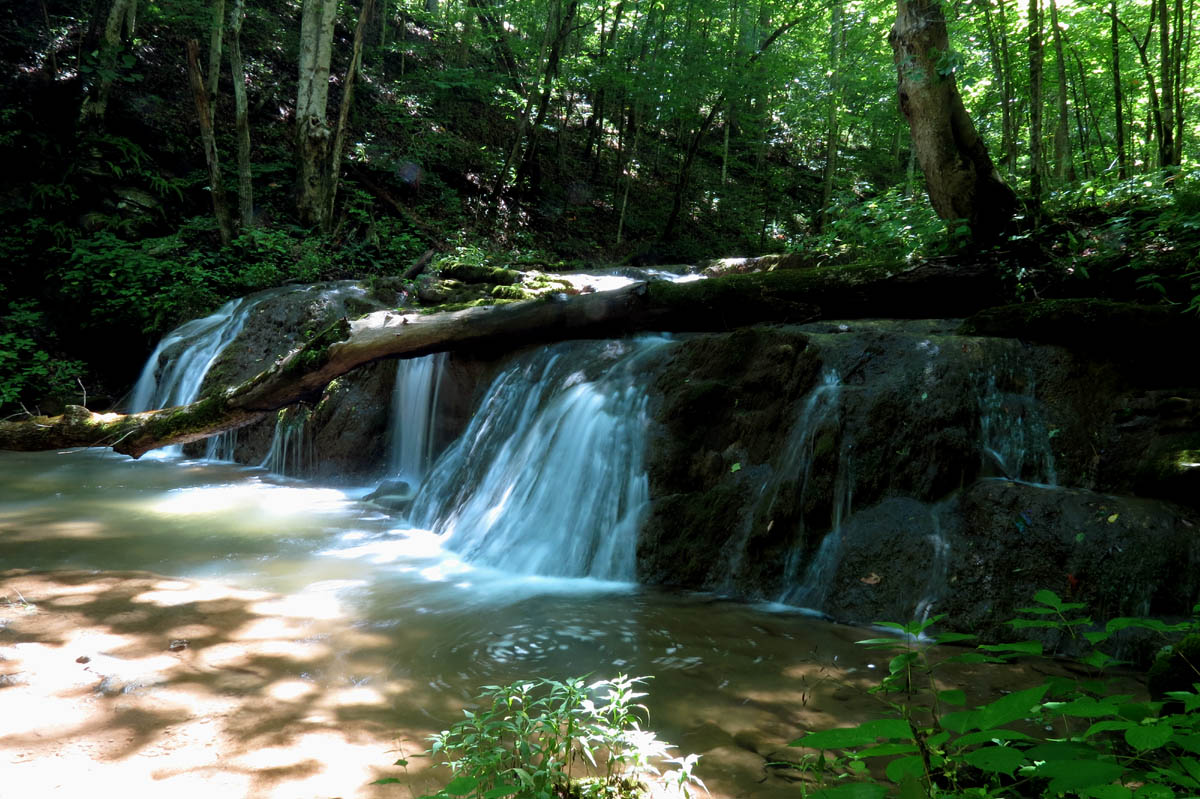
Cobweb Falls (you can see the mist from the falls rising in the air glowing in the bright sun and yes this DID get on the camera lens)

Cobweb Falls (best pic of the day I think)

Cobweb Falls as seen from above

Cobweb Falls

Cobweb Falls

Cobweb Falls

I love the way the ferns grow behind the water in the holes along the falls

More holes with ferns and moss behind the falls

Left side of Cobweb Falls
There is a small cave at the top of the falls but luckily nothing was living in it at the time. Once at the top of the falls, it became apparent that like many waterfalls there is more falls above that you can not see from the bottom. This is true with Cobweb Falls as there is another 16 feet of falls that are just a few feet from the top edge of the falls. Dave measured from the bottom using his laser hypsometer and the falls are right at 40 feet high. Add in the extra 16 feet and it is an impressive 56 feet high.

Cave above cobweb falls

Cave above Cobweb Falls (Find Dave)

Top of falls where you can see the 16 foot part of the falls you can`t see from the bottom

16 part of falls at top not seen from the bottom
Finding the log road above the falls led us to a small shelf falls of about 8 feet high but unfortunately we did not go any farther so we missed out on the awesome upper falls that are at least 20 feet or higher so we will be going back very soon for that. Mark has named them Lachash Falls. It has been raining all day today and more forecast for the next several days so I expect in a few days we will be back there to see the uppers and hopefully see more water and darker skies. We also hope to begin exploring the Tumbling Creek area which is not far from there towards Saltville as I am sure there are many falls there. Having seen almost all of the falls In TN and quite a few in NC, I am happy to be venturing out into VA for new falls to see.

Small shelf falls above Cobweb Falls
Small shelf falls above Cobweb Falls (I did not see the swirly thing tot he right until I got home or would have had some fun with that)

Part of the small shelf falls above Cobweb Falls. Sun was too bright to get anything fancy

Small shelf falls just above Cobweb Falls

Lachash Falls located above Cobweb Falls (Photo courtesy of Mark lackey) (we did not make it to these falls on this trip)
It did not take long to get back to the car as I doubt the entire trip was even a mile so it was not much of a workout but, the main thing is that the RAT is back in the woods and it`s only uphill from here ! I can not wait until our next adventure which I am sure will be very soon. Of course we had to stop at a Bar B Que joint on the way home (it`s bad luck if we don`t) so the Bonefire Smokehouse in Abingdon was the chosen one and I must say that it was very good both food and service. Stay tuned for more trip blogs to come soon ! Hairnt !

Parking attendants

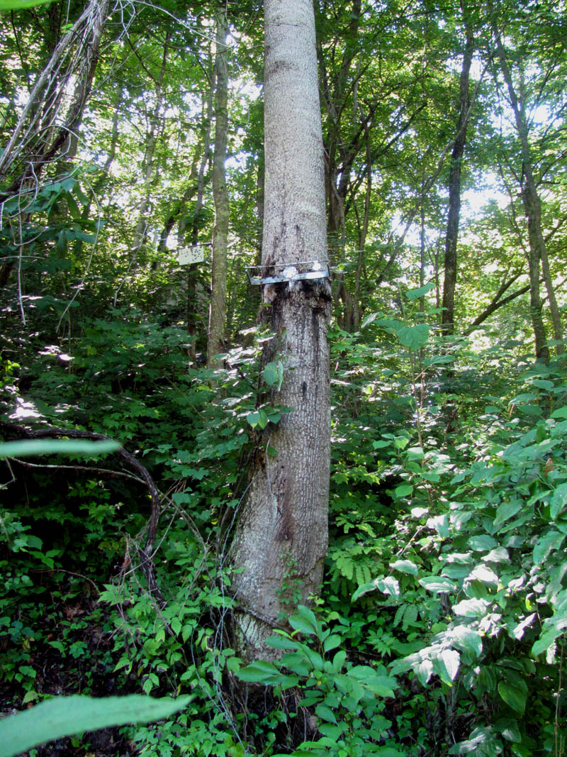
Bug and fungus
To see these pics and more, please visit our Photo Gallery here.

 My name is 'RAT' and I love the mountains and waterfalls of the East TN. area where I live and I hope you enjoy this blog about my outdoor adventures.


4 Comments to “Cobweb Falls (Virginia) – 7-16-2014”