


Death March 2014 – 2-21 to 2-23-2014
Wanting a change of pace from the normal designated hiking trails that everyone knows about and are well traveled, I have always wanted to just pack my backpack and go off into a Wilderness area and spend a few days and nights just hiking around, camping in different places where you would most likely not run into any one the whole time. The closest Wilderness area for me is the Sampson Mountain Wilderness Area and it is a fact that you can easily spend a week or more rambling around there and never cross the same path twice. I have always wanted to do that and I finally got an opportunity to do so. The only bad thing was I only had three days to do it. My friend Sam wanted to spend three days and two nights in the mountains before having to return to work so it was my job to come up with a plan. I did just that however, due to the time constraints and the route I chose, it would not be an easy one and was thus called ‘Death March 2014’.
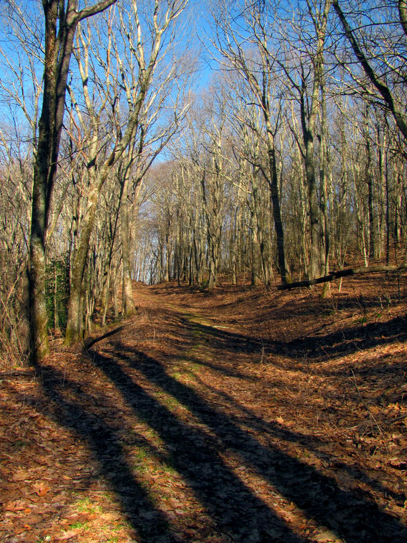
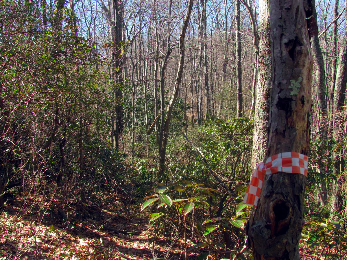
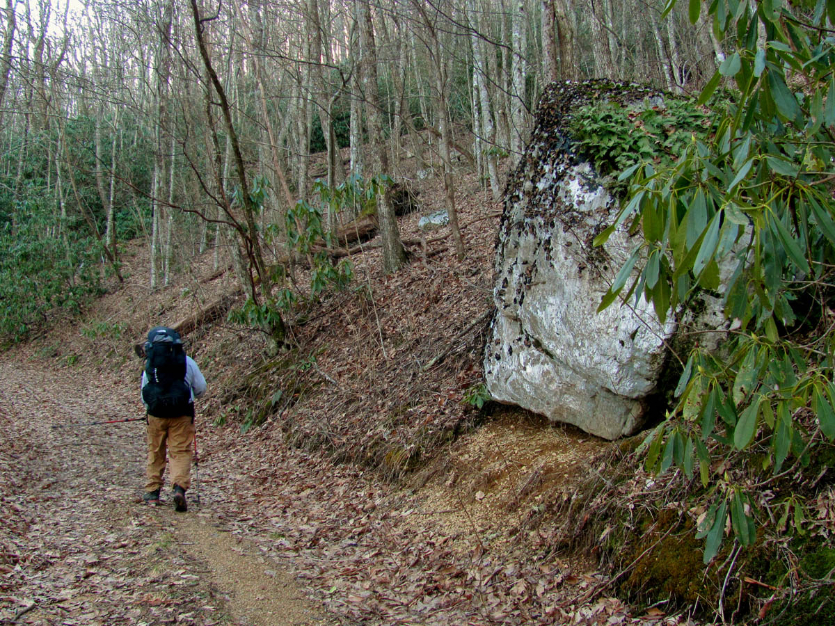
Old road through the back country
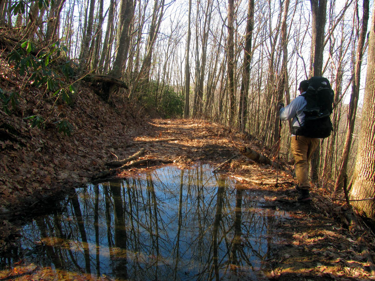
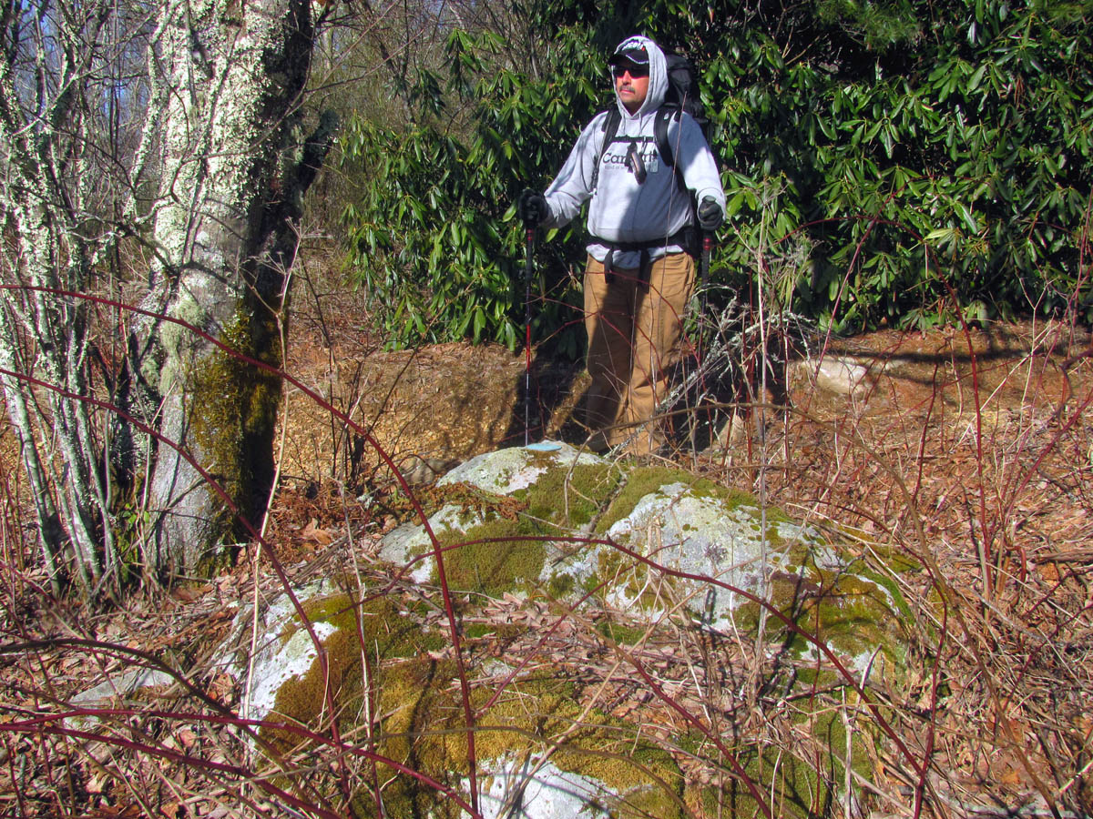
My friend Bol’Dar had planned to attend but, something came up at the last minute and he was unable to go. Sam accused me of creating this hike in retaliation for the frozen pond trip but, I swear that was not my intention ! We left on Friday, Feb. 21 around 11am after the rain stopped. There was a cold front that came through the night before that dropped quite a bit of rain on the already swollen creeks so we knew the creek crossings would be tricky to say the least. I did not want an itinerary but, I also did not want to have to come back to the same starting point so we left a car at Devil Fork Gap and then got dropped off at Higgins Creek so as not to have to leave a car there for three days. The creek was raging just as we expected as we shouldered our heavy packs and headed up the old road trail.

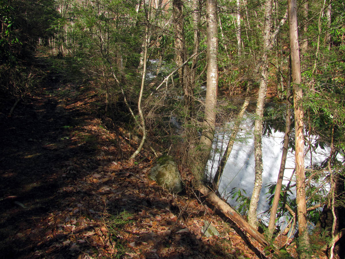
Lower Higgins Creek
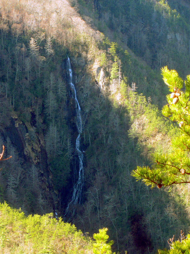
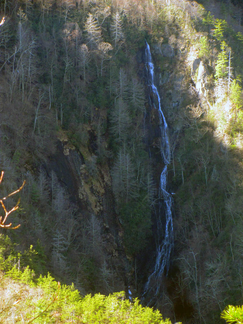
The lower Higgins Creek Waterfalls and feeder falls had a lot of water flowing and I wished that there would have been time to go down and get some pics but, we did not have time nor was I carrying my big camera so we continued onward and upward until we reached the first major creek crossing. There was no safe way to rock hop this one with the full packs on so we opted to test out a new idea I had about using large garbage bags over our boots. This actually worked very well as we did get across with minimal wetness and that was only because we used cheap bags and we each had one get a small hole in the bottom, most likely from a sharp rock. I am sure a thicker more durable bag would be even better.

Lower Higgins Creek Falls

Lower Higgins Creek Waterfall and feeder falls
Part of the top of Lower Higgins Creek Falls

Sam crossing Higgins Creek using the trash bag method
There were two more major crossings after that, the next one I chose to take my boots off and wade across barefooted. This worked fine but the water was incredibly cold as if it was coming right off a glacier ! Sam had brought his water shoes so he had no trouble doing this and decided to keep them on and carry his boots until all creek crossings were done. I opted for the trash bag method on the final crossing which also worked just fine.

Sam at the second crossing of Higgins Creek wearing his water shoes and carrying his boots this time

One of the upper falls on Higgins Creek (if you look close you can see the next one above it showing through the laurels)

Next set of falls on Upper Higgins Creek
After that the old road had water flowing down it like a small creek but it was no trouble to hike up it without getting wet. I had snow sealed my boots well the night before we left so they kept dry the whole weekend. It did not take long to reach the next gate where Higgins Creek continues up that valley and the old road continues to the right further up the hill a short distance to Bearwallow Gap where there is yet another gate and an intersection of many old roads and trails. It is about 1.9 miles to that point from where we started and we had made good time in getting there. We took a short break there before moving on.

Water flowing right down the old road trail

Continuing up the old Higgins Creek trail with water flowing down it

We came across this pile of feces in the trail just before Bearwallow Gap. Not sure what left this or what animal they had eaten.

Fork in the Higgins Creek road/trail. Behind the gate follows the creek and leads to more old roads that will go to either the Hidden Lake or Wilson Knob depending on which way you choose.

Gate at Bearwallow Gap. This is looking back down Higgins Creek the way we had just came. I noticed the extender bar had been painted black since my last visit here last year.
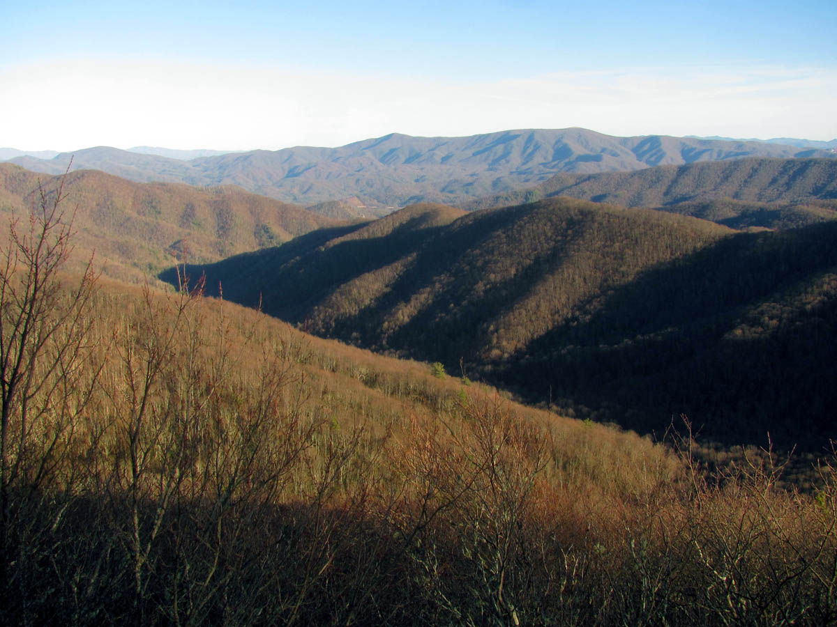
From there we took a left on the old forest road that leads to Chigger Ridge. The views from that road are decent in the winter time although hard to capture with a camera. We stopped for a snack break when we crossed over Longarm Ridge before continuing on towards Chigger Ridge. I wanted to camp as close to there as possible and we decided that since it was to be around 20 degrees that night that we would need to stop and make camp around 4pm to have time to gather plenty of firewood. There is plenty of water in the area as the road crosses the small tributaries that lead down to the main Chigger Branch several times. We chose a nice spot on a finger ridge that is very close to Chigger Ridge and is actually the last good place there is to camp with a tent. The only thing that stopped us from camping right on the ridge was the fact that I did not have a hammock because using a tent on Chigger is not possible.

Looking back at Bearwallow Gap and FS190 from the Chigger Ridge trail/road
Reflection along the Chigger Ridge road

Firewood gathered before dark at our camp near Chigger Ridge
We were close to water and had a nice spot for camp and had time to gather plenty of firewood. We could see some lights in the valley below from there as well. It got windy and cold that night and I realized that I need a new sleeping bag as I was on the verge of being uncomfortable. I roasted some hot dogs over the fire for my supper and we had some cocktails while we star gazed and had a great time being away from all the lights and stresses of the city. It was a wonderful night to be in the woods even though it is a bit spooky on Chigger Ridge at night.

Our camp on first night near Chigger Ridge. Camped in a switchback on the last finger ridge before my shortcut up to Chigger.

The lighting of the fire

Camp fire

The cooking of the hotdog which is what I had for supper

My supper for the first night
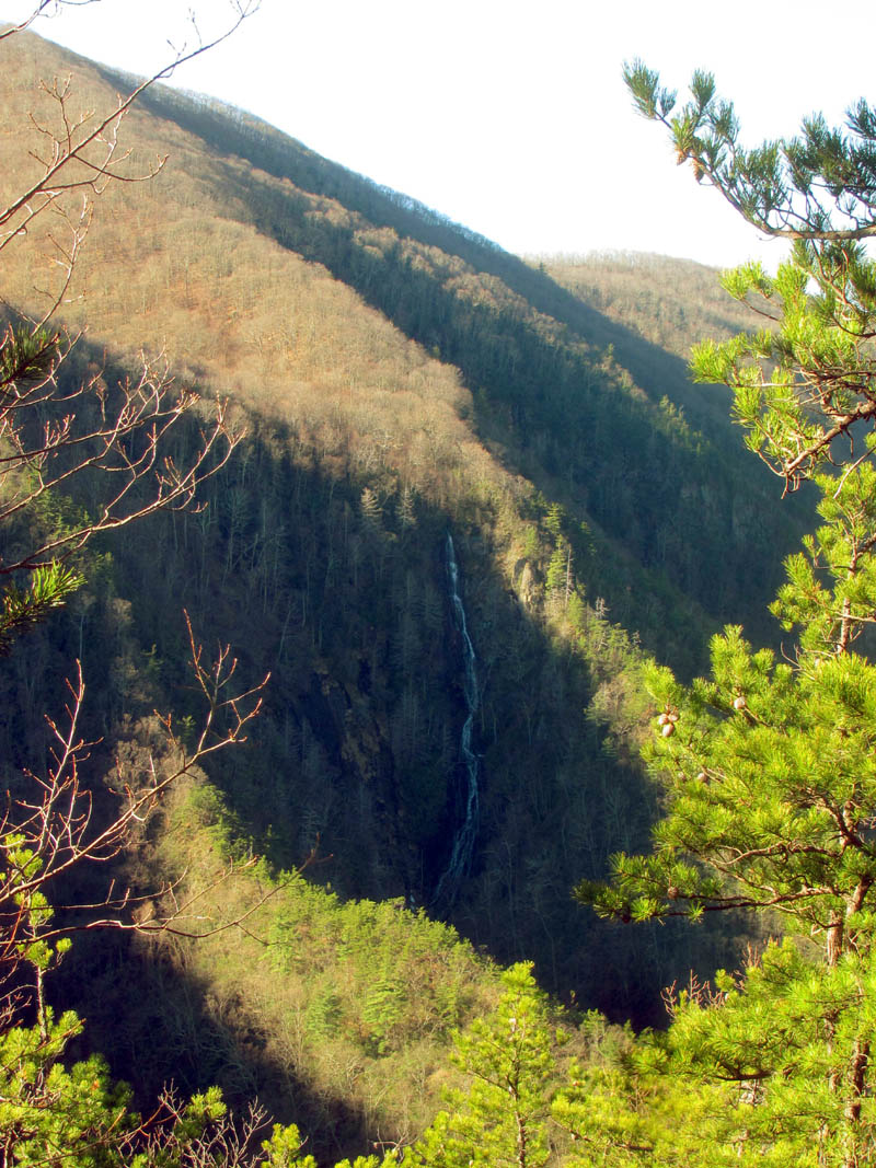
I was happy to see the sun the next morning and we got an early start around 9 am since we still had to take a side trip to the overlook on Chigger Ridge to see Buckeye Falls and have time enough to make it to the Buzzard Rock for the next night. After breakfast we packed up and hiked the short distance down to the secret shortcut where we stashed our packs and climbed up to the overlook and hung out watching the sun rise on Buckeye Falls. There was a lot of water flowing on them which is rare but awesome. There was not a lot of light on them so I wasn’t able to get any good pics but, it was sure awesome being there. It was Sam`s first time seeing the falls in their entirety from this spectacular viewpoint and having been to the base before he was in awe. We spent as much time as we could there before we knew we had to leave. It is always such a hard place to leave.

Walking under a downed tree on our way to Chigger Ridge the next morning

First shot of Buckeye Falls. The sun was just starting to come up on it.
Buckeye Falls. There was a lot of water flowing on this day. I hated that I did not have a tripod or my big camera.

Buckeye Falls

Buckeye Falls

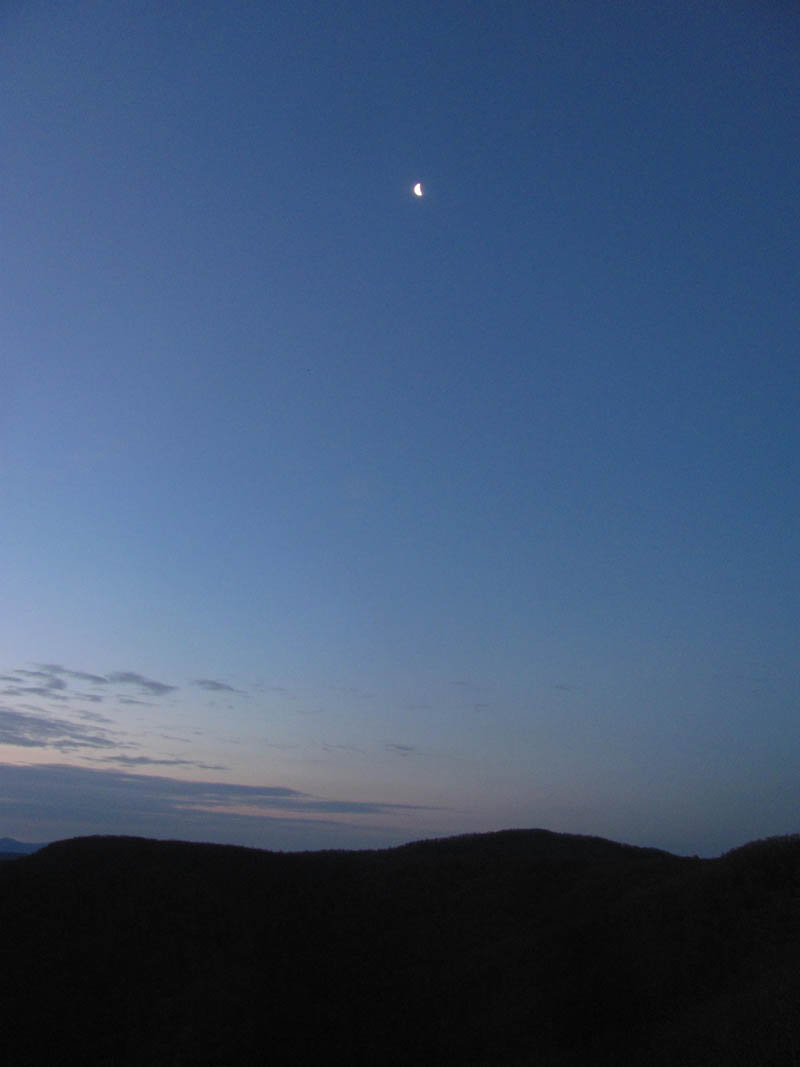
Sun was rising on Buckeye but the moon was still up. Can see it in this picture.

Buckeye Falls early morning
Buckeye Falls

Buckeye Falls

Buckeye Falls
Buckeye Falls

Sam taking one last look at Buckeye Falls before we had to leave. We wold be standing on top of Wilson Knob (high point just above the falls) in just a few hours.
Back down the shortcut to our packs and then off we went, back up the old road, backtracking to Longarm Ridge where we took another shortcut up past the old hunter camp which no longer has the shack there and is only a flat spot with a fire ring. This spot used to have a small primitive shelter with a small wood stove but, it is long since gone. I remember cooking hot dogs there on my last trip to that location. A short but steep climb up the hill to the Boundary Trail got our blood pumping. Taking a right and following that trail up a few more steep climbs would keep it there. Slow and steady and a few rest breaks later, we finally came to the new and improved hunter shack which is just before you reach the road near Wilson Knob. This is quite an elaborate setup with a metal roof, several 55 gallon barrels, and plenty of dry firewood. We could have made it here the first night had we not wanted to take the side trip to see Buckeye Falls.

Short but steep hill we climbed to reach the Boundary Trail up top

One of the few level spots along the Boundary Trail

There are still several pink flags along the Boundary Trail. Yes we know the person who put these here a few years ago !
There are several of these TN orange flags along the Boundary Trail also. Pretty sure I know who left these as well !

Starting to gain some elevation along the Boundary Trail. Can start to see some nice visuals of the Nolichucky River Valley off in the distance.

Notice the claw marks along the edges of the sign. I am told that squirrels do this.

Getting some elevation on the Boundary Trail, can see the valley below really well now. That is looking across the Nolichucky River Valley towards Bays Mountain in Kingsport and Clinch Mountains beyond

View of Wilson Knob (high point to left) , the butt of Clarks Creek (center) and the beginning of Sampson Mountain (right) from the Boundary Trail. Still along way to get there and then that much farther beyond it to reach our camp for night 2

Nice old log road that appears to lead down into the valley above Buckeye Falls found along the Boundary Trail as we got closer to Wilson Knob.

This is where the Boundary Trail starts to flatten out some and you know you are getting close to the new hunter shack and the Wilson Knob Road
Almost 30 years ago when we used to come to Wilson Knob on a regular basis, there was always a nice hunter shack with a roof and wood stove located just off the road on an old abandoned log road, hidden there above the draw that actually is above where Buckeye Falls bubbles out of the ground. I recall many times times hiking there from Rocky Fork in the blizzards and deep snow knowing we could get out of the weather and get warm using the old stove there. A few times it was torn down presumably by the caretakers of the Rocky Fork area until eventually it disappeared altogether. I am not sure how long this new one has been there but this is obviously the new location for it and I am betting built by the same people that built the other one. I have to wonder how the metal roofing and barrels etc were hauled in without a key to the gate. This had to be transported in via the road from Rocky Fork. The resident mice still have their home in the wood stove.

New hunter shelter near Wilson Knob

New hunter shelter near Wilson Knob
From the hunter shack it is a another short but steep hill to the road where we took a long lunch break as the Boundary Trail had taken all the wind out of our sails due to the heavy packs. It was a beautiful sunny day and it had warmed up nicely and I was happy to be off of the briar infested boundary trail. It was apparent that not many travel it these days. The road up to Wilson Knob has become quite grassy since I was last there many years ago. It was a pleasure to walk on compared to the Boundary Trail. It did not take long at all to reach Wilson Knob keeping in mind that it does not go over the summit as there is a side trail that leads to the small field on top there. There are not really any views from up there due to the trees that surround the summit. We continued down the old road which then bears right and goes down the hill a mile or more to what I call the butt which is the butt end of Clarks Creek. I knew we could get water there easily and take another break before making our next decision of which way to go.

Finally we reached the road that leads to Wilson Knob

Looking to our left as we hiked up to Wilson Knob I could see Frozen Knob (left) and Big Bald (center) in the distance

The old road does not cross the summit of Wilson Knob, it goes along right side but there are two trails that will lead to the small field on top

We found some leftover snow on backside of Wilson Knob. For sure it was 3 feet deep here at one time.

View from the old road at Wilson Knob of the Nolichucky River Valley

Looking down into the hollow above Buckeye Falls. That snow melt was helping to feed them

More snow on the old road near the butt end of Clarks Creek
There used to be a grassy clearing at the butt however, it is now grown up with laurels so there is not a view of the Clarks Creek Valley anymore. I have an old picture I took from there almost 30 years ago and I remember seeing the entire valley from the butt end to the ridge that Buckeye is behind and some of the ridges beyond. There is still a small trail cut through the laurels on the right side which leads into the woods there and as memory serves it has always been there and I have never took the time to see why or where it goes. Just past the butt I noticed the old road to Sampson Mountain has grown over but some four wheeler enthusiasts have cut a trail through the laurels there also. I remember walking out most of the main ridge on Sampson back when it was possible from there to Clarks Creek one time which was quite a fun adventure. It had old hunter camps and cast iron stoves there too and I could not help but wonder what shape all that ridge trail is in now. From this point there is an intersection of roads and we had to make a decision if we had time to go out to the new cliffs and hope the shortcut road was there to connect back up with the high road that leads to the Buzzard Rock or not.

Looking back at the butt end of Clarks Creek

Continuing out the road that runs along the butt towards Sampson Mountain

The old road turns left as a well cut trail continues straight and to the right which lead to the spine of Sampson Mountain. That used to be a road which went for several miles on top of Sampson.
Since it was getting late in the afternoon, and my desire to make it to the Buzzard Rock overlook to camp before dark was stronger than the desire to find the new cliffs and possibly end up having to camp somewhere else, we decided to not take that side trip and continue on the high road which leads eventually to Middle Spring Ridge and the overlook. I had my heart set on camping there and getting some sunset and sunrise pictures. Although it is a few miles to the overlook and a lot of elevation gain, the high road that connects over to it is very forgiving and laid out well with hardly any hills until the few switchbacks at the end. It gradually gains the elevation and passes on the high ridges through hardwoods where one can see views off both sides. Rocky Fork on your left and the Nolichucky River Valley on your right.

Some very old Ents along the old road

Looking down at the Cassi Creek Valleys below
After a couple miles on the old road, we did come to a nice road leading off to our left which was the shortcut road in question that we could have used to come up to reconnect after finding the new cliffs had we decided to go that way and soon as I seen it I was regretful that we did not take that chance and go that way but, there is always a next time for that ! At least now we know the road is there. After that it was not far to the switchbacks where the up hill begins. Not the best thing at the end of a long hard day but it had to be done if we were to make it to the overlook before dark. Slowly and surely we trudged up the long hill until we found ourselves at the intersection of the road and the Middle Spring Ridge trail. This is where the new big red gate was. The gate was a curiosity indeed as I wondered why it was even there as there is no way anything can come from our side of it as Rocky Fork is well gated and protected and the road behind the gate dead ends about a quarter mile past the Buzzard Rock overlook with no connections to Horse Creek or anywhere else (or so I thought) so I was confused. Also it was obvious that it was not a government gate as it was built from basically scrap metal that was cobbled together with some poor looking welds and sockets welded to it, basically a real mess but painted shiny red. We would learn the reason for the gate the next day.

Looking back at the connector road that we had wondered if it was really there or not. We now know it IS there !
Starting up the switchbacks on the old road that goes to top of Middle Spring Ridge

The new red home made gate that is located where Middle Spring Ridge Trail comes out on the old road
We continued on the road behind the gate still climbing uphill by the rocky ridge I barely remember when we met an old guy day hiking down the opposite way. Nice fellow from Greenville, TN , recovering from some health issues and the loss of his hiking dog that died. He was just getting back to his usual hiking routine which consisted of hiking up middle spring ridge and back, sometimes looping down Sarvis Cove Trail however, on this day he chose to go back down Middle Spring Ridge as the creek crossings from Sarvis to the parking lot in Horse Creek would be very difficult due to the high water. After a short break talking to him we continued up the hill past the last switchback and finally reached the Buzzard Rock just before 5pm.

Just behind the gate the road goes uphill past a large rocky area. This is where we met the guy from Greenville coming down.

Sam checking out the view from the last switchback on the old road, almost to the top and the Buzzard Rock Overlook
To my surprise there was a Private Property Keep Out sign, stating one had to have permission to go behind the sign which was right on the road meaning that the Buzzard Rock was behind the sign. Something about New Forestry LLC which I found out was a large timber and land management company out of Atlanta Georgia. It had a number to call for permission but, no one answered so we set up camp behind the overlook anyway. We had to hurry to get camp setup and fire wood gathered plus cook supper before it got dark so I barely had time to get any sunset pics but the mountain blocks out most of it anyway from the overlook side so I at least had the sunrise to look forward to as it would be on that side for sure. I got these pics as soon as I got there:

View from the Buzzard Rock

View from Buzzard Rock

View from Buzzard Rock

View from Buzzard Rock
View from Buzzard Rock

View from Buzzard Rock

View from Buzzard Rock

View from Buzzard Rocks

View from Buzzard Rock

View from Buzzard Rock
Of course I could not resist zooming in on Whitehouse Mountain and Cliffs for a few pics:

Whitehouse Mtn out there in the middle kinda

Whitehouse Mtn zoomed

Zoomed in on Whitehouse Mtn

Zoomed view of Whitehouse Mtn

zoomed view of Whitehouse Mtn (no tripod)
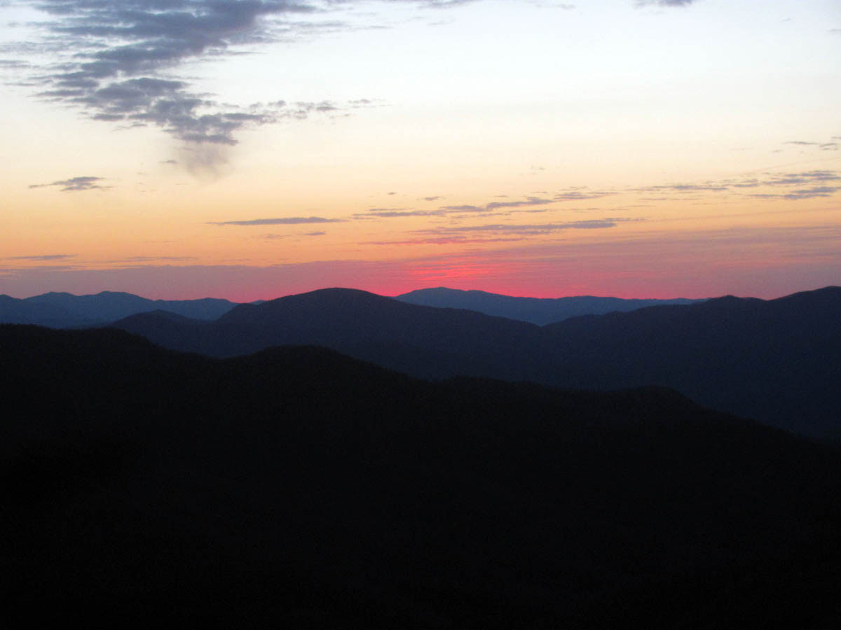
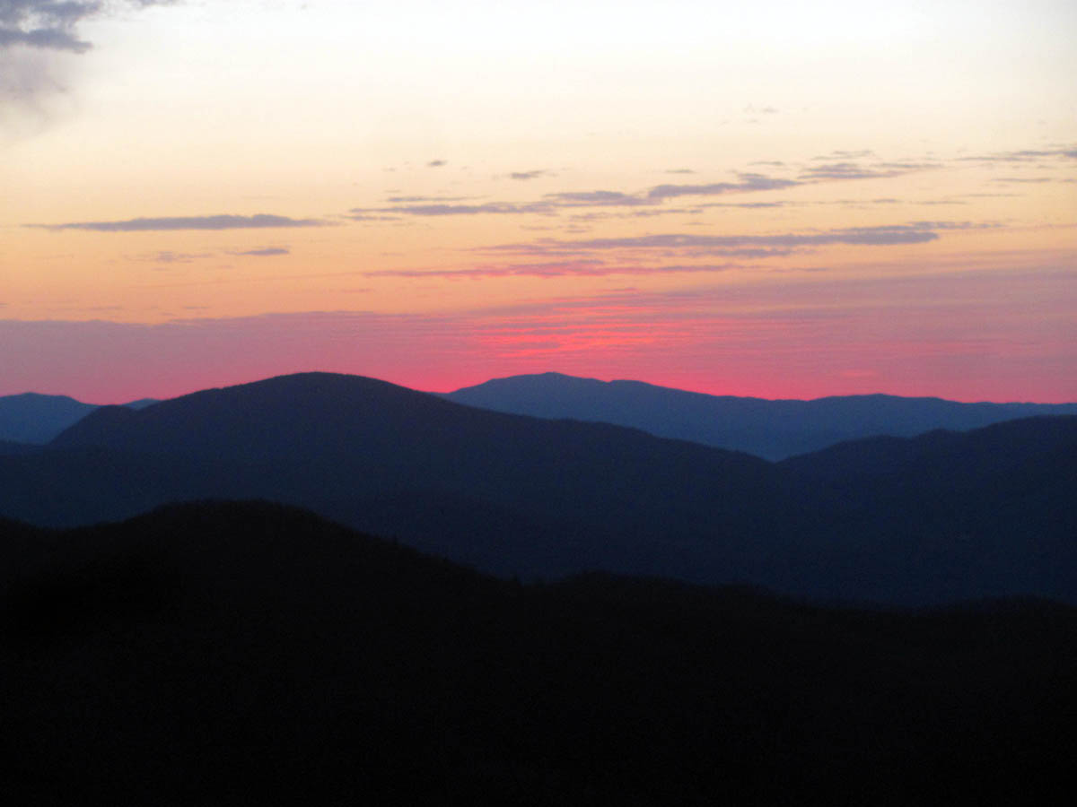
The only sunset pics I could get:

Sunset view from Buzzard Rock. This is looking towards Johnson City / Erwin. From left you can see tops of Sampson Mtn lit up, out from it is Rich Mtn basically the Boundary Trail we came up earlier that day, and to right is the top of Frozen Knob in the sun

Sunset view from Buzzard Rock. Frozen Knob taking center stage

Sunset view from Buzzard Rock. In the sun is Frozen Knob (left) Flattop Mtn and Spivey Gap (center) and Little Bald and almost Big Bald (right)

Sunset view from Buzzard Rock. Flattop Mtn (left) Little Bald and Big Bald (center) starting to see some sun on Flint Mtn (right)

Sunset view from Buzzard Rock. You can see Little Bald, Big Bald and now Flint Mtn in the fading sun

Sunset view from Buzzard Rock. Big Bald in background, Flint Mtn in center and an unnamed ridge on Coldspring mtn to left

Sunset view from Buzzard Rock

Sunset view from Buzzard Rock

Sunset view from Buzzard Rock
I did manage to get a few from the other side of the mountain looking off towards Greenville, TN. and the Nolichucky River Valley but the view is obscured in that direction by trees but I tried to make the best of it:

Looking towards the West (Greenville)

Looking towards the Nolichucky River Valley (Northwest)

Out of focus (sorry) but does show some of the many lights seen in the valley below. These were as far as the eye could see and were very beautiful to look at all night
Moon over Coldspring Mountain

The road at the Buzzard Rock. You can see our firewood piled up.

Sunset from the road just behind the Buzzard Rock
Just our luck, as soon as we lit the fire, the nightly winds started up. Of course it was too late at that point but it got too risky to let it burn very high for very long as it was much drier on the high ridge there than it was on Chigger Ridge the night before so we eventually had to let it go out to not risk setting the mountain on fire. It was going to be a much colder night with the higher elevation and high winds so we battened down the hatches and went to bed earlier on this night.

Campfire at Buzzard Rock

Campfire at Buzzard Rock

Sam worried about setting the mountain on fire !

Campfire at Buzzard Rock
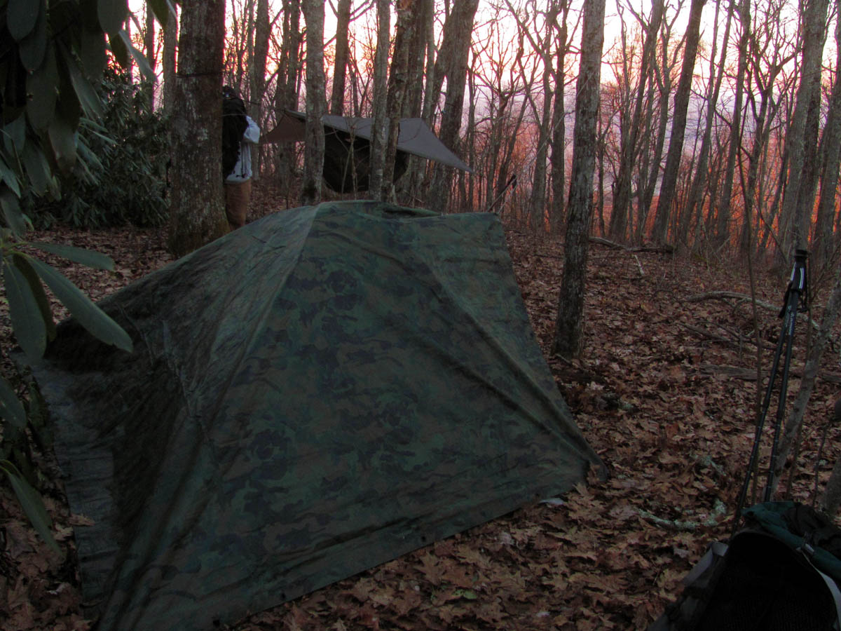
Stealth camp at Buzzard Rock

Stealth camp at Buzzard Rock
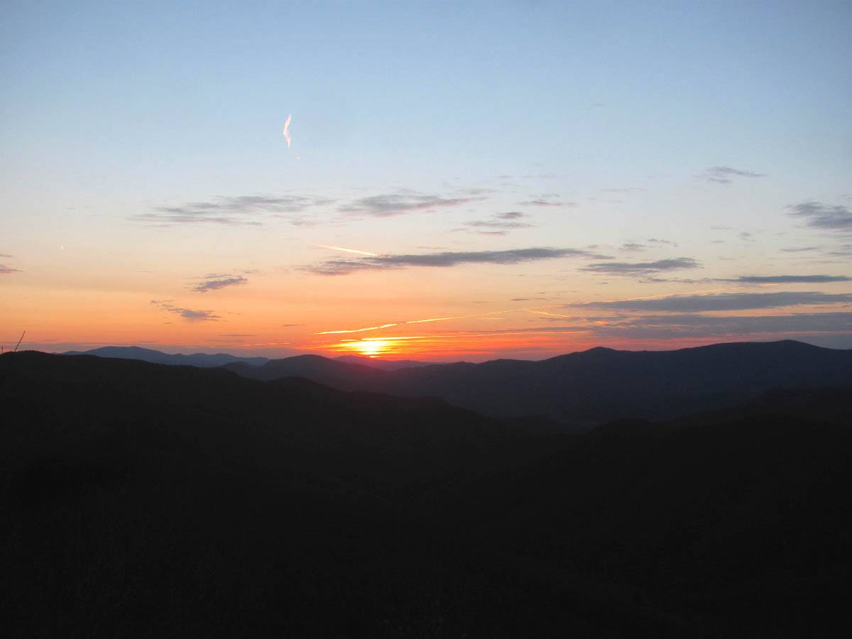
The wind was strong and very loud all night long and it got very cold near 20. Sam was comfortable in his hammock as he had plenty of extra layers (under armor) but, I soon learned that my old 20 degree bag was just no longer capable of sustaining enough warmth in these conditions. Add in the fact that I was going much lighter than I normally go due to the length and toughness of this hike, and it was soon apparent that I did not have enough layers to keep me warm so I was on the edge of discomfort most of the night. I was up very early at first light the next morning so I could try and get what sunrise pics I could get before the light went flat. I did not have my big camera so the pics are not that good but, my mental memories of it will never be forgotten as it was quite spectacular.

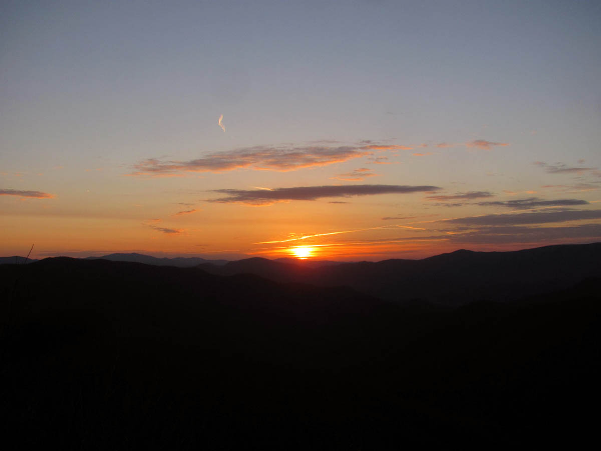
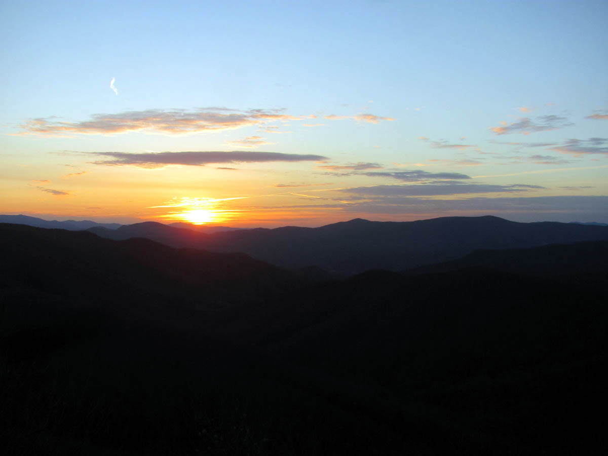
Sunrise from the Buzzard Rock

Sunrise from the Buzzard Rock

Sunrise from the Buzzard Rock

Sunrise from the Buzzard Rock

Sunrise from the Buzzard Rock

Sunrise from the Buzzard Rock

Sunrise from the Buzzard Rock

Sunrise from the Buzzard Rock

Sunrise from the Buzzard Rock
Sunrise from the Buzzard Rock
Sunrise from the Buzzard Rock

Sunrise from the Buzzard Rock

Sunrise from the Buzzard Rock

Sunrise from the Buzzard Rock

Sunrise from the Buzzard Rock

Sunrise from the Buzzard Rock

Sunrise from the Buzzard Rock
Sunrise from the Buzzard Rock
Sunrise from the Buzzard Rock

Sunrise from the Buzzard Rock

Sunrise from the Buzzard Rock

Sunrise from the Buzzard Rock
Sunrise from the Buzzard Rock

Sunrise from the Buzzard Rock

Sunrise from the Buzzard Rock
After the sunrise we cooked up a good breakfast as we would need all the energy we could get on our last and longest mile day of the weekend. We broke camp early around 10am and took some last pics from the Buzzard Rock:

Trail to the Buzzard Rock

The Buzzard Rock

Buzzard Rock

Buzzard Rock

View of Coldspring Mtn with leftover snow, as seen from the Buzzard Rock

Sam taking in one last view from the Buzzard Rock before hitting the trail

Some large triangular rocks that sit beside the Buzzard Rock

This was found close to the Buzzard Rock
From there we hiked out the road beyond the overlook towards what I remembered was a dead end and a very overgrown bear trail through some very dense scrub growth that goes nearly a mile to connect to the grassy field called the ‘Ball Ground’ and the Appalachian Trail at ‘Big Butt’. Once we reached the end of the road we soon learned the purpose for the new red gate. The old pig trail through the brush was still there but no longer being used as it has been replaced by a bulldozed four wheeler trail that goes all the way to the field !!! There were lots of mud holes and rocks as it is being well used by atv`s and is eroding badly int eh apparent short time it has been there. Soon it will be a real mess. We were actually lucky that it was frozen which made it easier to stay out of the mud.

Cool looking Ent that was guarding the road to the connector trail.

The road no longer dead ends, it continues through the scrub growth ! This is looking back, you can see Wilson Knob sticking up !

The ‘new’ road across the scrub growth

Hiking across the new connector trail

Frozen mud holes along the new road

Gnarly tree along the new road
I was happy to have the road to walk on verses the old way which was pure hell but, I had to wonder who allowed this road to be cut and who did it ? I had mentioned hand snipping the old trail out some many years ago to those in ‘authoriti’ and was told not to due to the property owner not wanting it to connect. I must assume that ownership has since changed. Once we reached the field I could see that it too had been cleared out some by a bulldozer as well, as many large trees have been cut and pushed to the sides in big piles. This of course is a good thing as I knew the fields have been encroaching for years since Sam Waddle is no longer with us and getting smaller so I was happy to see that they had been cleared but, I had to wonder if the same crew cut that road out to make the connector trail what it is and how the forest service could possibly allow it. This would require some research once I get back home which I still have not had the time to do.

Continuing along the new road

You can see part of the old trail running beside the new road. It looks to be cut out more than I remember it but is now no longer needed so will soon disappear

New road

Large mud hole close to the field at the Ball Ground. This part of the road has always been here.

Finally we reached the field that connects to the AT. I was happy to see it had been cleared and mowed.

Standing next tot he AT looking back across the field
We got on the AT there and went the short distance South to the Big Rocks overlook to take in the views and have a nice break. The views were awesome as always but, the trees have grown up quite a bit in recent years so the views are not what they used to be. Also some low life stole the Big Rocks View wooden sign that my friend Sam Waddle made and hung from a tree there several years ago when we built the new relo trail there before he retired and then passed away, which saddens me to this day. From there we went back North on the trail and headed towards Devil Fork Gap some 6+ miles away. The first thing you come too after the Big Rocks view is another small field that is called Big Butt. There is what is called the Cow Lick Rock at the corner of that field that according to Sam when his grandfather lived in a cabin near there and had cattle on the mountain, was where the salt was placed and after many years of cows licking that rock is had a huge low spot in it. It now has a new official survey marker anchored in it. This field has also been bulldozed out.

Big Rock overlook

BIG ROCK survey marker

View from Big Rocks

View from Big Rocks

View from Big Rocks. This is looking across the Nolichucky River Valley towards Kingsport. You can easily see Bays Mountain in the distance.

View from Big Rocks – looking towards Viking Mountain

View from Big Rocks – looking off the NC side

View from Big Rocks looking towards Coldspring Mountain with Big Bald in distance – the trees have almost taken this view away
Same standing beside the ‘Cowlick Rock’

BIG BUTT survey marker on the Cowlick Rock

First field going North on AT where the Cowlick Rock is

Old road (and AT) that leads out of the first field towards Coldspring Mtn.

Next field along the old road and AT
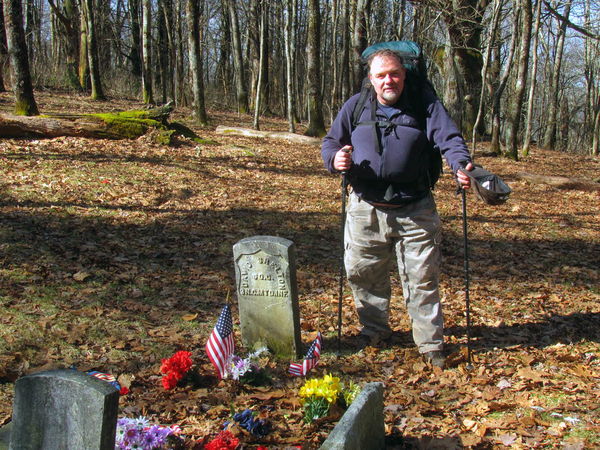
Continuing on the AT which follows the old road, it is about 2 miles to the Shelton Memorial Civil War graves. Twin tombstones on Coldspring Mountain mark the graves of David and William Shelton, an uncle and a nephew who fought for the Union during the Civil War. Although they lived in North Carolina, it was not uncommon for those living in the mountains to be loyal to the North. On a per capita basis, the area furnished more volunteers to the Union army than did many states above the Mason-Dixon line. According to the National Forest Service webpage the ambush occurred on July 19, 1864 as the Sheltons and a young 13 year old friend Millard F Haire who were on their way home for a family reunion while the war was still in progress. Other more reliable references claim the ambush took place on July 1, 1863 where David and his great grandson Millard were in hiding after the Shelton Laurel Massacre where they were caught by Keith`s Confederate detail and killed. William Shelton was killed July 17, 1864 also by Keith’s Confederate detail.

Approaching the Shelton Memorial Civil War Grave Site

Shelton / Haire grave site

David Shelton tombstone

William Shelton tombstone

Millard Haire tombstone

Additional explanatory marker stone
You can read about the Shelton Laurel Massacre where 13 young boys were murdered and their women were tortured by Keith`s regiment also. To quote my reasearch: ” This all began when the CSA controlled Laurel. They seized all the salt for distribution by the Confederate Commissioners. “Salt was selling at seventy five to one hundred dollars a sack. The Commissioners declared that the “Tories” should have none, and positively refused to give Union men their portion of the quantity to be distributed in that vicinity.” [The Civil War in Song And Story]. So the Union men stole their portion of salt, and thirteen men and boys were “arrested” and told by Col. Allen that they would have a trial in Tennessee. But just a few miles out, they were ordered to halt, and five of them were ordered to kneel down, where they begged for their lives and appealed to justice. “The soldiers raised their guns the victims shuddered convulsively, the word fire was given and the five men fell pierced with rebel bullets. Old man Wood and Shelton were shot in the head and their brains scattered upon the ground, and they died, without a struggle. The other three lived only a few minutes.” “Five others were ordered to kneel, among them little Billy Shelton, a mere child, only twelve years old. He implored the men not to shoot him in the face…He covered his face with his hands. The soldiers received the order to fire, and five more fell. Poor little Billy was wounded in both arms. He ran to an officer, clasped him around the legs and besought him to spare his life…The little boy was dragged back to the place of execution; again the terrible word, “fire!” was given, and he fell dead, eight balls having entered his body.” Kinda makes you wonder what kind of ******** would do this in the name of unity ? “
RAT at the Shelton Memorial grave site

Sam at the Shelton Memorial grave site
Previous to being killed David had spent a good amount of time traveling with the 2nd NC Mounted Infantry under the command of Col. George Kirk.(U.S. Army) He was in several important actions of the region most notably the raid on Morganton NC. There is an extensive file on him in the National Archives as his widow Elizabeth filed for a pension under the Pension Act. It details his movements with Kirk’s unit. The pension was eventually denied since there was no record that he officially enlisted – not an unusual thing for that area. The federal grave markers were erected in 1915 by two local preachers Rev. Frederick Webb and Rev. Monroe Shelton and dragged there by ox sled. The government provided the markers but they did the work themselves. There was no stone provided for Haire because he was not in the army. In 1998, descendents of the civilian, Haire, erected a tombstone in his honor. I have pics I took before and after that happened.

This is a picture of the Shelton Memorial grave site taken some 30 years ago. That is my nephew Christopher Phillips.

Another picture taken at least 25 years ago of the Shelton Memorial grave site. Let to right is: my dog Schwartz Hund, RAT (me), Mark Painter, and Charlie Bennet

Shelton Memorial grave site

Shelton Memorial grave site
For many years now on the fourth Sunday in July, the Forest Service has opened this section of the AT to motorized vehicles and horses for what is called the Decoration Day. close to one hundred people usually make the long trip up the mountain and gather by the grave site to sing religious hymns and listen to various speakers and there is the occasional alter call. With that number of people driving up a steep and sometimes muddy trail with numerous creek crossings, several agencies are on hand to insure safety, including the National Forest Service and members of the Greeneville Emergency & Rescue Squad and EMS. I have hiked through this celebration once in my lifetime and had my 7 year old nephew Chris with me at the time. I often wonder if he even remembers it. We spent some time here to enjoy the beauty of the area and pay our respects before moving on towards Flint Gap.

This flag had blown off and was laying on the graves. I put it back where it belonged

Shelton Memorial grave site
The first thing I noticed was more trees that had been cut down and also an orange flag line leading off to the left of the ridge from the grave site. It was not until we went down the long and drawn out steep as heck hill to almost Flint Gap that we found the other end of it where a new trail had been cut for quite a ways already. Further research when I got home revealed that the Konnarock Crews and CMC (to which I have worked with and been a member and trail maintainer with for the past 22 years) has been working on a huge relocation from the graves to Flint Gap thus eliminating one of the gnarliest and steepest hills on any part of the AT in this area. I was glad to see this and I can not wait to hike it. The second thing I noticed was that we could see Whitehouse Mountain pretty much the whole time we were on the ridge all the way to the gap. Not far from there we completed the knee grinding hill down to Flint Gap where we took a nice long break.

Whitehouse Mountain as seen from the ridge above Flint Gap

Flint Gap Looking towards NC

Looking South out of Flint Gap at the steps that would begin a serious climb IF you were going that way ! I was glad to have came down it instead !

Sam taking a break at Flint Gap on the Rocky Fork side

The trail leading North out of Flint gap towards Flint Mountain
After we rested we began the gradual ascent out of Flint Gap up to the main ridge at the butt end of Rocky Fork where the trail crosses over into North Carolina and proceeds down to the Flint Mountain Shelter. Rebuilt in 1987 it was the first time Sam had been back there since it was one year old approx. 26 years ago ! It was a really nice day with warm temps so we took another break there before moving on towards Devil Fork Gap. From the shelter the trail is really nice and easy and it did not take long at all to do the 2+ miles to the road. I was tired and had some sore spots but, all in all I was in really good shape considering what all we had done in such a short time. I was sad to be leaving the woods but, glad to be at the car and looking forward to a nice cold drink at the first store on the way home. We had made it out by 4pm so we had plenty of time before I had to login to work and I was not looking forward to that ! What a killer weekend it had been. One I will never forget. I am already looking forward to the next back country adventure.

Flint Mountain Shelter

Almost to Devil Fork Gap.
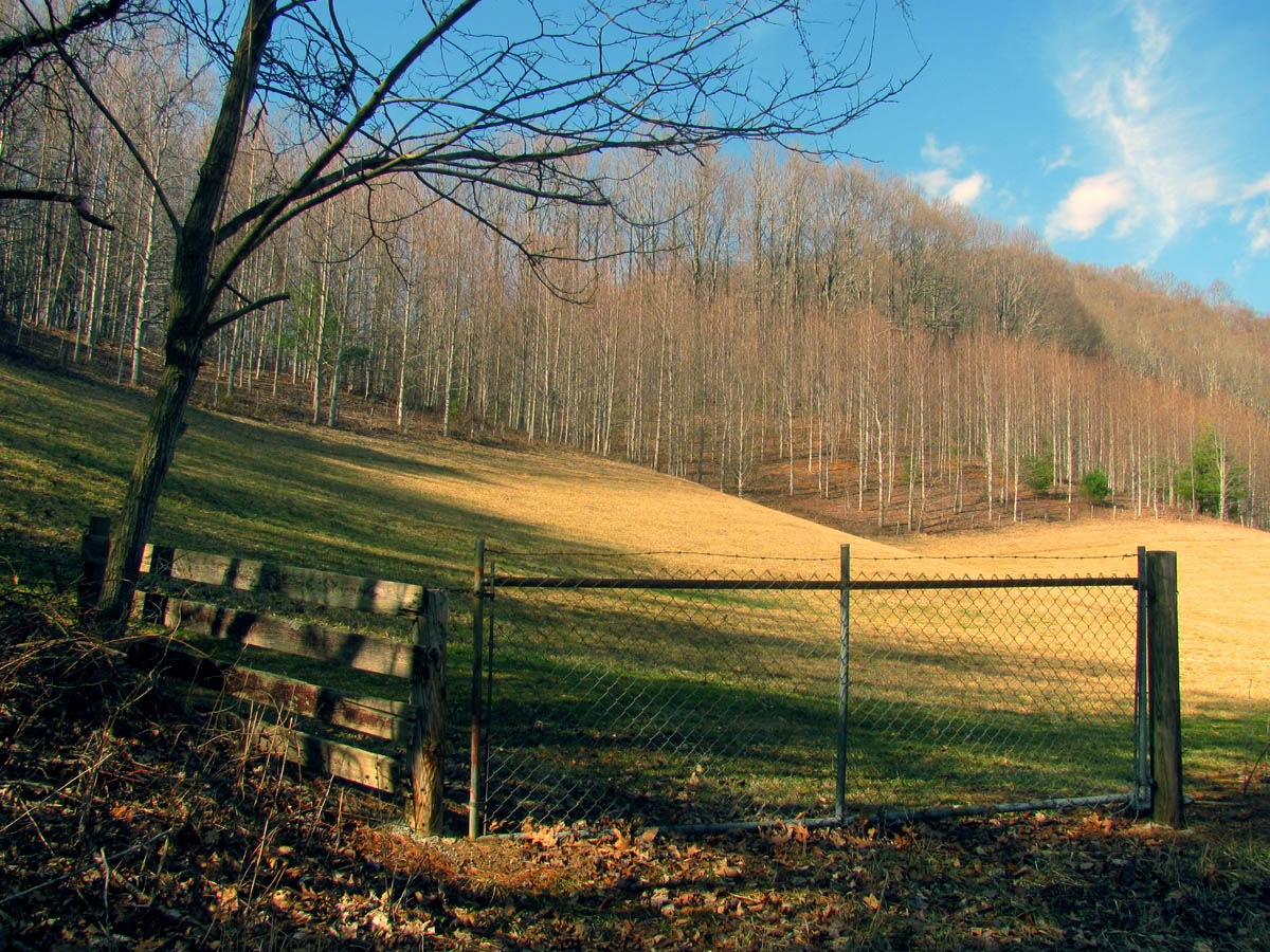
Field beside the road and trail head at Devil Fork Gap

 My name is 'RAT' and I love the mountains and waterfalls of the East TN. area where I live and I hope you enjoy this blog about my outdoor adventures.


One Comment to “Death March 2014 – 2-21 to 2-23-2014”