


DuPont Forest Waterfalls – 3-27-2013
For years I have heard about the ‘Land of the Waterfalls’ in Transylvania County of North Carolina (called this due to some 250 different waterfalls located there), some of them are located in the DuPont State Forest. It is also called ‘Home of the White Squirrel‘ (as they actually do have white squirrels there !) and I finally got to take my first trip there on Wednesday, March 27, 2013. My waterfall crazy friend Dave Aldridge invited me along on an exploration trip he had planned to find an unnamed and unlisted waterfall within the DuPont State Forest that he had found by looking at a satellite view of the area. He had discovered a way down to the top of them the week before, but was unable to get down to the bottom of them so it was our quest to find a way there. Dave knew that these unknown falls were just above a very well known and listed falls called Wintergreen Falls so we took what we thought would be an easier route to those falls and then looked for a passable route to get upstream to the falls we were searching for. Having seen an old road trail on the map, we easily found that and parked at a locked gate there and proceeded down this nice road trail towards the Wintergreen Falls. It is about a mile and a half to these falls by this route. There is a short rock hop to reach them. They are only about 20 feet high so they are the least impressive falls within the park but they are nice and besides, we were in search of a much larger one upstream from there.

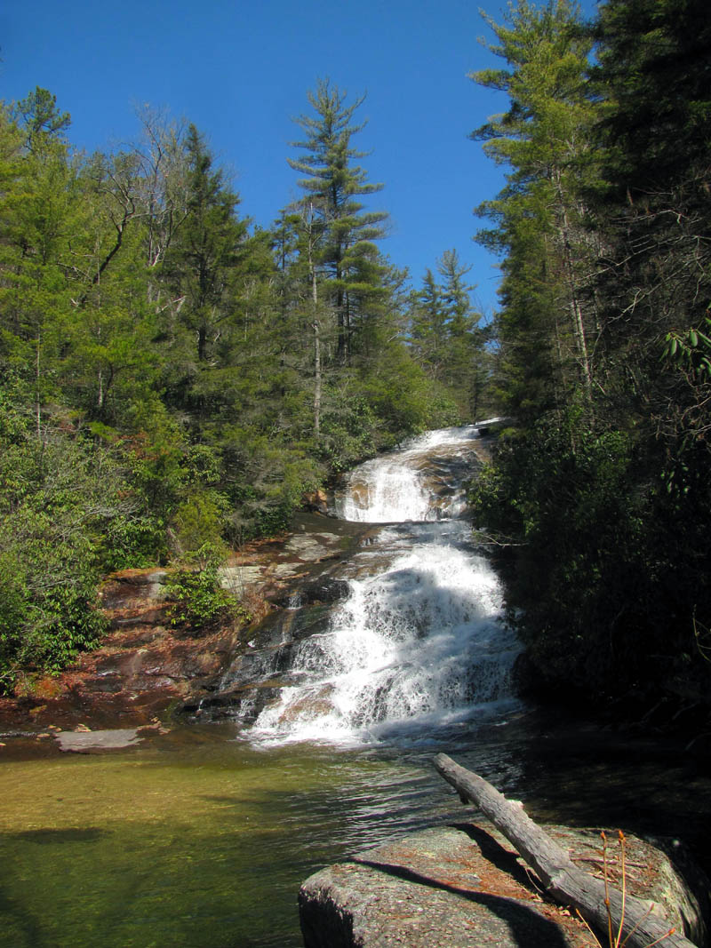
Wintergreen Falls (Photo by Dave Aldridge)
There was still snow and cold temps in East TN. when we left, and Sam`s Gap had at least a foot of snow still on the mountains there, but by the time we reached Asheville, NC, there was not a trace of snow and the skies were clearing. By the time we reached the Hendersonville area, it was sunny and nearly 50 degrees. There was some wind but it was perfect weather for hiking. Only the clear blue skies and bright sun would prevent getting any good waterfall pictures. It did not take long to find the road we were looking for and in a short time we were at Wintergreen Falls. We got what pics we could and then began looking for a way to get upstream to hopefully find the other falls.
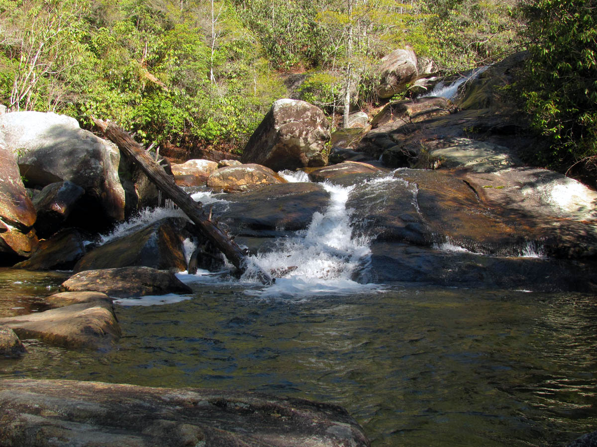
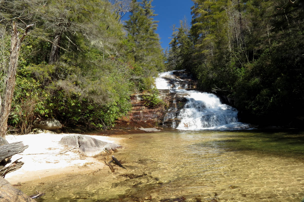
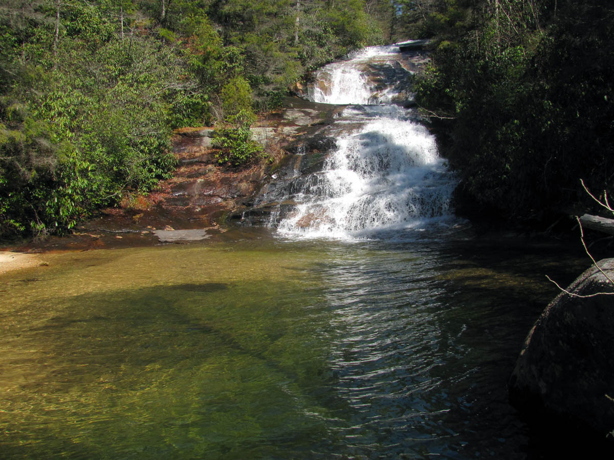
Wintergreen Falls (as seen from below, you can see barely the top of the main part of the falls)
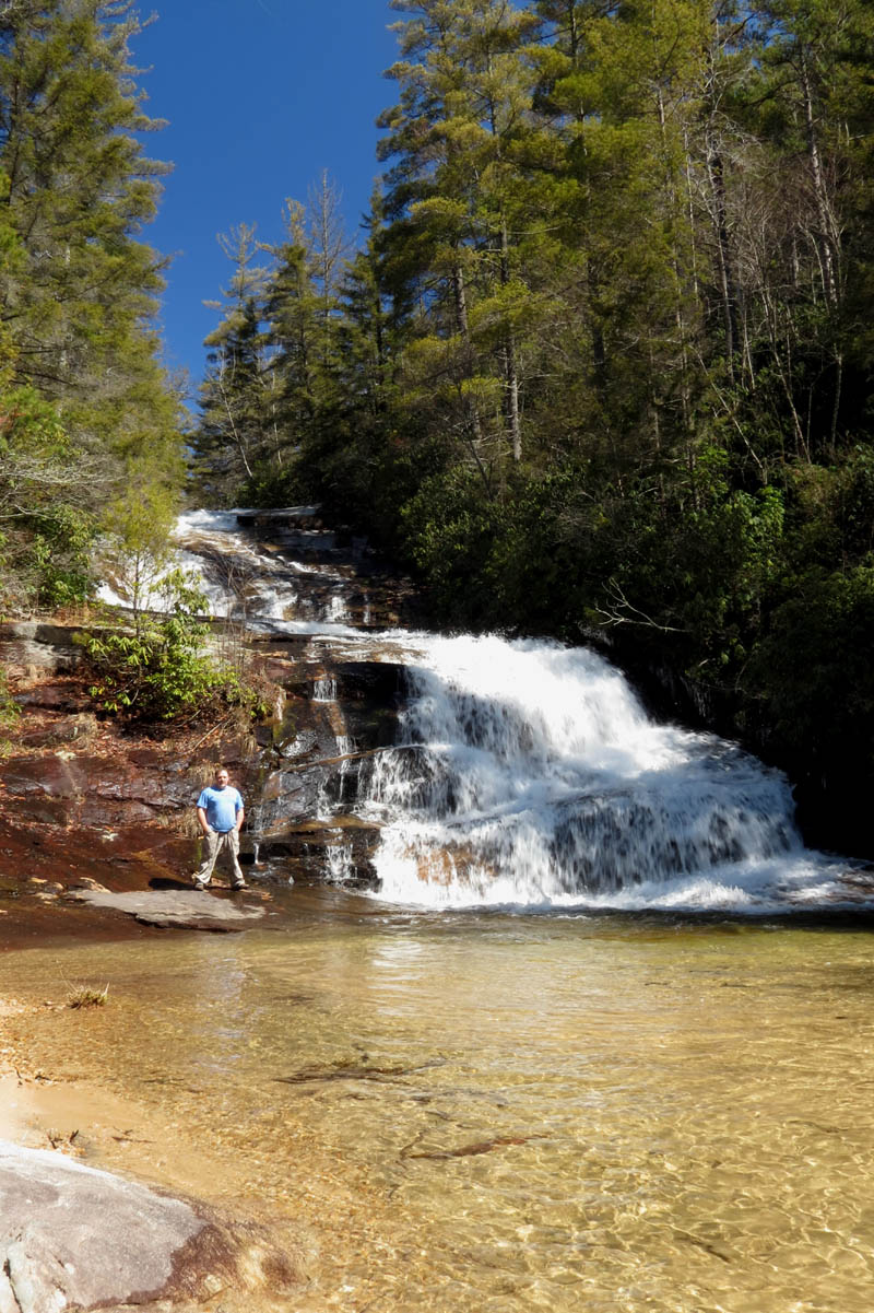
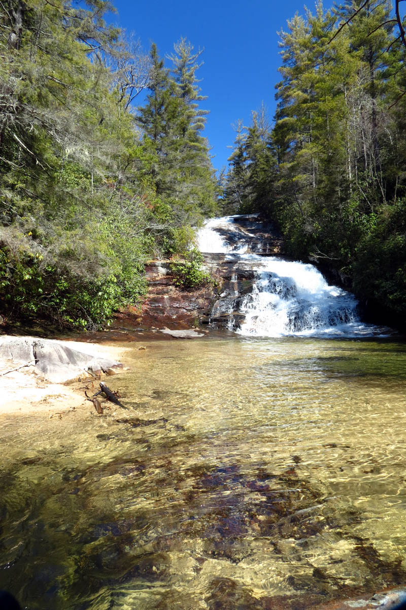
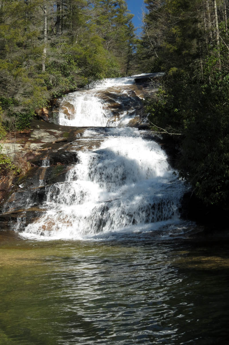
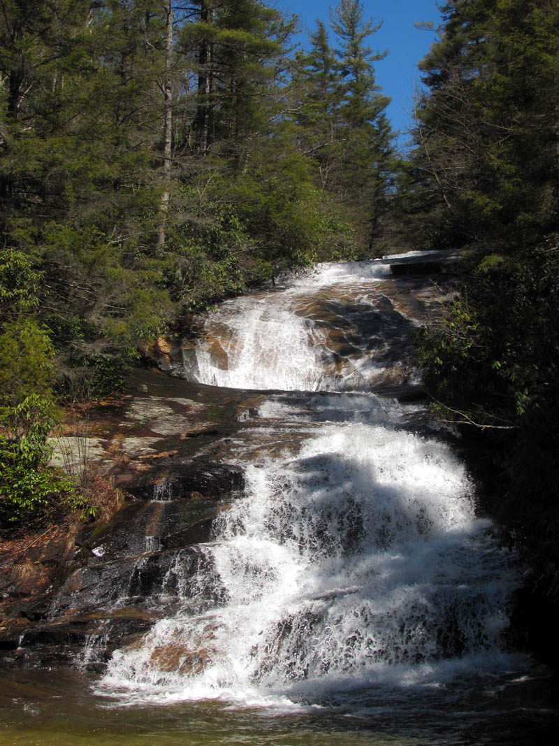
Wintergreen Falls
Wintergreen Falls
Wintergreen Falls (this is what is at the top of the falls,,, a foot rock ? a hand pointing ?)
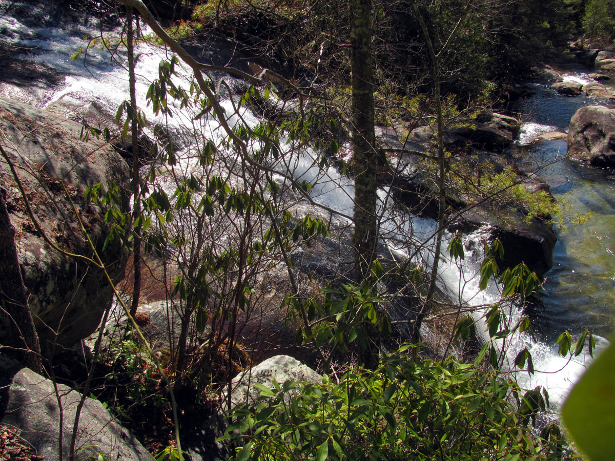
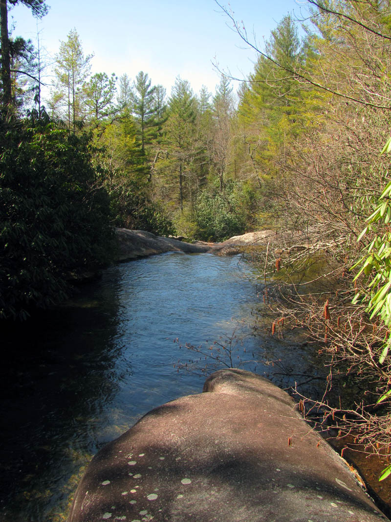
There was a small goat path of a trail that continued beyond the falls on the left side which did lead fairly easily to the top of the falls, but got smaller and more faint beyond that point. We continued making our way along a series of rabbit trails trying to take the path of least resistance. There were some tricky spots where it was difficult to get through but overall we were able to continue upstream at a steady pace maneuvering around each obstacle we came to. The whole time I had this feeling that there was a better way up higher on the ridge above us and even after the return trip where I climbed up to investigate, I still believe this. Now that we know how far it is to the falls, I am sure I will take that route when I come back to this place in the future. We could not see anything due to the thick growth so we had to venture out into the creek to try and get a visual upstream and eventually we did see the base of the falls off in the far distance, which are at least .2 from the Wintergreen Falls. After one more thick spot complete with briars, I found a small trail that led me to a fairly large sandy beach right at the base of these falls. It was obvious that a few others had been here but I can assure you that not many know about these falls or would go through the trouble even if they did.
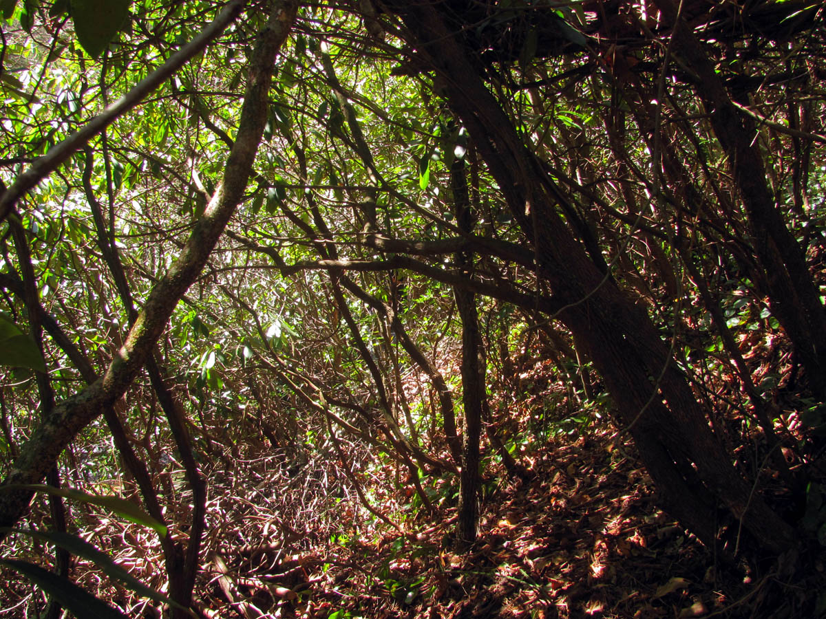
Looking back at Dave while following the rabbit trail in search of the falls
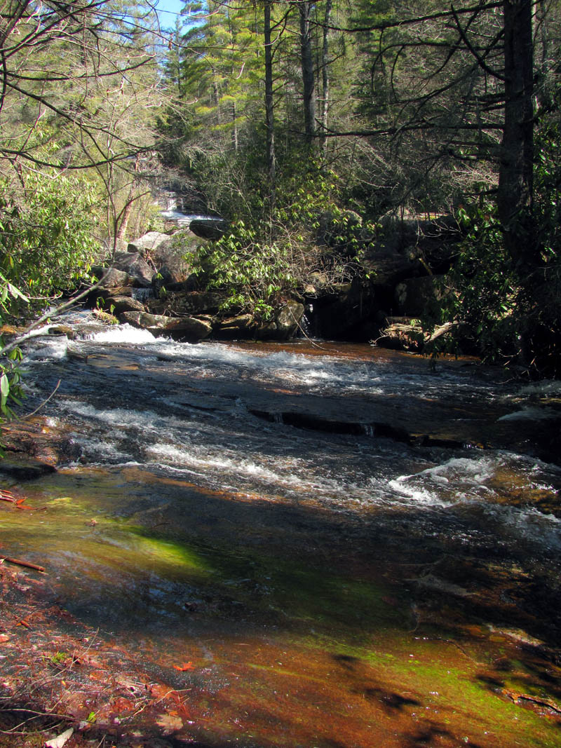
Grassy Creek about .2 above Wintergreen Falls (here we had to get out of the thickets to see where we were and could finally see a glimpse of the base of the falls off in the distance)
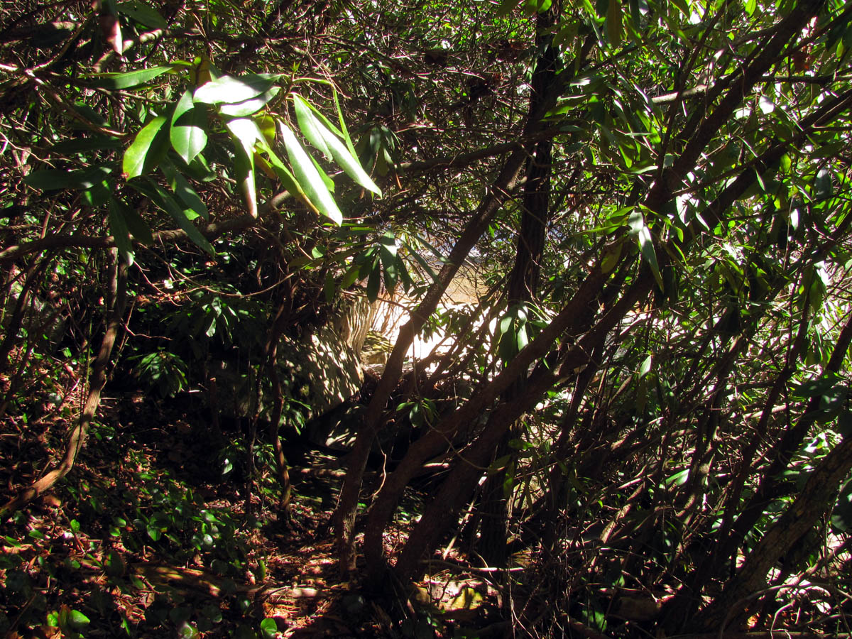
After some more time in the thicket, is that a sandy beach I see ? (we could hear large falls at this time)
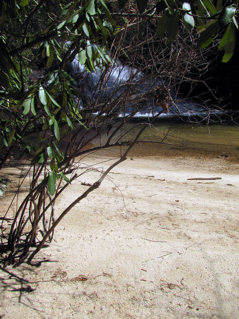
Yes ! It IS a sandy beach at the base of the falls we were looking for !!
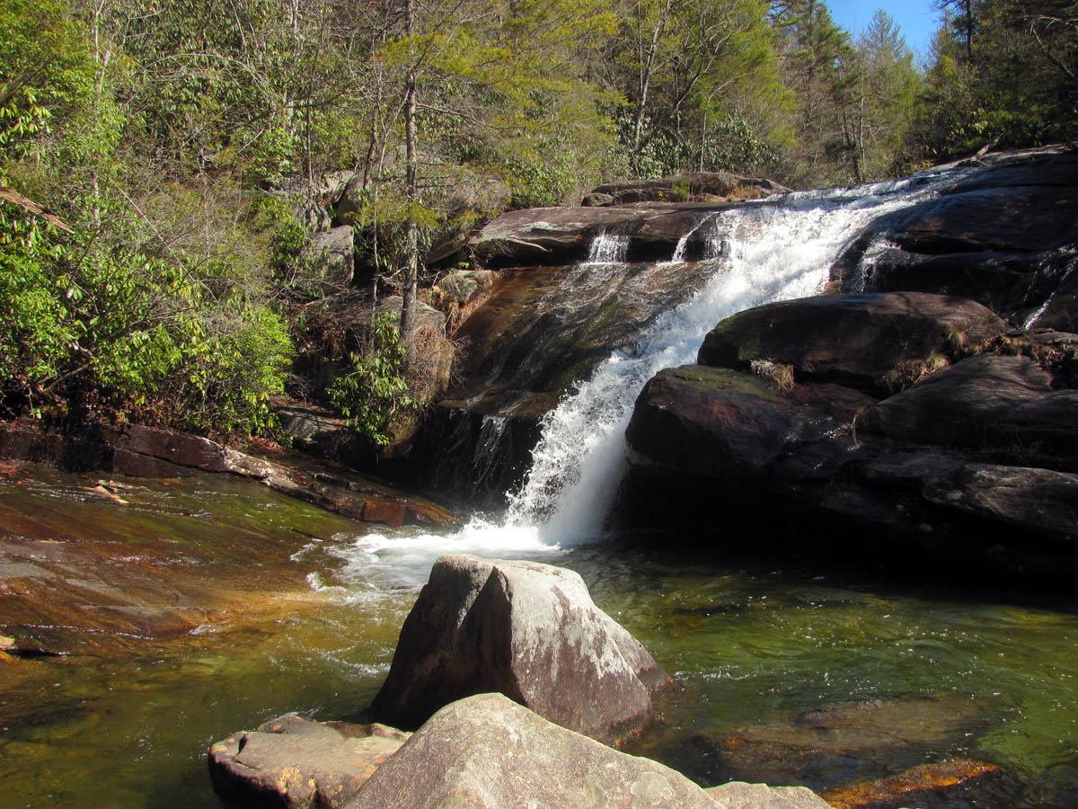
It was nice to be out of the bramble and be out in the open. The falls were much larger than I expected and Dave measured them at 82 feet high. It was around 1pm by this time and the sun was directly overhead and washing out any chances we had of getting any decent photos but, the falls were very impressive and the water levels were incredible. We really enjoyed being at these falls for awhile as it was obvious they are completely off trail, not listed on any maps, no info at all about them and very few people know they exist. That is always a good thing for a waterfall lover.
The 82 feet high falls Dave found,, he calls them ‘X RAY Falls’
unnamed falls ( we call, X RAY Falls)
unnamed falls we call X RAY Falls
unnamed falls we call X RAY Falls
unnamed falls we call X RAY Falls
unnamed falls we call X RAY Falls
unnamed falls we call, X RAY Falls
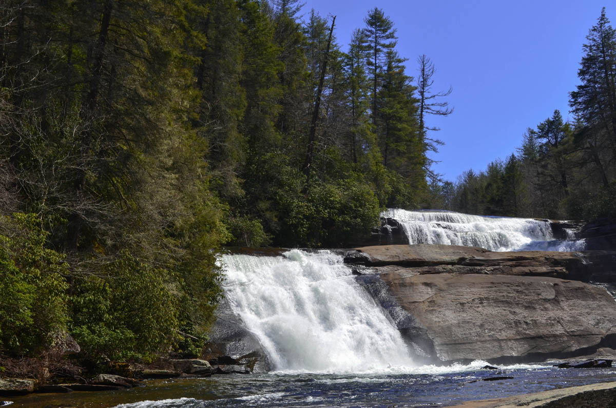
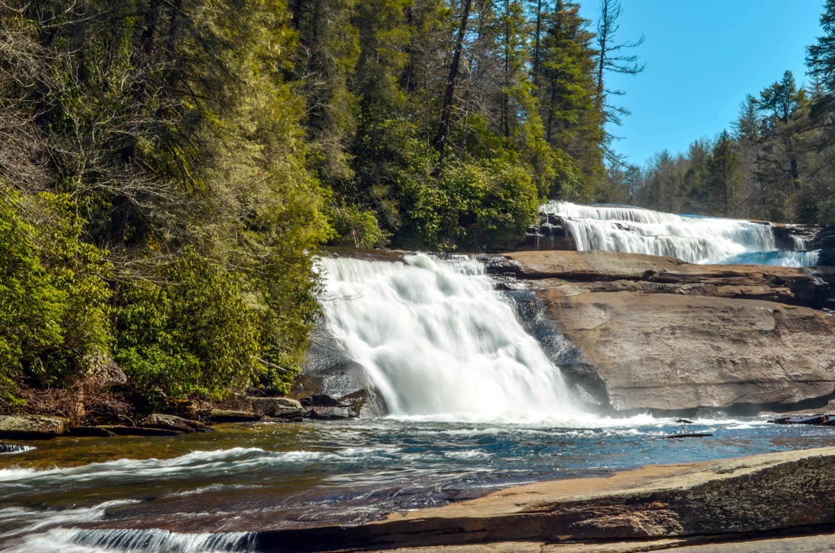
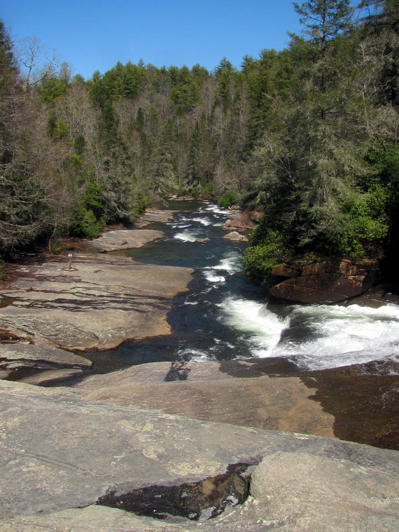
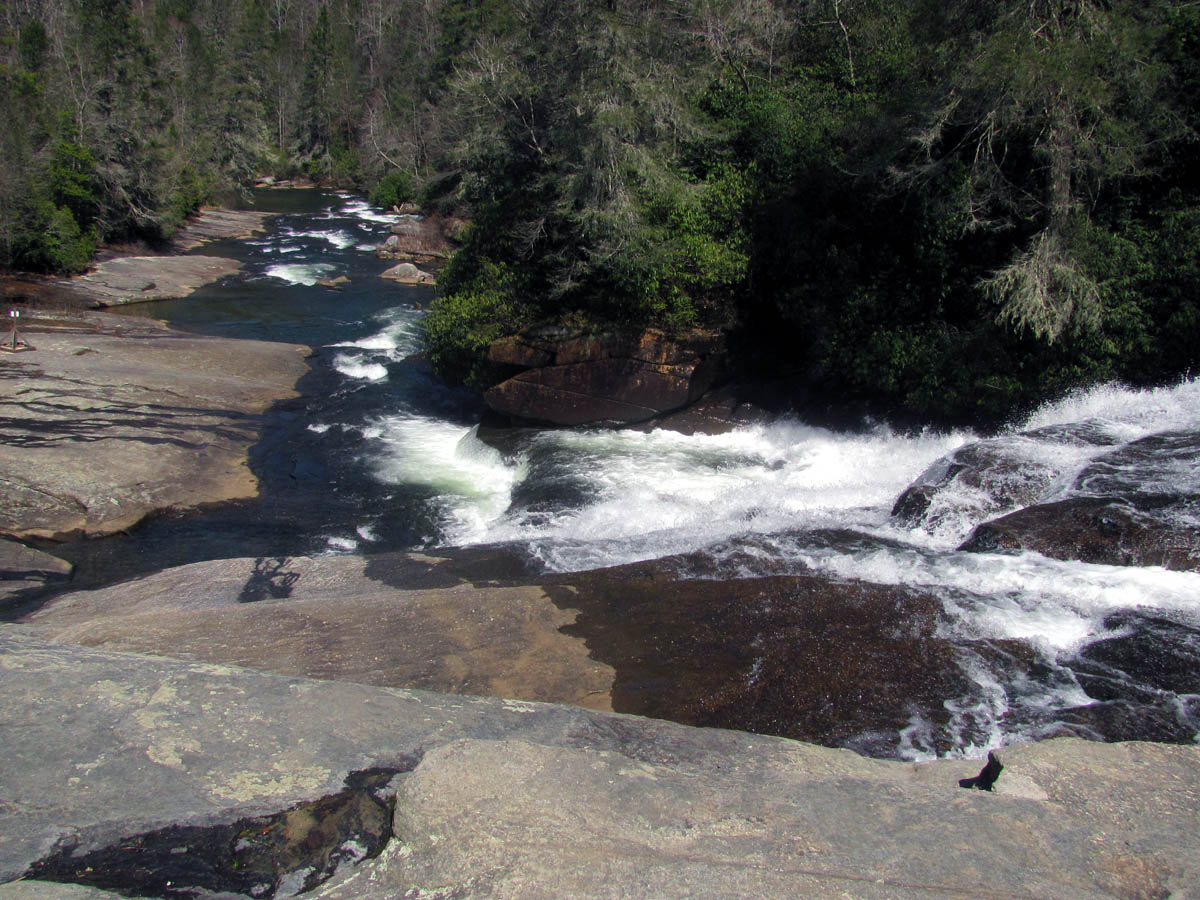
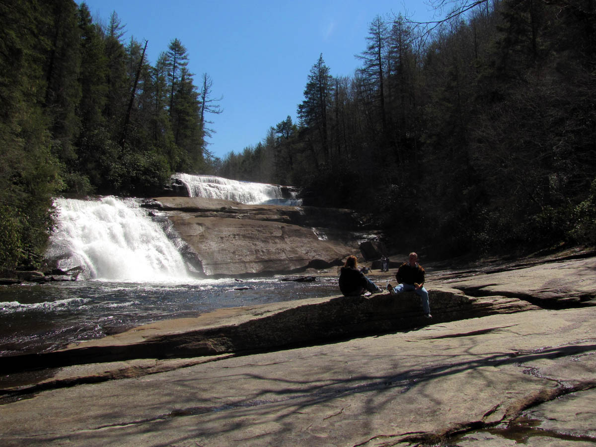
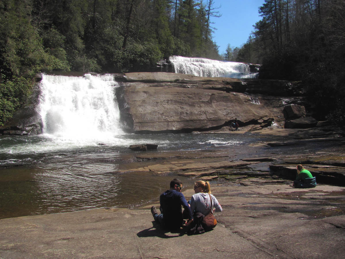
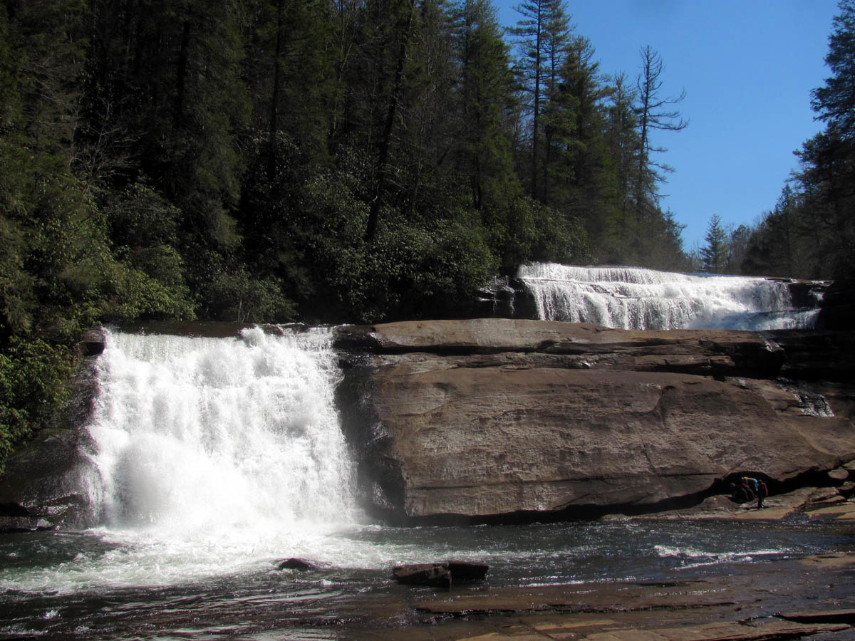
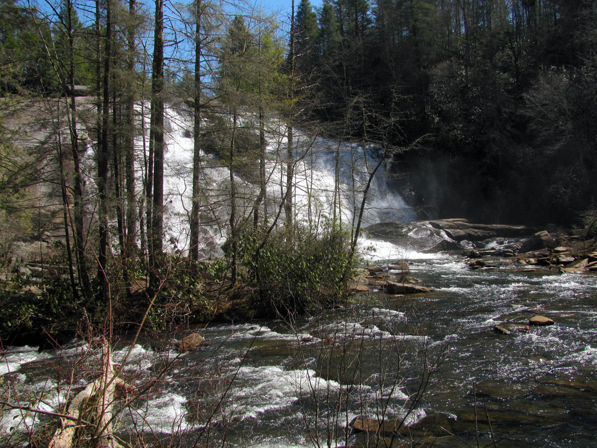
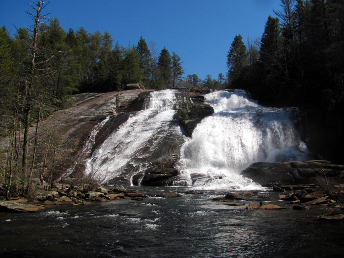
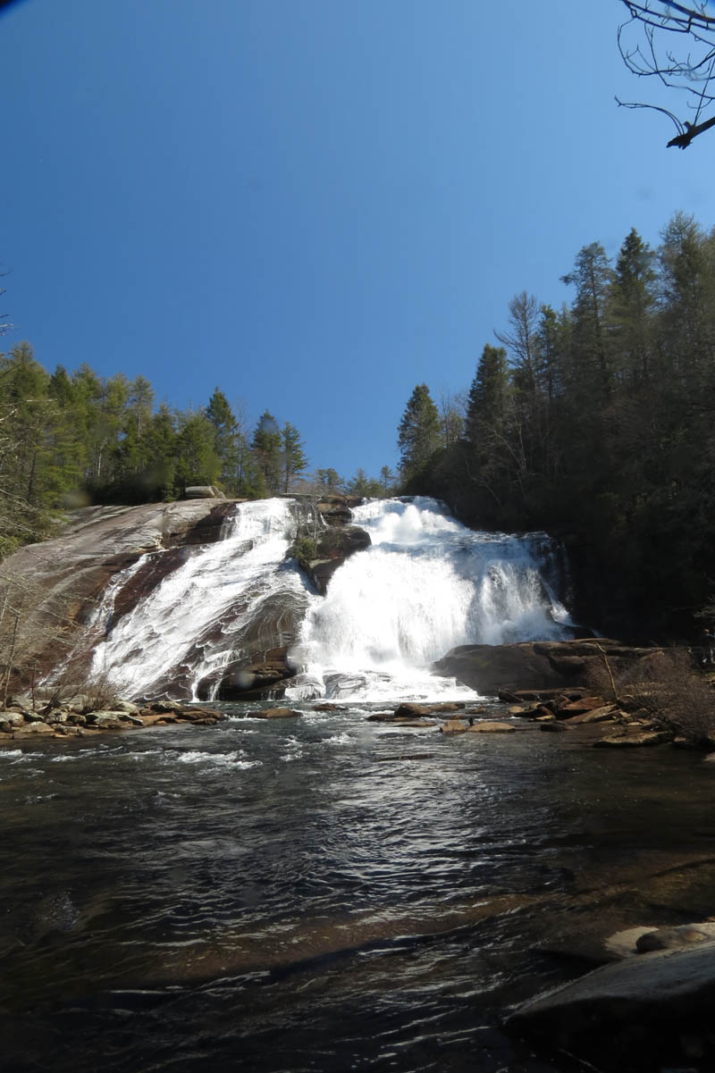
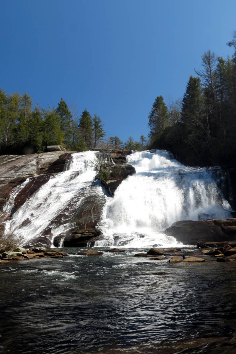
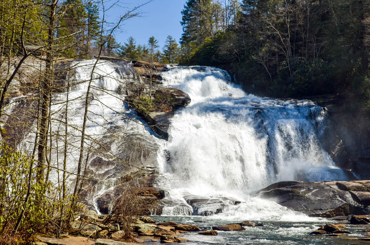
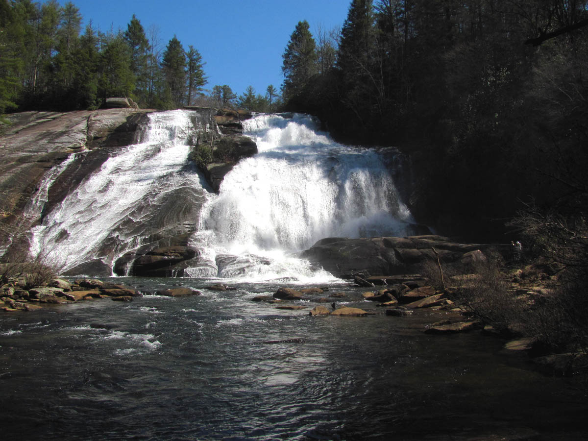
From there we made our way back kinda the way we had came but, I did venture higher on the ridge in search of a better path which I did find. I was soon looking down on Wintergreen Falls from high above just before reaching the old road trail we came in on. After doing the mile and a half of that road, we were back at the car and decided to see if we could make it to the Triple Falls and High Falls before we ran out of time. It is possible to see the 6 listed waterfalls of DuPont State Forest in one day but, you would have to hustle and not spend much time at any of them. I would recommend taking some time to enjoy them all, perhaps a camping trip for a few days. It was a short drive around to the parking lot where Hooker Falls is and a short walk to the Triple Falls. These are always crowded with people due to the easy access but, they are very impressive. Triple Falls is listed as 125 feet high but there are three tiers so it seems much higher to me. We did not take the time to measure any of them on this trip as we were pressed for time. The water level was definitely at a record high so it was breathtaking to see despite the bright sun that made any attempt of a good photo to fail. I got the best i could of the three falls from the trail before continuing up the hill to where the wooden steps lead down to the base of the upper set of falls.
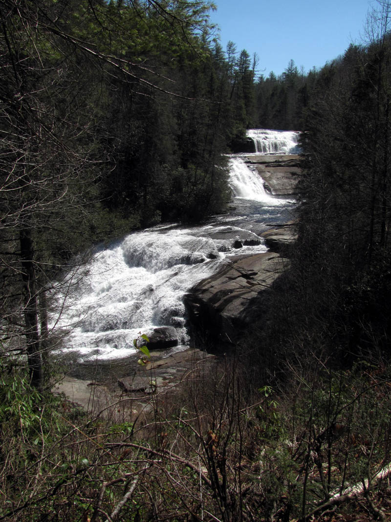
Triple Falls
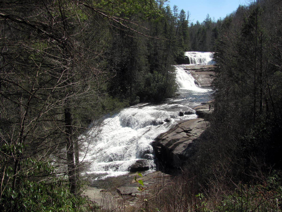
Triple Falls
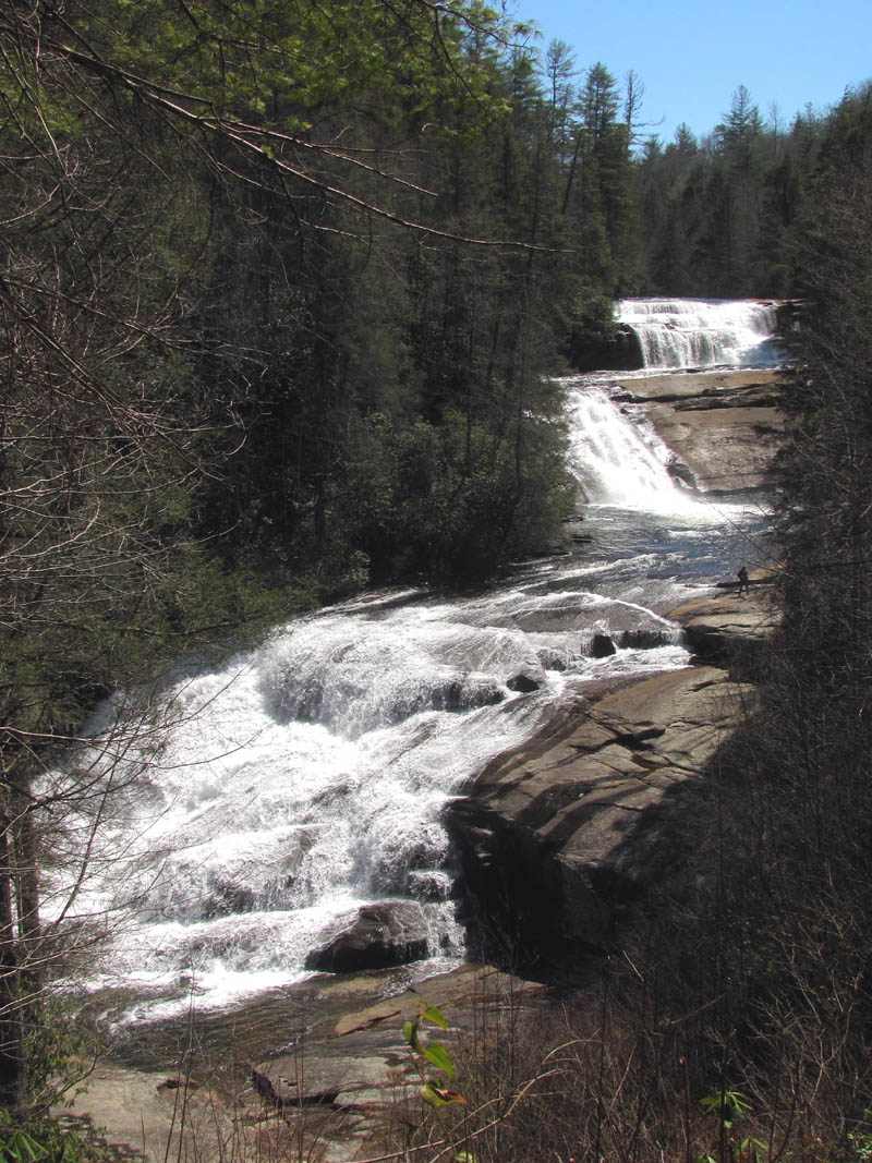
Triple Falls
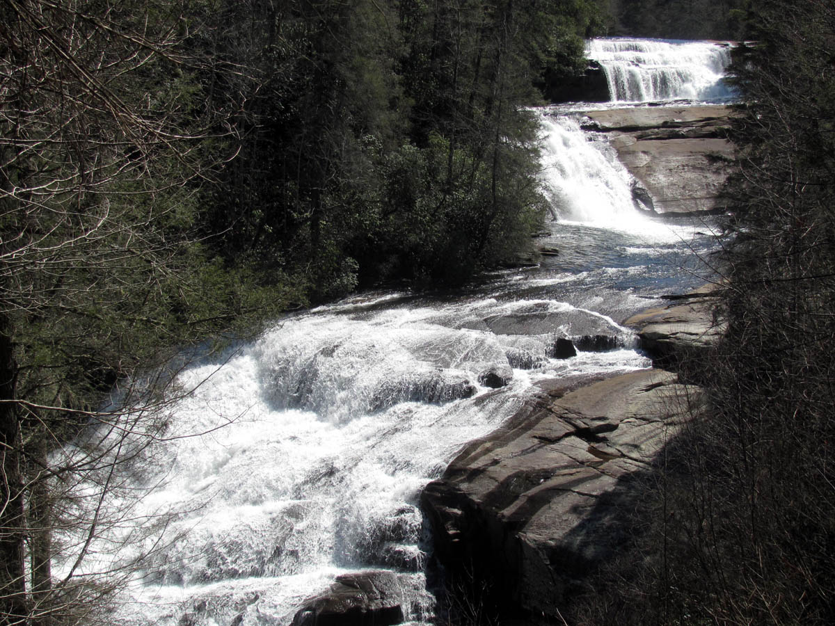
Triple Falls
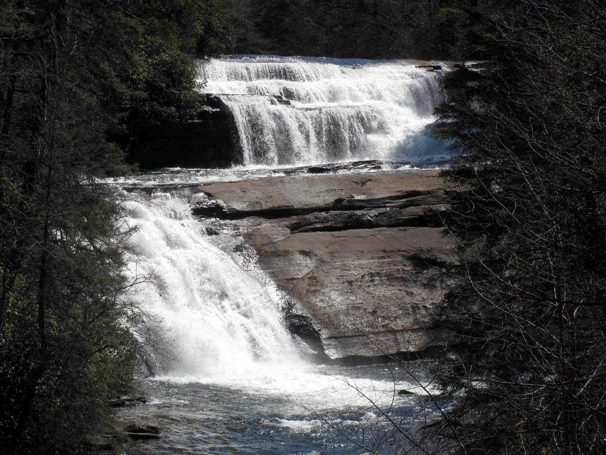
Triple Falls
Triple Falls (Photo by Dave Aldridge)
Triple Falls (Photo by Dave Aldridge)
Triple Falls
Triple Falls
Triple Falls
Triple Falls
Triple Falls
There was lots of people there so it was almost impossible to get a shot without someone in it but I was very impressed and will definitely be coming back here on a cloudy day. After getting a few pics we climbed the stairs back to the trail and made the decision to continue the half mile further to what is called the High Falls. This is an impressive 100 foot high falls. It is a nice hike and did not take long to get there. We stayed there for about a half hour to get a few shots but ran out of time and soon had to leave. The trail does continue further to the top of the falls where there is a covered bridge that goes right over the top of the falls ! It leads a short distance further to another parking area there. We would save that for another time.
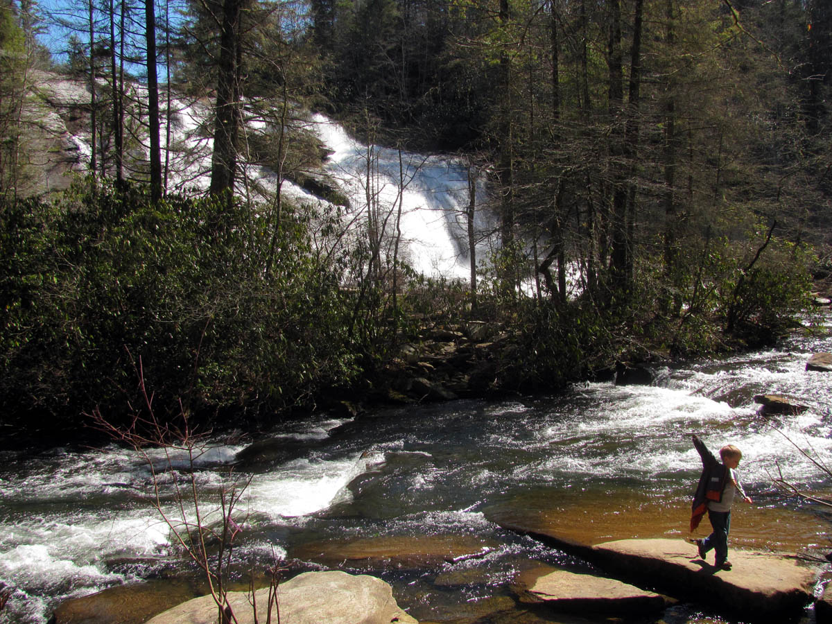
Approaching High Falls
High Falls
High Falls
High Falls
High Falls
High Falls (Photo by Dave Aldridge)
High Falls
It was level and then downhill back to the car so it was not long before we were back on the road heading to one of the best Bar B Q joints in the South, ‘Bad Wolf BBQ’. We had some really good Q there with some excellent sauces and sides before hitting the road again. It is a over an hour and a half drive to get back home and I had to work soon as I got back so it would be another long day and night for me considering I had not been to sleep since working the last shift but it was worth it to get to see that many waterfalls in one day. I can`t wait to come back.
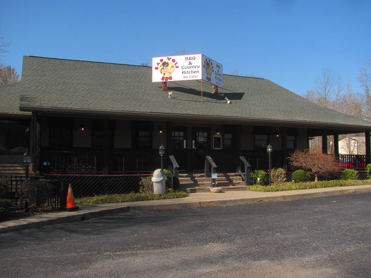
Bad Wolf Bar B Que
To see the complete collections of photos of all these magnificent waterfalls, please look for them in our Photo Gallery here.
Some information about the DuPont State Forest:
The DuPont State Forest is located in the Blue Ridge Mountains between Hendersonville and Brevard, North Carolina. Its 10,400 acres of forest feature four major waterfalls on the Little River and several on the Grassy Creek. The 10,300 acre DuPont State Forest was acquired in three major phases, spanning from 1995 to 2000. The 7600 acre forest was purchased by the State of North Carolina in 1996 and 1997 after DuPont sold its industrial operation and surrounding land holdings. The 2700 acres surrounding the industrial facility was sold to Sterling Diagnostic Imaging in 1996. The Conservation Fund, a national non-profit organization, negotiated an agreement between DuPont and North Carolina officials which facilitated the public purchase. More info can be found here: http://www.dupontforest.com/history.html
The park was used to shoot scenes from the 1992 film “The Last of the Mohicans” and the 2012 box office hit, “The Hunger Games”.
Other points of interest:
On the way back we passed through Etowah, NC and into Hendersonville, which has some interesting historical features. Besides the home of Carl Sandburg, there is also the Thomas Wolfe’s Angel located at the Oakdale Cemetery on Old Hwy 64. Author Thomas Wolfe’s first novel was Look Homeward, Angel. In the book there are constant references to an angel statue carved from Italian marble. This is the angel Wolfe placed in American literature. Thomas Wolfe’s father, W.O. Wolfe, sold the statue to the Johnson family to mark the family plot in Oakdale Cemetery. The angel is holding a lily in her left hand and extending her right hand upward. Oakdale Cemetery is located on Hwy. 64 W., just a short distance from downtown. The statue is protected by a wrought iron fence, and there is a historical marker located on the highway.
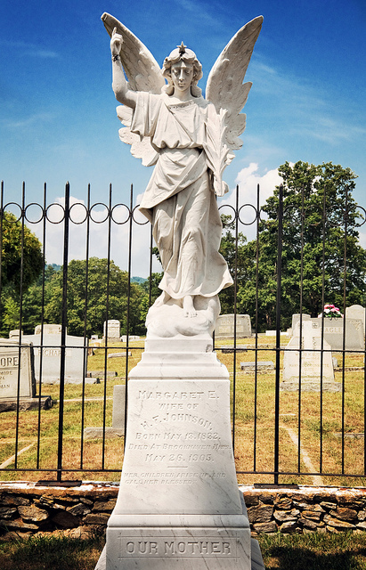
Thomas Wolfe Angel
The Thomas Wolfe Memorial, childhood home of Thomas Wolfe is located 22 north of Hendersonville, in Asheville.

 My name is 'RAT' and I love the mountains and waterfalls of the East TN. area where I live and I hope you enjoy this blog about my outdoor adventures.


Leave a Comment