


Flint Mountain Recon – 1-10-2014
For over thirty years and ever since I first walked under the cliffs on the end of Flint Mountain in Rocky Fork, I have wanted to stand on the top of those cliffs. This desire was rekindled in the past three years with our recent accomplishment of standing on top of the Whitehouse Mountain Cliffs (aka Stonehenge) and looking over at them from the opposite side. Having studied the area and maps for all these years I have always had a solid theory on the best way to reach these cliffs however I never actually took the time to make it happen. I always thought that it would not be that hard to get to them but that it would be too steep and gnarly to actually be feasible. On Jan. 10, 2014 my friend Sam and I decided to go on a recon mission to begin the first phase of testing my theory.

Sam about to walk under part of the Flint Cliffs in Rocky Fork

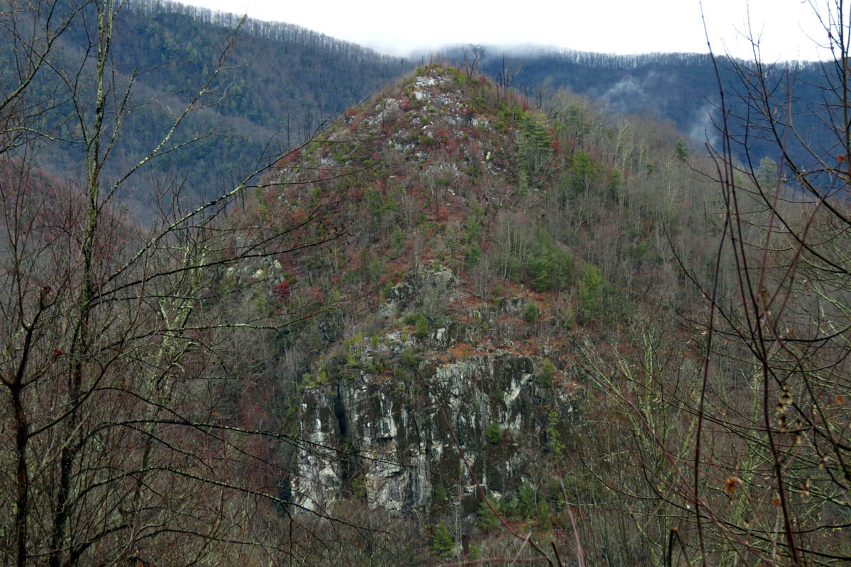
Looking down on Flint Mountain Cliffs from Whitehouse Mountain Cliffs
It has been over twenty years since I left any footprints on Flint Mountain as there really isn’t much to see there and we only used to hike the high road there during our earliest trips of exploring the Rocky Fork area and a few times when coming back from the Appalachian Trail near Flint Gap as we learned early on how to connect the two together. In the winter there are good views of Rocky Fork from the top of Flint Mountain but otherwise there is not much to see from there. On this recon trip we would be starting on the lower end of Rocky Fork but instead of going up the normal route beside the creek, this time we would be going across the creek below that and behind the ‘other’ blue gate on the old road that leads up on to Flint Mountain. Crossing the creek on this day would not be easy due to high water levels and icy conditions.

Rocky Fork Creek. Yeah we had to cross it there !

Cool looking fungus along the old road
All the main roads in the Rocky Fork area have been well kept over the many years and not just because there was a lot of logging that went on here not too long ago but because they have always been kept up by the folks that have managed this place for so long however, we quickly found that the high road on Flint Mountain was the exception to this. The road has deteriorated quite a bit in places since my last time hiking on it. The first thing you come to is an old homestead area on the left where you can still part of the old stone foundation still standing. The drainage pipes have long since clogged up and the creek now runs right down the road.

One of the old homestead areas found on the old road

All that is left of old homestead

Creek running down the old road

Sam on the lower part of the old road
We continued hiking up the old road through several switchbacks making our way to the top of the mountain. My plan for this recon trip was to refresh my memory of the area and then compare it to my recent map studies. We also had a new tool in our arsenal which is a hand held GPS designed for trails. We would use this to mark way points throughout the day which would confirm or deny my theories of the best way to reach the cliffs in question. Despite the old road having some bad places it did still have some very good ones, especially the closer we got to the top. After the first switchback from the bottom you can start to see Whitehouse Mountain and the cliffs there but, much closer to the top there is a great place where an excellent view can be had. We stopped there to get some pics.

First view of Whitehouse Mountain and cliffs

Whitehouse Mountain and Cliffs

Whitehouse Mtn. and Cliffs as seen from the old high road

Whitehouse Mtn and Cliffs (slightly zoomed)

Whitehouse Mtn and Cliffs with the foggy mist around Frozen Knob and Higgins Ridge above and behind

Zoomed shot of Whitehouse Mountain and Cliffs
I took along a tripod and my bigger camera (NOT a DSLR) to try and get some better pics:

Whitehouse Mtn. and Cliffs

Whitehouse Mtn and Cliffs

Whitehouse Mtn and Cliffs
Whitehouse Mtn and Cliffs

Zooming closer of Whitehouse Mtn and Cliffs

Summit of Whitehouse Mountain

Zoomed shot of part of the cliffs near the crack
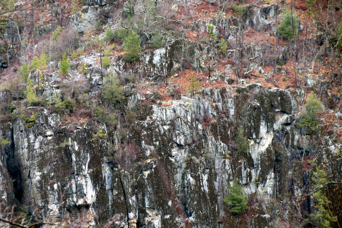
close up of the top of the cliffs
From there we continued our journey to the top and once we had reached the point where the old road crosses the main spine of the ridge that is the one the Flint Mountain Cliffs are on, we stopped there for a much needed lunch break. There is a wide curve there and if you go out on to the ridge you will soon find a surprise hiding in the trees there. For years I have caught what I thought were glimpses of large rocks on the butt end of Flint Mountain, and to confirm this, we found there are actually huge rock drop offs that line the entire ridge all the way down to the top of the lower cliffs only they are pretty much completely hidden by trees. We went out on them and went down a couple of levels until it dropped off vertically about forty feet with no safe way down. We went back up and ate lunch on the top one.

Almost to the main ridge,,,

Main ridge of Flint Mountain found in a wide curve in the old road

Walking out on the narrow spine of the main Flint Mtn ridge

Some of the first rocks we came across on the main ridge (find Sam)

A series of 30 and 40 foot drop offs on the main Flint Mtn Ridge. It is like this all the way down the the main cliffs below
After a nice break we walked a bit further up the old road which is now nearing its highest elevation it will get on Flint Mountain. We got some decent views of the Rocky Fork area and I really wanted to continue on the road and complete the loop which goes out to Flint Gap, down and around leading back out the Rocky Fork Valley but, that requires crossing the creek a few times which is very cold and deep right now which we had no desire to do and besides, we were on a recon mission and had to go back down the way we had came in order to check something out. Since it is downhill going back it did not take long to get back to the place where I wanted to investigate in regards to my theory of getting to the cliffs.

Looking off the side of the old road. That is Flint Gap off in the distance

View from the old road on Flint Mtn. Looking down at the Rocky Fork Valley

View from the old road on Flint Mtn. Looking into upper Rocky Fork

Going back down the old high road

Going back down the old high road almost back to the main ridge crossing
I had seen what looked to be remnants of an old log road trail leading out towards the area where I knew the cliffs would have to be on our way up so we took some time to venture out that way to see what we could find. The old road trail quickly ended but I was able to follow what I call a trace trail that only myself and a few others would have the ability to see which led us out close enough to get a view around the corner where I could see just enough to almost confirm my suspicion that we were on the right elevation and would be able to continue a short distance to reach the ridge where the cliffs should be. We did not have any tools to cut our way through the large patch of laurels that were there so we took a way point of our location on Sam’s new gps and headed back out. I could not wait to get home and find out if I was where I thought I was in relation to the cliffs.

Cool looking assorted fungi growing on a huge fallen tree at the spot where the only good view of Whitehouse Mtn is on the old high road

Close up of the fungus

You can see Whitehouse Mtn and cliffs from this tree with all the colorful fungus

Hiking down the lower part of the old high road
It was a short hike back down to the creek where we had to once again navigate our way across the deep and icy creek to reach the vehicle. We made it without any issues and were soon on our way home where I could check our gps points and see if my theory was correct. That and plan our next trip of course.

Sam on the lower end of the old road where the creek is flowing down it

Back to Rocky Fork road and the two old blue gates

Sam crossing the creek to get back to the vehicle

 My name is 'RAT' and I love the mountains and waterfalls of the East TN. area where I live and I hope you enjoy this blog about my outdoor adventures.


One Comment to “Flint Mountain Recon – 1-10-2014”