


Linville Gorge – 9-23-2015
I am ashamed to say that it had been since May 26, 2013 since I last set foot into the Grand Canyon of the East officially called the Linville Gorge or as I now refer to it as ‘The Ditch’. At that time I was formally introduced to some intimate sections of it by the Gorge Rats during an annual camp out they do at the Hawksbill trail head. I was instantly addicted and before the weekend was over I was accepted as a Gorge Rat and properly given the patch. Having been busy with life since then and the pursuit of waterfalls it has taken me until now to get my claws back into the gorge. On this day I would be accompanied by my mountaineering friend John Forbes who although being no stranger to the gorge had never been to the particular section we would be enjoying on this trip. That section is the area called The Chimneys and is one of my favorite places in the gorge. After a nearly 2 hour drive we arrived at the Table Rock parking lot and began our journey South along the Mountains to Sea Trail.

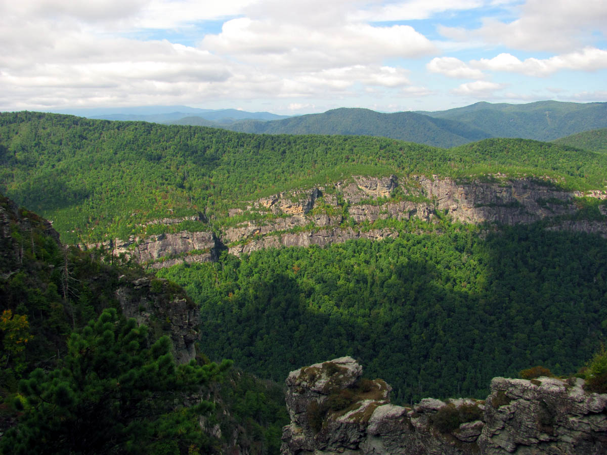
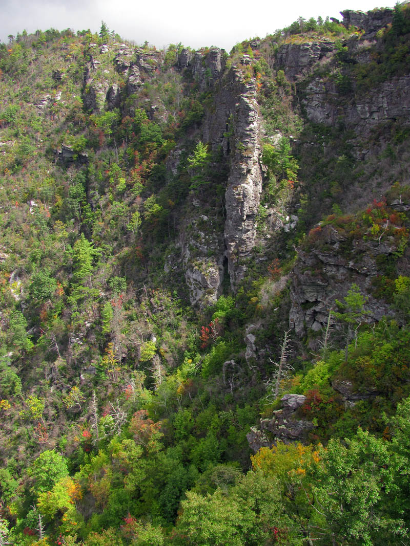
View of the upper part of Linville Gorge looking North over the Camel Olk rocks
This route climbs immediately up into the Chimney Rocks and soon we would find ourselves climbing up onto rocky outlooks the first of which, was looking back with an incredible close up view of Table Rock and Little Table Rock and beyond. If this first view was any premonition of how our day was going to be, it was going to be epic. I must warn you now that this blog contains about 400 pictures. This is because this place is just that awesome ! That, and I can not possibly produce any words that could describe its beauty and awesomeness so I will let the pictures tell the story for me.

Obligatory sign shot (Photo by John Forbes)

View of the morning sun waking up Table Rock (center) and Little Table Rock (left) with the summit of Hawksbill peeking up in the distance

Table Rock

Eye to eye with Table Rock

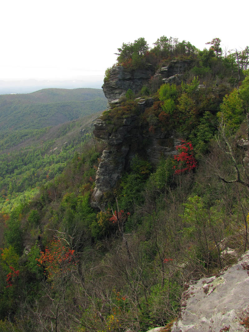
Close up of Table Rock from our first overlook

Looking East (just to the right of Table Rock) That is Brown Mountain on the far right side of the pic.

RAT doing a Gnome pose from one of the first overlooks. That is looking East behind me. (Photo by John Forbes)
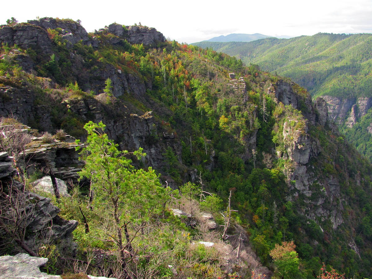
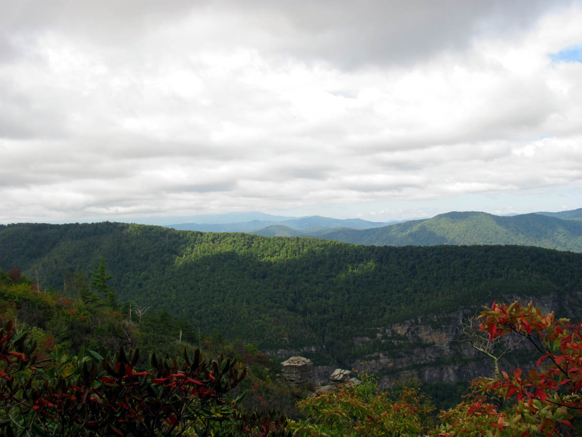
Looking South we can see the backside of the first cliffs of the Chimney Rocks with part of Shortoff Mtn in the distance

From our first overlook we could see not only Table Rock but, by looking just to the left of TR we could see Little Table rock (pictured here) along with the upper (North) end of the Linville Gorge

Zoomed shot of Table rock, Little Table Rock and the upper (North) end of the gorge

View of Table Rock and Little Table Rock behind me (Photo by John Forbes)
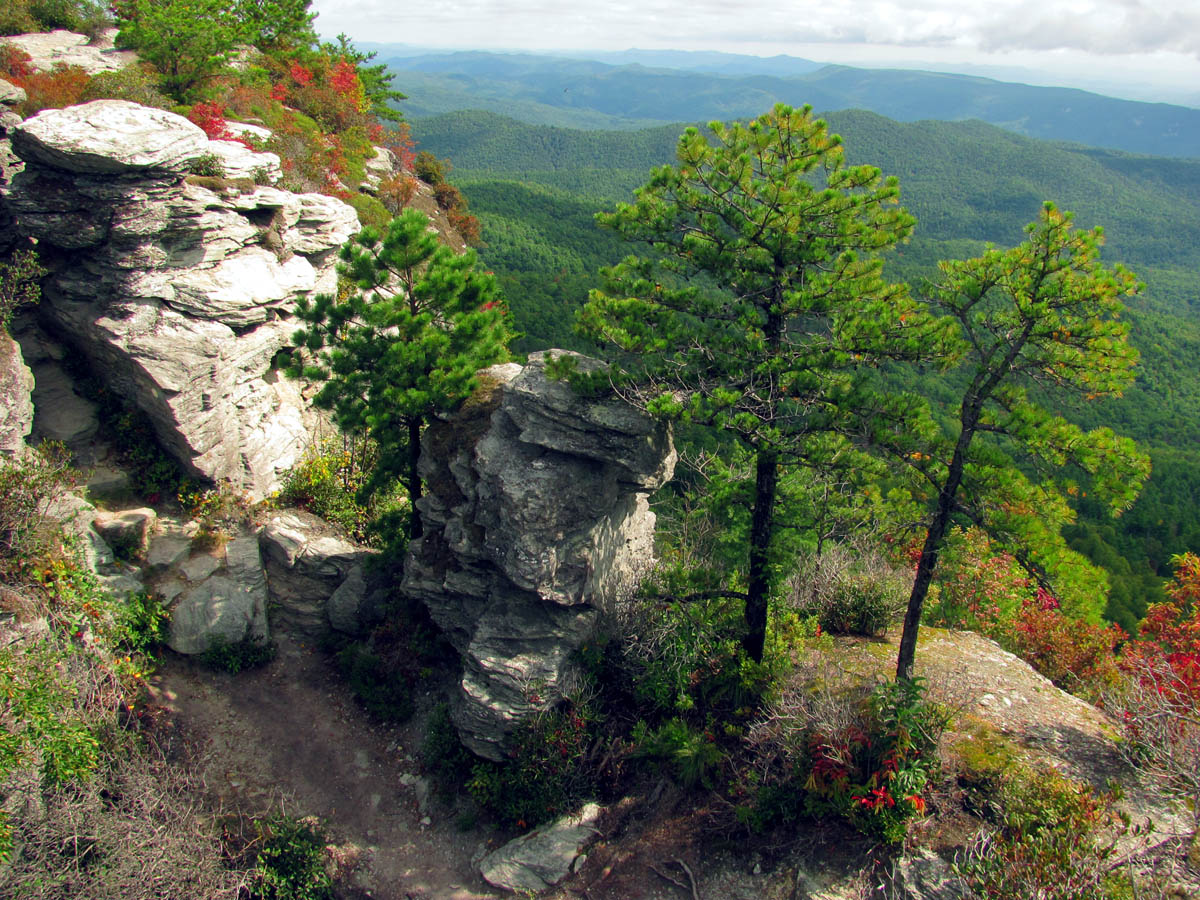
From there the views only continue to improve as you enter the Chimneys which is filled with numerous rock cliffs and formations that would take several trips to explore all of. The next stop would be a rocky overlook where you get your first good view into the gorge and over to the next rock spine which is a favorite of mine they call Botswanna Arete. It is a very narrow yet, tall rock spine that has a square hole in its side that I hope to stand in one day.

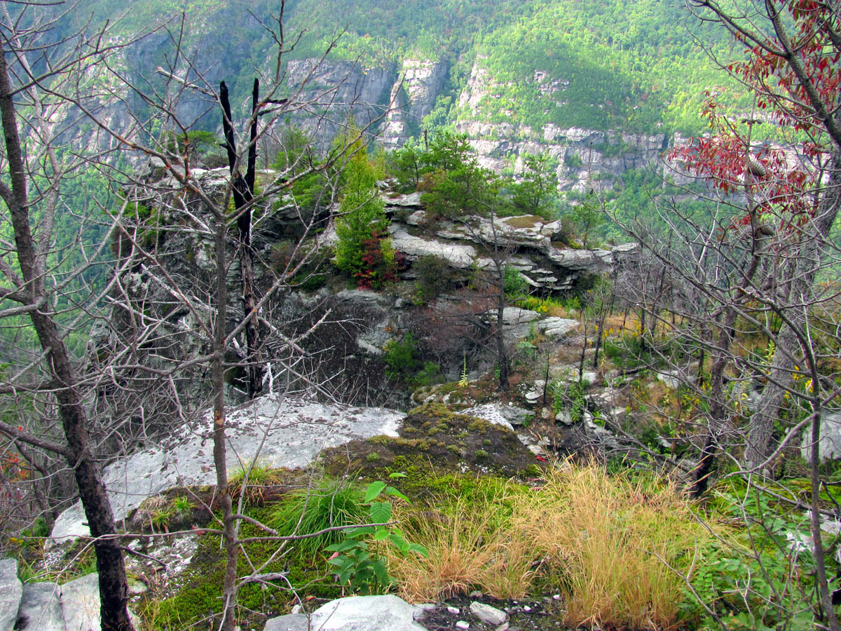
Our first view of the Chimney Rocks

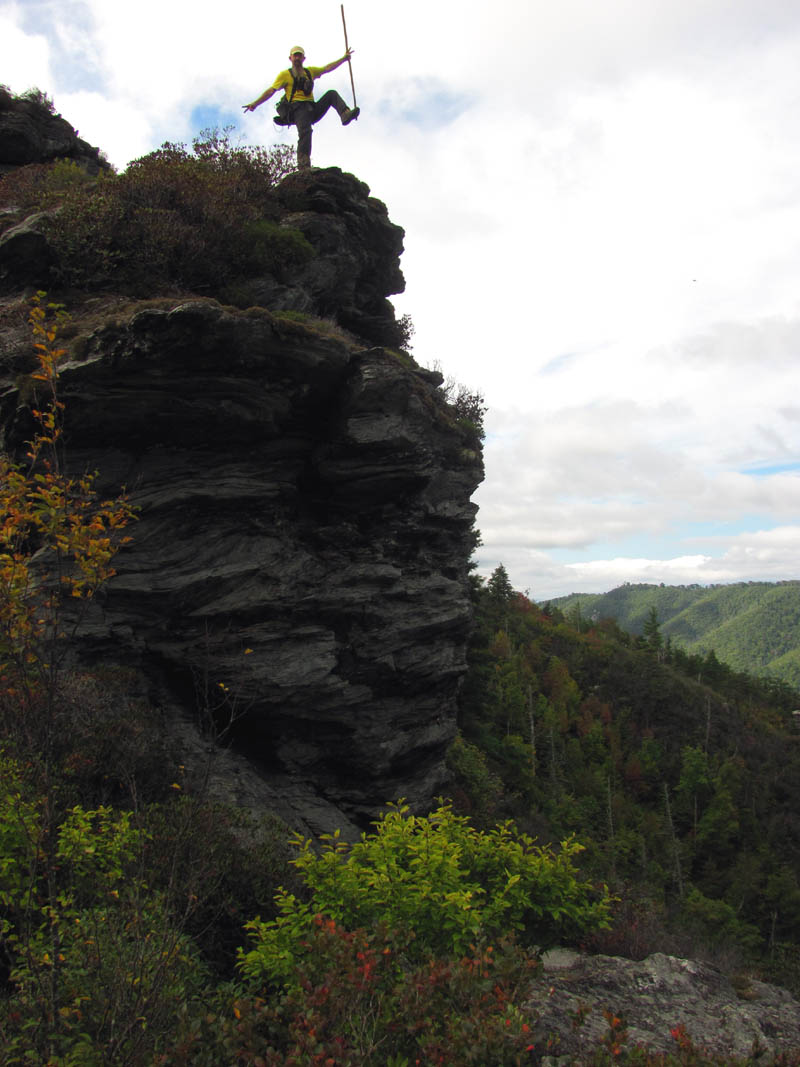
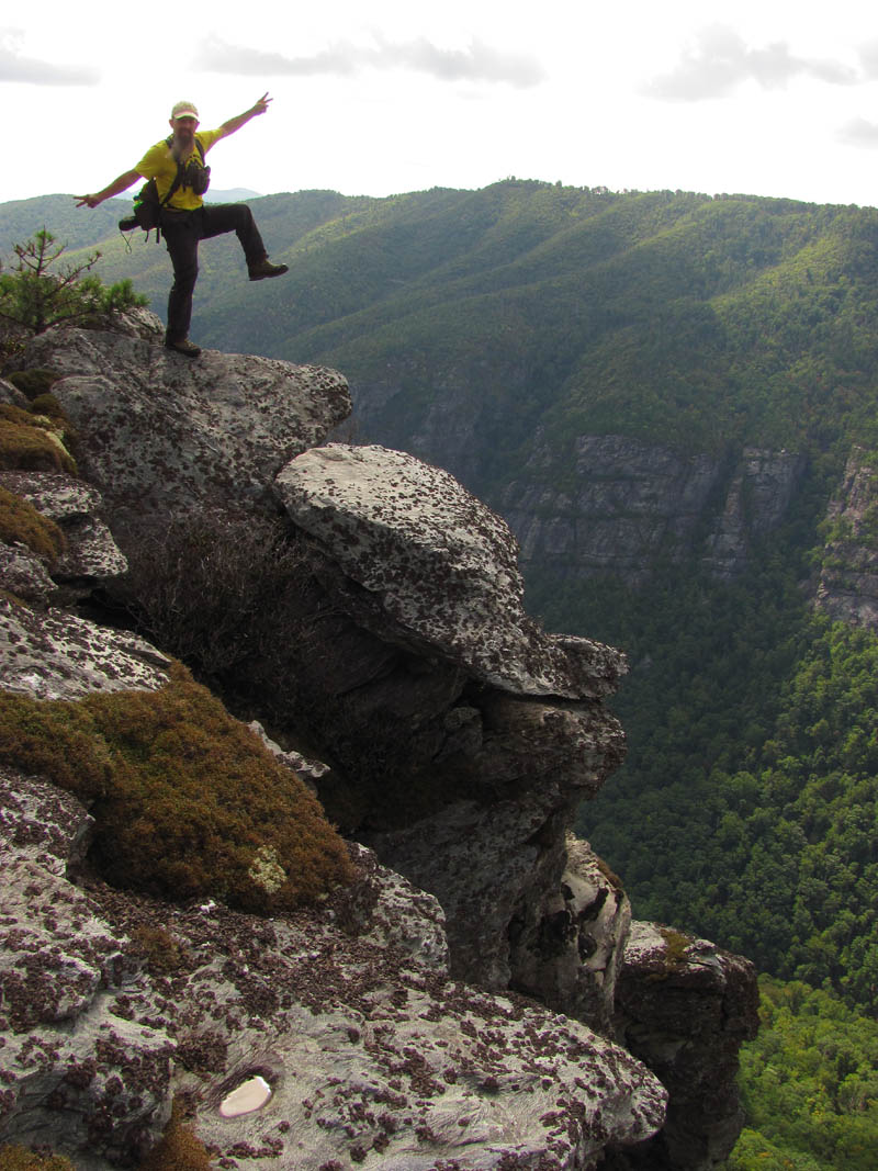
Here I am practicing the famous Gnome pose atop one of the many overlooks we would be on. You can see the Twin Tower rocks in the distance behind me. (Photo by John Forbes)

Sitting on a puckering perch (Photo by John Forbes)

Me sitting on a very high puckering perch (Photo by John Forbes)

Zoomed shot of me on the puckering perch (Photo by John Forbes)
Our first view across the Chimneys

Panning farther right from the Chimneys you see our view across the gorge

Continuing to pan right looking farther across and up the gorge

Looking farther North to the upper end of the gorge

Looking over at the narrow rock spine wall known as Botswanna Arete. Can you see the hole in its side ?

Botswanna Arete

Zooming closer on the BA spine,, now can you see the square hole in its side ?

Zooming closer on the BA so you can see the hole ! I plan to stand inside it one day !

The hole as seen with my larger cam, zoomed !
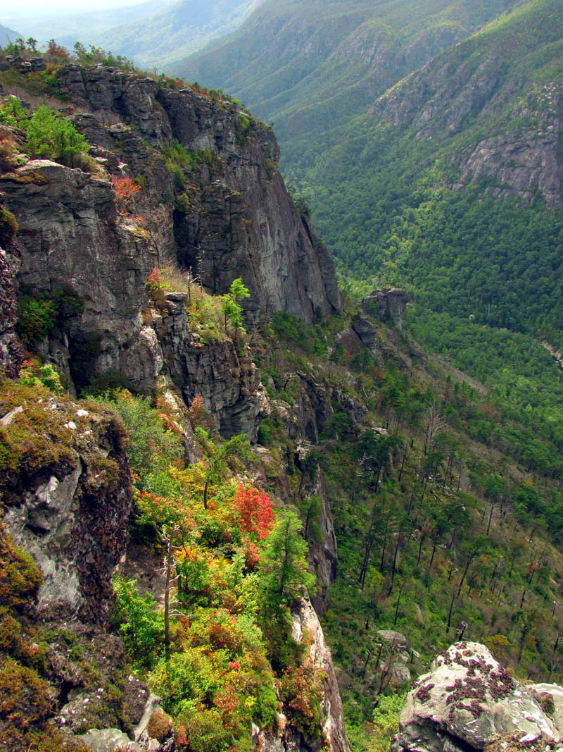
There are also several look offs on the back side of the Chimney Rocks area where you can see for miles and miles towards the East. Of course the best views from the Chimneys is to climb up on top of them however, we would not be doing that on this trip as we would follow the MST (Mountains To Sea Trail) below them to reach the trail that leads down to the Camel Olk rock cliffs which reside at that end of the NC Wall. As we made our way across and below the Chimney Rocks the views were constantly changing so I will apologize now for the high volume of pics this blog will contain!

View off the backside of the Chimneys looking East

Looking East off the backside of the Chimneys

Another morning view looking East off the backside of the Chimney Rocks ridge

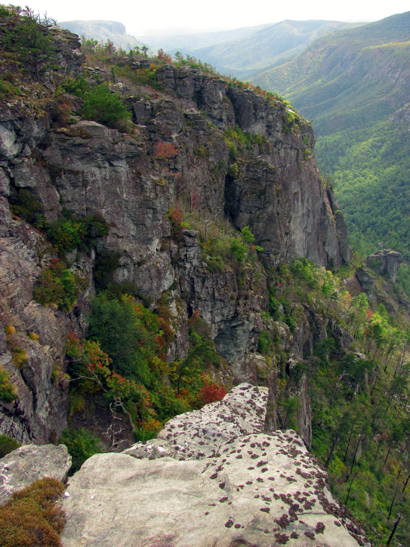
Looking over and down at Catbriar Cliff with Camel Olk rock in the background

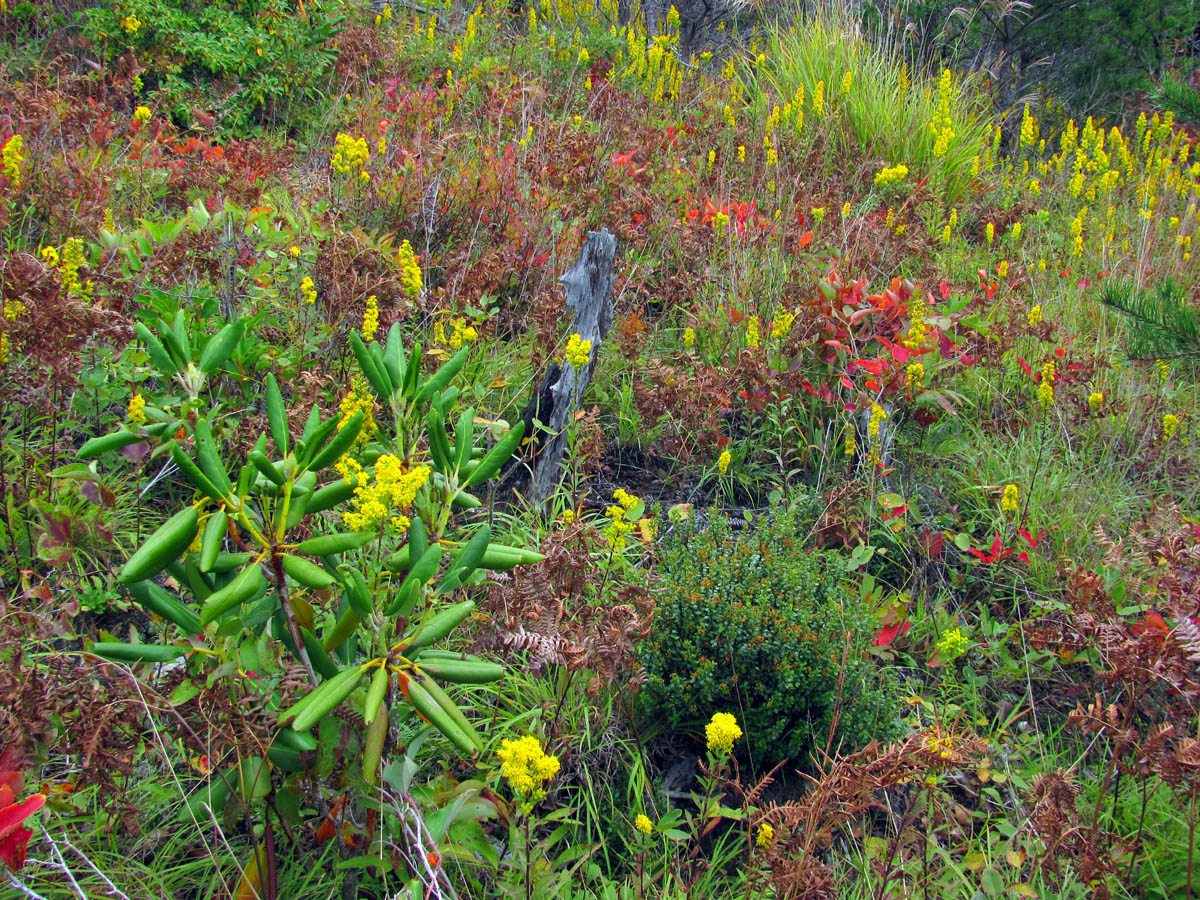
The Goldenrods ? were in full bloom on this day which made for some nice contrast along with the early Fall colors that were just starting

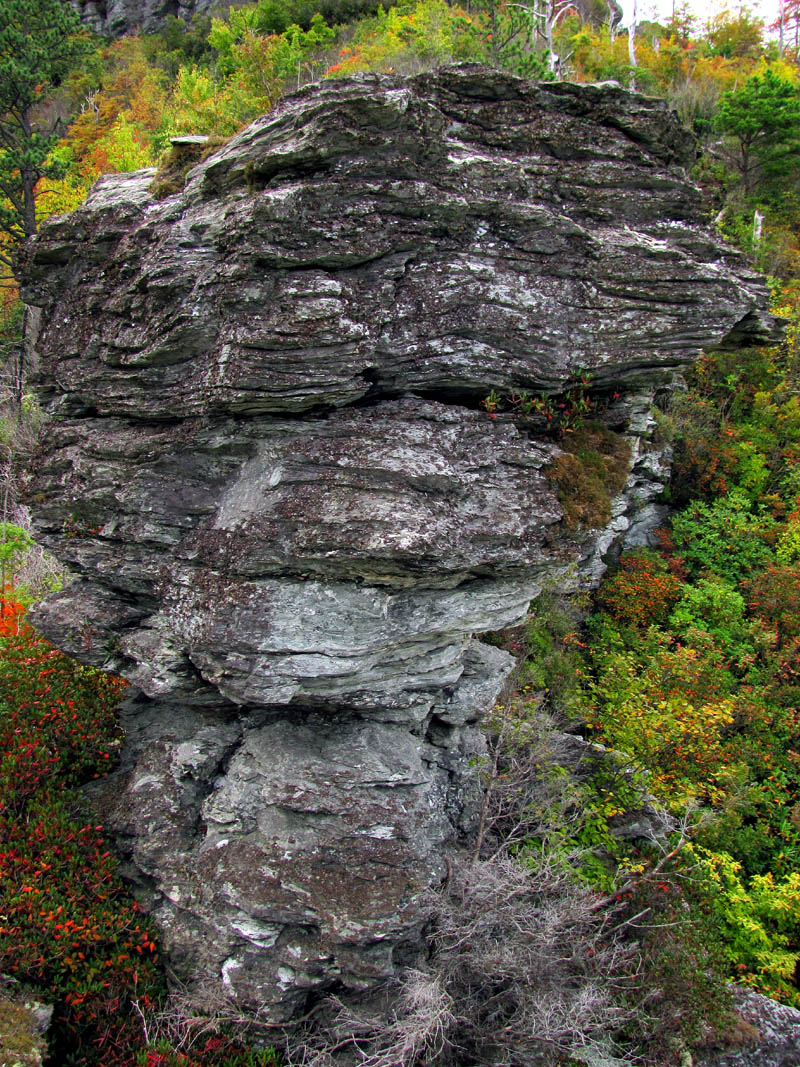
Huge rock spires that are a part of the Chimneys

View of the Chimneys in the direction we are going. You can see the Twin Towers in the right side of this picture

Another view back towards the upper (North) end of the gorge

This is a view from the backside (east side) of the Chimneys looking South. That is part of Shortoff Mountain in the far distance

Looking Southeast off the backside of the Chimneys. That is one end of Shortoff Mtn

Another Eastward view. That is Brown mtn on the right half of the pic

Looking back at the Northeast view of the backside of the Chimneys

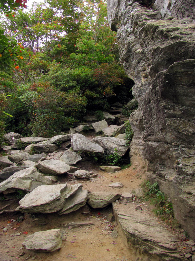
One of many such places along the MST through the Chimneys

View from the trail as we make our way across the Chimneys

Following the trail towards the Chimneys

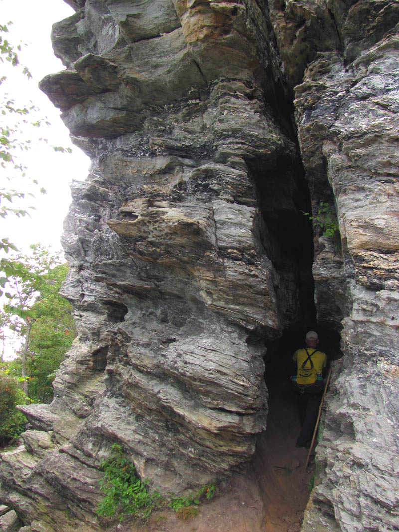
Here the MST goes through a narrow rock chasm. This trail is marked with a white circle

John Forbes coming out on the other side of the chasm along the MST

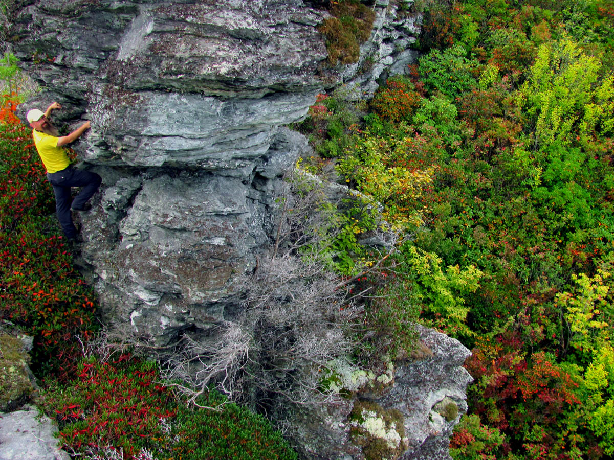
John got this killer shot of me atop one of the many rock formations as we entered into the Chimney`s (Photo by John Forbes)

Looking East with Brown Mtn in the center of pic

View between two rock spires looking across the gorge to the West

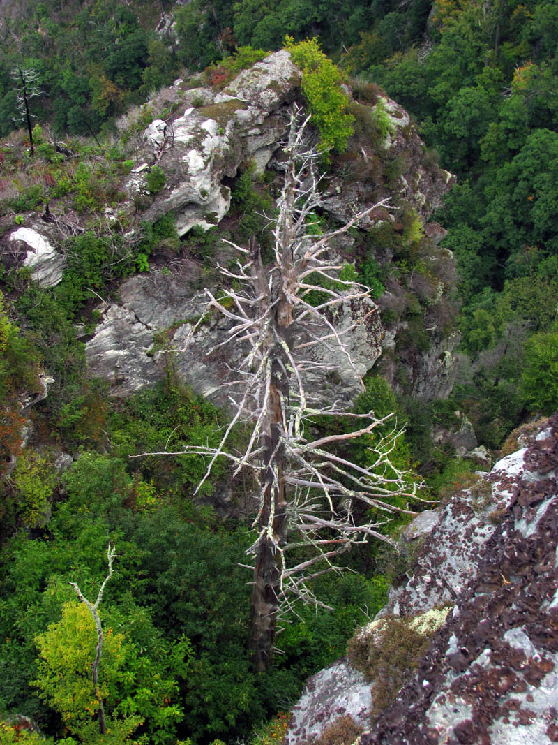
Colorful tree on the East side

Looking back the way we had just came

Looking back North at where we had just been standing
Looking back and down at a piece of trail we had just came across

Me doing the Gnome pose on top of a rock spire (Photo by John Forbes)
Without climbing up to the top of the highest cliffs of the Chimney Rocks, there is still so much to see and do just traversing this short distance across their base. It is such a vast area that it is not possible to take it all in during one outing. As we slowly made our way along the trail we took time to check out many rock formations, cracks, rock spires, etc. as we marveled at their beauty and the exquisite views we were constantly being bombarded by. Despite what many may assume, the gorge and its cliffs were not formed by any shifting of plates or volcanic activity but, rather it was all done by many years of erosion.

John doing his trademark Gnome pose atop a narrow rock spine. I like to put people in my photos to show scale of the surrounding terrain

Hanging out on some rock spires (Photo by John Forbes)

The views from the various rock cliffs are amazing. If you are afraid of heights though, this place is not for you !

John atop one of the many rock formations, taking in the views of things to come

John capturing Westward views across the gorge

The narrow trail as it winds through the Chimney Cliffs

Another view looking back

Rat Gnome posing atop one of the many look-offs we woulds see on this day (Photo by John Forbes)

John gets a pic of me atop one of the many rock formations. This is looking back towards Table Rock. (Photo by John Forbes)

Looking back and up the gorge

Following the white circles of the MST as it makes its way around the cliffs along the ledges

Some very uniquely shaped rocks along the way. We would take the time to climb these upon our return trip

Panorama of me on the MST beside the side trail to the cliffs we would check out on our way out. This is looking East off the back side of the Chimneys (Photo by John Forbes)

John got this awesome hot looking down on me with some unique rock formations behind me. These are at the beginning of the Chimney rocks. (Photo by John Forbes)

John on top of one of the many rock cliffs we would climb along the way
John and his Gnome pose on the brink of a high cliff. DISCLAIMER: DO NOT TRY THIS !!!

John was high atop a rock cliff when he took this shot of me (Photo by John Forbes)

I have no idea what I was doing in this pic ! (Photo by John Forbes)

As we reach one of the larger Chimney Cliffs there is a high road and a low road. Since we would not be going up top of these we would choose the low road (the MST)

More views as we pass by the top part of the Botswanna Arete spine
View over Botswanna Arete with Catbriar Cliff seen in the lower left

Looking down on the Botswanna Arete spine

Me standing on the MST with the Botswanna Arete rock spine in the view behind me (Photo by John Forbes)

Looking away from the BA Spine towards the twin towers and catbriar cliff

You can see the trail as it heads towards that large cliff in the distance where we will bushwhack down to those two rock spires that sit just above Catbriar Cliff

Another view of the same shot only taken with my larger camera

Panning right to get a kickin` view across the gorge looking West

John checks out the view as he stands on the low road

Some early colors were beginning to pop along the high cliff tops over on the West side of the gorge

Looking down at Catbriar Cliff and the bottom of the gorge

Profile view of the ridge we would be bushwhacking down to reach the rock spires that sit above Catbriar Cliff

Looking back at the other side of the Botswanna Arete spine. What fascinates me about this picture is that the square hole in its side is not showing from here. It is there only it requires the right angle and lighting to make it visible. It would be visible in the setting sun on our way back as seen here.

View looking back across the Botswanna Arete spine

Just another Rat Gnome pose on just another cliff top (Photo by John Forbes)

We spotted these climbers as we passed under one of the large Chimney Rock Cliffs. I will be going up top of these and the others on my next trip here !

I am sure this little side trail that goes beneath those huge rocks leads to somewhere neat but, we did not have time to check that out. Another reason to come back !

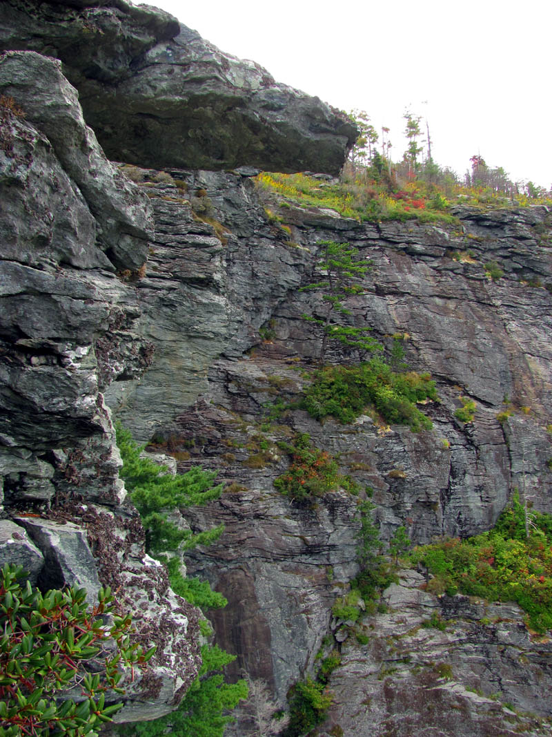
Looking up at the Chimney Cliffs as we pass below them
Proof that rocks do fall off these cliffs and why most climbers wear helmets !

Looking out at John from a large crack in the main cliffs
John enters into the crack

John inside the crack. This crack does go all the way to the top of the cliff.

Climbing around in the crack (Photo by John Forbes)

Looking up at one of the main cliffs of the upper chimney rocks
Following the MST we could see the tops of the two rock spires. Somehow I knew we would end up finding our way down to them.

Better view of the Twin Towers and the top of Catbriar Cliff. We could tell it would be a bushwhack down to these.

Huge fern along the MST. The next cliff we are approaching is where the ridge comes up from the twin tower rocks

Looking back towards Table Rock and the route across the Chimneys where we had just came from

A happy RAT in the gorge ! (Photo by John Forbes)
We did decide to take a detour to bushwhack down to a couple of large rock spires that we had been seeing that drew us to them like a magnet to steel. It was worth fighting the scrub growth and being scratched by briers to see them, not to mention the steep climb back up as they are very awesome spires. I later learned these are called the ‘Twin Towers‘. One day I plan on continuing below them to stand atop of the huge cliff below that is called ‘Catbriar Cliff’.

John captured this shot of me leading the way down the steep bushwhack to the Twin Towers (Photo by John Forbes)

After an off trail bushwhack down the ridge John finds himself at the base of the upper twin tower rocks. These were very impressive.

John at the base of the largest twin tower rocks

John giving some scale to the rock tower

Looking around the base of the tower. My view of the gorge towards the Camel rock.

Looking back up the way we had bushwhacked down

Looking back up at the Chimney Rocks from the ridge that led us to the twin towers

View from the twin towers looking towards the Chimneys. This is looking straight on the Botswanna Arete rock spine showing just how narrow it really is.

Our view of Table Rock and Little Table Rock from the Twin Towers

John at the other and shorter twin tower rocks shot from the base of the larger one. The early colors were amazing

In your face view of one of the twin tower rocks

Looking towards the gorge and the NC Wall beginning from between the Twin Tower rocks

View of the Botswanna Arete from the Twin Tower rocks

Our view of the Chimneys where we had just came from

Looking down into the gorge from the Twin Towers rocks

View of the gorge as seen from the Twin Towers rocks. This view never gets old !

More of the view of the gorge from the Twin Towers rocks

Looking straight down to the top of Catbriar Cliff from standing atop one of the Twin Towers rocks. You would not want to fall from here.
Trying to show the steepness of the Chimneys and Botswanna Arete as seen from the Twin Towers rocks

Looking the other way (Southwest) towards the beginning of the NC Wall from the Twin Towers rocks
Backside view of the tallest and most unique Twin Towers rocks
Looking down on Catbriar Cliff from the Twin Towers rocks. You can see the huge crack between it and us. It would not be easy to get tot he top of those cliffs but I plan to try

John had thoughts of climbing the tallest of the Twin Tower rocks but, was not feeling it as we did not have a rope for safety.
Hanging around on the Twin Towers rocks

Looking at the Chimneys from the Twin Towers rocks

Looking towards Table rock(s) and Hawksbill from the Twin Tower rocks

View looking towards the North end of the gorge from the Twin Towers rocks

View from the base of the twin towers rocks looking towards the start of the NC Wall

Looking towards where we would be going soon from the Twin Towers rocks

John sits atop the lower of the Twin Tower rocks

View from the base of the upper Twin Tower rocks

Looking back at the Twin Towers rocks as we climb back up the spine of the ridge to get back to the trail.

John gives some scale and contrast to our return bushwhack as we climb back up from the Twin Towers

My view where I stopped to catch my breath during the off trail ascent from the Twin Towers rocks

A brilliant red found on the bushwhack back up the ridge from the Twin Towers rocks. This view is the route up !
Once we finally got back up to the trail above, it was only a short distance farther to locate the unmarked side trail that leads steeply down to the Camel Rocks and the start of the NC Wall. It does not take long to get to that point either but, we did take another faint side trail out the opposite way that leads down to another awesome set of overlook rocks/cliffs where you can see the Camel Rocks up close and personal. We even took the time to climb out on some of the lower ledges (goat trails) of the NC Wall which gave us some more unique views of the Camel Rocks and the gorge. We spent quite a bit of time climbing around in this area.

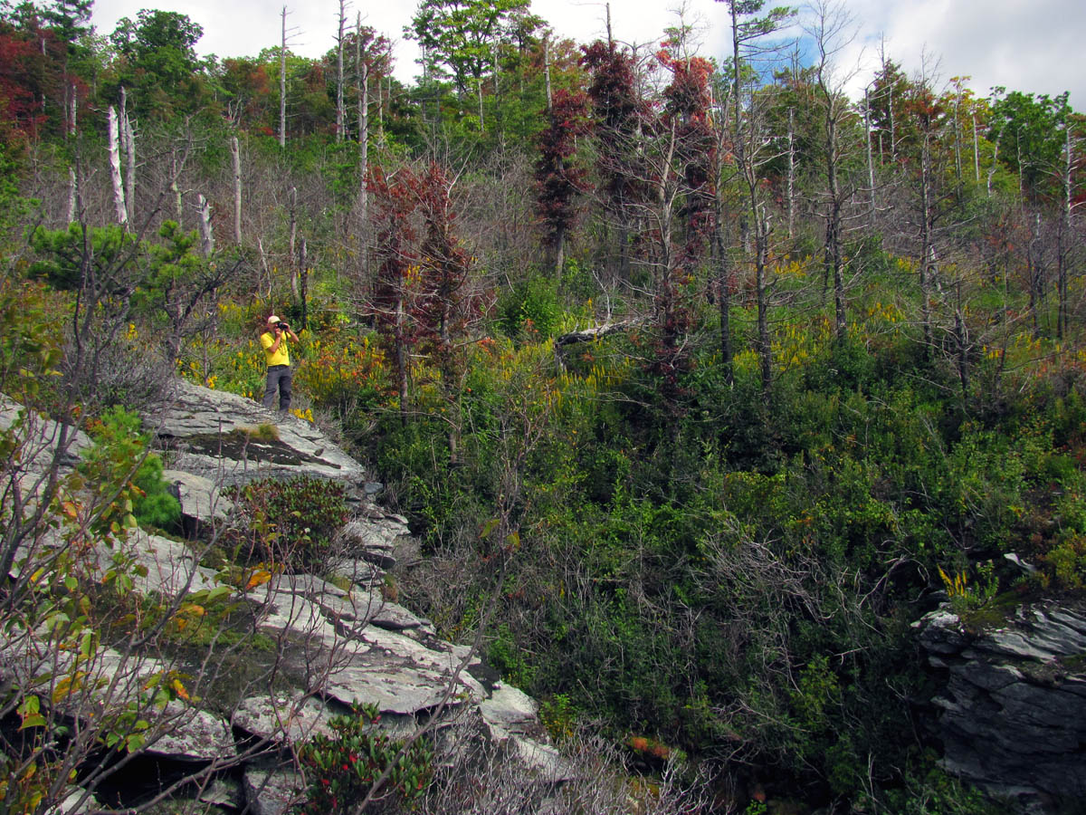
Nice colors and residual burn damage along the right side of the trail that led us down to the Camel Olk Rocks

Our first view of the NC Wall at the lower end of the Camel Rocks side trail. You can also see the Sphinx rock.

Not only our first view of the NC Wall but, also our first view of Shortoff Mountain in the far distance
We would take time to go out on this narrow rock spine cliff to get views of the Camel Olk Rocks before proceeding over the NC Wall

Killer view !

Reflections of a RAT in a pothole (Photo by John Forbes)

John tries his hand at some RAT reflections (Photo by John Forbes)

Camel Olk Rocks

Gnome posing on the brink (Photo by John Forbes)

The Camel !

Zoomed pic of the Bonzai tree that grow on the Camel`s back.

Our view from this rocky overlook above the Camel rock. From here we could now see Hawksbill and Sitting Bear

Hanging out on the overlooks on the side trail that leads to above the Camel Rocks (Photo by John Forbes)

We found this awesome little cliff base trail that would lead to awesome visuals !

It is from this angle that the Camel Rock obviously got its name. You can see its head turned sideways and the hump on its back. Awesome !

The Camel rock

Looking down from our puckering perch at another rock spine below that sits near the Camel rock

Looking down at the base of the Camel Rock. Yes it is huge, and very steep. It is a long ways down there and even farther to the Linville River below.

Another view of this amazing thing called the Camel

Looking over top of one of the overlooks above the Camel rocks

Looking towards the other side of the Camel

The beginning of the NC Wall

Start of the NC Wall as seen from our cliff ledge

Looking across the NC Wall you can see the Sphinx rock that sits below it.

Looking down into the gorge towards the Sphinx
View of the unique plant life that thrives along the side of the NC Wall with the Sphinx in the background. We would climb out on some of these narrow ledges for some other views

Zoomed shot of The Sphinx

John makes his way out a very narrow ledge to get a better view of the wall and what lies far above and below it

A very dangerous Gnome pose from a very high puckering perch on the side of the NC Wall

Close up shot (not zoomed) of the Camel

John is in mountain goat mode here along a narrow ledge of the NC Wall

Our view looking East. Can`t you just smell the clean mountain air by just looking at this ?

The incredible view looking towards the North end of the gorge. Ahhhh !!!

Looking down here you can see what an excellent job Mother Nature does of landscaping the ‘window boxes’ of the cliffs. The colors and beauty are outstanding.

Although it does not look like a camel from this angle, it is an awesome view nonetheless

John`s view of me as I stand high above the Camel Rocks (Photo by John Forbes)

John standing on the narrow rock spine that is over from the Camel rock overlook. (one we seen earlier at the base of the side trail we took down to here)

Looking over at the NC Wall from the narrow rock spine we were about to explore
As we stand on top of the narrow rock spine, we look back at the overlook we were just on that sits above the Camel Rock. Killer view !

Doing my version of the Gnome pose high above the Camel Rocks (Photo by John Forbes)

John on one of the many overlooks we would experience on this day. Note his hiking stick laying on the rock beside him as this is foreshadowing of event.

Hanging out in high places

Our view of the NC Wall and Shortoff as we make our way along this awesome rock spine

Looking back towards the Camel rocks you can see the large crack between it

Zoomed shot of Hawksbill to show the early Fall colors there

Looking back at the puckering perches we were just on above the Camel rock

View of the opposite side of the Camel

Looking down into the gorge with the Sphinx and some early Fall colors starting to show

Again, it does not look like a Camel from this side however, the colors and view of the gorge below it from this angle is unbelievable !

Praying Mantis just before he dove down deep into the bush
Looking towards the NC Wall from the narrow rock spine we were playing on. That overhanging rock I called the ‘crocodile rock’

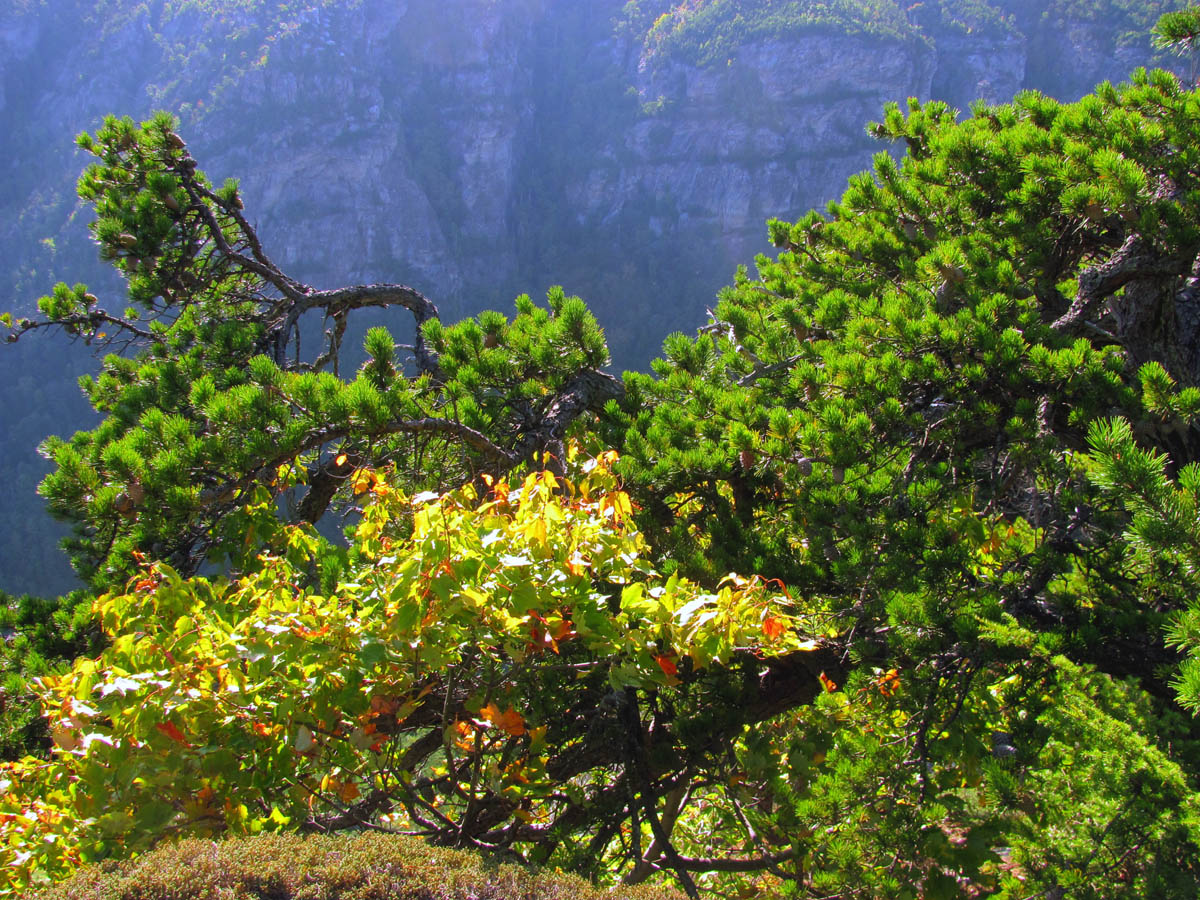
Rather large pine tree growing right on the side of the NC Wall. It always amazes me how things like this can thrive on solid rock.

A small part of the NC Wall as seen from the rock spine we were on. We would soon be standing on its top edge

Part of the NC Wall. Is it just me or do those dark holes and cracks intrigue you and make you want to be there to poke your nose in them ?

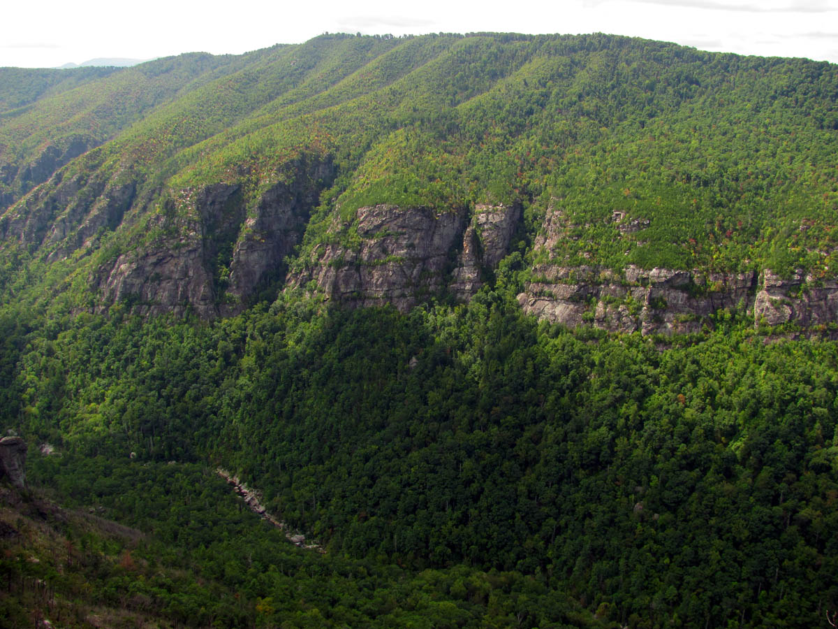
The NC Wall in all its beauty

Our view from the rock spine. You can clearly see a large portion of the NC Wall , the Moss Monster and the Sphinx

Taking in the endless vies of the gorge
View of the West rim

Zoomed shot of the Sphinx Rock. You can see a small taste of the steep and rugged terrain you will encounter when going down there

Bonzai tree growing on the edge of the rock spine

Looking down into the abyss between the rock spine and the NC Wall

Looking across the crack to the top of the wall where we would be heading to
Me Gnome posing on top of one of the many cliffs we would cross on this day. (Photo by John Forbes)

John on the rock spine

Me on the narrow rock spine (Photo by John Forbes)

View of the NC Wall across the crack from the rock spine

John on the upper end of the rock spine. We would be going back up and around the crack to make our way onto the top of the NC Wall

View from the butt end of the crack with the wall on the left and the rock spine we were just on to the right
Once we exhausted that area we backtracked back up to the trail and started making our way across the NC Wall. This was slow going. Not because of a poor trail but, because of all the killer views ! We could not resist stopping at each overlook and rock spine, climbing out on every one of them to check out all kinds of rock formations, huge cracks, and incredible views in all directions. We would also get views looking back towards the Camel Rocks and other things we had explored earlier. This gave yet another perspective on it all and we could also start to see the Moss Monster (among other large spires) and The Sphinx rock which all sit at the base of the NC Wall.

NOT a blueberry or huckleberry ! But, rather just one of the many invasive variations of the catbriars that are pests in this area.

Looking back at the rock spine we were on with a Trident shaped plant

crossing over the massive gully looking back towards the narrow rock spine we were on
Colors along the top of the NC Wall
View of the NC Wall as we make our way on to it

Looking back across the gully to the narrow rock spine we were just standing on. You can see the cool little bonzai tree at its point !

Close up of the rock spine we were just on

More of the rock spine we were just on
Standing on the point of yet another narrow rock spine looking across the NC Wall

Finally we are almost on top of the NC Wall !!

Top of the NC Wall. In this view, we are looking down yet another gully where you can see the Moss Monster Rock and the point of the Sphinx Rock sticking out at the lower right

Checking out yet another rock spine we can see a lone rock spire standing tall in front of the Moss Monster behind it with the Sphinx point sticking its nose out in the distance

Here you can see the space between the Moss Monster and the NC Wall

John stands on another rock spine. To me this pic is epic because it shows the lone rock spire, the Moss Monster, the Sphinx, the NC Wall and Shortoff with Lake James all in one shot !

John points to places we want to go soon !

Zoomed shot of the top of the Moss Monster and the Sphinx. It looks small from the top but you can tell in this shot it gets MUCH larger as you get close to them !
Continuing across the NC Wall we would traverse over and around more rock formations, rock spines, and crevice style gullies. The views never stopped coming. I filled up more than one memory card on this trip.

Looking back at the first major rock spine we had been on. You can see the lower part of the Camel in the lower right of the cliffs

Although you are looking at the same things, each picture has something new to offer and I could never tire of these views !

Looking back at what we had just thoroughly explored

The clouds added to the quality of the pics on this trip
John stands atop one of the many gullies along the NC Wall

I love the trees that grow along the edges of the cliffs

Looking back at one of the many rock spines we had been on

Making our way across the NC Wall you can see many unique rock formations such as the strangely shaped rock seen in the far right side of this picture. It is just sitting there and looks like it could slide off at any time yet it is molded to fit the rock it sits upon.

Looking up from the edge of the NC Wall you can see it is healing quickly from the recent wild fire that occurred here. The postcard blue sky and puffy white clouds along with the colors were brilliant on this day

A happy RAT does a Gnome pose high above the gorge ! (Photo by John Forbes)

I took several shots of the same view as the clouds and lighting was constantly changing
John Gnome posing on the edge of the wall near the oddly formed rock I mentioned earlier

Looking back

Looking back at the awesome eroded rock formations

Looking down on the lone rock spire

John living life on the edge of the NC Wall

Getting closer to the Moss Monster Rock Spire. You have to wonder how that one white looking rock got singled out on top of it !

Zooming closer to the Moss Monster. I can not wait until I squeeze between it and the wall at the base

Vertigo view of the lone rock spire as we pass it by

Growth along the top of the NC Wall

View of Shortoff Mountain and and small sliver of Lake James in the distance

Another crazy view from the NC Wall

Another look back reveals there was much air below us !

Looking back across the lone rock spire up the gorge

Finally got the light right to show the crack between the NC Wall and the Moss Monster

Zooming closer of the Moss Monster and the NC Wall. You can see the Sphinx is still way out there !

Yet another chasm / gully coming up. I am told this is the Moss Monster climbers trail and desire route down to it.

View from the edge of the NC Wall

Most of the rocks you go over but, some you go under !

The early Fall colors were very nice

Cool salamander we met along the way

The Goldenrods made excellent contrast for pics

Some of the terrain you will encounter along the NC Wall

Looking back you can see it is a gnarly place but, worth every effort

Looking ahead we could see more cliffs to play on !

Looking down into the next gully

John takes the lead and finds the route over to the next set of cliffs we would explore

John does another Gnome pose once he gets over to the next set of cliffs. A posing Gnome is a happy Gnome !

John stands among the huge boulders that line the top of the NC Wall

The clouds were phenomenal at times during this wonderful day in the gorge. Here you can see the lower part of the Moss Monster below

John looks down into the deep dark crevices of the NC Wall

I would love to explore down there but, you certainly do not want to fall into it !

I have always found the colors to be beautiful here of course I have not seen it during Winter !

Looking back from here, we could see the keyhole shaped crack between the Camel Rock and the NC Wall with Hawksbill at the top of it !

Famous crack shot

John sits among the beauty which is uniquely that of the gorge

Looking down into one of the many depths of the NC Wall cliffs

Another view of the keyhole shaped crack between the Camel and the wall

Zoomed view of the keyhole crack between the Camel and the wall. This shows the colors on Hawksbill too

Here I am taking a break enjoying the view. You can see the keyhole crack between the Camel Rock and the NC Wall at the far left side of this picture (Photo by John Forbes)

Super zoom of the above pic looking thru the keyhole crack between the Camel and the NC Wall with Hawksbill in the background

Mega zoom !! I was trying to show the keyhole crack and the colors of Hawksbill as seen of the Camel and the NC Wall

John looks back and down upon the Moss Monster. You can see all the various rock spines we climbed up as well

View of more of the NC Wall to come

Looking back over the Moss Monster

This is one of the best looking back shits O took, you can see everything we came over from Camel rock (far left) to where we are now
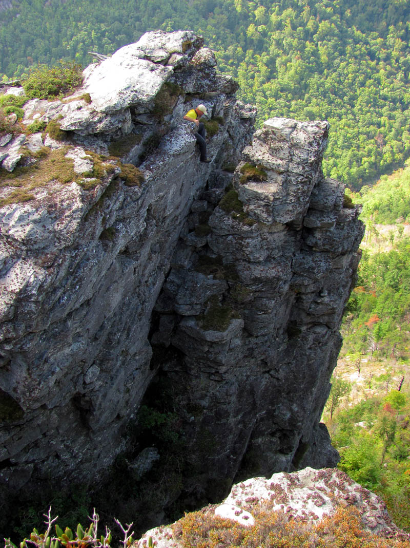
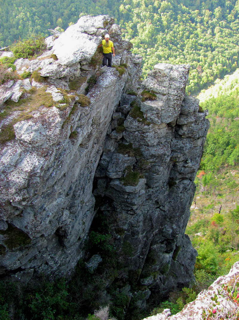
It was at this point that we noticed a huge rock spire over from us that was actually connected which enabled us to carefully negotiate a climb out to it. This amazing spire had a crack in it which separated it from its sister half. John knew as soon as he seen it that he would have to sit upon the alienated part of it so I stayed on the wall overlook while he climbed over to it and proceeded to lower himself into the crack which would be required to climb up onto the extremely narrow spire. This would prove to be larger and harder than it first appeared yet he did manage to freestyle this climb over and back while I took a series of pics to capture the dangerous feat. Please notice the ‘jenga’ stacked rocks in the crack. We had no way of knowing how sturdy those would be until he stood up them.

View of the upcoming rock spire we would be climbing out on

I knew when I saw this that we would be standing upon it soon !

I could see a hillbilly springboard to sit on to the left side and a rock spine and spire to climb on to the right !

John about to climb down into the crack and over to the top of the rock spire

John carefully lowers himself down into the crack to see if the pile of Jenga rocks is solid enough to stand upon
It is quite a drop down into the Jenga rock crack

John stands upon the Jenga rock pile in the crack

I looked away for a split second and when I looked back John was no where in sight. At first I thought he had fell but, then he appeared from behind the rock spire which was the best way to climb up on it. I was relieved but, then I remembered that we both have an agreement that if we ever do fall, that we will scream loudly all the way until the point of impact !

John after a successful climb to the top of the rock spire !

John straddles the rock spire

Of course this would mean he had to come back ! Here John is carefully negotiating the climb down the backside where he once again would disappear. I was watching this time !

Backwards off the backside !

John returns to view from the backside of the spire

Standing in the crack looking for hand and footholds to pull himself back up

Pulling himself back up the rock

Continuing the climb back up. This is perhaps the most dangerous part of the climb. Very narrow and slanted footing and instant death if you fall.
With the hard part over, a short rest break before continuing to the top
Once John completed the climb back and was safely upon the main spire again, I noticed a rock sticking out of the vertical cliff I was taking the pics from that resembled a diving board. We call these ‘Hillbilly Springboards’. This one had a lot of air under it so I proceeded to climb out onto it to sit. As I did this I heard John saying in an excited manner, that I might not want to do that but, at the time I could not see any problem with it so I dangled my legs over the edge and took some pics as John also got some pics of me sitting on it. It was not until I got off it and joined him on the rock spire that I could see what his concern was ! It seems there was not much above the rock holding it down and it appeared as if it could fall at any time. Had I looked at it from that angle I probably would not have sat on it ! But, it never moved and the small amount of rock holding its backside most like weighs a ton or two so I was probably safe in doing so for the most part but, I know I will not risk doing it again on that particular rock !

My position from where I was taking pics of John`s climb, just before I would climb out onto the puckering perch below me ! (Photo by John Forbes)

While John rested, I took a shot looking down from the Hillbilly Springboard I was sitting upon. This is some 3 feet away from the cliffs edge and after seeing this rock from John`s perspective, I wish I had not ever sat there !!

My view from the overhanging rock. John expressed much concern when I climbed out onto it and for good reason that I would see later !

This shows where the pics were taken from and where John was

Back on top and feeling triumphant !

In this pic you can see why John was concerned with me sitting on the Hillbilly Springboard rock (center one that is casting the short shadow) as you can see how far out it protrudes and how little it has on its backside to hold it into place !!!!!

Me sitting on the very unsafe puckering perch. Once I got this view of it, I realized how easy it could flip and tumble down into the gorge below (Photo by John Forbes)

I joined John on the Jenga Rock Tower and this was the view looking back at what we had came over

After joining John on the Jenga Rock Tower, this was my colorful view of the NC Wall

Looking back from the Jenga Rock Tower it becomes obvious that when you are standing along the edge of the NC Wall, that sometimes there is a lot of air beneath you !!
We played around on the awesome rock spire there for a long time before continuing on our way across the rest of the NC Wall. The next leg would require climbing back up some to get around this huge gully type crack. It was awesome looking down into this and I am pretty sure it is along here where the Moss Monster trail comes down from the top and goes into this ravine to descend down to the base of the Moss Monster and the NC Wall as I have friends who have done this and went out to the Sphinx Rock. That too is on my list.

Looking ahead at things to come

View looking back once we are back on the main part of the NC Wall

Pothole, cloud and color magic along the edge of the NC Wall

John captures my reflection in a pot hole (Photo by John Forbes)

Pretty in pink

The South end of the NC Wall is much different than the North. it is not as easy to follow.

A happy RAT Gnome posing high along the NC Wall (Photo by John Forbes)

Me taking pics along the edge of the NC Wall (Photo by John Forbes)
Once we neared the Southern part of the NC Wall I kinda lost track of the route having only been here once before and it was from the other direction so, instead of following the edge down as the cliffs drop in elevation on that end, we ended up going kinda straight and above it all which caused us to lose the route and miss going across the last part of the edge of the NC Wall. Due to this I did not get my favorite view looking down on The Sphinx however, we did find a nice set of cliffs hidden in the new growth that has came back since the fire that we were able to make our way along the base of which at least took us in the right direction.

Stayed high when I should have went low here !

Checkin` out some cliffs along the NC Wall ! (Photo by John Forbes)

We did find these cool cliffs and a nice route hidden at their base

Following along the base of the cliffs was a lot of fun until they ran out

Making my way along the rocks we found when we went too high along the NC Wall (Photo by John Forbes)
Everything looked so different from my last trip through here. It was not just because it had been awhile but, because the fire really changed things and so much different growth is coming back with a vengeance that it makes the old routes hard to find and follow. After we came to the end of these rocks, we ended up in a short bushwhack through some briers and such before I got a visual on the Amphitheater. There were no trails and although I knew where we had to be there was this large gully between us and the ridge I knew we had to be on as I could see the Amphitheater beyond it so, we had no choice but to go down into it and climb up onto that ridge which put us right on the Amphitheater Trail that I quickly recognized and led the way to the overlook there where we took a long rest and enjoyed the incredible views seen from there and reflected on all that we had seen and done thus far.

John on Amphitheater overlook

Standing on the overlook we can look down into the Amphitheater and over to the Mummy Buttress with Shortoff Mtn in the distance. This is another one of my favorite places in the gorge

John getting shots from the Amp overlook

Standing on the point of the Amphitheater Overlook (Photo by John Forbes)

Me on the Amp Overlook (Photo by John Forbes)

The Amp Wall

I love the view through this bonzai tree at the point of the Amp overlook. Shortoff looks great in the distance

Looking down on the Mummy Buttress from the Amp Overlook
It is so gnarly on the Amp Overlook, the trees grow sideways !
Although it had not been a great distance as far as miles goes, we were both feeling tired which was a combination of the lack of sleep, roughness of terrain, the heat as it was a warm day with intense bright sunshine to which we were completely exposed to the whole time without cover, and the intensity of the experience. I was bloodied from the briers but, I consider those merit badges given to me by the gorge I love so much. We rested for awhile taking in the views from this killer overlook that views not only the entire Amphitheater, but a close up view of the Mummy Buttress cliffs, and a much better view of Shortoff in the distance. The sun was too bright for any good pics but, it did not matter to us at the time.

A bloody RAT ! (Photo by John Forbes)

View across the Amphitheater towards Shortoff Mtn

So far one of my favorite views in the gorge

View from Amp Overlook over the Mummy Buttress towards Shortoff Mountain and the South end of the gorge

Looking down on the Mummy Buttress from the Amp overlook

View over the Amp from the overlook

Looking off the point of the Amp Overlook at the Mummy Buttress

This view from the Amp Overlook is another one that will never get old for me

Zooming in towards Shortoff Mtn

Zooming farther you can start to see Piano rock that sits at the base of the cliffs of Shortoff and more of Lake James where the Linville River empties into

Zoomed shot of Shortoff with Pinch In Trail (ridge) prominent in the bottom right
I was dreading the climb up to the top on the Amphitheater trail but the time finally came to leave so I slowly but surely drug my fat butt up the hill. This would take awhile and I was really happy to reach the MST and have my feet on level ground for a change. From there we headed North to get back to the Chimneys where we had started. With much easier walking on this real trail we were soon back to the place where we had left this trail earlier to go down to the Camel Rocks having now made a loop. We stopped to check out some other cliffs above us on the way out.

Looking back down the Amphitheater Trail. Yes, that`s a trail !!!

Looking up the Amp trail,, almost to the top, can see blue sky finally !

Finally made it to the top and back on the flat ground and good trail of the MST !!

Once back to the Chimney rocks area, I could clearly see the hole in the side of the Botswanna Arete rock spine as the sunset was illuminating it. Yes I am somewhat obsessed with this hole as I do plan to sit in it one day !

Zoomed shot of the BA spine to show the hole in its side that I am so intrigued by

Super zoom of ‘The Hole’

Mega zoom of ‘The Hole’ !

Overkill zoom of ‘The Hole’ !

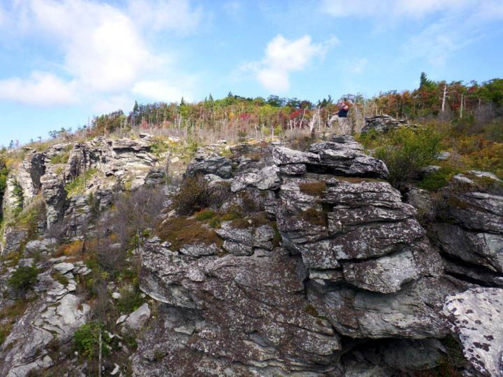
Looking up at the higher parts of the Chimneys. I hope to traverse across the top of these on my next trip here. The views from up there are about the best the gorge has to offer.

Looking back to see a view of the Twin Towers rocks that we had climbed down to early that morning while the sun was setting upon them

Even though the sunset is washing out this pic, I included it to show the ridge profile that leads down to the Twin Towers rocks. Climbing down and up that earlier that morning was a lot of fun

Looking up at the upper parts of the Chimneys as we passed back under them

Following the trail along the base of the upper Chimney Rocks

John had gotten ahead of me and I came around this corner to find him doing a full Gnome pose on top of one of the large rock formations we had planned on checking out on the way out
By the time we got back to the end of the Chimneys where we had started it was getting late and the sun was beginning to set. We did take a short side trip to climb up on one of the rock formations on the high side to get some different views with the changing light. The moon was also already up so I tried to get some pics of it as well. The light had been too bright all day so I had hopes of maybe getting a few decent pics but, it was not to be.

John had already taken the short side trip up to the large rock formations and was calling me to join him

John signalling me in to the cliff tops !

Trying to make use of the setting sun behind me I took this silhouette of myself

As I climbed the cliff I could see the moon was already up

Moon shot
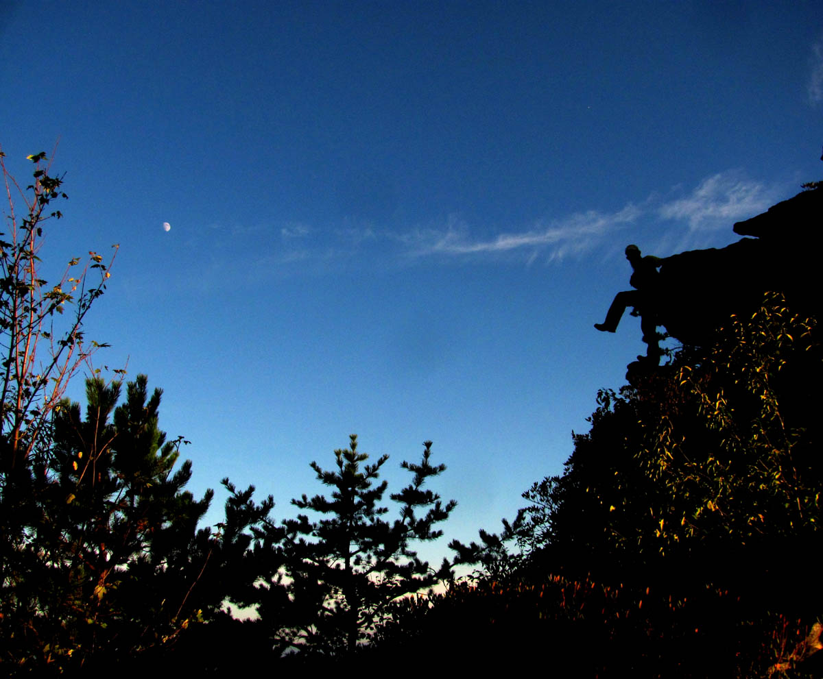
My attempt at a moon shot with a Gnome pose silhouette

John poses atop the strange rock formations

John captured this shot of me exploring some of the rock spires on out way out. (Photo by John Forbes)

The moon looking East

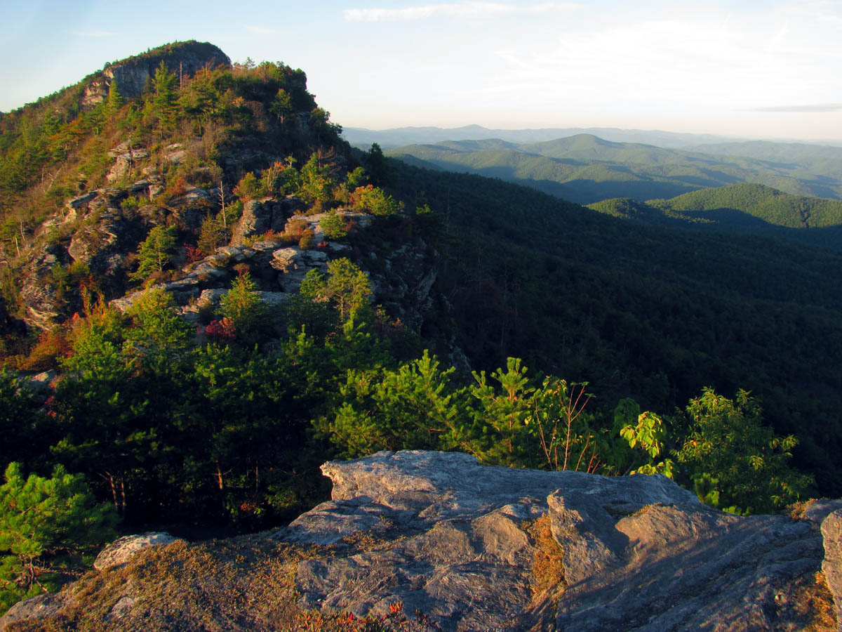
From the top of these rocks we could see our route out with Table Rock behind it basking in the setting sun

Looking Eastward you can see the shadow of Table Rock and how it got its name

Looking farther East we could see the shadow of Table Rock which made it clear why it was named as such

Looking East

John and the moon

Moon to the East

We could see the sun setting on Shortoff Mtn to the South from atop the high rock formations

Sun setting on Shortoff Mtn

Slight zoom of Shortoff to the South

Looking towards Table Rock and Little Table Rock
Sun setting on Table Rock
over those two humps and down to base of Table Rock and we are done ! This is looking North

Let is be known that a fat RAT can climb !! (Photo by John Forbes)

Once I free climbed to the top of this Spire, this is the view I had looking towards Table Rock (Photo by John Forbes)

Another view East of the Table Rock shadow

The moon as seen in our Eastward view

Looking to the South , the sun was setting on the Chimneys

View of the sun setting on the Chimneys as seen through the chasm along the MST

Sun setting on Shortoff Mountain

Sun setting on Shortoff Mtn looking towards the South

Sunset on Shortoff
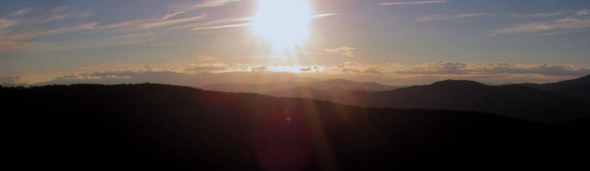
The only sunset pic I would get on this trip. This is over the West side of the gorge
I was wanting to stay on top of the mountain for the sunset but, I could tell it was really not going to be a very good one and we were both starving so, I slowly made my way off the mountain and back to the parking area. John was already ahead of me and got there way before me as I was moving pretty slow by this time. It was nearly dark by the time I reached the car where John was waiting for me and I was glad to be back and making the long drive back. We stopped at Lone Star steakhouse in Elizabethton, TN. for the post hike grub out. It had been a stellar day in the gorge and I was already planning my next trip back there. Until next time,,,,,,

It was almost dark by the time I reached the parking lot

My post hike salad

My post hike grub out steak, shrimp and mashed potatoes

 My name is 'RAT' and I love the mountains and waterfalls of the East TN. area where I live and I hope you enjoy this blog about my outdoor adventures.


Leave a Comment