


Sill Branch Overlook (MonkeyHead Rocks) and Upper Falls – 2-9-2013
It had already been 10 days since my last hiking adventure, mainly due to the weather so, I was more than ready for a hike somewhere. The weather forecasters were promising a sunny day with near 50 degree temps on Saturday, Feb. 9, 2013 after a cold start in the low 20’s so I decided I was gonna take advantage of it and go hiking somewhere since who knows how long it would be before the next chance would come along. Also our friend ‘Dan-O the Man-O‘ had informed me that he was available for a hike on that day along with my friend Bol’Dar who also said he would go along on this adventure. Our first choice was to be a long uphill hike to the Buzzard Rock Overlook but Dan-O needed to get back by 4ish pm so we knew that was not possible which prompted us to change our plans to go to the Sill Branch Overlook aka The MonkeyHead Rocks. Since that is a short hike and due to the water levels being decent, we chose to lengthen the hike by going to the Upper Sill Branch Falls. That is quite a hike within itself and to prevent having to backtrack down from the Overlook the way we came and starting over, we decided we would take a shortcut straight down the incredibly steep ridge directly into the Sill Branch Valley ! This is an extreme off trail descent and not for the faint of heart and is only recommended for seasoned extreme hikers. We left Hairnt-Quarters around 9am and were leaving the trail-head at Sill Branch by 9:30am.

View from the Sill Branch Overlook (looking at Sampson Mountain)
Taking the secret hidden ninja trail up to the ridge where the MonkeyHead Rocks reside took over an hour including some rest breaks and then a little longer to make our way off trail across the meat-grinder growth to get over to the highest and most prominent of the statuesque rock formations there for the incredible views they offer. This is by far one of my all time favorite places. From there we always make our way (carefully) further out the ridge to the many other rock cliffs and formations that are there until you eventually get out near the end where there is a nice place to hang out under some small pine trees that also provides a good view looking down on the Lower Sill Branch Falls (although you will need a good zoom to get any decent photo`s of them from that angle). I got some much better photos of them on my last trip here. We could hear both the North and South Forks of the Sill Branch Creeks roaring loudly far below us. Although the sun was intensely bright, the views were great and we had a great time chilling out there enjoying the immense beauty although I can not be there without thinking of the first time I ever was there when we climbed up the ‘meat-grinder’ and had the ‘stealth-pack incident’.

Small falls found along the branch beside the secret ninja trail that we use to access the Sill Branch Overlook ridge

View from the Sill Branch Overlook (looking over Sill Br. towards Sampson Mtn and the Clark Creek Valley)

View from the Sill Branch Overlook (looking at the ‘Volcano’ with Sampson Mtn on the right and glimpses of Rich Mtn all the way to near Wilson Knob on the left) (note the snow near Wilson Knob)

View from the Sill Branch Overlook (looking towards the left side of the ‘volcano’ with ‘the land bridge’ and South Fork of Sill Branch with Rich Mtn and Wilson Knob in background)

View from the Sill Branch Overlook (looking into the North Fork of Sill Branch)

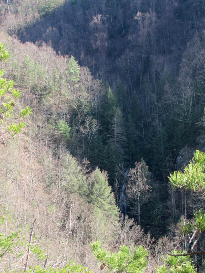
View from the Sill Branch Overlook (looking down on the lower end of Sill Branch and yes we would be going down that)

Bol’Dar atop one of the rock formations of the Sill Branch Overlook

View of the Lower Sill Falls from one of the cliffs of the Sill branch Overlook (click pic to see larger and labeled image)

Zoomed shot of the Lower Sill Branch Falls as seen from the Sill Branch Overlook

Zoomed view of the Lower Sill branch Falls as seen from the Sill Branch Overlook
Here are some photo`s I took from my last trip here:
Lower Sill Branch Falls as seen from the Sill Branch Overlook Taken 3-19-2010

Zoomed shot of Lower Sill Branch Falls as seen from the Sill Branch Overlook Taken 3-19-2010
After a good long break there, we went back across the rocks to where we started, only this time went under some of the larger ones to get a view from there as the rocks take on more of a character from that angle as the faces and shapes form various looks such as birds, monkeys, etc. From there we went back to the ridge to find the way we would take down that steep side to get to Sill Branch that was way down below us. While back on the ridge we came across a salt block, a stealth-camera, and a tree-stand which we thought was odd since hunting season ended over a month ago. We soon found ourselves standing on a hill so steep it was difficult to even stand on, making our way slowly down the spine of the ridge, sliding on our butts at least 10 or 20 feet each time one of us fell ! There was some good views of Longarm Ridge and the Clark Creek Valley, Sampson, etc., from there and I could even make out the rocks on the steep North side of Longarm Ridge. It does not look that far to get down but, the distance is VERY deceptive. It takes some time to reach the creek at the bottom as it is much further than it seems. There is no trail and would be too steep to build one so you just have to find the path of least resistance and make your way down. We did locate some more very nice rock formations on the way down that made the effort well worth it as I doubt many have ever seen these.

Standing under one of the large rock formations of the Sill Branch Overlook

Looking up at one of the large rock formations of the Sill Branch Overlook from below

Bright yellow fungus on a rock found below the cliffs (we have passed by this rock many times before)

We begin the steep descent (Find Bol’Dar)

My view from the steep hillside (note: Longarm Ridge in center off in distance)

Cool rock formation we found on our descent

Another really cool rock formation we found while descending down into lower Sill Branch (you do see the face right ?)

Another view of the really cool rock formation we found going down into Sill Branch (now do you see the face? )

Not quite halfway down looking straight down the way we were going (you know how cameras can not show depth/steepness ? Well this looks steep in the pic so that goes to show how steep this descent really was !

Looking to my right while descending the steep ridge

Looking back up the way I had just came down
After what seemed like forever we finally reached the creek which was running really good so we had to locate a decent place to cross without getting our feet wet. We all prevailed and soon were hiking up the old road trail towards the trail to the Lower Falls. We did not have time go see them so we passed them by continuing on the old road past what we call the Snakehead Rock where Dan-O and myself stopped for lunch as it seems there was a misunderstanding which caused Bol’Dar to go non-stop all the way to the trail that leads to the Upper Falls. He went all the way to the ‘Umba Bagumba’ spot and was waiting on us wondering what had happened ! We were eating lunch on the Snakehead Rock wondering where he was ! We took a short lunch so we could catch up to him soon as we could and it did not take too long to get to the exit off the old road where the not very well known trail is that leads to the Upper Sill Branch Falls. We found Bol’Dar sitting at the spot looking over, eye to eye with the MonkeyHead Rocks which is where we first discovered them nearly 30 years ago.

Finally we can see the creek and old road trail below !! We have made it down !

Crossing Sill Branch (Find Dan-O)

Small section of the snake rocks

Dan-O coming down from our lunch spot atop the SnakeRock (you can see the Sill Branch Overlook high above in the background)

Looking up at the Sill Branch Overlook from the SnakeRock

Looking up at the Sill Branch Overlook and the steep ridge we just came down from the SnakeRock

Small falls along South Fork of Sill Branch just above the SnakeRocks

The old arm tree located along the South Fork of Sill Branch Trail
Many years ago the trail used to be clean as pin as it made its way up through pine trees, it was very shady and the trail was carpeted with moss and pine needles, it was smooth and a real pleasure to hike and back then it did not take near as long to get to the upper falls but, now due to the recent pine bark beetle damage, the trail is pretty much destroyed with blow-downs as the entire ridge is now open with all the pine trees being downed and everything is dead looking. Lots of sun now allowed in which is causing some really thick growth to replace what once was all trees. You now have to climb over and under several blow-downs but I will say that it was easier this time than my last trip here back in November of 2010 when I took my friend Dave to them. Seems there have been quite a few people stomping through here to the falls. Too bad none of them took the time to do any trail work !

Trail leading up to the ‘Umba BaGumBa’ spot and eventually to the upper Sill Branch Falls

Looking over at the Sill Branch Overlook (MonkeyHead Rocks) from the ‘UmBa BaGumBa Spot’

Looking over at the Sill Branch Overlook (MonkeyHead Rocks) from the ‘UmBa BaGumBa Spot’

Looking over at the Sill Branch Overlook (MonkeyHead Rocks) from the ‘UmBa BaGumBa Spot’
Eventually the trail descends down to the creek above the lower falls and follows it all the way to the upper falls crossing a few other wet weather streams that come in from the right side along the way. There was some small snow traces there and it was MUCH colder as this is on the North side of the mountain and the sun does not shine in there. You will pass several small falls and cascades there. After a while you come to where the creek splits at a large washed out area. The main branch stays to the left to continue on up to the upper falls and beyond to many other falls and the one to the right (which is smaller) leads up into the steep hollow there that leads to the rocky ridge above. There are a few old log roads there once you cross the creek. The lower one that follows the main branch leads to the bottom of the Upper Falls and the upper road will take you to the top of the falls where you can get a higher view and be able to use it to cross the top of the feeder falls there and get beyond the upper falls.

Trail view after the ‘UmBa BaGumBa’ spot looking into the North Fork of Sill Branch towards the upper falls and Rich Mtn

Dan-O and Bol’Dar on the trail beside the North Fork of Sill Branch

Dan-O and Bol’Dar on the trail to the upper falls (Dan-O noticing that the ‘stoners’ and ‘the pink flag badger’ had already been through here sometime in the past)

Small waterfall along the North Fork of Sill Branch

Another small cascading falls found along the North Fork of Sill Branch

Another shot of the cascading falls found along the North Fork of Sill Branch

One of the larger falls found along the North Fork of Sill Branch

Another one of many of the small falls and cascades found along the North Fork of Sill Branch

Another shot of the same falls

Another angle on those same falls

Another shot of those same falls

Cascading stream that enters into the North Fork of Sill Branch along the route to the upper Sill Branch Falls
We took the low road in order to get the best pictures as we were pressed for time and would not be going any further on this trip. The falls were really nice with the extra water flowing over them. We hung out there at the base for as long as we could taking in the awesomeness before we finally had to leave. DISCLAIMER: Please note that I did not take my new camera nor did I carry a tripod on this trip so the pictures did suffer from it !!!

First view of the Upper Sill Branch Falls

Feeder falls that come in to the right side of the Upper Sill Branch Falls (the upper trail crosses at the top of these)

Upper Sill Branch Falls

Upper Sill Branch Falls

Upper Sill Branch Falls

Upper Sill Branch Falls
It is mostly downhill going back so we made better time and were soon back to the warm sun at the ‘Umba Bagumba’ spot. I was glad to be out of the cold refrigerator-like canyon. We rested there for awhile checking out the views of the nearby mountains and the MonkeyHead Rocks before continuing on down to the old road down below.

Section of trail leading back up to the ‘UmBa BaGumBa’ spot

Looking over at the Sill Branch Overlook

View looking out over Sill Branch towards Clark Creek with Sampson Mtn in background

View looking out over Sill Branch to Clark Creek and Sampson mtn (you can see the steep ridge of the ‘volcano’ starting on the left side

Looking over the South Fork of Sill Branch at the ‘volcano’ with Sampson Mtn behind it from the ‘UmBa BaGumBa’ spot
From there it did not take long to get back down the rest of the trail and back down the old road and past the Snakehead Rocks to the trail-head where we started that morning. We were out by 4:30pm so Dan-O was on schedule ! It had been a great day in the mountains and I had gotten some good exercise. So much in fact, that my legs were already hurting and it would end up taking me a couple days to recover. It was only a little over 5 miles total so, that goes to show just how steep and gnarly the route was ! I am already looking forward to the next trip hopefully soon while the water levels are up.

Hiking the last leg of the upper falls trail. You can see Dan-O and Bol’Dar below me and that is the ‘pyramid’ and ‘land bridge’ looming above us in the distance as we descend into the South Fork of Sill Branch below

Small part of the upper falls trail that is still awesome like it used to be many years ago

Small cascade along Sill Branch

Series of cascades along Sill Branch
To see the complete collection of photos of the Sill Branch Overlook (MonkeyHead Rocks) please visit our Photo Gallery here.
To see the complete collection of photos of the Lower and Upper Sill Branch Falls please visit our Photo Gallery here.

 My name is 'RAT' and I love the mountains and waterfalls of the East TN. area where I live and I hope you enjoy this blog about my outdoor adventures.


Leave a Comment