


Simmons Branch Falls 2-20-2010
Second trip this weekend ! HAIRNT !! And a much warmer day with less snow to hike through than the day before. Got a slightly earlier start this time even after oversleeping until almost 1 pm, still there was no answer at Bol’Dar’s (hmmm__ I wonder ?,,,) so once again it was just my son Tyler, and me. After recently hearing talk about waterfalls up Simmons Branch in Bumpus Cove, (pretty sure we always referred to it as ‘Bumpass’ cove !) I decided to go there since it was close and in the lower elevations as there is still a lot of snow in the mountains. It has been many years since I have been in the Bumpus Cove area and there have been some noticeable changes but for the most part it is still just as I remember it. I used to spend a lot of time there over the years for various reasons. We drove right to the end of the paved road then continued a short ways further to where the old forest service road (that goes to Rich mountain and beyond) begins. It is gated this time of year. We had no trouble finding Simmons Branch as it is basically the first hollow on the right.
 rs")
Simmons Branch Falls (lower)
This is an old mining community that at one time had at least 31 mines in operation (maybe more at one time) and was considered to be the largest company in the state of Tennessee back in those days (according to 80 yr old resident Clay Rogers who can remember vividly when they were in operation) mining such minerals as Zinc, Iron, Manganese, and Lead, just to name a few of the popular ones. Although it has been reclaimed, caution should be taken as there are remnants of old mine and air shafts that could be potentially dangerous, so please be very careful if you tread here. There is a visible mine location right at the start of Simmons Branch just after you cross the first creek. More info on all the mines can be found HERE. (make sure to click ‘terrain’)
The first thing we noticed after we went past the gate and headed up the old forest road, was the familiar ‘star’ boot tracks that I knew had to be left by my new friend Dave ‘Old Salt’ ! It seems he was there the day before, however the tracks ended when we turned up Simmons Branch. I found out later he went to the East part of Simmons branch to the waterfalls there. Thanks for the photo Dave ! (photo seen below)

East Simmons Branch Falls (taken by Dave 'Old Salt' Aldridge)
The trail we took begins as an ancient old road bed that follows the creek up the hollow. It is still in fair shape with only a few tough spots from recent blow-downs and storm damage so we made our way fairly quickly to where you have to switch to the left side of the creek which takes you directly to where we got our first view of the lower falls.

Ice Bats
Upon first glance they did not seem anything like other pictures I had seen, but as I climbed closer I could see that there was a lot of downed trees and debris piled up in front of them much like the Squibb Creek Falls from the day before. The rest was hiding behind ice and snow. As I finally got to the actual base of the falls (which does take a little bit of climbing but not bad) I could see that there were still some very decent waterfalls there.

Simmons Branch Falls (lower)
As we were enjoying this spot, taking pictures and enjoying the area, I spotted numerous fresh piles of rabbit pellets or as my dad used to call them: ‘smart pills’ !!! There were some fresh turkey tracks but no coyote or wolf tracks to be seen. There is a sizable draw off to the left where I assume is where the ‘feeder’falls’ (as seen here) are located but as you can see from my photos and previous other photos taken, these are nothing like they used to be as Mother Nature has made many changes to this area just like several other places we have visited lately.

Feeder falls to left of Simmons Branch Falls (lower)
Although we knew we did not have enough time (or energy) to make it to the middle and upper falls, I couldn’t help but feel this urge to climb the steep hill and cliffs in front of us directly to the left side of the falls, but I just wanted to be up there as it looked like the place to be and also to see what the next step of the journey would be for when we came back to venture to the other falls later.

Rock cliff to left of lower falls
Since we had left our packs at the bottom before climbing up to the base of the falls, Tyler volunteered to go back down and retrieve them. What a good kid I have ! We carefully climbed to the top of the rock cliffs where I took a few pics of the falls, surrounding ridges and Embreeville mountain (you could see the old landfill site from here), then we noticed an old log road right on top behind us. This was now in the warm sun so we rested here for a lunch break before doing some scouting around. We then found some more nice old roads above us leading down towards the creek which would definitely be the way to continue towards the middle and upper falls. These also led up towards the ridge between us and the forest road we started on so perhaps there is another way into this area which we will study up on later.
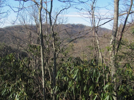
View of Embreeville Mtn. (and old landfill site) from cliffs above lower falls
I hope I can get back here soon to see the rest of the falls but for now we had to make our way back down the steep cliff in the snow where I ended up doing a ‘Bear Grylles’ slide, catching my right kneecap on a sharp rock that was hiding in the snow ! It did cut it slightly and felt like I was hit with a sledgehammer, but I think it will heal enough for another trip which I hope will be next weekend even though the forecast is for more snow. It was a short hike back to the vehicle and we thought we would get home before dark, but we decided to go by Clarks Creek on our way home to see if Bol’Dar had went on any ‘extreme’ adventures there but he was not to be found. We got delayed there by some guys cutting firewood who had the road blocked and then got behind a very slow driver most of the way home. All in all the trip was a really good ‘fix’ for the cabin fever and it helped the adventure levels to be out in the woods again during this winter that seems to never end.
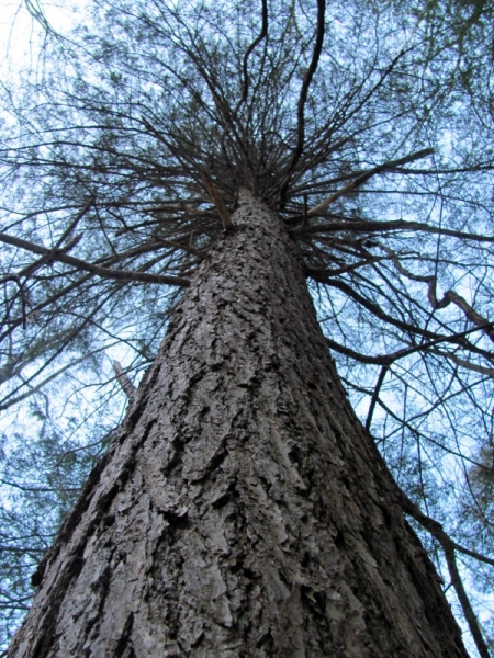
Cool pine tree
More pics of these falls can be found in our gallery.

 My name is 'RAT' and I love the mountains and waterfalls of the East TN. area where I live and I hope you enjoy this blog about my outdoor adventures.


3 Comments to “Simmons Branch Falls 2-20-2010”