


Summer Hikes 2010
Weir Dams / South Holston Dam:
It seems I forgot to mention in my last entry about the trip we took to the Weir Dams on South Holston River and the dam on South Holston lake on 7-10-2010. It was just a short day trip but after all it is an interesting area with a nice walking trail around Osceola Island for some exercise and enjoying nature. The Weir Dams were built to oxygenate the water for the fish and other creatures in between times when the dam is not releasing water (generating power). It was a hot and very bright day so getting any fancy pictures was out of the question but I did enjoy being out walking somewhere and did get a few nice shots. You can see more of them in the photo gallery.
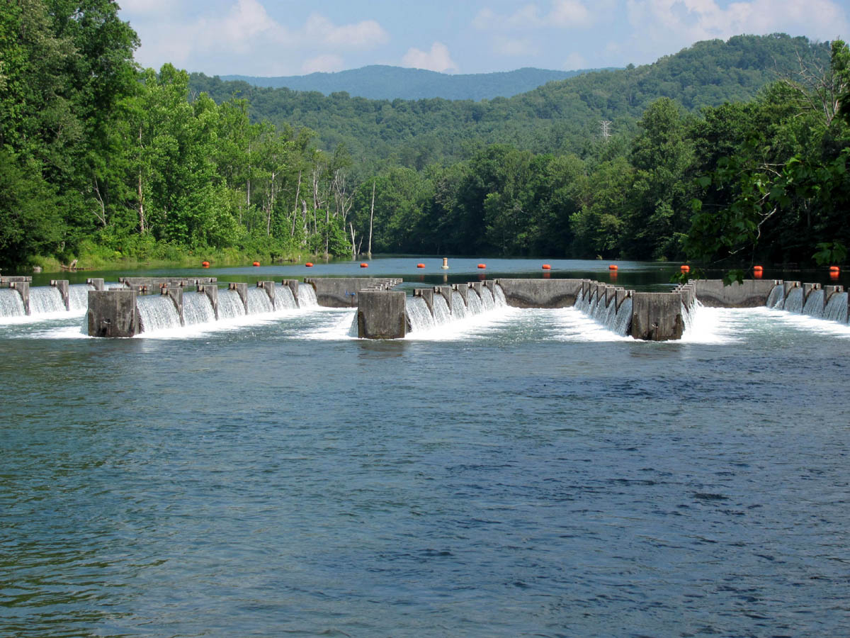
Weir Dams on South Holston River
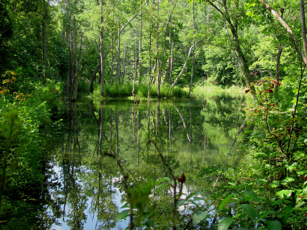
South Holston river as seen from Osceola Island trail
South Holston Lake
Since it was a short trip we got back fairly early, and I was still feeling energetic, so I drove up to Dry Creek and walked by myself up the old forest road above the Green Mile trail about a mile to the shortcut trail I found the week before.
I decided to take it down to see where it came out and if there was anything interesting to be found. It came out right near the beginning of the Green Mile trail but no water was to be found, nothing interesting, only some bear scat and tracks.
Watauga lake:
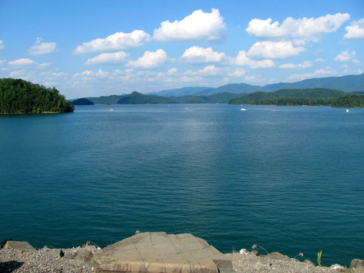
My next trip would not be until 8-7-2010 to Watauga Lake. This was to be the first trip there this year. I can’t believe it is already August and we have not yet been to the lake. Especially with a record breaking 48 days at 90 degrees or higher ! We decided to go to Watauga Point this time which was a good choice as the refurbishing is now complete and it is very nice there. I enjoyed swimming although the usually cold mountain fed water was warm as bath water. I am sure the aqua-therapy was good for my still aching ribs and back. I hope we can go back again before it gets too cold.

Watauga Lake
Hughes Gap to Iron Mtn. Gap:
The next day, (8-8-2010) my son Tyler, and myself got up unusually early and headed up to Hughes Gap where we left my car and headed South on the trail to meet up with some new hikertrash friends, Melissa and her gang (S-Troop). We caught up with them at Little Rock Knob vista after a long hike up a new trail relocation that I had not hiked before. The AT no longer takes the steep, grueling, ridge trail but a rather nice, gradual climb to the top which adds a bit of mileage to the section. It was nice to finally meet and hike with Mel and some of her gang, they are a really cool and fun bunch to play in the woods with. One of them even had a map ! Well hey !

Hazy view from Little Rock Knob
This was the first long hike (9+ miles) since my rib injury and now being much overweight and way out of shape, I had my doubts that I would be able to make this trip and keep up, but I managed to do just fine with only a couple of Dr. G. moments ! (Mel says that pounding in my ears is my heart telling me I am still alive!) The trail was in good shape, and it wasn’t long before we were at the Clyde Smith shelter. It is named after a long time member/maintainer of the Tennessee Eastman Hiking Club, now deceased, who was known for making the signs along the AT in this area. The lean-to has had some improvements since I was there last with a roof extension and bar-type table across the front. Too bad no one brought any cocktails !

Orange Fungus Amongus

Huge tree with Tyler inside split at bottom
We continued on through the hardwood forest passing by some of the older, gnarley, and much larger trees that are found in these parts until we made it to the old homestead site where we stopped for lunch. I remember camping there the last time Bol’dar and I hiked that section back during the ‘Eufernia’ tour several years ago. This area is lined with really gnarley old maple trees.

Tyler at the Old Homestead campsite
After lunch we proceeded on to the field where the old apple orchard is. It was very hot walking through there and I was happy to get back under the cover of the trees.

Old Orchard
There was a snake encounter but it turned out to be only a garter snake. I was happy that we did not see anything like the rattlesnake a friend of mine seen last week as seen here. Seen several webs full of worms . Soon enough we were on the main ridge of Iron Mountain passing by the rocks I remember so well. It is a nice stopping place so we rested here taking a few pics before continuing on. Soon after, we reached the point where you can see Unaka Mountain over from us on the Tennessee side and the climb up the Roan on the North Carolina side. We could hear the highway below us as we neared Iron Mountain gap. After a quick mile down we were there and the trip was over. I had made it and felt reasonably good ! Mel and her gang had a vehicle there and was nice enough to haul us back to our car at Hughes Gap. It was a great trip and I took some pics of the mighty Roan backside as seen from Buladean, NC on my way down the road as there are some nice cliffs on top of this particular ridge.

Roan Ridgeline as seen from Buladean, NC
Indian Grave Gap to Nolichucky River (and Jones Branch Overlook):
Not to lose any momentum in my slow recovery, I decided to go with Bol’Dar the next weekend (on 8-14-2010) from Indian Grave Gap, going South to the Nolichucky River, with an off-trail side trip to the Jones Branch Overlook and back, since I had never been there before. After a fairly early start from Hairnt-quarters, and dropping a car at the river, we made it to the trailhead around 10:30 am. I had not hiked this section since the ‘Eufernia’ tour quite a few years before, but it was just as nice as I remember it, although it was going to be another hot day with 90+ degree temps. There was a breeze blowing as you can see by this caution tape blowing in the wind (I have no idea why it was there). The trail on the northern end of this section has become somewhat ‘encroached‘ by laurels and woody growth (obviously from lack of trimming on the upper side) which forces hikers to walk on the lower side, which in turn erodes the fragile treadway, making for much harder rehab work later. Other than that, the trail was in good shape; however lots of large blowdowns have been cut due to this area having some serious damage during the past winter. There was this one big rock that had recently fell right into the trail. I am glad I am not the one that has to move it !

Ferns
We reached Curly Maple Gap in due time where we left the AT and headed towards the Jones Branch Overlook. This would end up being about a 2.5 mile detour with the ‘and back’ part being the hardest ! I had never been there before and although Bol’Dar had been there a few times, it was still tricky to find. (See Bol’Dar trying to remember the way here!) I kinda knew we were almost there when I saw the ridge we were on drop off sharply as if the Earth was flat and we had found the edge of it ! It was worth the effort as it is a very nice place with incredible views of the entire Jones Branch valley with views of the many mountains beyond in all directions.

View from Jones Branch Overlook
It was a bit hazy, and bright, but you could see Flattop, Little and Big Bald Mountains, along with No Business Knob, and the Temple Hill Ridge. I can see that this would be a great place to be in the Fall. You can see the AT over from you and hear any hikers that might be traveling through at the time, but it would be tricky and some work to get back over to it as the ridge down from the overlook is very steep as you are basically looking down on the tree tops below ! I can’t help but feel that there will be an adventure back there one day to plot out a traversed shortcut to the AT!

View from Jones Branch Overlook

Rat and Bol'Dar on the Jones Branch Overlook
After spending some time on the rock cliffs there, we said our ‘UmBa Ba GumBa’s’ and headed back up the steep ridge, stopping only to check out another cool rock formation just above the overlook. We did manage to find a route back to the old road that was a bit easier than the way we came in, which was a good thing. After that it was not long before we were back to the other old road trail that leads back to Curly Maple Gap. Before returning on that trail, we took a few minutes at the fork in the old gap trail to check out the spring, that is just below the fork. After some lunch back at Curly Maple Gap, we went down the hill to Curly Maple shelter where we met a Northbound section hiker who called himself ‘Heavy Metal‘. It was now late afternoon and with over 3 miles left to go, we continued on down the trail towards the river.

Gnarley Trees Dancing
We stopped at a rocky outcropping of cliffs where despite my being tired, sore, and bleeding, I allowed myself to be talked into climbing to the top of it ! Even Bol’Dar had to stop and ‘think about it‘ ! It was a cool place, if only I had more energy ! The view looking over at the overlook ridge where we had been earlier was not bad.

Rocky outcrop we climbed up on from along the trail
After climbing back down and continuing South on the trail, we reached the place that you could see from the Jones Branch Overlook where views of the overlook can be seen. It looks much smaller than it actually is from this angle. We managed to get a few pics of it before heading on down into the valley, where we eventually reached the creek which leads to the river.

Jones Branch Lookoff as seen from the A.T.
The water was low but is flowing. It wasn’t long before we could hear the noises of the campground, as there were some kind of loud event going on there. I crossed the bridge while Bol’Dar took the ninja logwalk and we reached the car to complete at least 11 miles that day. I was again proud of myself for being able to handle the mileage and was beginning to think that I might be able to go on my annual birthday hike in September after all ! Beam me up Mr. Scott !

Yellow Fungi

 My name is 'RAT' and I love the mountains and waterfalls of the East TN. area where I live and I hope you enjoy this blog about my outdoor adventures.


One Comment to “Summer Hikes 2010”