


Unaka Talus Fields – 12-3-2014
For as long as I can remember I have seen the bare spots on one particular slope on the Tennessee side of Unaka Mountain. These are most prominent when there is a dusting of snow on them which allows the areas to stand out from the rest of the terrain there. It has only been in recent years that I have looked more closely at these areas and realized that they consist of broken rock that form enormous football field sized boulder gardens that lie on the steep slopes. Having looked at these rock piles from various locations as well as looking down on the upper one from the road that runs across the top, I never really gave much thought to several things like how large they really were, what they were made of, what made them and just how steep it actually is. About a year or so ago a hiking friend of mine asked about them and it made me realize that although I knew they were there, that I really did not know that much about them. That person became very interested in them and vowed to go there and stand on them as soon as possible. Since this had tweaked my own interest in them, I advised as to where they were exactly and what routes one would have to take to get to them, whether it be from bottom or top, and vowed that I would be there before them ! On Dec. 3, 2014 I made that a true statement.

Unaka Mountain frozen. You can see the Talus fields under bright snow on the left side of the mountain (Taken Feb 2010)

Closer view of a frozen Unaka Mtn. with the Talus fields glowing in snow on the left side (Taken Feb 2010)

Zoomed shot of the Talus field of Unaka, covered in a blanket of snow (Taken Feb 2010)
After having recently crawled like a lizard through the entire length of the Dick Creek Valley, and having poked my nose in almost every hollow and valley on Unaka at one time or other, and knowing how rough it all was, I assumed it would not be an easy task to traverse into the Straight Creek Valley which would be a requirement to reach the talus fields so, I consulted with my friend and fellow mountaineer (and recently a Unaka expert), Larry Jarret, to advise the best and safest plan to accomplish it. Knowing that going from the bottom would require backtracking through whatever obstacles and laurel hells that would be found there, it was decided that we would go top down the same way I did the Dick Creek Valley. Once and done is my motto and preferably downhill.. Although Larry had not actually been on the Talus fields, he had been very close to them and knew what he thought would be the easiest way and agreed to accompany us on our quest. This was pleasing music to my ears.

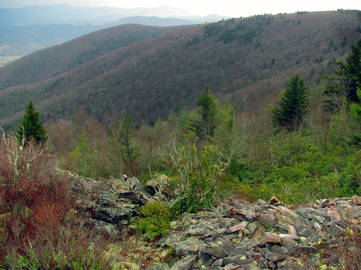
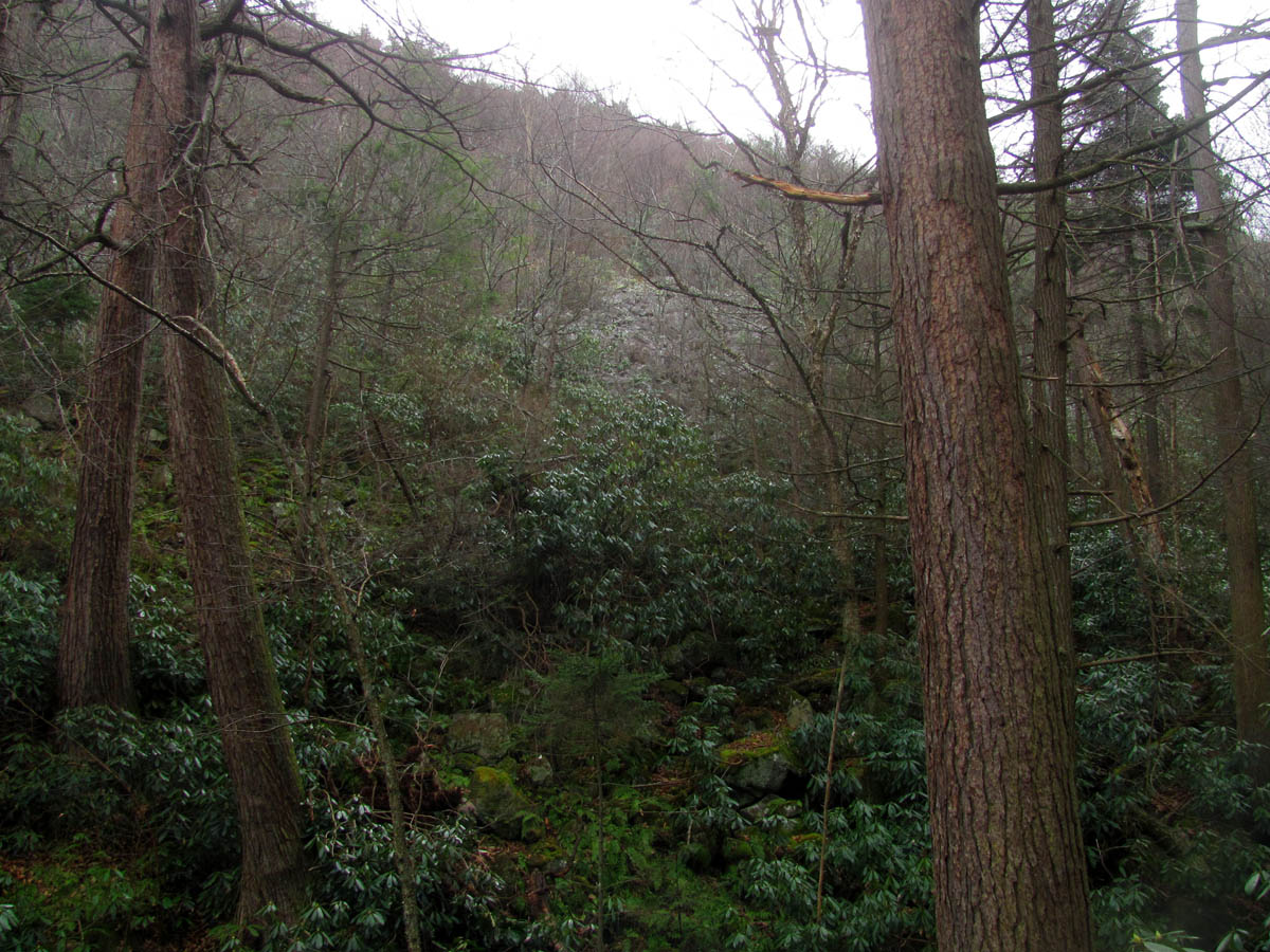
A trail of talus,,,, (this is not the way to the talus fields but, it is nearby at the start of our journey ,,,,
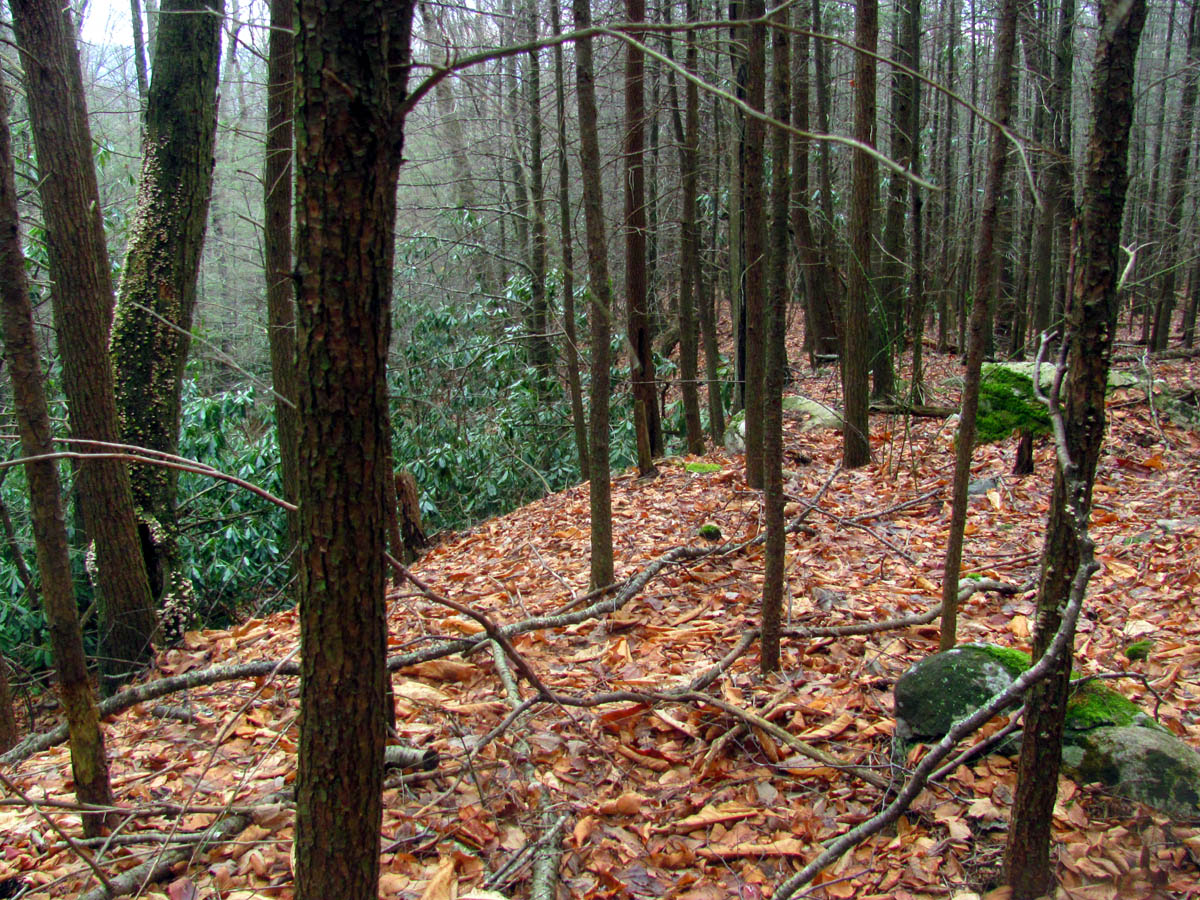
I had not yet set a date for going on this wild adventure but, it just so happens from out of the blue I got the call from Larry asking if I would like to go in the next day or so. Of course this would not allow for much planning yet there was no way I was not going so, it was agreed on that in 2 days we would be embarking on this quest. He had also invited our mutual friend and fellow mountaineer, John Forbes which was actually perfect for this type of mission. I knew there were many others that would love to be on this campaign with us but, there was no time to make any more arrangements and after being there I know now it was a good call because, it is really not safe to have large groups clambering around on the talus at one time for safety reasons. We began our journey by meeting Larry near Dick Creek so we could drop our vehicles there and ride with him in his truck to the top of Unaka where we would start this incredible one of a kind voyage.

Sunrise creeping over Stamping Ground Ridge
One very important factor when hiking anywhere near the summit of Unaka Mountain is the weather as the word comes from the Cherokee Indian word ‘unega’ which means ‘white’. This is in reference to the foggy haze that drapes around the mountain like white clouds that can be seen there when other surrounding mountains are clear. Descending something that steep during total whiteout would not be an option plus moisture would cause the talus to be wet which would also be more dangerous. It is risky enough when its dry. On this day we would be very lucky as there were no clouds or fog on Unaka which is a rare thing, especially in the mornings. There was a slight chance of rain but, we were hoping that would not be an issue at least not while we were on the rocks. Before we started down into the Straight Creek Valley we would go out on the opposite side of the ridge to see something that Larry wanted to show us. It was a beautiful morning and there were nice views from that side of the mountain.

Checking out the morning views from the other side of the unnamed ridge looking down into the valley that lies between Stone Mtn (left) and the Stamping Ground Ridge (right) Photo by John Forbes)
Standing on the upper part of the unnamed ridge looking towards Stamping Ground Ridge with the many mountains beyond

View from the ridge looking over Stone Mtn . That is Buffalo Mtn and Johnson City in the distance

Looking down at Stone Mtn and the valley beside it from the unnamed ridge
After checking that area out for a bit, we went back to the top of the unnamed ridge and began the descent off the other side following a faint opening in the trees and laurels that Larry had scouted out earlier in the year. Keeping to the path of least resistance I was surprised just how open it was and soon we came to a place where a sizable amount of water bubbled right out of the ground not far from the top of the mountain. Basically this would be the main source and headwaters of Straight Creek. It was a nice find however, within a short distance this water would disappear back into the ground from whence it came. We continued on as we could already begin to see a small part of the first and largest talus field.

The summit of Unaka as seen from the ridge we were on

Spring (head water of Straight Creek) bubbling out of the ground near the top of Unaka Mtn)

The spring water just before it went back into the ground from whence it came

First view of the Talus field. Look closely ! This was only the mere tip of it !
We came out on the edge of the rocks and climbed up on some of the larger ones at the bottom of that area and got our first real view across the width of the main talus field. There was a short silence before the screams began as it was breathtaking for lack of a better word. The sheer size of it was hard to take in and we knew that from that vantage point we still could only see part of it as there is a section in the center that has small trees and other growth on it that blocks the view but, we would soon make our way across the rocks to the other side where we would then realize the full enormity of it all. John did what John always does and climbed up towards the top of this skyscraper of rocks. Although you can see the height of the small section we were on at the edge of this boulder garden, once he climbed up and around to near the top of the main part, you had to squint to see him and he described us as small ants below him. The immensity of this place is indescribable.

Larry Jarret leading us towards the talus fields. You can see there are small veins of it everywhere. Not all of it is visible as it hides beneath the growth.

Looking down the draw that leads into the main valley. This is where the water is now under ground/talus and this is what I expected the route to be like the entire time however I was pleasantly surprised that we were able to find easier paths to follow

The edge of the main talus field ! We were about to climb out and stand upon it and be amazed.

Looking up as we step out onto the far edge of the talus field. You can see how there is growth that has managed to cover a lot of it. I am sure that many years ago this field would appear much larger. Keep in mind the rocks are still there just under the growth !

Our first view over at the main, upper talus field

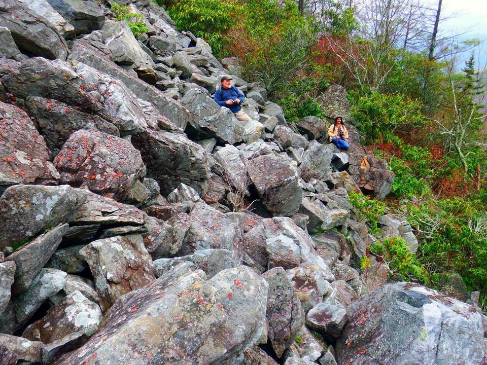
John standing above us on this small edge of the talus field. You can not judge how steep these rocks are.

Checking out the first part of the talus field where we entered upon it (Photo by John Forbes)

John`s view from the above picture (Photo by John Forbes)

There is much beauty to be found among the talus

Natures beauty within the talus

From our perch on the small edge of the talus, we could see the main valley over from us and the views towards Erwin. You can start to see just how steep all of this is. That steep thing is just a finger coming off Horseback Ridge.

You can see the large boulders we are standing on and the route we will take to the main talus field

Lots of photo ops when out on the talus. This is John standing above us as seen through one of Natures natural picture frames

Here I am trying to capture the sheer vertical wall of rocks that lie before me. I am not holding the camera up but, rather I am looking straight ahead with it.

Trying to put it all in perspective. Keep in mind this is only the small leading edge of the talus and not the main field
While John was making his way to the top and across that way, Larry and I slowly made our way across the middle towards the other side. Much care has to be observed here as the rocks are not only slick but, come in all shapes and sizes and at any given time you could step on one and it move under your feet which could create an array of serious problems. This could include anything from a twisted ankle to a broken leg, perhaps a fall ending in a head injury or death, or the most serious would be becoming trapped beneath a car sized rock. There are dark cracks and holes that seem to have no bottom that you would not want to fall down into. Another danger is sending an avalanche of rocks down onto your fellow hiking mates. For all these reasons and more we made sure to watch our steps very carefully and stayed across from one another and not above or below each other in case of any rock slides. You must take each step as if it may be your last and pray it does not rain or have any moisture while you are there as they are very slick even when dry. We were very cautious and there were no mishaps on this trip. I was actually very surprised just how solid this mass of jumbled up stones really was.

Making our way across to the main talus field

There is a large circular area of growth near the center of the main talus field. This is going just below it as we continue across this massive field of stone

The farther across we go the larger and more awesome it becomes. We are starting to see a remnant of an old cliff below. I must wonder if all this was not a cliff at one time,,,,

John standing high above me on the wall of stone

John climbing up the edge of the talus
We took several breaks while traversing across this massive wall of stone just to take in the magnificent views down the valley and to check out the many different types of rocks and just to try and absorb all the beauty there. It is a large place and the steepness of it is impossible to describe as I still find it hard to understand how this gargantuan amount of loose rocks can stay stacked so solidly upon itself on such a steep grade. This tells me that the stone pile is very deep especially closer to the base. We also know there is water running under it and you can not hear a trace of it so it too is very deep. We were all in awe of its magnitude and were very happy to finally be standing upon it.

Looking down the center of the Straight Creek Valley.

Larry leading the way across the center of the main talus field. John was far above us going across the top.

Looking down the talus into the Straight Creek Valley (Photo by Larry Jarret)

A ‘Camel Servicer‘ who has lost his camel in the talus.

Threatening clouds moving in towards the mountain

Ants in the Garden of Life (Photo by John Forbes)

There are so many cool looking rocks and patterns in the talus field

More talus art

Finally John emerges from behind the overgrown talus that lies near the center of the main talus field far above us near the top of this mountain of stones

Wider angle of John standing near the top of the main talus field

John`s view of us (Photo by John Forbes)

Here I am standing directly under the part of talus that has growth over it, just off center of the main field, while John explores high above us

Looking back where I had just came from, my route just under the overgrown part that came from the edge where we had started. Normally pictures can not show steepness so use your imagination here as to how steep this really is

The same shot only this time you can see some of the unnamed ridge above which is where we had came down from

John high above us enjoying the view from the top of the talus field

John`s view. (Photo by John Forbes)

Larry becoming mesmerized by the talus. Can you tell how steep this is ?

We are tiny in this river of talus (Photo by John Forbes)
We could see a small cliff on the lower left side with a small cave-like area underneath. As we made our way towards that which was on the opposite side, we had to wonder if perhaps at one time all this rock was one huge cliff that stretched across the top of the mountain and something like ice, fire, or earthquakes caused it to break apart and form this mighty talus field. I have recently seen pictures of this area from right after the great fire of 1925 and it looks nothing like it does now so I would love to have a geologist educate us on what took place here over the years. Taking our time we slowly reached the cliff and of course John joined us there and climbed on top to find his seat there.

Looking across the main talus field towards the small cliff that we were slowly heading over and down to

Zoomed shot of the valley below. Keep your eyes on that row of large hemlock pine trees glowing in the center, they will play a large part of the journey later on,,,

John still high above us like a kid lost in a candy store

Trying to show how steep this mountain of talus is

Find John !

See that one rock up there ?? way up top,, yeah that one,, I seen it too. I may see it at the bottom on my next trip here,,,

Different view of the valley below now that we are closer to the other side of the main talus field

Some of the rocks have a quartz face
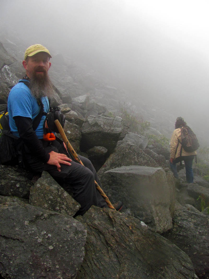
While we were still trying to realize that we were actually there, looking up from the bottom of this massive ocean of rock, we could see the dark clouds building below us and the white fog starting to drape over the top of the mountain above us. We could feel light sprinkles in the air and we feared we were about to get rained on so we made our way down the left side in order to reach the next talus field which we could see below us. We could also see a row of large pine trees way down in the V of the valley below us which looked to be Hemlock. Of course they looked tiny from where we were but, we knew in reality they were going to be rather large trees and I was intrigued by them and could not wait to stand beneath them as it was obvious that`s where we were going to end up eventually and that it would be a special place of some sorts.

Hillbilly Talus Surfing !

Now on the other side we look back across to where we had started. You can see the small edge of talus where we first came out on just other side of the circular area with the growth on it. The fog is beginning to come in over the high mountain top

Larry making his way to the edge and then down to the small cliff

Making my way to the other side above the small cliff area (Photo by John Forbes)

Apparently being on the talus does make one delirious (Photo by John Forbes)

Thick whiteout fog rolling in over the ridge above

Larry at the edge , taking in the view of what we had just came across
Hanging out on the main talus field (Photo by John Forbes)

John trying to capture the moment. This was history in the making

This place is like sex. You have to have a smoke afterwards.

Look at the far edge of the talus field. See that small row of talus just over the narrow band of green growth (near top center of picture) Now think back (or scroll back) tot he first pics I displayed of where we first came out onto that edge of talus. See how big it looked ? Now see how tiny it really is in comparison to the main field of talus !!!!!

This place is so large it is simply not possible to capture it all in one shot

More cool looking rock

There is just something about being on the talus, it makes ya happy happy happy ! This is Larry near the small cliff with the small cave underneath it

Larry checks out the cliff and rock shelter

John sits high above us on the top of the small cliff

The fog continues to come in bring some sprinkles with it.

John and I at the small cliff on the edge of the main talus field (Photo by Larry Jarret)

AT least if the cliff was to fall, I woulda had a picture of it ! (Photo by John Forbes)

Checking out the cliff

Climbing inside the small rock shelter inside the cliff

Small rock shelter in the side of the cliff

Looking up at the main talus field from the small cliff

Looking at the small cliff from just below it

Looking up at the main talus field from the center of the valley below

John setting up for a group shot at the very bottom of the main talus field before we proceed further down the valley to the next talus field coming in on the left. I did not take my larger camera nor did I bring a tripod to which I do regret. I will be going back,,,,

Group shot of us at the base of the main and largest talus field (Photo by John Forbes)
The next field is smaller than the main one on top yet, it is not small by any means. The closer you get the larger it becomes and although it is not as tall it is very wide and I think even steeper than the one we were just on. By the time we got to it we found ourselves in almost whiteout conditions as the fog had completely overtaken the mountain top and it was sprinkling rain ever so lightly making the rocks very slick. Strangely enough each of the talus fields has a different texture of rock and this second field did not seem as slick as the first. We slowly made our way across it in the fog taking our time as it was just as unique and beautiful as the first one.

Edge of the next talus field as we make our way down the valley. The fog thickens and the light rain begins

Carefully making our way across the second talus field on the now wet and very slick rocks in the encroaching fog (Photo by John Forbes)

Following John and Larry through the rain and fog across the bottom edge of the second talus field

The rocks of each talus field seem uniquely different from the one before

Although you can not make it out in the whiteout conditions, this second field of talus is very wide and about half as tall as the main field. You can see many quartz veins in these rocks.

Looking back where we had just came from, the main talus field has already disappeared in the fog but you can see how steep this second talus field is

It is much farther across this second field of stones than we first thought it would be
A very happy John taking a rest at the second talus field

Even through the fog you can see how tall and steep this second talus field is. Some of the rocks seem to defy gravity. Look close and you will see the one I refer to,, it has some curves on its bottom like a ruffles potato chip that seem to be holding it in place !

Larry standing in the center of the second talus field, shrouded in fog, taking it all in,,,,

This second field seemed to keep growing in size as it seemed to go forever as we continued across it

I will have to come back and hopefully get a better picture of this second talus field.

Looking back across the second talus field as we bid her goodbye and make our way farther down the valley
It was farther across it than first appeared and it was definitely steeper than the other main field. Once we got to the other side we had to go down into the bottom of the V where we could see yet another talus field below us, this time on the right side.We crossed over and made our way down the right side to the edge of this new pile of rocks which would be the last talus field of the day. It looked smaller at first but, like the previous one this would not be true, in fact it was ever bit as large as it was and perhaps even wider as it took awhile to get across it. Again, it seems like there were different forms of rock and there was a layer of likens on the top part of this one that I had not seen on either of the others. Larry led the way across the bottom edge of this one while John and I followed, taking pics and marveling in its glory.
There were small remnants of snow in some places

Larry stops to marvel at the next and third talus field we came to. This one is on the opposite of the valley.

As we make our way out on to this new talus field, the way is paved with some fantastic sphagnum moss

it is really good that the talus is here, as you can see the going wold be much tougher if you were not walking across the rocks

There was no shortage of beauty in this third talus field. It did not disappoint

Larry plots our route across the third talus field. Although this one is smaller than the first two, it is still much larger than it appears. it is wide and takes some time to get across.

Coming out on the third talus field (Photo by John Forbes)

Looking up at part of the third talus field. I noticed this one had likens growing on rocks located at the top. The other two fields did not show this

Looking back you can not see the second talus field behind us due to the thick stuff that grows in the gut of the valley. Keep in mind that water is flowing deep underneath all of this

As you can see this third talus field is every bit as steep as the first two
Luckily the rain and fog was short lived and as quick as it had came, it went away and we were once again getting some good views of the valley below us, along with the Dick Creek Valley way down below and further to the main valley where you can see the town of Erwin and the mountains beyond it. The row of hemlock trees was becoming larger and larger in our view and we would soon be down to them once we made our way across this unbelievably wide and last talus field. As we made our way across the bottom of this last field of stones and into the trees below and beyond, it became apparent that the talus was still going only was hidden with thick moss and other types of growth over it. It seems nearly the entire mountain here is basically a big pile of rocks only a lot of it is covered with vegetative growth so it does not stand out like the barren areas do. It is quite fascinating to see it all up close and personal.

Making our way across the third talus field we can see the hemlock trees getting closer and views of the valleys below

Looking down the lower edge of the third and final talus field towards the mystic pine trees below

Zoomed shot of the mysterious pine trees with the clouds lifting and some sun shining in the valley below

John photographs the third talus field. You can see the thick likens that cover the top layer of rocks in this field

Third talus field. I was happy the rain had stopped and the fog had lifted

We took our time going across this talus field slowly making our way along its bottom edge still pondering the row of pine tree Ents standing guard below us

Zoomed shot of the very large pine trees

Larry stands among some of the larger stones at the base of the third talus field looking up in amazement. I am sure no one has stood here in several decades, perhaps longer

Almost to the end of the last talus field, Larry says goodbye to his mistress of stone. It is incredible how the huge boulders just stop at the bottom of the valley. You can`t help but wonder, where did they come from ?

Knowing there would be no more large talus fields after this one, I looked up and said my goodbye as well. I did promise to come back again though !
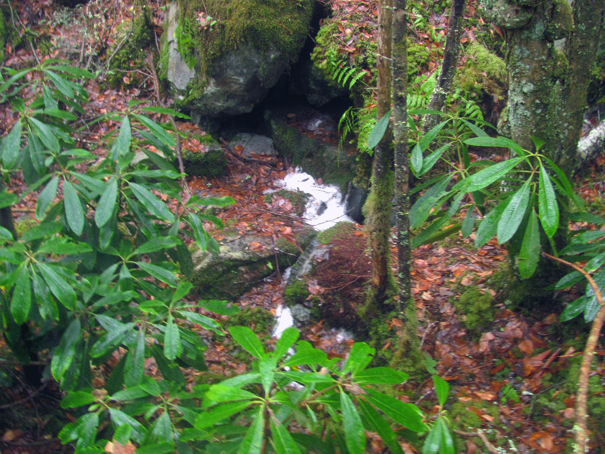
Once we left the last talus field and were in the gut of the valley something very strange and totally unexpected happened. We actually had to go uphill over a small bump to continue going down ! This was quite a surprise given the height we were at and the view looking down had been extremely steep as far as the eye could see. As soon as we topped this out of place rise we then seen the row of pine trees below us. It was quite a spectacular sight to behold but, it would only get better because as soon as we reached them we could hear water gushing and sure enough there it was, an oasis at the foot of the talus fields. Water was coming right out of the ground again below them and right out of the roots of these mighty Hemlock Ents that guard over this rocky sanctuary of beauty. The rocks were the greenest green you have ever laid eyes upon and the many shoots of water coming out below each root all the way across was beyond words. It was actually spiritual and a place where one would expect to see angels meet or at least to see fairies and unicorns. Of course this was the same water we had encountered earlier just before we reached the first talus field. I was regretting not taking my larger camera at this point but, I knew right then that I would be coming back armed with not only my other camera but, other more experienced photographers.

Going into the growth out of the last talus field

This is where the last talus field meets the valley floor

There was actually a small uphill bump we had to climb over before it dropped off sharply down to where the row of pine trees were

After the small hill it dropped of sharply and went down a steep slope to where the pine tree Ents stand guard at the foot of the talus fields

Standing beneath the large pine trees

Straight Creek reappears coming right out of the roots of the mighty trees

The Hillbilly Oasis

Oasis at the foot of the talus fields

The beauty here I can not display because I did not have a decent camera with me

Water coming out of the ground beneath all the talus fields and the huge hemlock pine trees

The amount of water coming out is really surprising

John in a trance at the Hillbilly Oasis

This was truly an amazing place that I am sure not many eyes have ever seen

John taken aback by all the beauty that gushes from every orifice of the Hillbilly Oasis

John proudly stands atop the mossy rocks of the Hillbilly Oasis

It was really hard to leave this place. It was magical.
Standing just above the Oasis looking back at the edge of the last talus field
We spent a lot of time at the Hillbilly Oasis as it was such a special place that we had such a hard time leaving. Eventually though, we had to break away from it and begin what we expected to be a very tough and trail-less descent down the long and steep Straight Creek Valley. It started off just like that, having to crawl through some laurel hells along some very steep slopes making our way high above the creek in hopes of seeing some new waterfalls since we now had a good flow of water to accompany us along our venture. It was not long before it looked somewhat easier on the other side (like it always does!) so we bushwhacked our way down to the creek to cross it. There we found some small falls as we crossed over to reach the right side which ended up being a good choice as the going became easier from that point on.

Leaving the Hillbilly Oasis we begin our descent out the Straight Creek Valley

Straight Creek Valley

Small falls along Straight Creek where we crossed over at

Another shot of the same small falls
The farther we followed that side of the ridge down, the better it seemed to get. Once we reached a open area where there were several large misplaced rocks that we hiked through, the ridge became more and more open and before long it flattened out even more and showed signs of ancient log roads just below us albeit they were grown up and were no longer passable. We could also see and hear several small falls and cascades way down below us as we continued following the valley out. One very interesting find was an old tree that had the largest bark I believe I have ever seen on a tree. I am not sure but, we think it is a Black Gum tree ?

John checking out some large rocks along the right side ridge

Area of large boulders along the right side ridge in the Straight Creek Valley

Following the sharp edge of the right side ridge

Another slightly larger falls along Straight Creek. I had to zoom to get this shot as we did not take the time to climb down to them

More zoom of the small falls
This right side ridge was definitely the best choice to follow

John`s hand on the huge bark
After that we could see the land laying down before us as we entered into the upper end of a huge, almost flat saddle that is at least a mile or more long and just as wide. This would lead eventually down to join the lower Dick Creek Valley but, it is a lot farther than you think and it does take a while to cross. The good thing is that it is unobstructed woods and you can walk upright without anything trying to poke your eyes out. We decided at this point that we better don some orange since it was hunting season. Just after that we came out on a narrow edge and could look down and see a rather nice road down below us. There was what looked like a plastic chair sitting in the middle of it. As we dropped off the steep bank onto a level area, we immediately came to an old moonshine still from long ago. It was very near the creek and the old road with some really ancient jars that seemed larger than quart size, and there was not only a dug up place where the still was obviously built in the ground beside a small bank, as they used to use rock and mud around their base but, there was also remnants of metal that was the actual still. One piece stood out to me as it was the rounded top that fits over the still among other metal from the base that was in the ground, rusted terribly from years of being exposed to the elements. It was quite a find and it was obvious why it was such a good location as it was really far back in the woods away from the main roads and very well hidden yet was very close to a road where the product could be moved out easily enough. We spent some time there fantasizing about how life must have been during that time. I could almost smell the fire and taste the liquor.

Remnants of a very old moonshine still

Old moonshine still remnants

Old jars found near the old moonshine still
We found the road just beyond and crossed the creek there as the old road seemed to dead end just after the creek crossing anyway. There was a really twisted tree that was about as gnarly as any I have seen and yes there was an old plastic chair there in the middle of the road. I found a really nice homemade grill grate nearby too so in recent years this place has been used but, after we started walking out the old road, continuing out the Straight Creek Valley, it soon became apparent that it was very overgrown in places as far as a vehicle is concerned so, it has been a minute since anyone drove in there.

Old twisted tree found at the end of the old road at the creek

Straight Creek just below the old still at the end of the road. Not too far from here this creek disappears back in to the ground.

Another shot of the beautiful Straight Creek

Yet another shot of Straight Creek
We continued walking on that old road that seemed to go on forever. Having hunted this area when I was very young from the old Dick Creek road at the bottom of the valley, I knew the saddle was large but, I never imagined just how far across it actually reached. It took quite a while to walk all of this road and it did not go all the way to Dick Creek but, instead it joined another road that is now the Limestone Cove Trail that goes from Dick Creek to Rocky Branch. Another strange oddity was the fact that not far below the old moonshine still that Straight Creek goes back into the ground ! It simply disappears and never reappears even once you get to Dick Creek road. We did not have the daylight remaining to pursue that and find where it actually goes into the ground at but, since that time Larry has been back and did find the precise location where the water vanishes. Later on this trip when I would cross Dick Creek to get to the private field to get to our vehicles, I was lucky enough to see where some of it comes back out of the ground and enters into Dick Creek right at the creek and just below the road. Straight Creek is a very mysterious and interesting creek.

Following the old road out the Straight Creek Valley
We did take a right and walk a short distance on the LCT road until it crossed the creek and determined that it did keep going, which confirmed our suspicions that it was the new Limestone Cove Trail and after turning around and following it what seemed like another mile to where it reached Dick Creek road, is where the water disappeared at very shortly after that creek crossing. Once we reached the last road, there was a rock painted yellow with LCT which confirmed that was the trail.

Limestone Cove Trail marker (found at the trail head along the main Dick Creek Spur road)
It was nearly dark at that point and we still had a mile or so to walk on the Dick Creek road to get back to our vehicles but, we made pretty good time in doing so. John and I crossed Dick Creek and the private field to reach our cars while Larry used his portable waders to cross the swollen North Indian Creek at the campground and walked down the highway to meet us at about the same time we got there. We took John`s car back to the top of Unaka Mountain to get Larry back to his truck and along the way ended up with a flat tire on the right rear ! Like a Nascar pit crew, the three of us had it changed within a few minutes and we were back on track. Despite the spare tire being very low, we managed to get on to the top of the mountain and also back down to my car. From there Larry headed home and John and I made a beeline for Clarence`s for the post hike grub out. What an incredible day it had been having seen the talus fields finally and it not being the meat-grinder that I had anticipated it to be was surreal. It was not an easy trip and it was packed with danger and adrenaline but, it was an amazing journey and I can not wait to go back there and do it all again. I feel very fortunate to have been one of the few to have stood among the talus on this day as I know for sure no one has in the last several decades if not generations. This is definitely a crown jewel, the creme de la crim, for me. In other words, one of the best achievements and highlights of my hiking career and I am very proud to have accomplished it. It would be days, maybe weeks or months before the excitement of this trip would wear off, if ever. Until next time,,,,,

Post hike grub at Clarence`s Restaurant in Unicoi.
To see more photo`s of the Unaka Mountain Talus Fields, please visit our Photo Gallery.

 My name is 'RAT' and I love the mountains and waterfalls of the East TN. area where I live and I hope you enjoy this blog about my outdoor adventures.


One Comment to “Unaka Talus Fields – 12-3-2014”