


Work Trip on the Appalachian Trail – 10-22-2015
I have been a trail maintainer with Carolina Mtn. Club for over 25 years now. My section lies between Spivey Gap and Little Bald some 5.1 miles of very steep terrain. Due to a frayed rotator cuff on my right shoulder I have been unable to cut the annual growth as I am not supposed to be swinging a sling blade (some calls it a kaiser !). The weekly work crews led by my friend John Whitehouse have been gracious enough to take up the slack for me to which I am thankful. They got it all this year with the exception of the top if Little Bald (aka Big Hairy) so when I got the email from my fellow maintainer Doug Corkhill who does the section next to mine at Big Bald that he was going up on the mountain, I jumped at the chance to go. I try to go with him anytime I can as this makes it easier for me to do the entire section from top down one way as he goes out of his way to pick me up at Spivey Gap and we drive around to the top of Big Bald via the Wolf Laurel access and using a key to the forest service gate. Otherwise I would have to do it the old way of working trail from Spivey Gap to the top of Little Bald and then still have to go back which is double the miles and very strenuous. I can not thank Doug enough for his efforts. On this trip I would be accompanied by my friend and cohort John Forbes. Upon meeting Doug and departing from Spivey Gap around 9:30am, it was already developing into a beautiful day.

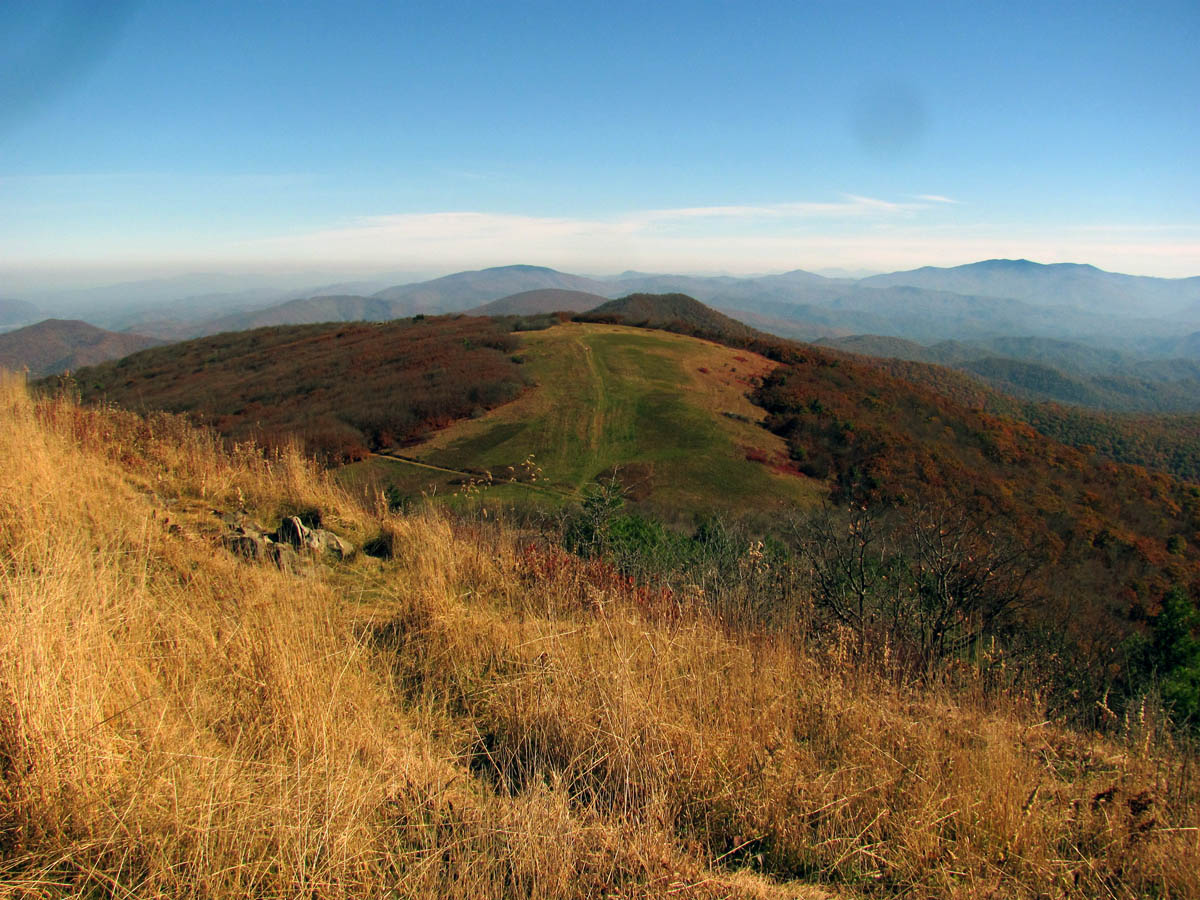
Big Bald as seen from Big Stamp
Since it was such a gorgeous day and because John had never been here before, we took the time to hike up to the summit of Big Bald for the 360 degree views that are breathtaking. We met some long distance section hikers there from Ohio who were very happy to meet us and thank us for our work. We returned the compliment by pointing out and naming some of the significant mountains in the views to be enjoyed there. It was bright and hazy yet, there is really no bad view from there aside from being in total whiteout.
View from one side of Big Bald. There are too many mountains to name but just to name a few, here you are looking over Big Stamp with Little Bald, Flattop, and Unaka Mountains in a line. That is the Roan Highlands prominent to the right in distance and No Business Knob in far left

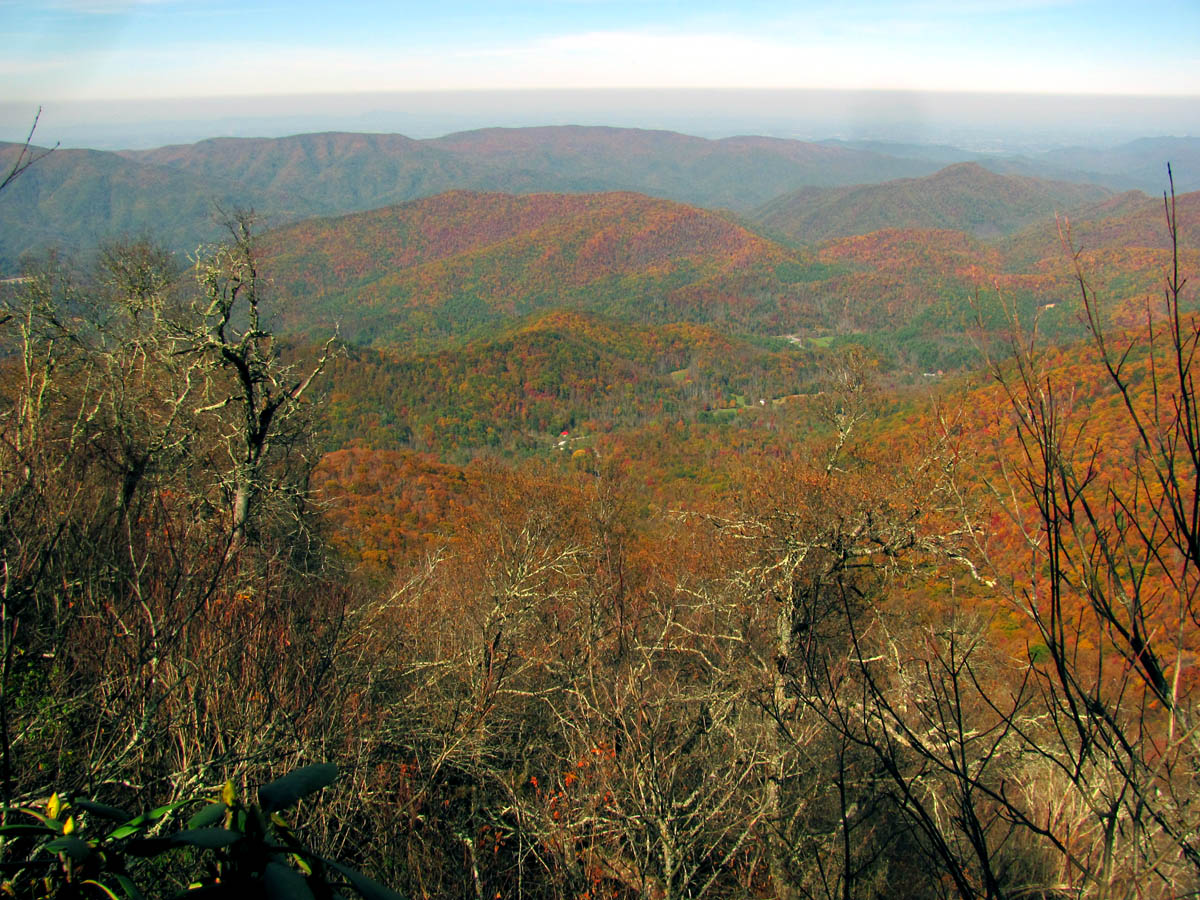
Panning left slightly, here you are seeing Roan Mtn in distance

Looking farther left in the next frame you start to see the Black Mtn Range / Craggies etc,, almost to Mount Mitchell (right)
Next frame to right you can now see Mount Mitchell (Highest point east of Miss) almost straight ahead in the far distance

Next frame to right looking farther into NC towards Southeast

Continuing to pan right looking almost due South into NC

Next frame to right is looking into TN, you can see from Camp Creek Bald (far left in distance) to Frozen Knob (far right) with Coldspring Mtn just off center right. All of Flint Mtn is seen in front of it. You can see Whitehouse Cliffs in Rocky Fork if you know where to look !

Just slightly more right you can now see Rocky Fork/Frozen Knob in the center of the pic

More to the right you can see from where last pic left off just to right of Rocky Fork all the way down the chain to where it meets Johnson City on far right. That would basically be the Rich Mtns, with Buffalo Mtn at very end

Next frame to right you can see where Rich Mtns end and Buffalo Mtn begins with Erwin and Unicoi in the valley along the I-26 corridor. Those towns are seen between Temple Hill (left) and No Business Knob (right) Of course fartherest out in Holston and you can start to see Unaka Mtn again on far right as we complete the 360 degree panorama !

Speaking of panorama`s,,, here is one I call ‘Purple Mountains Majesty’ (Photo by John Forbes)

Zooming a little to show all of Flint Mtn in middle with ColdSpring Mtn in distance. The AT runs over it and the low spot in center of pic is where Jerry Cabin is and that is Round Knob out to left side of pic

Zoomed shot of all of Rocky Fork. I will not call it s State Park because it isn’t one yet and I hope it never is. That is Coldspring Mtn to left and Frozen Knob to right and RF between them. You can easily see Whitehouse Cliffs in this one

Here is a much zoomed pic of Whitehouse Mountain and Cliffs in Rocky Fork

Another shot from the summit. This is looking towards Mt Pisgah

View across summit looking towards Hot Springs NC

View across summit (Camp Cr Bald (left) to Frozen Knob (right) )

Doug and his office view for the day !

Doug and myself enjoying the view from our office (Photo by John Forbes)

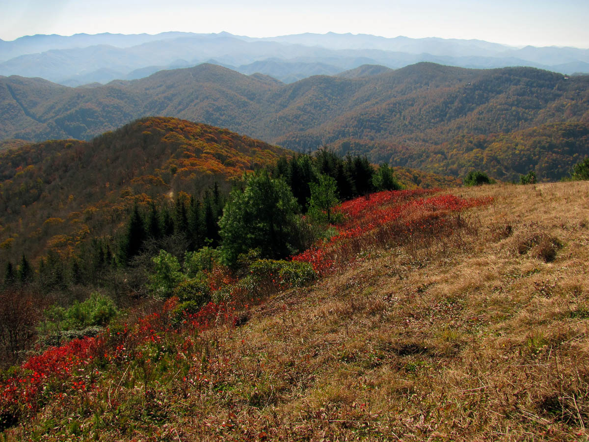
Zooming in on some colors just below the Bald

Fall colors below Big Bald

Zoomed view looking over Big Stamp you can see Little Bald, Flattop and Unaka Mountains

John Forbes instagrams pictures from the summit of Big Bald !

John at teh summit marker on Big Bald (elevation 5,516′)

Just like the smiley face on the summit pole, here is a happy Gnome ! (STOP AND SMELL THE ROSES !)

I particularly like this zoomed shot as you can not only see Erwin and Unicoi along the I26 corridor but in the center of pic there is the Buffalo Mtn chain (closest to interstate) and Cherokee Mtn (behind it) which I live just on the other side of !

Me pointing out various mountains to the hikers (Photo by John Forbes)

Hanging out with the hikers pointing out things and having various discussions. They were very thankful for our information and our trail work. (Photo by John Forbes)

It appears everyone is pointing a different direction ha ha (Photo by John Forbes)
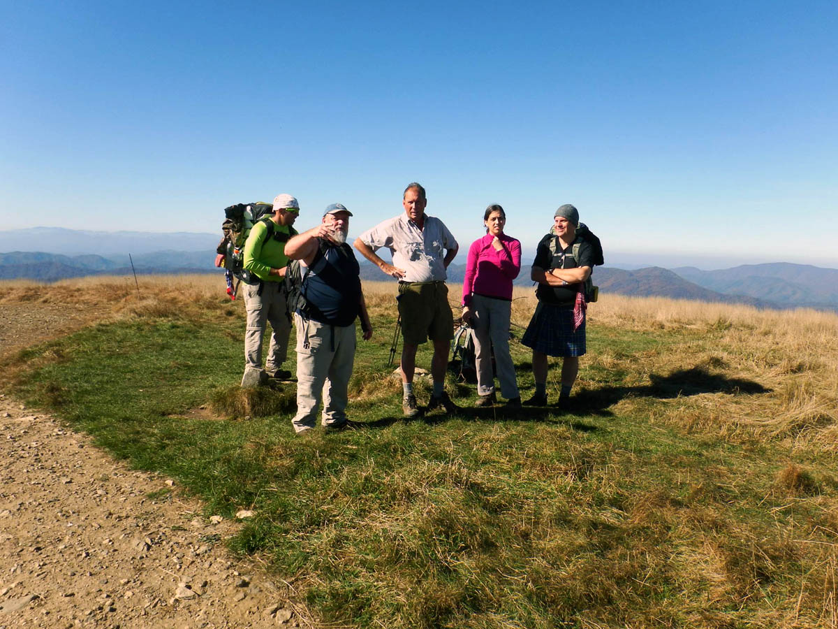
Me and Doug discussing things with the Ohio hikers ! (Photo by John Forbes)
After hanging out there for a while it did come time to get back to the business at hand. After a quick descent we were soon climbing up the hill towards Big Stamp where we met a large group of ‘birders’ which included several young school kids which we took time to speak to and point out some things like Mount Mitchell, the highest mountain east of the Mississippi, etc. They also thanked us for our trail work and we continued along our way.

Following Doug and John off the summit

Part of the trail on Big Bald

Me coming down off Big Bald (Photo by John Forbes)

Doug and I climbing up Big Stamp with Big Bald behind us (Photo by John Forbes)

Climbing Big Stamp

First group of school kids / birders we met on Big Stamp

Other groups of kids being educated on bird banding on top of Big Stamp

Doug and I teaching kids about trail work (Photo by John Forbes)

Me and Doug pointing out some distant mountains to the kids (Photo by John Forbes)

Doug lines up a destination point as he tries to explain to the kids where to look. I hope they can see it because it appears as if I cant ! (Photo by John Forbes)

Signs along the trail advising hikers of the bird banding

Luckily this is not Jurassic World ! I wold hate to think the Raptors were out of their enclosure !

Bright red things growing on Big Stamp with a view of Mt Mitchell in the background

Just one of many nets that are used to catch the birds for banding

Some stuff at the bird banding station

Huge owl on a pole at the edge of the balds that the birders use to scare the birds towards the nets and blinds
Once we passed by the bird banding station and the many nets in the area, we left the bald and entered the treeline where we soon met two friends of ours, Shane and Jason who had hiked up that morning from Spivey Gap on their way to Big Bald and back. That is some serious elevation gain in a short time and from the look on Shane`s face he was feeling it ! We continued on our way towards the shelter as they continued towards the bald. They would not see us on their return trip but, we did hear them as they passed us by on the summit of Little Bald later in the day while we were there on the NC side overlook eating lunch and checking out cool stuff.

John could not resist climbing up into this old gnarly tree ! it was here that we met Shane and Jason

One of my favorite gnarly spooky trees that lives just above the shelter
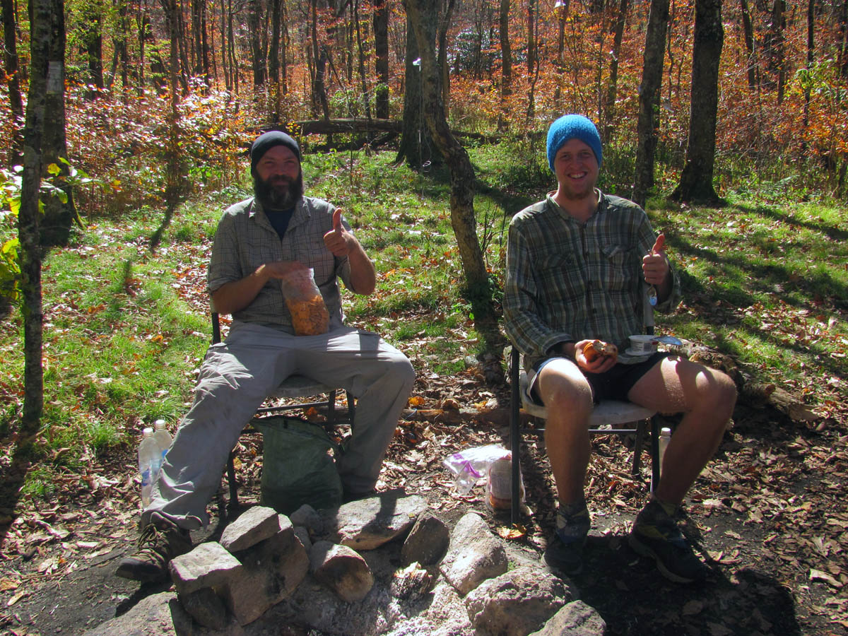
Two happy Southbounders we met at the shelter

Large widow maker tree on Doug’s section on the way to Little Bald. he is lopping some limbs to make it easier to pass under until the saw crews can take it out

A Gnome in a known Gnome habitat

Here John gives some scale to a large rock formation found along the ridge on the way to Little Bald. From the trail on top of the ridge it looks insignificant but, a short walk down the hill reveals it is very large and from a distance it looks like a crashed alien spaceship but, up close it looks like a dolphin head coming out of the ground to me anyways !

Climbing Little Bald aka Big Hairy

Looking up through the colorful trees and a postcard blue sky near the summit of Little Bald
On the Tennessee side of Little Bald`s summit, there is a small overlook that we have been working on to keep the views open from the growth that constantly threatens to overtake it. Our work has paid off as the views from the old gnarly tree there were looking very nice on this day with the Fall colors beginning to show.
View from the TN side of the summit of Little Bald. The red roof you are seeing is near the Spivey Mtn road that we take to get to the trail head. The main mountains seen here are the Rich Mtns (distant left and center) and Temple Hill (right)

Looking slightly more right you can now see No Business Knob (right)

View from Little Bald summit, TN side, That is No Business Knob in center of pic. Beyond it is Buffalo Mountains and Johnson City will be at the right side end of that range. You can see Erwin and Unicoi along the I 26 corridor to the bottom right of that range as well.

Moving slightly more right you now see No Business Knob on the left with Flattop Mtn to the right and Unaka showing behind it (top right)

More right you can now see Roan Mtn at top right

Beautiful colors seen below us

Zoomed shot of some of the colors below us that are starting to show

Fall colors between us and the Rich Mountain range

Zooming in on the valley below. The church along Spivey Mtn road (19W) is seen on the far right
After lunch we said our goodbyes to Doug as he headed back to work on his trail section and enjoy an awesome sunset on Big Bald at the end of his day while we headed down Little Bald to cut some weeds that were left earlier in the season, clean out water bars, remove downed trees and debris, and do some clipping. The trail was in really good shape which made our jobs easier. It was a nice day to be on the mountain and we savored every moment of it as we made our way down the steep descent.

Cutting briers and weeds using a fire rake on Little Bald. Not the usual way but, its the tool I had ! (Photo by John Forbes)

Me digging out a water bar (Photo by John Forbes)

Digging out water bars on Little Bald (Photo by John Forbes)
Once we reached the upper relocation that I helped the Konnarock Crews build in the early 90`s, we took a break at the campsite there. From there it is much easier walking and our next break would be at the famous AT Rock where John would manage to stand on top of the narrow edge of for a classic Gnome pose ! This rock was aptly named for the AT symbol that was painted upon many years ago by the ‘Phantom Blazer’ who used to go out every few years and paint the white blazes on the entire 92 miles of CMC`s section from Davenport Gap and Spivey Gap. I am pretty sure he has passed away since those days and I have always honored his efforts and memory by keeping the AT symbol painted on this rock. On this day I was disappointed to see graffiti written on the mark itself saying how the mark was graffiti and should not be there. I was somewhat angered by this person as apparently they do not realize they are hiking on a ‘marked trail’ and it is not only common to see white blazes and AT symbols marking the route, but, it is also allowed and therefor not considered graffiti in this case. I will take pleasure painting over their ignorance when I repaint the blazes next year.

Me on the upper relocation (Photo by John Forbes)

John doing his Gnome pose on a less than 2 inch edge of the AT Rock

It is hard enough to climb up there but balancing on the toes of one foot is impressive !

All this did was piss me off.
After a short break there we continued down the trail, digging out a few more water bars until our next stop which would be Whistling Gap. I have spent many nights camped there for a week at a time with the Konnarock Crews while doing major trail construction projects. I was feeling the miles at this point and dreading the now uphill part of the journey as we would have to climb up the hill to get to High Rocks and then two more miles of downhill.

Me digging out a waterbar just below the AT Rock (Photo by John Forbes)

Me cleaning out the bars (Photo by John Forbes)

Rock water bar after being dug out some
We definitely took the time to climb the steep blue blazed side trail to the summit of High Rocks as that is not to be missed for any reason (unless of course it is lightning !) We spent an ample amount of time on top of the massive rock monolith to the point where John even fell asleep in a Gnome sized crack along its high vertical edge.

High Rocks Sign

Fall color on High Rocks

A happy Gnome poses on top of High Rocks. its a bout a 40 to 50 foot vertical drop off just to his right !

View from High Rocks. This is looking towards the Rich Mountains in the distance

Me chilling out on High Rocks (Photo by John Forbes)

John actually took a nap while lying in this comfortable crack right on the highest edge of High Rocks Cliff !

Flattop Mountain as seen from High Rocks

John is asleep on the cliffs edge. You can see Little Bald in the top left where we had just came down from.

The trees around High Rocks are about 60 feet high or higher

The RATman having a good rest break on top of High Rocks (Photo by John Forbes)
The sun was setting but, we would not be able to stay for its finale which is usually not that good from there anyway due to Little Bald blocking it out before it completes its destiny. We were also feeling very hungry and still had almost two miles to go which would put us back at the car just at dark if we were lucky. I did not show John the shortcut off the backside as I wanted him to experience the base of the cliffs and to see the rock steps that took me years to build up the steep trail there ! Once we reached the base and upper end of the cliff, I would show John my personal climbing wall which he eagerly climbed to the top and back down. It is not the hardest wall to climb yet not the easiest either, especially the ‘and back’ part because you have to come off the high cliff backwards and feel for the first and very narrow foot hold in a blind fashion. This of course was fuel for the Gnomes soul and I could tell he enjoyed this challenge immensely.

John climbs the upper end of High Rocks from its base

John climbs High Rocks from its base

Almost there !

Success !

Coming back down is tougher at first as you have to come off the cliff top backwards and find the first toehold blind by feel only

Continuing the climb down
We made fairly quick work of rest of the trail down once we got off the steep part from High Rocks as there is a lower relocation that we finished in 1993 that although added nearly a mile to the distance, makes for much easier walking. I gave John a brief history lesson of the area from my 30 years of experience there and before long we were back at the car.

Me working on cleaning out a water bar (Photo by John Forbes)

John leads the way down the lower relocation trail

I am making better time coming down the new relo (lower) (Photo by John Forbes)

it was not pitch dark by the time we neared the car but the moon was out !
Tired, sweaty, smelly, and feeling fulfilled, it felt good to be sitting and on our way to Clarence`s in the small town of Unicoi where we graciously enjoyed the post hike grub out before the rest of the ride home. What a grand day it had been on the mountain and I was thankful that I had John along for the help and the company. The trail section should be good now until the next Spring walk through. Until next time,,,,,

My meal of an open faces roast beef sandwich with mashed potatoes and gravy with mushrooms added !

John opted to get breakfast

 My name is 'RAT' and I love the mountains and waterfalls of the East TN. area where I live and I hope you enjoy this blog about my outdoor adventures.


Leave a Comment