Since it had been awhile since my last trip to the mountains (11-16-2013), I needed to get a quick fix but, it was already 3pm so it had to be somewhere close to home. For this reason I decided to go to Clarks Creeks and hike up Sill Branch to the Lower Falls to get some exercise and take some pics of those falls and some of the other smaller ones in the vicinity. It was about 3:30pm when I left the car and began my hike up the Sill Branch hollow. There was still snow on the ground and the breeze blowing out of the valley was chilly but, it felt good to be in the woods. I met two friendly older ladies who were on their way out and we conversed for a spell about waterfalls as it seems they were from Sevierville and were tired of hiking in and around the Smokies and were venturing further out to see new things. They asked me about some huge waterfall called Mill Creek Shoals and for once it was a falls I had not heard of. We have a very small falls on Mill Creek over on some private property near Erwin but nothing large by that name that I know of. I let them know about my website and welcomed them to contact me anytime to help them find lots of falls in the area.
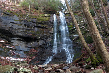
Lower Sill Branch Falls
(more…)
Posted on 5 December '13 by RAT, under RATtreks. No Comments.
These waterfalls have been on ‘the list’ for quite awhile now but, somehow I never seemed to get around to going there. I suppose it could be because they are close by and only a one mile hike to get to them and we always seemed to have bigger fish to fry but, on this day I got up too late to go see any ‘bigger fish’ and knew I would be lucky to have time to reach these falls and get out by dark so it was time to mark this one off ‘the list’. I reached the gated forest service road around 3:30pm and it only took me about 20 minutes to hike the one mile to the falls.
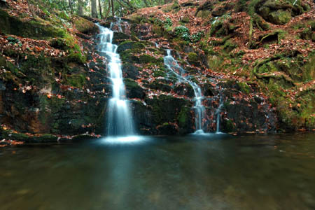
Martin Creek Falls
(more…)
Posted on 19 November '13 by RAT, under RATtreks. 1 Comment.
The colors were not as good in most areas around here this year and I was unable to get out to see them at precisely the right times anyway so, getting any good photographs did not happen. We did take a trip to the Blue Ridge Parkway but, the colors were just not in peak plus the sun was intensely bright. I have no fancy cameras with filters for that so no way to get any good shots under those conditions. There were huge crowds of people there which created bumper to bumper traffic with nowhere to park. People walking everywhere running out in front of you and with the sun in everyone`s eyes it was a dangerous situation. I was on edge the entire time. It was just an unpleasant experience for me but, regardless, here are a few pics from that trip:

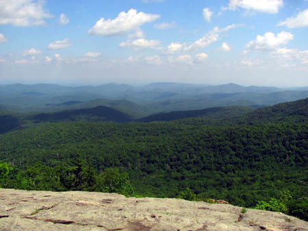
Looking up at Rough Ridge
(more…)
Posted on 10 November '13 by RAT, under RATtreks. No Comments.
I joined my friends Dave and Lou for a hike in what is called the ‘Graveyard Fields’ which is located off the Blue Ridge Parkway around milepost 418. This is a very popular spot so expect crowds anytime. You’ll pass through alpine-like meadows, stands of Mountain Laurel and Rhododendron, and young northern hardwood forests. If you like red colors in the Fall, this is the place to be ! Although the colors were not yet in their peak, it was still very nice and I am glad I went on this trip as it turns out I was only able to get in one more trip to see the leaves and they were already past peak during the only time I could go. This is an easy hike through a unique and beautiful area and it does have two main waterfalls on Yellowstone Creek and a third if you are the more adventurous type. The mountain was shrouded in fog and clouds as we drove in to the parkway that morning but it soon cleared off to be a sunny day. We chose to go to the Upper Falls first.
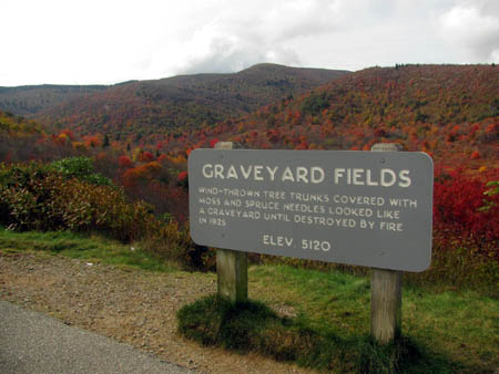
Graveyard Fields
(more…)
Posted on 8 November '13 by RAT, under RATtreks. No Comments.
This years annual birthday hike was a spur of the moment one as there almost wasn`t one due to a situation at my job. Thankfully it worked out that I was able to go for a week but, it left little time for planning anything elaborate. For this reason my friend Bol’Dar and I decided to do something close by with easy logistics. I really did not want to do any AT sections but it was better than not going at all as any time in the woods is better than anytime in the city. The choice was to go from Sams Gap to Erwin. A mere 25 miles or so but, with my being out of shape along with my desire to be able to take my time and do low miles in order to enjoy every day of my well earned vacation, this would be perfect. Besides, it has been a few years since I hiked from Sams Gap to Big Bald and from Spivey Gap to Erwin plus it would give me a chance to enjoy all the hard work I have done on my trail section this year between Little Bald and Spivey Gap. We dropped my car at the parking area on the other side of the Nolichuckey River bridge at Chestoa, and my girlfriend Linda drove us up to Sams Gap where the adventure would begin.
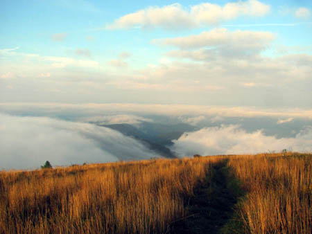
Above the clouds on Big Bald
(more…)
Posted on 4 November '13 by RAT, under RATtreks. No Comments.
It had been two weeks since my last work trip to my section of the Appalachian Trail to cut the annual growth when I was finally able to get back to finish the job. The last trip was an all day rain filled adventure which left us soaked but on this trip it would be quite the opposite as it was a beautiful sunny day with postcard blue skies and warm temps. On this trip my friend Sam Kilby and my girlfriend Linda came along to help me out as we finished up cutting from Spivey Gap to High Rocks and back. The weeds had grown some in the two weeks but they were no where near as tall and thick as they were on the higher parts of the section. Also, the lower part is more under the trees with fewer sunny, trouble spots. It was actually an easy day for a change and we had a good hike up to High Rocks and back and Same surprised us with grilled bbq chicken breasts for lunch ! We did encounter a black hornet nest hanging low in a small tree right next to the trail which had been damaged by something, so we made sure to tread lightly but quickly by them. We hung out on High Rocks for a long lunch break before hiking back down to the car to enjoy the fruits of our labor on the way back. I hope to get back at least one more time this year to clear out the water-bars after all the leaves fall.

View from High Rocks looking towards No Business Knob
(more…)
Posted on 24 October '13 by RAT, under RATtreks. No Comments.
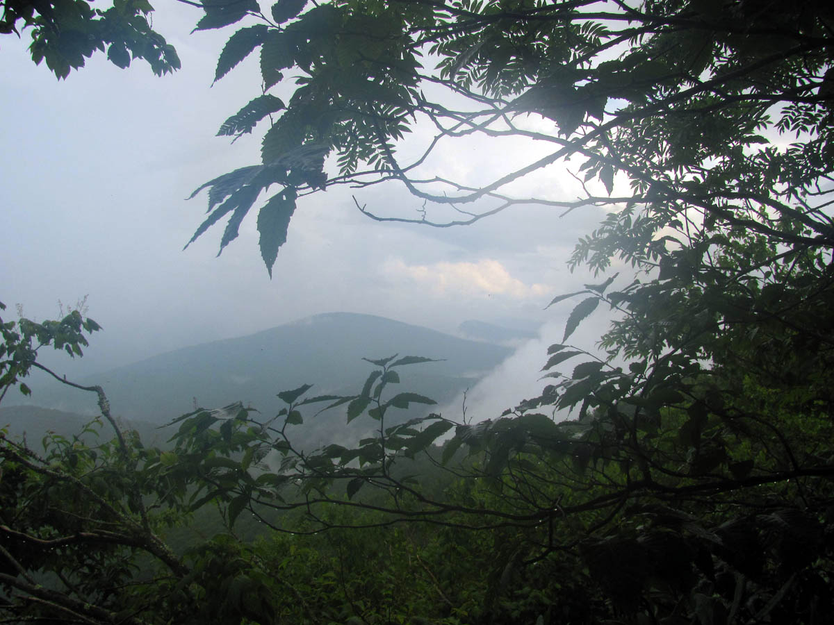
I was late this year in getting around to cutting the annual growth of my section of the Appalachian Trail. The forecast was not good but I have to go when my friend Doug Corkhill goes as he is gracious enough to drive out of his way to pick me up at my trail head (Spivey Gap) and ride with him to the top of Big Bald where his section begins to enable me to walk downhill and work my entire section one way. When we arrived on Big Bald it was already sprinkling light rain. This is never a good sign and even worse for Doug who was hoping to use his lawn mower to cut across the bald towards the shelter. The growth was jungle like since it had rained so much already this year and us getting a late start in the year also did not help things. The best part was that I had ample amount of helpers on this trip as my old friend Sam Kilby came and brought his weed eater, along with my son Tyler and my daughters boyfriend Mitch who were both using swing blades like myself. I did not take many pictures as it was fogged in the entire time and after we started our descent of Little Bald the thunder and lightning and heavy rains started. It rained on us almost the entire time. It was the hardest rain I have ever hiked in and keep in mind that I hiked North from Springer Mountain Georgia in 1991 and it rained for 12 of the 14 days and I was wetter on this work trip than I was the entire time in Georgia ! We did not let the extremely heavy rain defy us as we came to cut weeds and that`s exactly what we did, but it was a long hard and very wet day. I can not thank Sam enough because his weed eater really made a huge difference in getting as far as we did. We cut all the way to High Rocks (about 4 miles of trail) in the non stop pouring down rain with loud thunder and violent lightning the whole time. The trail was like a creek and was white capping over my boots pouring right down into them. I have never seen so much water on a trail and I have hiked in rain for over 30 years ! I was glad when it was finally over and we were back to the car but even happier that the weeds and growth was cut and all I would have to do is come back to finish from High Rocks to Spivey Gap hopefully in the next week or two.

Our view from the TN side of Little Bald (looking towards Flattop Mtn.)
(more…)
Posted on 24 October '13 by RAT, under RATtreks. No Comments.
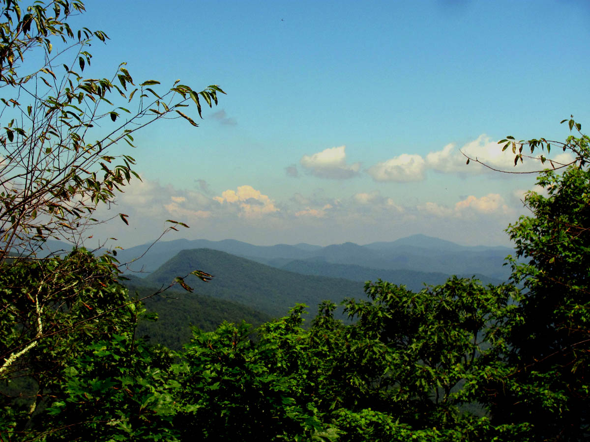
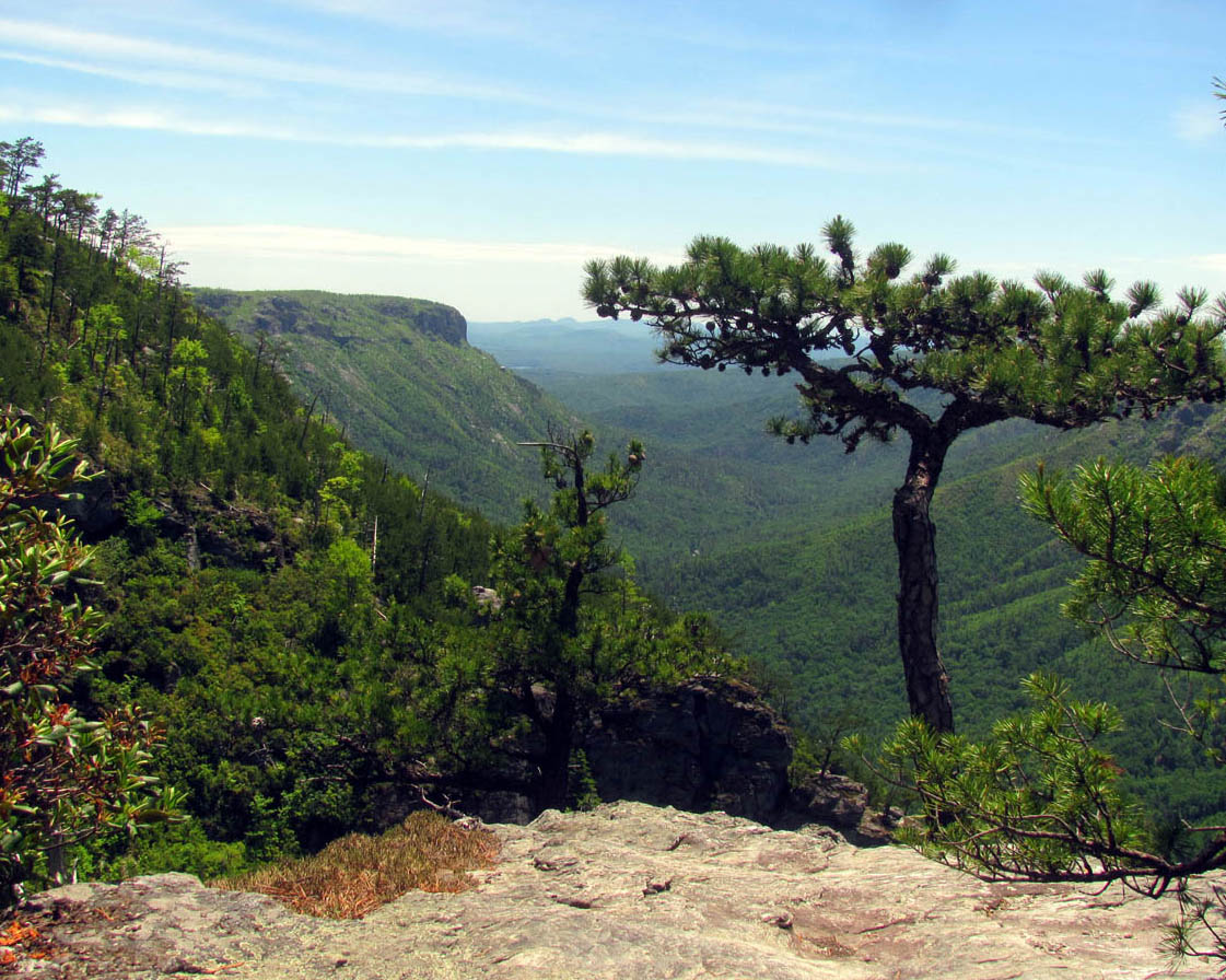
I recently reconnected with an old friend whom I have not seen in over 20 years. It was good to see my long lost hiking buddy, Sam Kilby who was an original member of the Rat Patrol Hiking Club back in the good ole days. We celebrated by doing a 3 day hike and I was given the task of choosing the location. The only criteria I was given was that it had to be somewhere that Sam had not been before. Since we did A LOT of hiking back in the old days, mostly in TN, I chose to do a section of the Mountains to Sea Trail in North Carolina. I chose part of a section that my friend Bol’Dar and I had hiked last year on my annual birthday hike of 2012. Sam and myself started on a Friday at Beacon Heights along the Blue Ridge Parkway and the plan was to come out on Sunday just beyond Huntfish Falls on FR464 (Pineola Rd). It was a beautiful sunny day with a postcard blue sky with fluffy clouds and there was no chance of rain for the week so we had a great time catching up on the past 20+ years while enjoying something we both love doing which is backpacking through the wilderness. Our first stop was the two rocky overlooks on Beacon Heights.
View from our starting point, Beacon Heights
(more…)
Posted on 24 October '13 by RAT, under RATtreks. No Comments.
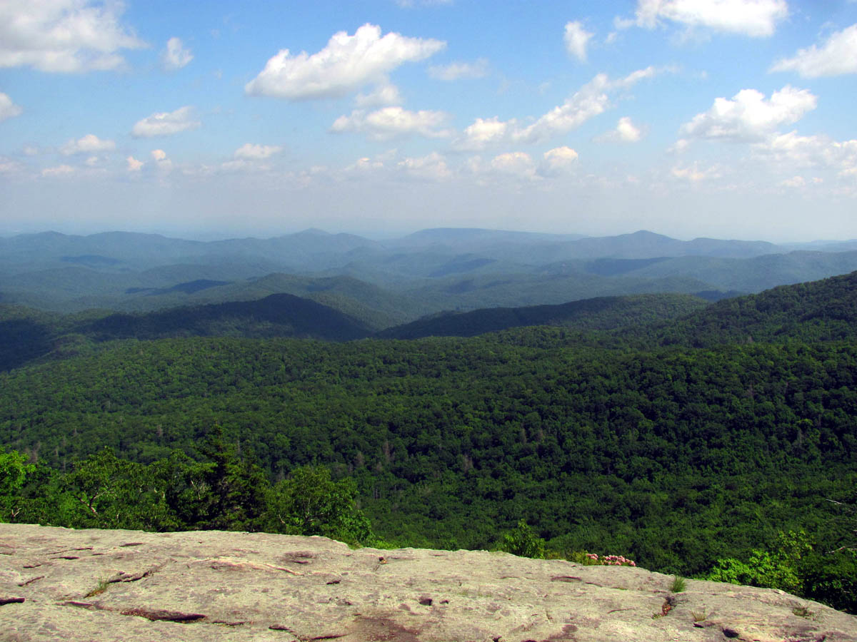
After getting home from Trail Days, I finally got an opportunity to do some hiking in the Linville Gorge also known as the Grand Canyon of the East. The Cherokee Indians called it “Eseeoh,” meaning a river of many cliffs. Today the Linville Gorge is named after explorer William Linville and his son, John, who were killed by Cherokees in the gorge in 1766. This is a place I have been wanting to explore for quite some time now so, when I was invited to join the Gorge Rat’s (a group formed and dedicated to the promotion and preservation of the gorge) I jumped at the chance! I had a gig on Friday night so it would be Saturday morning before I could make it to the Gorge Rat`s camp at the Hawksbill Trail head. They gather together here each year in the Spring and Fall. I was welcomed in and felt right at home with these fellow rats.
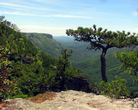
Looking across the lower end of the gorge towards Shortoff Mountain from a rocky overlook beside the Amphitheatre
(more…)
Posted on 22 October '13 by RAT, under RATtreks. 1 Comment.
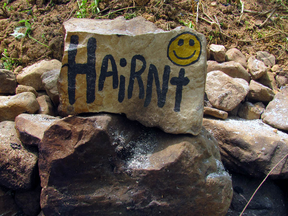
Despite the absence of some of our dearest hiker trash family, and nearly being killed during the Hiker Parade, this years Trail Daze was still a lot of fun. It is much like a huge family reunion where we only get to see many of our friends once a year. Thanks to the modern age of social media we are able to keep in touch a lot better than it was in the many years prior but, nothing takes the place of getting to hang out and have fun together at Hairntville.
The weather did not cooperate this year as we did have a lot of rain, so much in fact that it made it tough to get the vehicles out of the upper field where this years camping area was moved to. There was no choice but to move it there as the lower yard was way too wet a week before the event from weeks of rain. We had a great time up until the Hiker Parade on Sat, where my daughter, her boyfriend, her dog, and myself were hit first from behind by an out of control Cadillac driven by an older guy who suffered from a sugar coma. After striking us and a parked car, he went on to mow down dozens of other hikers in the parade. My daughter nearly went under the car but, despite many injuries no one was seriously hurt or killed which was miraculous. The emergency response people were phenomenal in their handling of the crisis. What better place to have an accident than where dozens of emergency personnel were close by ! Literally within seconds they were on scene and helping the many who were injured. Five helicopters were called in along with several ambulances and within 20 minutes all the injured were in route to various hospitals including ourselves. I can not praise or thank them enough for their excellence that day.
It took a long time for the shock of that traumatic adventure to wear off but we managed to not let it ruin our good times back at Hairntville as we were all thankful to still be able to sit around the fire, eat good food , drink some beer, play guitars, and enjoy the company of our closest hiker trash friends. I am already looking forward to next year. To see the complete collection of photo`s from this years festivities, please visit the Photo Gallery here.

Hairnt Stone at the Level 2 Fire Pit at Trail Days 2013
Posted on 18 October '13 by RAT, under RATtreks. No Comments.


 My name is 'RAT' and I love the mountains and waterfalls of the East TN. area where I live and I hope you enjoy this blog about my outdoor adventures.


