My waterfall crazy friend Dave Aldridge has asked me to take him to a few of the more difficult to get to waterfall locations in this area ever since I have known him.These include such places as Buckeye Falls (both the base and from Chigger Ridge), Josiah, and Lilybeth Falls (just to name a few). We did finally get to Chigger Ridge but it was not until recently that we succeeded in getting him through the Waterfall Tour without any mishaps. If you are not already aware of what falls the Waterfall Tour includes, it takes you down all of the following: Lilybeth Falls, Devil`s Slide Falls, Josiah Falls, and Pine Ridge Falls. Getting to and climbing down each of these falls is not an easy task and it is only recommended for the most experienced off trail hikers especially since the old road into Devils Fork is completely devastated and we had to find a new way in. It is a shorter route but, MUCH steeper. First one has to get to the top of Rich Mountain to get to the new route down which involves some climbing no matter how you get there. We started out in Sill Branch which is a two mile hike UPHILL to the old road (the last part of which is very steep) which will then lead you out to FR190. We did encounter a mama bear and her cub while photographing a small falls there but I was unable to get a pic of them. (Bol’Dar got one and I have included it below) From FR190 it is extreme downhill the rest of the way to reach the Devil Fork Valley. Dave did good on the steep climb up the South Fork of Sill Branch but, was very happy to finally reach the level ground of the old road.
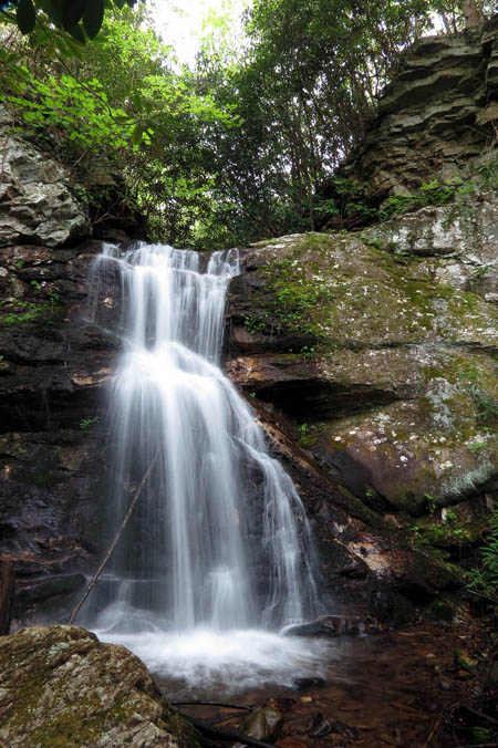
Lilybeth Falls
(more…)
Posted on 17 October '13 by RAT, under RATtreks. No Comments.
Despite constant rain on Saturday and Sunday, the 22nd Annual Brown Gap Hiker`s Feast was a huge success. We had large numbers of hikers, some of which stayed all weekend and even thought Friday and Friday night was beautiful, the cold rain that we all endured for the rest of the weekend made the hikers appreciate our Trail Magic even more.
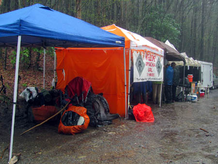
Brown Gap
(more…)
Posted on 7 May '13 by RAT, under RATtreks. No Comments.
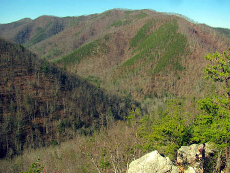
My annual early Spring inspection hike for my section of the AT was a bit later this year due to the Winter weather conditions that did not seem to want to go away as we actually had some snow this year. As you will see in the pics there was still some snow in the higher elevations but this was the first decent day we had that we could get up to the mountain to check things out and get some cleanup done. When I say ‘we’ I mean my friend and fellow maintainer Doug Corkhill who is nice enough to drive several miles out of his way to pick me up at my trail head which is Spivey Gap, in order to take me with him to the top of Big Bald where his section begins. This allows me the luxury of doing my section one way from the top down with the only sacrifice being hiking an additional 2 miles from Big Bald to get to the top of Little Bald (Big Harry) where my section starts. Since I am not as young and spry as I used to be, this helps me out tremendously not having to start at the bottom and hike the super steep 5+ miles to the top of Little Bald only to have to hike it all back out although these days, going down is just as painful if not more so. It was a beautiful morning and although a bit chilly, it was a great day to be on the mountain. It is always a pleasure to be on Big Bald. I have been asked why do I continue to do this after 22+ years knowing how much I usually hurt for a few days afterwards, to which I can only reply, because it gives me great pleasure and who would not want to work in such a beautiful setting? Although it does not pay any money and actually cost me plenty to do it, the rewards I get from it are more than any amount of money can buy. Just look at the following pics and tell me who else has an office with this kind of view ?

View looking into NC towards Mt. Mitchell from Big Bald
(more…)
Posted on 7 May '13 by RAT, under RATtreks. No Comments.
Ever since my last trip to Camp Creek Falls in Greene County, I had wanted to find the Camp Creek Trail to see if it still existed. Since it is hard to find at the bottom due to it beginning on private property, I thought maybe it would be a good idea if we could locate it from the top of Green Mountain. We had been wanting to explore that area anyway as it has been many years since we left any bootprints there. My friend Bol’Dar and I left Hairnt Quarters after 10am getting our usual late start and took the fairly long drive around to Viking Mountain Road which leads up to Viking Mountain / Jones Meadows / Camp Creek Bald where we planned to park at the gate to a forest road that is labeled as ‘Green Mountain Trail’. This is located about halfway up just before Low Gap in the sharp switchback of the road but we could not make it to this point due to the snow and ice covered road so we ended up parking and walking an extra mile to get there. That mile is mostly uphill but it was a good warmer upper for a chilly morning. From the gate it was mostly level for about two miles over to the Kennedy Cabin area. It is important to know that there is a a lot of trail and road intersections to be encountered here and many are not on any maps so, you will need a good sense of direction and some knowledge of the area to negotiate these successfully. Following the old forest road, the first major intersection you will come to is where the Bullen Hollow trail comes in from Low Gap. If you go off the main road and walk up to that intersection from the split, you will see where FR358 goes on the other side of the ridge and down towards Bullen Hollow and you will have views of Viking Mountain and Blackstack Cliffs from this point. There was a few inches of snow mostly on the shaded North slopes but it was not deep enough to make hiking difficult and actually gave some contrast to the mountain views to make things more visible.
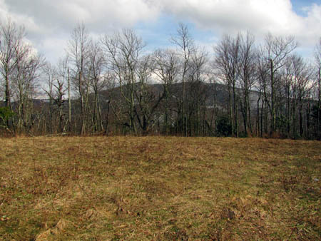
View of Viking Mountain from the grassy fields near Kennedy Cabin area
(more…)
Posted on 19 April '13 by RAT, under RATtreks. 1 Comment.
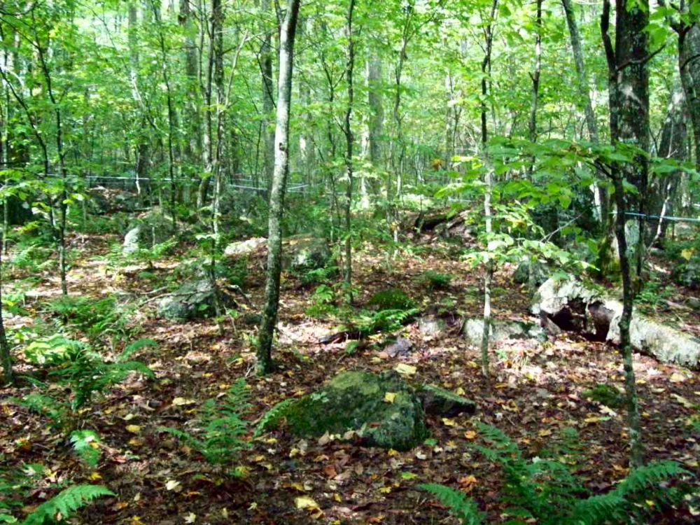
For years I have heard about the ‘Land of the Waterfalls’ in Transylvania County of North Carolina (called this due to some 250 different waterfalls located there), some of them are located in the DuPont State Forest. It is also called ‘Home of the White Squirrel‘ (as they actually do have white squirrels there !) and I finally got to take my first trip there on Wednesday, March 27, 2013. My waterfall crazy friend Dave Aldridge invited me along on an exploration trip he had planned to find an unnamed and unlisted waterfall within the DuPont State Forest that he had found by looking at a satellite view of the area. He had discovered a way down to the top of them the week before, but was unable to get down to the bottom of them so it was our quest to find a way there. Dave knew that these unknown falls were just above a very well known and listed falls called Wintergreen Falls so we took what we thought would be an easier route to those falls and then looked for a passable route to get upstream to the falls we were searching for. Having seen an old road trail on the map, we easily found that and parked at a locked gate there and proceeded down this nice road trail towards the Wintergreen Falls. It is about a mile and a half to these falls by this route. There is a short rock hop to reach them. They are only about 20 feet high so they are the least impressive falls within the park but they are nice and besides, we were in search of a much larger one upstream from there.
Wintergreen Falls (Photo by Dave Aldridge)
(more…)
Posted on 5 April '13 by RAT, under RATtreks. No Comments.
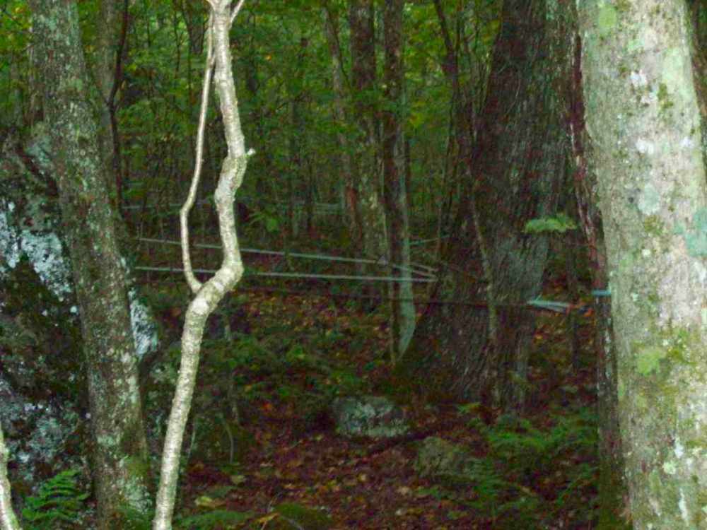
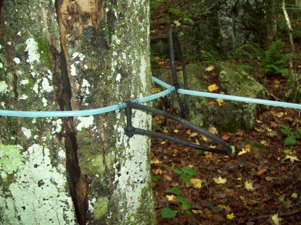
I recently discovered the answer to a question I had about some strange tubing that was attached to several trees and strung out like an alien spiderweb that we encountered on my annual birthday hike back in 2009. Seems at that time no one knew what I was talking about but recently I learned that in the Whitetop Virginia area they use this gravity fed method to collect sap from the many Maple trees found there which drains down the mountain to a catch bin where it is collected and taken to a sugar house where it is then placed into stainless steel containers to be cooked down to make Maple Syrup. The days of using the old tap and bucket method have been replaced by this new high tech way. The local firehouse on Whitetop does this to raise money. I am told it takes 50 gallons of this liquid to make 1 gallon of syrup. I am going to buy a bottle of it this year as they sell it at the end of March each year and I am happy to finally know the reason for the strange tubing in the trees ! As I understand it, they have an annual Maple Festival to celebrate this making of the syrup. It seems the flowing of the sap is triggered by the cold nights and warm days during this time of year which makes it the best time to collect the sap needed to make this wonderful treat. The Mount Rogers Volunteer Fire Department Maple Syrup Festival is the last weekend in March. This year the 24th and 25th.

Strange tubing we seen in the woods after crossing at Elk Garden on our ascent of Whitetop Mountain in Sept. 2009
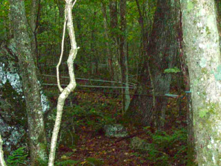
More of the tubing like a strange alien spiderweb

Close up of the tubing attached to the tree.
Posted on 27 March '13 by RAT, under RATtreks. No Comments.
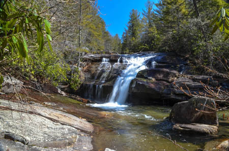
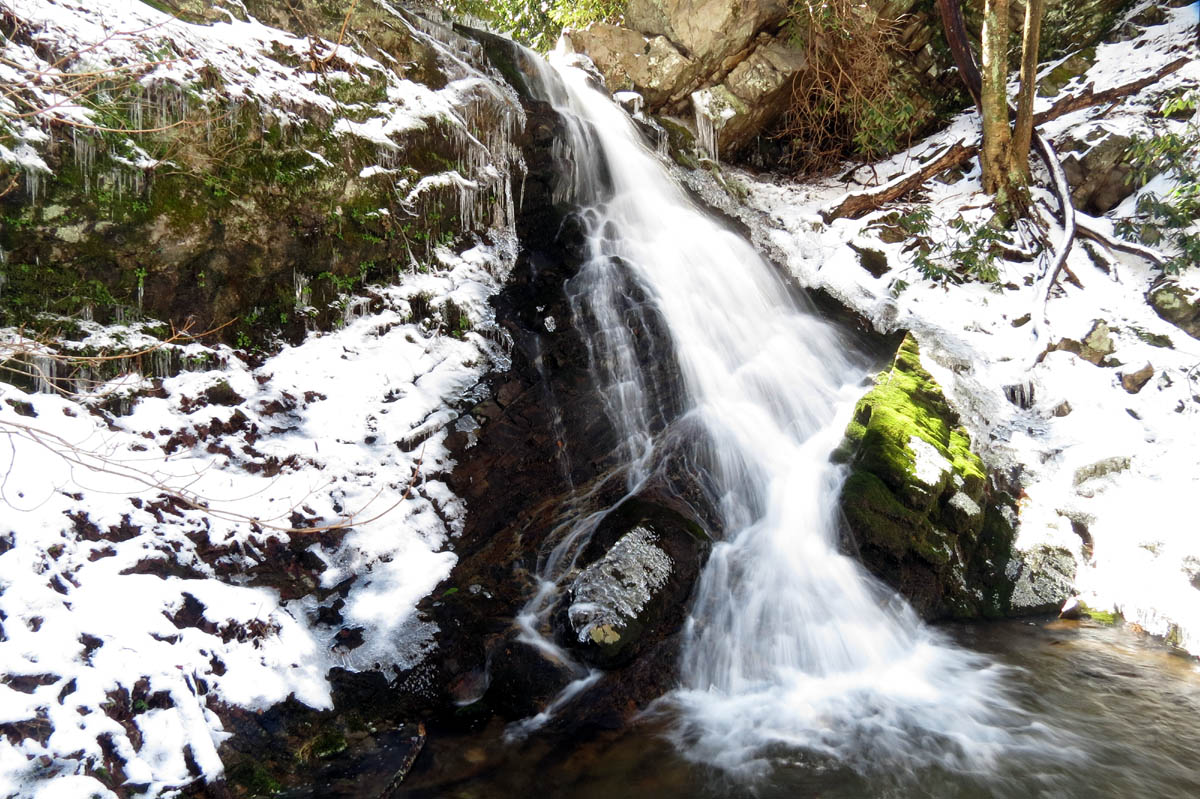
There was still deep snow in the upper elevations but with a forecast of 60 degrees and sunshine it was decided that we would attempt a hike to somewhere in the lower elevations. The water levels were up so the destination of Squibb Creek Falls was chosen. It was a cold morning when my friend Bol’Dar and myself left Hairnt-Quarters around 9:30am but the sun was up and quickly warming things up. I recalled my last trip to these falls in early Feb. of 2010 when my son Tyler and I ended up in some very cold temperatures with lots of ice and snow barely making it back before dark due to a late start. The trail was in rough shape then due to several downed trees and deep snow. I was hoping that we did not have a repeat of that.
Squibb Creek Falls
(more…)
Posted on 27 March '13 by RAT, under RATtreks. 1 Comment.
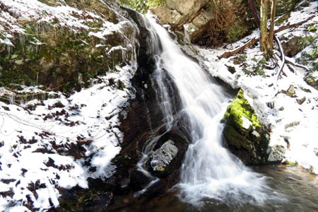
The Camp Creek Falls has been on my list for quite some time now and I finally got around to making the trip to find them on Valentines Day. My friend Dave had already been there once before a couple years ago and knew the way so I asked him to show me. He is also good at getting permission to cross private property which was required for this particular route we would take to reach the falls however, we were instructed by the property owner that we should not ask again that we should find an alternative route in the future. I had invited Bol’Dar to go with us on this adventure but he was unable to go so Dave and I left Hairnt-Quarters around 9am on a near freezing, frosty morning and arrived at the Baptist Church Camp (The Oaks Retreat) by 10am. After gaining permission to park there we proceeded to walk up the gravel road which eventually becomes a driveway for the private property at the end of the road, we were approached by several large dogs barking loudly and they were definitely on the defensive. We were quickly greeted by the owners grandson who was also defensive and very interested in our business there and asked if we had permission. Dave worked his magic and we were granted access to the property in order to cross and get to the forest service land which lies directly behind the house there. The guy was nice enough after learning we only wanted to see the falls but upon our return did ask that we not come back across his property again in the future to find another way to the falls. We do respect the rights of all property owners and always get permission if possible before crossing any private property because not only is it the right thing to do morally, but is also the legal thing to do. You must also take into consideration the fact that many property owners have blocked all access to so many waterfalls due to people who did not respect the property owners rights by trespassing and others have also trashed some really nice places, not to mention ignoring safety and getting seriously injured or even falling to their deaths resulting in many falls now being off limits to everyone. So, please get permission and always be careful and leave the area the same or better than you found it.

Camp Creek Falls (231 feet)
(more…)
Posted on 27 February '13 by RAT, under RATtreks. 1 Comment.
It had already been 10 days since my last hiking adventure, mainly due to the weather so, I was more than ready for a hike somewhere. The weather forecasters were promising a sunny day with near 50 degree temps on Saturday, Feb. 9, 2013 after a cold start in the low 20’s so I decided I was gonna take advantage of it and go hiking somewhere since who knows how long it would be before the next chance would come along. Also our friend ‘Dan-O the Man-O‘ had informed me that he was available for a hike on that day along with my friend Bol’Dar who also said he would go along on this adventure. Our first choice was to be a long uphill hike to the Buzzard Rock Overlook but Dan-O needed to get back by 4ish pm so we knew that was not possible which prompted us to change our plans to go to the Sill Branch Overlook aka The MonkeyHead Rocks. Since that is a short hike and due to the water levels being decent, we chose to lengthen the hike by going to the Upper Sill Branch Falls. That is quite a hike within itself and to prevent having to backtrack down from the Overlook the way we came and starting over, we decided we would take a shortcut straight down the incredibly steep ridge directly into the Sill Branch Valley ! This is an extreme off trail descent and not for the faint of heart and is only recommended for seasoned extreme hikers. We left Hairnt-Quarters around 9am and were leaving the trail-head at Sill Branch by 9:30am.
View from the Sill Branch Overlook (looking at Sampson Mountain)
(more…)
Posted on 14 February '13 by RAT, under RATtreks. No Comments.
It has been almost two years since our last trip to Chigger Ridge which was in March of 2011 and our waterfall enthusiast friend Dave Aldridge has been itching to get a glimpse of Buckeye Falls so we decided that since we have gotten some decent amounts of rain and snow recently that we would take him to the only place where you can see most of the falls in their entirety. It was a chilly Tuesday morning when my friend Bol’Dar, Dave, and myself left Hairnt-Quarters in route to this surreal location. I decided to take a slightly different approach on this trip having come to the conclusion that it is shorter and somewhat easier to get to Bearwallow Gap on Rich Mountain via the Higgins Creek Trail rather than the usual trek up Longarm Ridge Trail from Clarks Creek. This turned out to be true as it did shave off some distance and quite a bit of time in getting to the gap, not to mention the trail is much smoother overall with less rocky parts compared to the Longarm Ridge Trail. It only took us an hour and forty five minutes to get from the car to Bearwallow Gap. There was plenty of water coming out of Higgins Creek so the numerous falls you pass along that route were very spectacular although, it was not too high (like our last trip there) to make the creek crossings difficult.
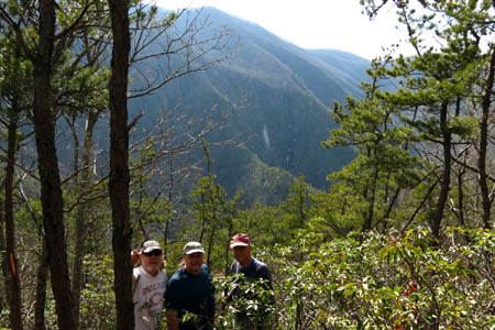
Bol’Dar, RAT, and Dave on Chigger Ridge with Buckeye Falls and Wilson Knob in the background
(more…)
Posted on 6 February '13 by RAT, under RATtreks. 4 Comments.


 My name is 'RAT' and I love the mountains and waterfalls of the East TN. area where I live and I hope you enjoy this blog about my outdoor adventures.


