


Buckeye Falls (left ridge) – 4-11-2015
I have made many trips to Buckeye Falls in the past 30+ years yet, only once before have I seen it from the left side ridge. This is due to the incredible difficulty involved in climbing what has to be one of the steepest and most gnarly trail-less ridges in this region. It is overgrown with thick laurels, briers, and other scrub growth, not to mention the cliff-like obstacles encountered before becoming very narrow at barely 3 feet wide. Before it is all said and done it transforms itself into a narrow spine of solid rock, having been eroded over time. Even after all the strenuous effort is sweated out and, all the blood has clotted from the numerous pickers that gouge and tear your skin, there is still not many views afforded as it is very overgrown however, there are a couple spots where one can get a small window to catch a unique glimpse of the falls, almost in their entirety. It is rare that there is enough water flowing to make it worth going to these falls never the less going through the agonizing Hell of climbing the left ridge, but, on this trip there would be just enough water to make it almost worth it. Besides the aforementioned obstructions, some of the worst parts of this trek would be the swarms of blood sucking flies and the intensely bright sun which, would impede any chances of getting top quality pics of the falls.
Buckeye Falls
Due to the distance (7.4miles round trip) and off trail nature of this hike, an early start is recommended but, it ended up being around 10 am before we would all arrive at the trail head. I would be accompanied on this journey by Bol’Dar, John Forbes, and Larry Jarret as including any larger number would not be safe once on the left ridge. It was a beautiful, sunny morning as we began our assault on the numerous creek crossings that end up being too many to even count. Larry and I were sporting our Muck boots so there was no worry of us having wet feet which is rare on any trip to Buckeye Falls but, Bol’Dar opted to bring along an extra pair of dry boots to change into once we reached the left ridge. Of course John would attempt his usual method of rock hopping with the hopes of keeping dry boots the entire time. I must say that would end up being successful on this day.

John and Larry crossing one of the many creek crossings.

All clean, happy, and feeling energetic as we begin our trek to the left side ridge of Buckeye Falls. This would change drastically on the return trip ! (Photo by John Forbes)
The first part of the hike is along the old road that was closed off years ago when the Sampson Mountain Wilderness Area was extended. This will take you through the first 7 or so creek crossings and is the easiest part of the hike. Each time I walk this section I am flooded by memories from the last 30+ years especially the ones from when I used to drive my old `71 Chevy pickup truck all the way to beyond the last creek crossing where the road broke off and fell into the creek some 100 feet below many years ago. We used to camp almost every weekend at a spot we created after about the 4th creek crossing not to mention the numerous times we would drive to the end of the road and then hike to Buckeye and back, which made the trip much shorter then. It was also more open and much easier to hike in those days, unlike the way it is now with the many blow-downs and flood ravaged areas that make it much harder. I have noticed however, that there is now a visible trail almost all the way due to the increased traffic to this area in the last few years. This is due to increased information found on the internet including social networks.

Old road trail
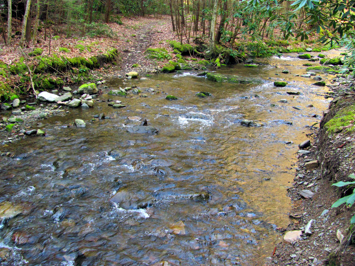
Old road trail going across one of the numerous creek crossings

This is after all the creek crossings on the old road a little over one mile in. Hard to believe I used to back my old truck up on that spur road to park and start walking from here !
The old road trail passes by the turn off to Small Falls at almost one mile in and just beyond it there is a creek crossing where that creek enters into Clark Creek A smaller falls is found there if you look for it. It makes a nice place to take a break.

Small waterfall on the side stream that is below Small Falls

Small waterfall below Small Falls where that creek enters into Clark Creek

A nice pic of these small falls (Photo by John Forbes)

A small waterfall from another angle (Photo by John Forbes)

Apparently I am telling a funny story while we hang out below the small falls (Photo by John Forbes)
It did not take long to reach the ‘caved off part’ and just past that, the ‘end of the road’ where there used to be a huge bridge (before my time) that crossed a deep expanse over the now gorge-like creek. Most people climb steeply down into this and cross the creek and then scramble to ascend the steep, solid rock part on the other side to continue on the old log road found there however, I do not take that route any more as there is much more enjoyable route along a ninja trail that will descend gradually into the gorge further upstream which provides views of some rarely seen beauty of this min-gorge. John and Larry who had been to Buckeye before, were amazed at this hidden gem and were very happy to enjoy its beauty. In the early years we never came that way but, had explored upstream from original crossing so we knew of this glowing green chasm of rock and always made a point to visit there. There used to be a HUGE log sitting at the base of the original crossing point that we always climbed up on and took a long break there at the ‘end of the road’ before continuing on. It is no longer there as it has been moved a ways downstream two times in my lifetime due to massive floods. I was able to locate it again on this trip to show the others and share the fond memories of our times upon it. It was like an old shipwreck to us then.

They say X marks the spot but I have no clue why someone marked this tree with a X !

Someone tried to shoe a tree !

The old road is now a well worn trail at least to the end of the road where the chasm is.

You can see one of the steep ridges on the left way off in the distance. The one we would be climbing is steeper.

Chasm at the end of the road ! Hard to imagine a bridge across this

The old ship log we used to sit upon at the crossing of ‘the chasm’ back in the day. Pictured here are my brother in law Bobby Bufkin and an old acquaintance Ronnie Osborne. This would be circa 1987.

The old ship log where it sits today, quite a ways downstream from the chasm crossing

Zoomed shot of the old ship log in its present location
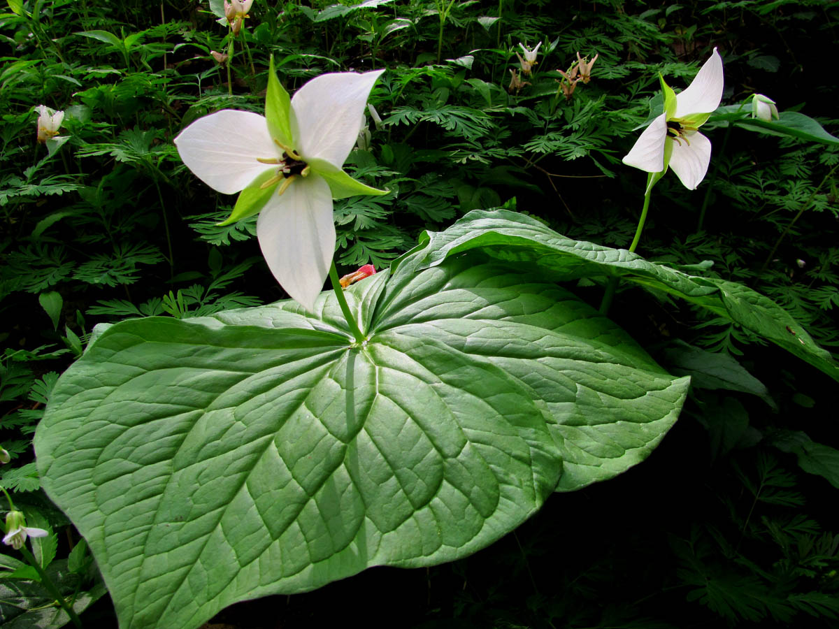
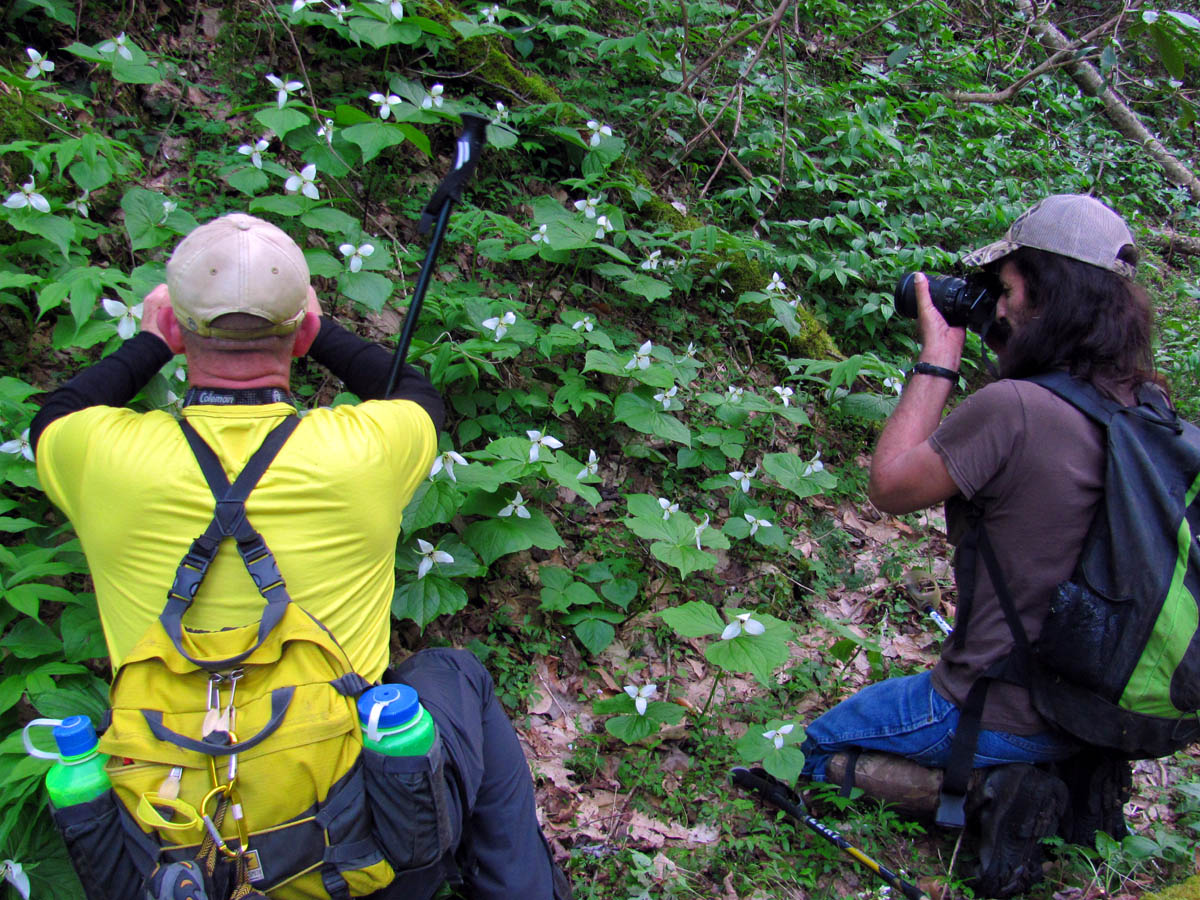
The white Trilliums were out in full glory and were leaning towards the bright sun as we continued on our way. I can not recall ever seeing so many in one spot ever. We also seen some of the largest I have ever seen in my life with single leaves being larger than my hands.

White trillium

Sun coming over the ridge to shine down upon the trilliums

Sunburst over white trilliums

Trillions of Trilliums !

Larry and John getting up close and personal with the HUGE white Trilliums

Largest Trillium I have seen

Trying my best to get a decent shot of the large Trilliums
This was the best shot I got (IMO)

White Trillium

Showing the size of these awesome Trilliums
It is always a pleasure passing by the old bulldozer blade. I am unsure how long it has been sitting there but, I am sure it is off the dozer that made the old log road (and most likely many more in the Clark Creek area) that leads all the way to the head of Clark Creek. It is hard to fathom the amount of dirt, rocks, and trees that thing must have pushed around. There are pieces of steel cable to be found everywhere as well, each time a tree that was so large that it broke it and they just left it behind. Somewhere buried in the creek not far from the old blade is on old V8 engine that used to sit beside the trail many years ago but, I have lost track of it after the last two mega floods.

Old bulldozer blade

John gets a pic of the ancient bulldozer blade

Larry checking out the old bulldozer relic

Front side of the old bulldozer blade you can see the abuse it has taken
After the dozer blade the next point of interest is the ‘Rat Tub’ which is a large pool in the creek with a small falls flowing into the upper end of it. Too many times to count have I spent sitting in that hole, drinking cold beer and cooling off in the Summer heat in years past. It is one of my favorite places on this earth.

The RAT Tub

The RAT tub
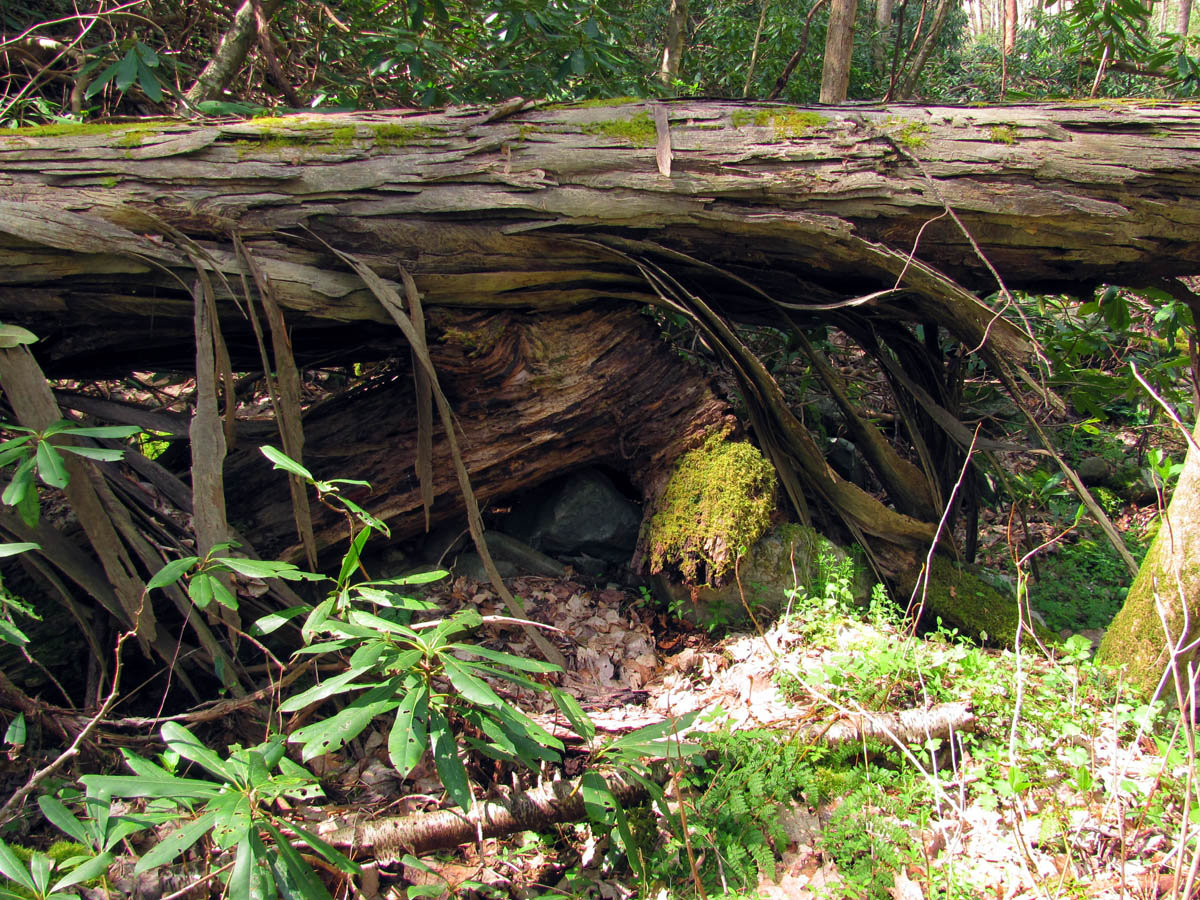
There are a few very large downed trees to negotiate now in order to continue following the creek upstream. One is a real pain to get over and is too large for a hand saw and no chainsaws allowed in a wilderness area so we have to live with it. Bol’Dar came across an old metal Coleman cooler laying along the trail that was quite a sight to see !

One of the larger downed trees along the route

Larry takes his turn crossing this large tree beast

John demonstrates the proper method of crossing this giant obstacle ! What makes it difficult is the angle !

Antique Coleman cooler found along the trail

Bol’Dar finds an old cooler and thinks “What the ??? ” (Photo by John Forbes)
There are also a few small falls to see during the wet seasons as they flourish this time of year flowing freely off the steep mountain sides as they make their way down to join Clark Creek . We stopped at a few of the closer ones along the way to get a few pics and enjoy their beauty since they only come around a couple times a year.

It doesn`t look like much from here, but from my experience, I knew to get a closer view,,

Getting closer it becomes a very nice wet weather falls

Wet weather falls

Wet weather falls

Another angle of the wet weather falls

Wet weather falls

Old log beside the wet weather falls
There is a huge downed tree that stretches across the entire valley that most people just walk under and pay it no mind but, we spent some time under it on this trip as there is a nice little falls in the creek there and I was amazed at the amount of bark hanging down like hair on a wooly mammoth on this old growth specimen. Some of the pieces are taller than I am ! It is also a nice shady spot to cool off at as it reminds me of a tiki hut !

Off in the distance you can see the huge tree that lies across the Clark Creek Valley (find John Forbes)

John makes his way underneath the large downed shaggy tree
Getting closer to this large tree with the long shreds of bark hanging off it

Here you can see the large pieces of bark hanging off the extremely long tree

John enjoying the shade inside the Hillbilly Tiki Hut

Small falls that runs under the Hillbilly Tiki Hut

Standing under the shaggy tree

Standing under the shaggy tree (Photo by John Forbes)

Looking back at the shaggy tree
Further upstream there is the ‘strata rock’. I will never forget my first time seeing this. I was not a geology major but, I knew enough to know this was formed millions of years ago when the rocks were flowing up and down like water and this is the position it came to rest in and I must say it is a sight to see. It rolls like the waves of the ocean and the layers are all different thicknesses from very thin to really thick. On this trip we would notice a birds nest built in the archway of the largest opening. I am told this may be built by a ‘Phoebe’. I always spend time here admiring these amazing rock patterns.

Bol’Dar above one of the small falls of Clark Creek on teh way to Buckeye Falls (Photo by John Forbes)

Continuing up the Clark Creek Valley. It is to the point now where there is not much trail and much of the time is spent going up the creek to get around the rough spots.

John and Bol’Dar taking pics of the bird nest at the top of the strata outcropping

Phoebe nest in the rock strata overhang (Photo by John Forbes)

Phoebe nest found in the top of the rock strata shelter (Photo by John Forbes)

Birdseye view of the Phoebe nest found in the arch of the rock strata (Photo by John Forbes)

John standing under the curved rock strata

John poses under the main rock strata

The rock strata continues up this same side for a ways but you have to look close as a lot is covered with moss and other types of growth but, you can see it rolls up and down like waves along the ocean !

Main part of the rock strata
Just past this strata is another one on the other side only it is not as profound yet, it is nonetheless just as marvelous as the first. They actually kinda face one another and it is apparent they were made at the same time and the creek has divided them. At the second one we noticed a large ‘TuanTuan’ tree sitting high on the rocky cliff above us. This provided an opportunity for Bol’Dar to ride and tame which we were more than happy to get pics of. He had his work cut out for him just climbing up the slick, moss covered, rock cliff to get up to it and more so when coming back down !

To get to the strata on the other side you must continue up the creek and go under this huge downed tree.

John giving some scale to the size of the downed tree

John sits beneath some of the rock strata on the other side of the creek
More of the other rock strata

The strata on this side is not as tight but is impressive nonetheless

Larry giving some scale to the size of the rock strata on this side

Bol’Dar climbs the steep wall of rock strata to get to the ‘tuantuan tree’ for a ride !
Bol’Dar rides the tree some 25 feet above the ground !

Closer view of Bol’Dar breaking the TuanTuan tree ! (Photo by John Forbes)
Once you pass the strata rocks it is not far to the turn off to Buckeye Falls where we stopped for a long break to ‘snack early and snack often’ as Bol’Dar always says. We would rest up before beginning the arduous climb up the ridge from hell while Bol’Dar changed out of his wet creek crossing boots and into his dry ridge climbing boots ! Once the climb began, it was slow going and we were instantly consumed by the thick forest growth.

Looking ahead you can see where the water from Buckeye enters into Clark Creek

John hangs out at the turn off to Buckeye Falls as he stands in front of the right side ridge

Looking up the creek that flows down from Buckeye Falls. As you can see there is no visible trail to the falls. It is all off trail over some extremely rough territory

Looking at the start of the left side ridge dreading the start of the arduous climb

It gets very steep right from the get go as the forest quickly consumes you

Instantly consumed by the growth ! if you are the least bit claustrophobic then this ridge climb is NOT for you !

Upon taking this selfie you can see John and Larry over my shoulder behind me. Bol’Dar is already high above me. To describe how steep this ridge is, you can see how close we are together yet John`s head is at my feet and Larry`s head is at Johns feet yet we are close enough to reach out and touch the other !!!!!
Everything there is trying its best to stop you from proceeding. There are constant laurels catching you and your pack from all directions. Even the smallest ones can stop you and drain you of precious energy. Then there are pickers that cut you like tiny razor blades so I had not gone far at all before I was bleeding. After that there is the rocks that form a series of small cliffs that have to be negotiated. Normally that would be the easy part but, in this situation they are covered with growth and going to either side is too steep to stand on and if you lose traction here you could slide back down a considerable ways before something stops you and it will hurt. All you can do is take your time and go slow and steady being extremely careful. That and my secret is to take a lot of breaks !

Some of the growth covered rocks that have to be negotiated

Bol’Dar making his way around the left side of the rock obstacle. What you can not see here is just to his left by a foot or so is a huge drop off as this ridge is very narrow and extremely steep on all sides

Looking up this is what you see.

Looking down I can see John behind me. Pictures can not show the steepness of this mighty ridge

I had to rest so I let John pass me and right behind him was Larry making his way slowly up this 50 to 60 degree angled ridge
Bol’Dar ended up ahead of the rest of us as usual and we played catch about the whole time. One of the most interesting things we came across on the steep spine of the ridge when we first started gaining some serious altitude was a small bear`s nest. We actually encountered two of them , the first was the smallest but the freshest as the chewed laurel leaves were still green. It was kinda funny because we had been talking about it earlier as Larry Jarret came across a couple of them on Holston Mountain only a week or so before this trip. There were some skeptics that said it was made by wild cats but, we can prove it is done by bears as at each one of these was not only bear hair in the nest but, there is also obvious signs that bears have scratched and clawed the trees right beside them. it is a known fact they make these nests on the South slopes of steep ridges, each is on a small overhanging rock cliff type location where they can see and hear all around them while the rest in the warmth of the sun which is found on the South side of the mountain most of the day. They are very unique and we felt very privileged to see not one but, two.
First bear nest we came across on a small rocky overhang

Bear nest

Bear nest

View from the first bear nest. You can almost see the falls

View from the first bear nest you can look across the Clark Creek Valley to see part of Sampson Mountain to give an idea how high we are already only a third of the way up this ridge

Looking down from the first bear nest at the way we had just came up

John taking a rest while we check out the first bear nest

I spent a lot of times in this position while climbing this beast of a ridge (Photo by John Forbes)

Looking up I can see Bol’Dar high above me

Looking up,,, find Bol’Dar !

Larry and myself resting while climbing the left side ridge (Photo by John Forbes)

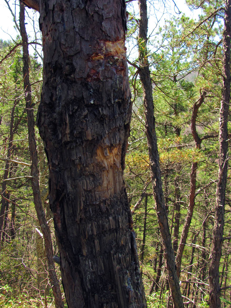
This large dead tree stands right on the spine of the ridge and upon closer inspection I could see several bear claw marks where the tree has been climbed many times by the resident bear

Look close and you can see the claw marks

Close up of the claw marks. There were many on the front and sides of this tree.

One of the side claw marks. These were as large as my hand

Just above the dead tree was the second and much larger bear nest sitting on the edge of a larger rocky overhang

Close up of this carefully crafted bear nest. This is a much older one as the laurel leaves have all died and turned completely brown. Each nest contained significant amounts of black bear hair

A lot of time and care went into making these nests and I was fascinated by them.

Larry checking out the bear nest. There are very few places anywhere on this ridge that has a spot level enough to stand on, these two nests were on two of them.

we all were trying to find a place level enough to perch upon while we checked out the largest bear nest

Looking down on the nest from above, you can see how it was strategically located on the rocky overhang
Once beyond the two bear nests we began to get some visuals of the surrounding mountains in between the gnarly trees and growth that seems to impede your travel and views from every angle. The flies were getting worse the higher we climbed and even when the terrain finally became less steep, it was still nearly impenetrable with the thick growth growing on the main spine as everything competes to reach the sun. Like I said before, going around it is just as hard due to the insane steepness on either side of the extremely narrow ridge that gets narrower the further you climb.

Cool looking tree just above the bear nest. it resembles a pipe !

Looking to my left I got my first semi-unobstructed view of Chigger Ridge over from us

Continuing up the grueling ridge it is starting to become slightly less steep but still very thick with growth
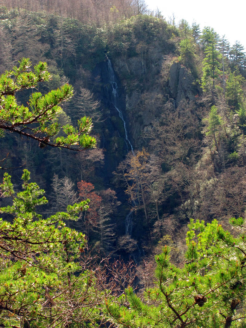
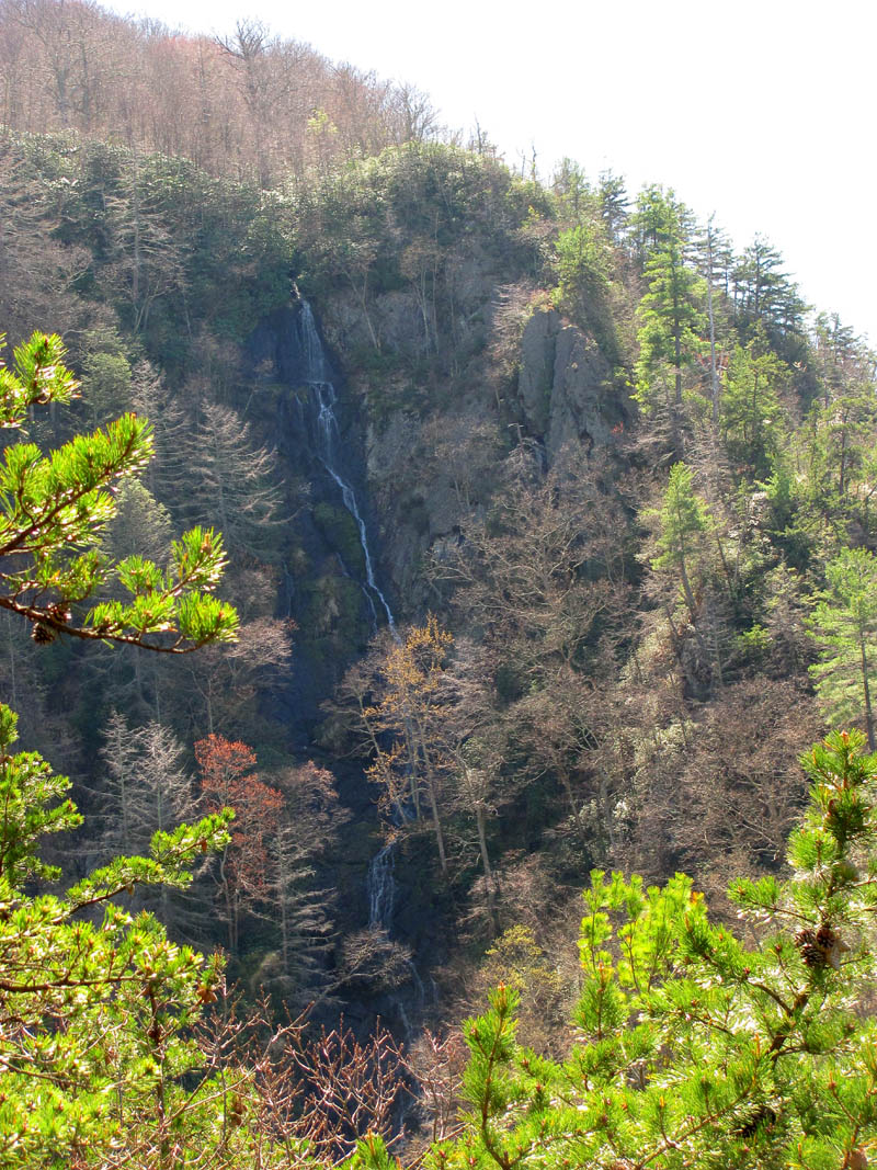
Soon we would get our first visual of Buckeye Falls although, there is not much of a view trying to peer out between the pine trees and other obstacles. They were also shaded due to their unique location so, even if you had a clear view (which you do not) you still can barely see the water as it is in the dark an the rest was intense bright sun. That is why my first trip here was in the Winter time. We would be going farther up the ridge on this trip though.

Eventually there is a small window to see the falls through

Slightly zoomed view of Buckeye Falls
I was happy when we finally made it to the top of the ridge and it started to level out some. The growth is less there but, the ridge gets more narrow and much steeper which is something you could not imagine being possible ! Once there we could see the falls on our right and off to our left could see Chigger Ridge looming high above us. The viewpoint from there is much better from there but, it requires a good zoom to get the falls due to the distance. The left ridge is closer but affords very little views of the falls. There were many trees along the ridge top that were clawed and chewed by bears so they apparently like this ridge.

Looking through the blooming Sarvis (service) berry trees we can see Chigger Ridge off in the distance to our left

Better view of more of Chigger Ridge off in the distance

Getting closer to the top of the ridge it does mellow some but not much

There are very few places to get a view of the falls

Finally the crest is in sight as I see John and Bol’Dar looking towards Chigger Ridge

Even standing on the crest of the now very narrow ridge, you are still encroached by growth in most places as you can see in this pic of Larry

You can tell by John`s view of Larry and I just how steep this ridge is from this shot (Photo by John Forbes)
Several trees on the ridge spine have these fresh bear markings

Finally on the high crest of the ridge walking across the main spine you can see it is very narrow and I can not describe just how steep it is off either side and of course plenty of fresh bear signs
We finally found one spot to get a slightly unobstructed view of the falls where we got a few pics but, we continued up the ridge to get a closer view.

First decent view of Buckeye Falls

First decent view of Buckeye Falls

This first decent view of the falls was on such a rocky and narrow spot along the spiny ridge that we had to take turns setting up to get pics. Here is Larry taking his turn.

John looks down on us from higher up on the steep ridge while we attempt to get our first shots of the falls (Photo by John Forbes)

My view of Sampson Mountain and the Clark Creek Valley (beyond Buckeye) from this perch as I await my turn

Looking over at Sampson Mountain while I await my turn to shoot the falls

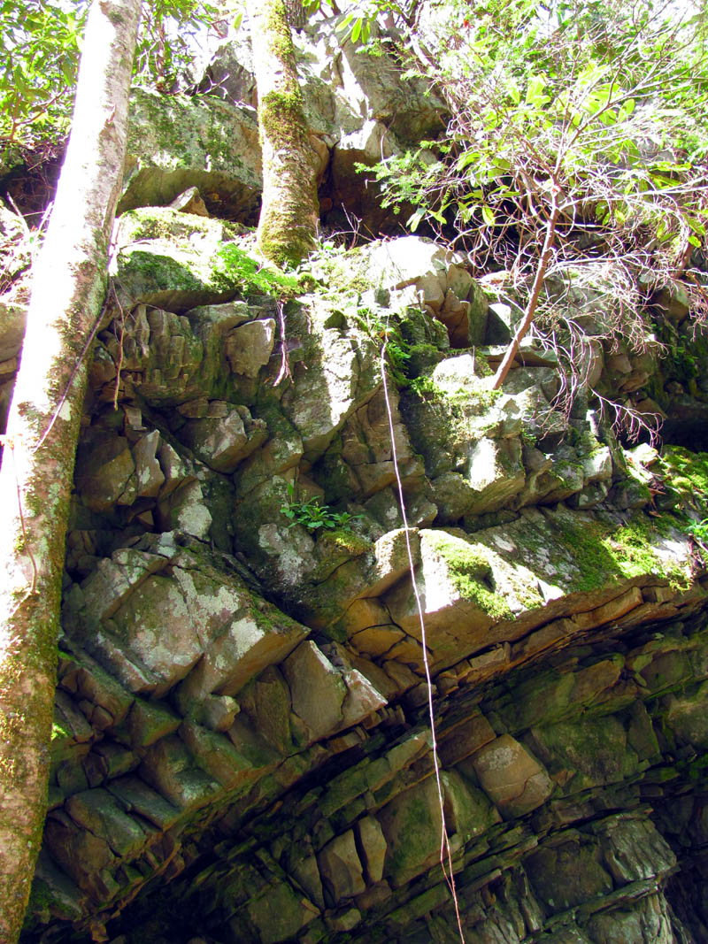
Buckeye Falls

Buckeye Falls

Buckeye Falls

Buckeye Falls

Buckeye Falls

Buckeye Falls

Buckeye Falls
Buckeye Falls

Buckeye Falls

Buckeye Falls

Buckeye Falls

Buckeye Falls
The ridge becomes very narrow and eventually turns to mostly rock where the dirt has eroded away from it. It is very dangerous here as the sides are steep resembling the sides of a concrete dam. Just trying to get around one of the many gnarly trees on the spine could cause a slip and you would not stop until the bottom. Mostly twisted and crooked pine trees so lots of pine needles which are slick to walk on so we took our time making sure we did not make any mistakes. Finally we reached the point to where the ridge becomes a solid rock spine that goes more or less straight up into the sky. There is no reason to go any farther as you would be passing the falls and could not see them and it would require some serious climbing to continue anyway. We had a good long break there despite the annoying bugs that were literally eating us alive. My arms ended up being infected for two weeks after this hike from the countless whelps I had from those blood sucking vampire flies.

Me standing high on the left side ridge after it has already shredded my pants leg ! (Photo by John Forbes)
Bol’Dar sits on the ridge spine and you can see how steep the sides are. The other side is the same distance from him which shows how narrow the ridge is and the next pic will show how steep it is,,,,

This is just to the right of where Bol’Dar is sitting in the previous picture. It is really steep on each side of this very n arrow ridge line.

We are almost as high as parts of Sampson Mountain as seen across from us here

Another view of Sampson Mtn and the Clark Creek Valley we came in through

This picture shows best how narrow the ridge is and how careful one must be when going around obstacles as you can see Bol’Dar carefully going around this gnarly tree, one slip on those slick pine needles and he wold take a quick ride to the bottom off the back side of the ridge !

Carefully going along the narrow spine of the ridge

Believe it or not, it just gets more narrow !!!
At this point the ridge becomes solid rock spine and goes nearly straight up

View of the upper portion of Chigger Ridge

The ridge turns to narrow stone and goes up into the sky

Larry perched precariously on the narrow stone part of the ridge getting some shots of the falls when we were at the closest to them but it is a side view,,

Looking off the back side of the ridge you can see a clear view of Chigger Ridge where the overlook is located on the high part of that knob where a great view of Buckeye Falls can be seen, although much farther away than where we are here.
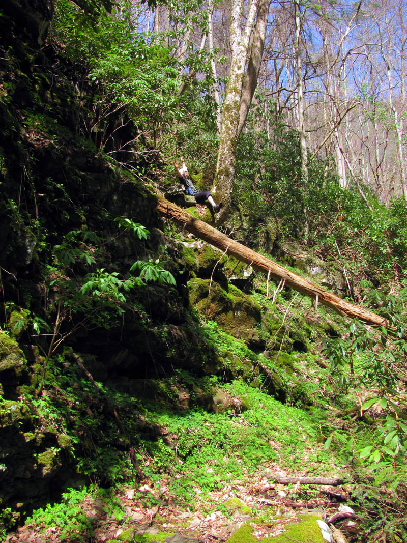
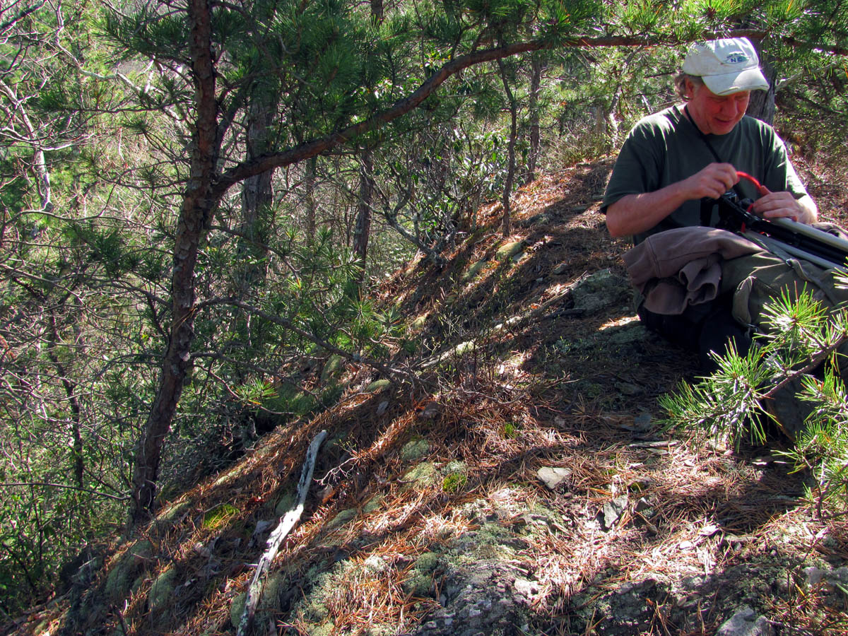
Since there were several things blocking our view of the falls we had to work to get any shots of the falls from this extreme side angle. Luckily Bol’Dar had a small rope of sorts. It actually resembled more of a string but, John volunteered and tied himself off for safety reasons and volunteered to take my sierra saw and remove some limbs which required going down a short ways on the unbelievably steep side. It made a difference and we eventually got our sun-washed pics before the bugs and the heat made it unbearable to be there and we began the slow retreat back down the ridge.

John tying off the string that he would depend on to save him from certain doom if he was to slip

John takes the string down off the side of the ridge to prune the tree that was obscuring the view

Working on a few limbs. NO trees were hurt or killed during this process !!!

Bol’Dar and Larry sit on the edge of the ridge while the tree is being pruned. You can see just how steep this side is.

John working hard in a dangerous position

John, Bol’Dar and Larry taking advantage of the tiny window view we now have of the falls

Buckeye Falls – side angle

Side view of Buckeye Falls

Buckeye Falls

Buckeye Falls

Buckeye Falls

Buckeye Falls

Buckeye Falls

Buckeye Falls

Buckeye Falls through intense bright sun

Zoomed shot of lower section of the falls

Buckeye Falls

Buckeye Falls

Me getting a shot of the falls. If this tree had broke I would not be here now ! (Photo by John Forbes)

Zoomed shot of a small section of the falls

Zoomed view of the gnarly trees that grow along the steep vertical sides of the falls

Close up of the prominent rock that sits near the top of the falls on the right side ridge. I have climbed that ridge to the top back in the late 80`s
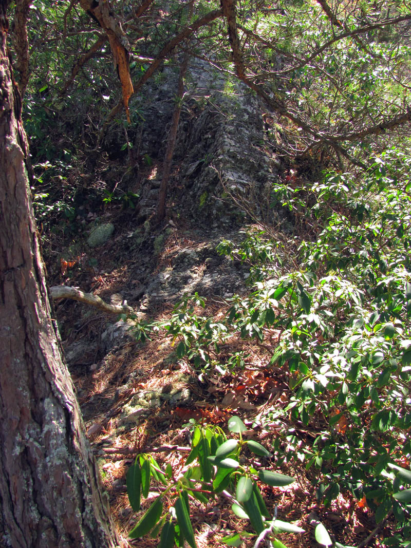
Going down is just as hard as climbing up as it is very hard to keep from losing traction plus the ridge turns slightly to your left as you go down which is much harder to follow going down that it is going up making it easy to get off track which we ended up doing and came out at a slightly different place than where we started. In doing this I did come across a very unique rock strata that contained the tightest circle of rocks that I have ever witnessed. it was quite a pleasure to see this interesting creation of Nature.

My view as we descend the ridge. You can see the lower part of the right side ridge at the lower left, the Clark Creek Valley below, and Sampson Mountain across from us.

A great view looking beyond the right side ridge up the Clark Creek Valley all the way to the butt end where it joins Rocky Fork. I have stood in the bottom of the amphitheater there at the butt end and I must say it is an awesome place but, was a rough trip to get to even back in the old days. Clark Creek actually splits into two tributaries just before it.

This strata is on the left ridge and is so tight it`s not over a foot across

Really close together, tightly curved strata found on the left side ridge

Strata on the left side ridge

close up of the strata showing just how tight the circle is (this is about 12 inches across)
Larry and I had worn our muck boots to surf this crazy ridge which in my case was not a wise decision because by the time I got back down I had done some damage to my knees that I am still suffering from nearly two months later. I can not say it was worth it because the pictures were of poor quality and not worth the risk or effort which of course means that to get better I have to come back and I am just not sure I am physically able to do it again. Only time will tell. I suppose the one really cool thing about it is the fact that we seen the falls in their entirety from an angle and puckering perch that not many people have ever seen it from or, most likely ever will see it from. I was happy to be back at the creek and stand on level ground. I was drained and my pants were shredded off me with blood flowing from every limb with too many bug bites to count. My eyes were gouged and, my knees were killing me yet, it was another 3 miles back to the cars. We took our time and still made it back just before dark which is always a good thing.
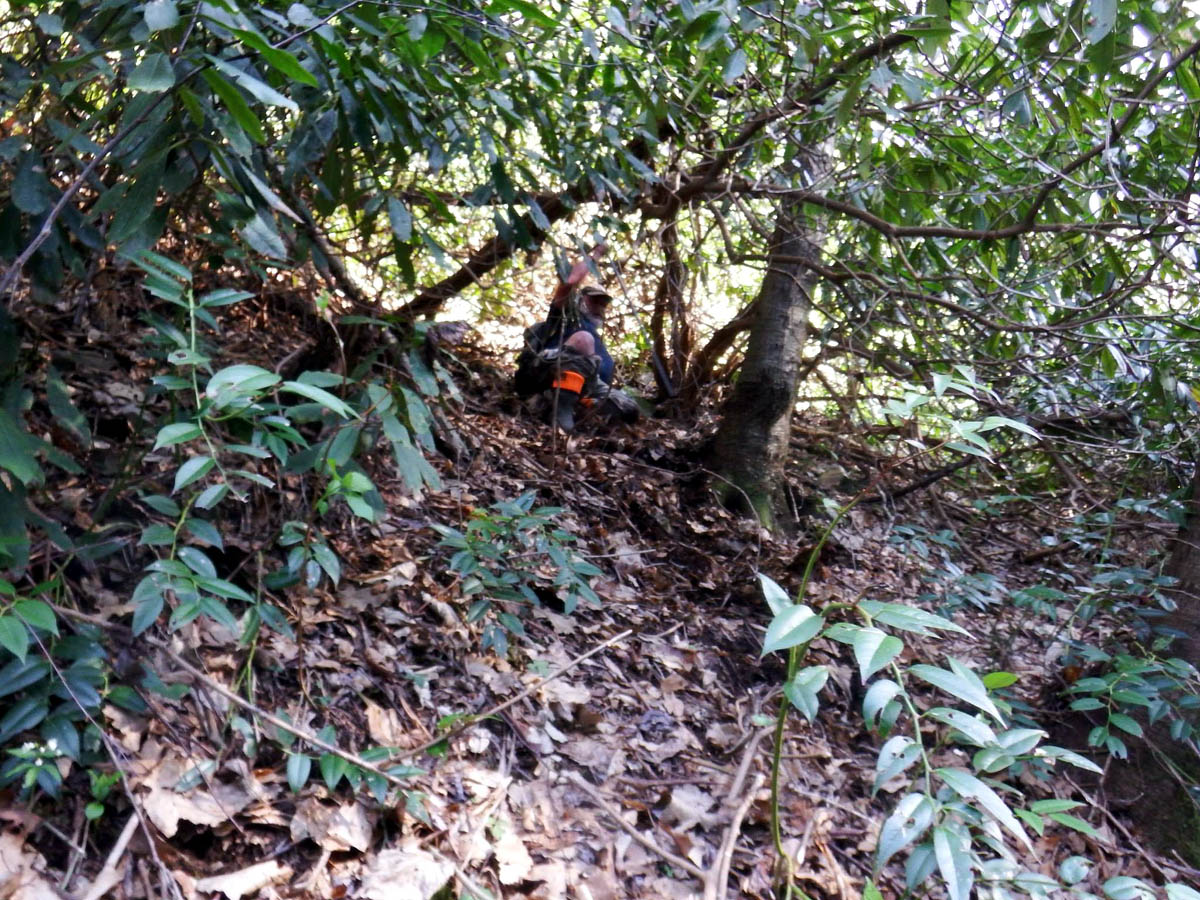
My final ‘slide for life’ descent off the left side ridge ! Once I got going it was fast and no stopping until the bottom ! (Photo by John Forbes)

Hillbilly Ridge Surfing ! (Photo by John Forbes)

My final slide off the left side ridge ! Arrived at the finish line bloodied and tattered screaming HAAIIIRRRNT ! (Photo by John Forbes)

On the return trip, bloody, tired and clothes shredded ! (Photo by John Forbes)

Most likely I was describing something to Larry but, it could be that I just needed a time out ! (Photo by John Forbes)

The light was better on the way out as John is seen here getting a close up of something. I was too tired to get my big camera or tripod out so my pics from this point on are somewhat blurry for which I apologize for. This one of the little waterfalls along Clark Creek

Doing the best I can with tired, shaky hands with my pocket cam.

Passing back by the strata I could not resist taking another pic with the sun now not in my eyes

John obviously still full of energy practices his balancing act on a log over the creek

The 3 mile route out is not an easy one

Back at the old cooler, Larry admires the view of trillions of trilliums

Passing by the RAT-tub I took a couple pics under better lighting

The small falls that flow into the RAT tub
Even on the way out the Trillium Papparazi were in full action !

I was happy to be back on the old road finally
One of many creek crossings along the old road. This one is where the stream below Small Falls enters into Clark Creek as seen to left side of pic. There is a really nice small waterfall there that we got better pics of on the way out.

My blurry shot of the falls with my pocket cam

Another blurry shot of the small falls

Some pretty purple flowers found on the way out

This is the place I used to camp for many many years. I have spent much of my life at this spot.

John Forbes managing to keep his boots dry at one of the last few creek crossings on the way out

Near the end of the road and the cars, there is this wet weather falls. During flood times these can be quite impressive.

An old Unicorn horn found near the end of the journey
There was no post hike grub out on this trip, at least not for me as I had to get home and soak in a hot tub to ease my aching bones, bloodied limbs, and gazillion bug bites. it will take me a long time to recover from this adventure, if ever. I would not recommend climbing that ridge to anyone. Until next time…

 My name is 'RAT' and I love the mountains and waterfalls of the East TN. area where I live and I hope you enjoy this blog about my outdoor adventures.


3 Comments to “Buckeye Falls (left ridge) – 4-11-2015”