


Buckeye Falls Via Chigger Ridge – 1-29-2013
It has been almost two years since our last trip to Chigger Ridge which was in March of 2011 and our waterfall enthusiast friend Dave Aldridge has been itching to get a glimpse of Buckeye Falls so we decided that since we have gotten some decent amounts of rain and snow recently that we would take him to the only place where you can see most of the falls in their entirety. It was a chilly Tuesday morning when my friend Bol’Dar, Dave, and myself left Hairnt-Quarters in route to this surreal location. I decided to take a slightly different approach on this trip having come to the conclusion that it is shorter and somewhat easier to get to Bearwallow Gap on Rich Mountain via the Higgins Creek Trail rather than the usual trek up Longarm Ridge Trail from Clarks Creek. This turned out to be true as it did shave off some distance and quite a bit of time in getting to the gap, not to mention the trail is much smoother overall with less rocky parts compared to the Longarm Ridge Trail. It only took us an hour and forty five minutes to get from the car to Bearwallow Gap. There was plenty of water coming out of Higgins Creek so the numerous falls you pass along that route were very spectacular although, it was not too high (like our last trip there) to make the creek crossings difficult.

Bol’Dar, RAT, and Dave on Chigger Ridge with Buckeye Falls and Wilson Knob in the background
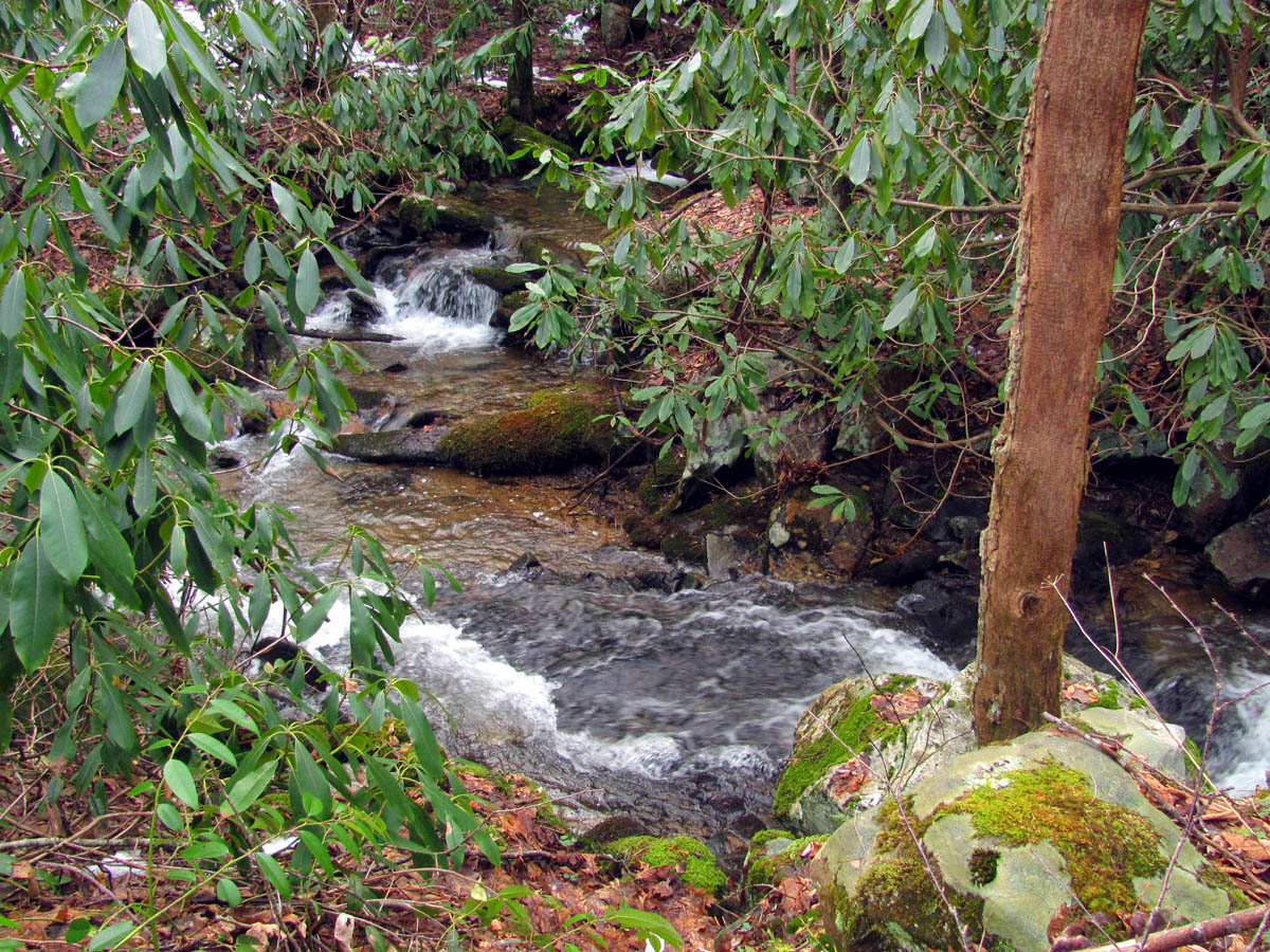
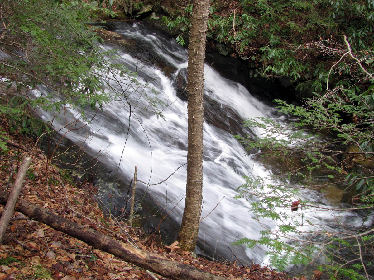
The first creek crossing at the trail head was over the makeshift plywood bridge there which was frozen with some very slick ice and due to its sloping nature, we had to be extra careful getting across it. From there it was an easy hike to the first steep hill that leads up beside the Lower Higgins Falls which is always impressive to see with the high water levels. After that hill it levels out some and crosses the creek several times as the old road winds around the mountain past the Birchfield Camp Branch intersection and beyond. There used to be log and plank bridges here as it was a 4wd forest road but floods have washed out all of those over the years but there are still remnants of the old bridges from days gone by.
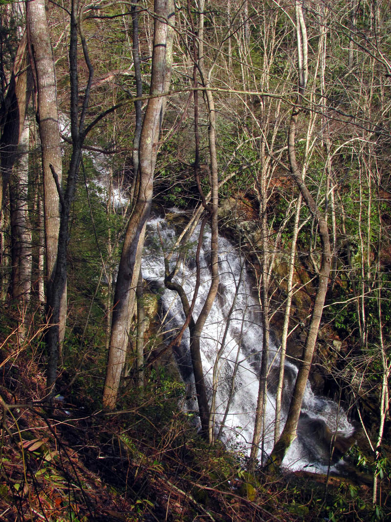
Lower Higgins Creek Falls as seen from the trail above
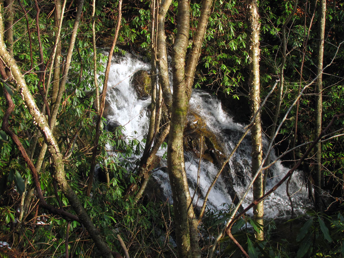
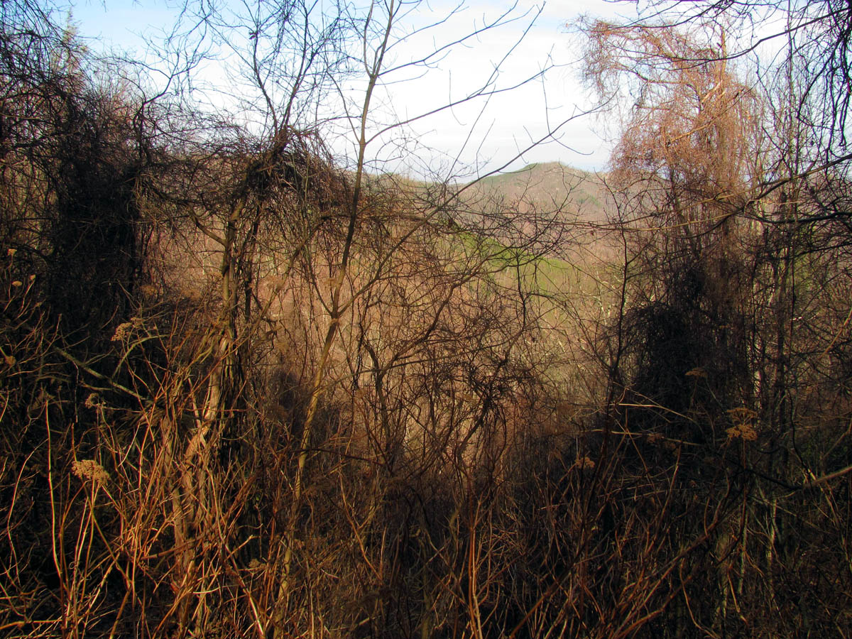
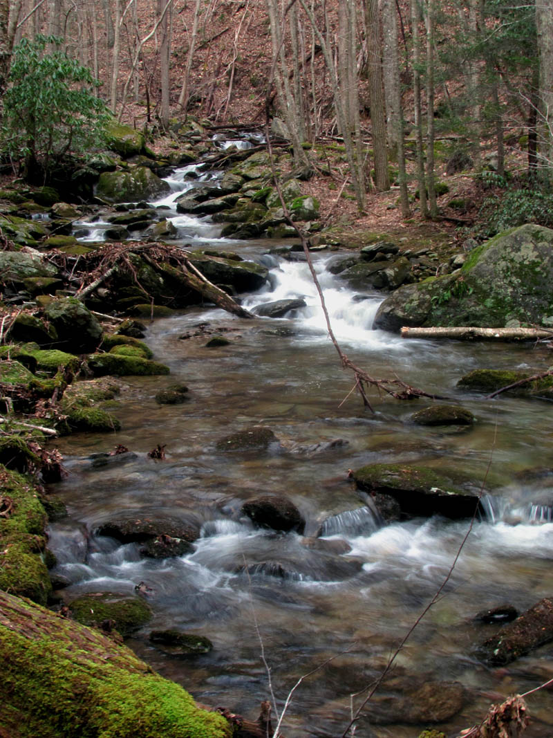
Waterfalls found on upper part of Higgins Creek (zoomed from above)
From there the old road trail goes uphill again passing by several more waterfalls in the Upper Higgins Creek area, all of which were looking good but, these are all way down below and require a steep descent and some laurel hells to get to along with a steep climb to get back up so, we did not have time to visit those but, we did locate some large falls above those that we plan to come back to in the near future. Just after those, the trail levels out again for a ways and crosses the Higgins Creek again where the Higgins Creek Valley turns to the left as it heads towards Wilson Knob. Just after this last creek crossing you will soon reach a locked blue gate that blocks the forest road which leads into the Higgins Creek Valley. This brought back several old memories of our many trips to the Wilson Knob area some 20+ years ago. The old road goes uphill again past this gate where you soon reach another locked blue gate at Bearwallow Gap. We had a good long rest break there.

Trail that leads up the Higgins Creek Hollow near where the upper falls are
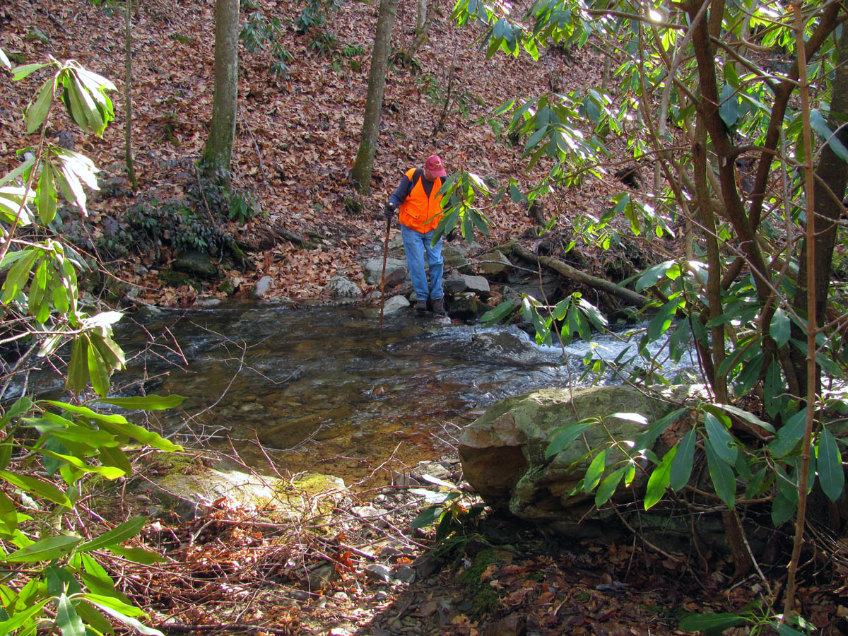
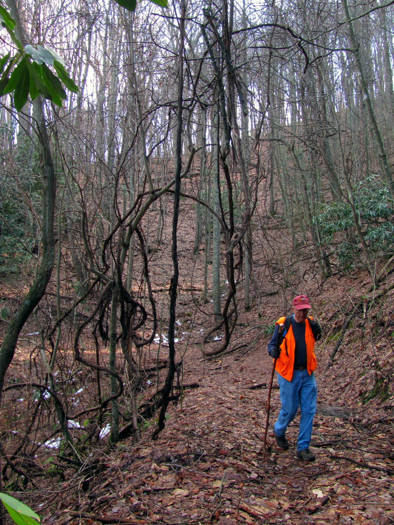
Dave crossing Higgins Creek
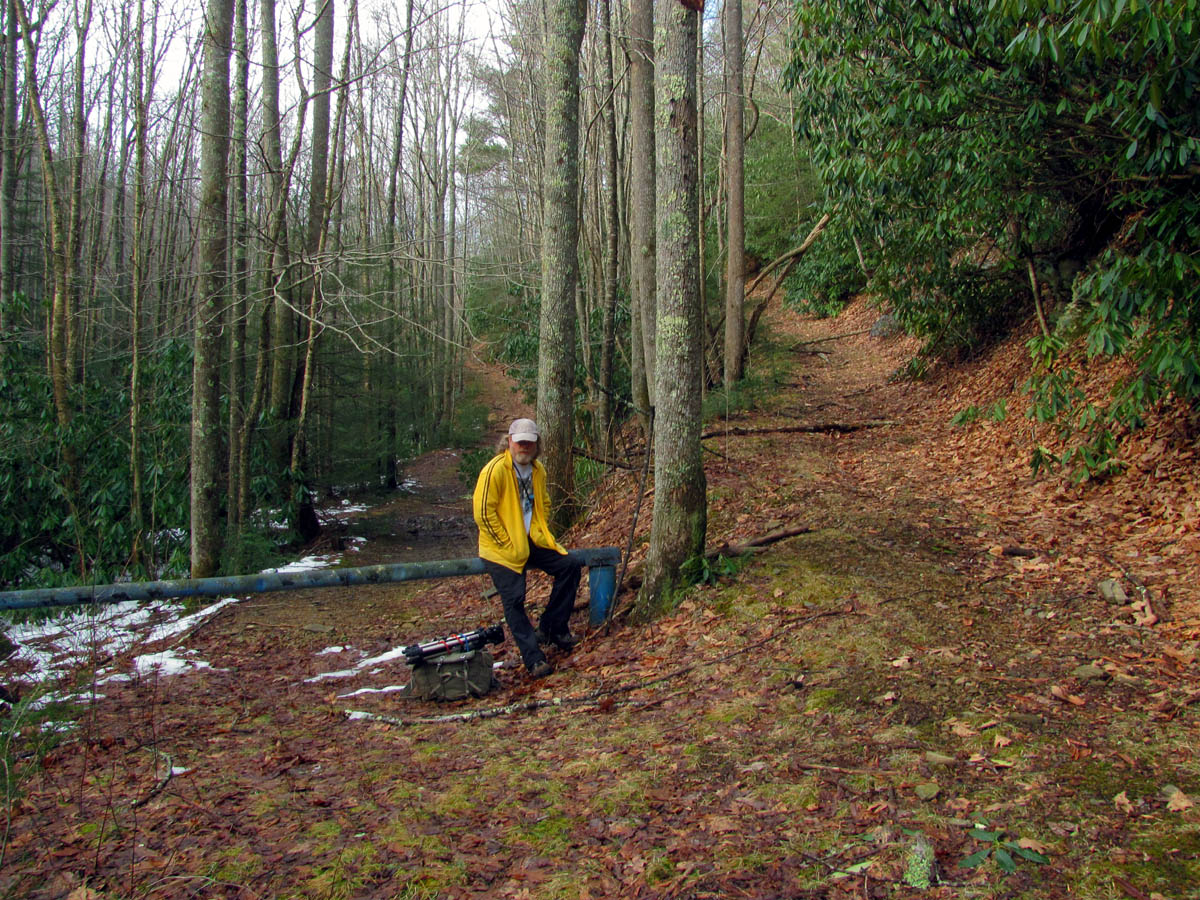
Bol’Dar resting at the first blue gate (that road follows the Higgins Creek to Wilson Knob)

Second blue gate located just past the first one, you can see Bearwallow Gap just beyond and above the gate
Bearwallow Gap is very cool place as it is where five (actually six) trails/old roads intersect from all directions and you can go to so many different places from there. There is the old forest road we came up that goes up the Higgins Creek Valley that will not only take you up/down all of Higgins Creek but also can go up Higgins Creek further to Wilson Knob (easiest method by far) not to mention, to Rocky Fork, and the Birchfield Camp Branch valley, but there is also the Boundary Ridge Trail that leads up a steeper more difficult route to Wilson Knob, plus the old road that leads over to Longarm Ridge and eventually to near Chigger Ridge, the Longarm Ridge Trail that leads back down to Clark Creek, and last but not least, the old forest road #190 that goes by the many California Fields as it makes it way eventually to Bumpass Cove. There is a small ridge trail between the last two mentioned that will take you to one of the grassy fields along FR#190. We set our sites on Chigger Ridge and went down the old road that leads in that direction. I remember driving down this all the way to end some 20 years ago but now you would not get very far as after a short ways it becomes a foot trail only before you cross Longarm Ridge. There are some great views in the wintertime of the Clark Creek Valley below and the Sampson Mountain Range on the other side.
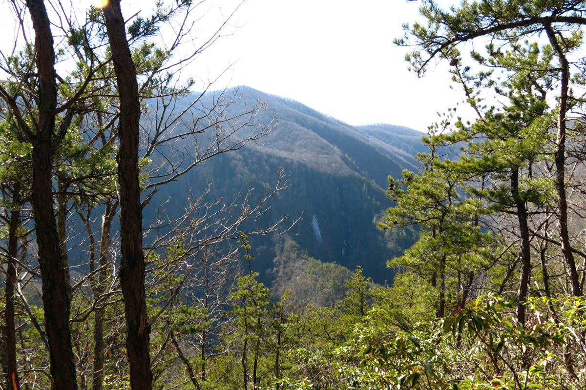
Looking over Longarm Ridge with Sampson in background
Dave hiking down the old trail out of Bearwallow Gap towards Longarm ridge (below the boundary trail)
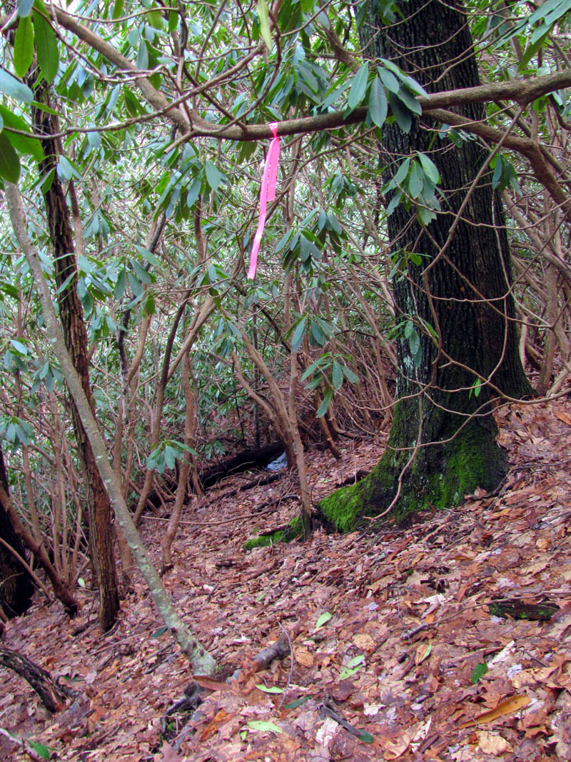
We made good time and soon enough we were at the next to last of the four small branches that leads down into the Chigger Valley which helps feed the waterfalls way down below (Delsatch aka Milky Way Cascades). From this point the old road continues to make a hard right hand turn where we could see fresh pink flagging and recent trail clearing obviously done the weekend before by our friend Melissa ‘Badger’ Braswell and her crew as they cleared that route and flagged it pink for a hike she was leading for the Johnson City Hiking Club on the following Saturday to the same destination. Knowing it was significantly farther to go that way with more climbing and laurels involved, we opted to take our shortcut, the blue-flagged route to the left which is a bit tricky (since there is no trail and it is not marked) if you do not know where you are going but, is more direct and much easier overall to get over the gnarly ridge and where you can hopefully find the secret ninja trail that leads over to the gap on Chigger Ridge where it is then about a 300 yards to the overlook. It is a short but steep climb and it definitely winded Dave so, we took our time and had us a good long rest once we reached the ridge top. After that it was much easier once we found the secret gap trail and we soon were on Chigger Ridge looking over at the frozen ice on Buckeye Falls.

Looking up a deep hollow below the boundary trail near the secret ninja trail that leads towards Chigger Ridge

Looking back down from almost the top of the ridge along the secret ninja trail (find Bol’Dar)

Looking up on the secret ninja trail, I am almost to the top !!!
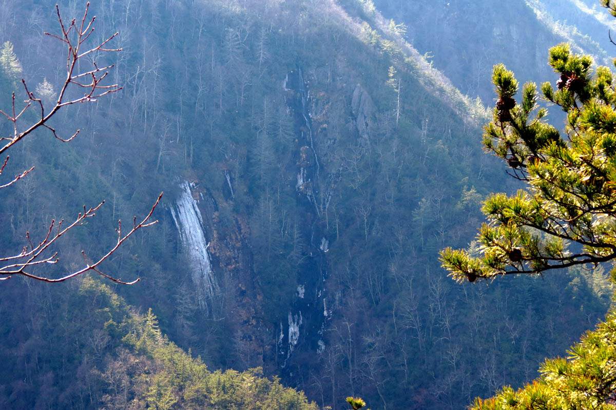
There was not as much water flowing down the falls as I had hoped and as usual the sun was so bright and intense that it made it impossible to get any good photo`s just like our last trip here. It does not matter though, because it is always such a pleasure just to be there and see the beauty and wildness of these falls since they are some of the hardest to get to (and tallest) of any in this area. We could hear them as well as the other falls that lie hidden in the deep hollow below which is adjacent to Buckeye that you look over when viewing the falls. We could hear huge ice chunks falling and falling as they made their way down this 400′ + falls. It reminded me of the many times I have stood at the base of the falls on top of huge piles of frozen ice chunks as large as cars like a huge glacier where the ice freezes and falls constantly during the Winter season. The base is a very dangerous place to be at anytime of year but especially if there is any ice overhead. We stayed on the ridge for a couple hours enjoying this tranquil, serene place (hoping some clouds would come over) until we eventually had to pack it up and begin the long hike back.
View of Buckeye Falls from Chigger Ridge

View of Buckeye Falls (zoomed) from Chigger Ridge
View of Buckeye Falls (zoomed) from Chigger Ridge

View of Buckeye Falls (zoomed) from Chigger Ridge

View of Buckeye Falls (zoomed) from Chigger Ridge

View of Buckeye Falls (zoomed) from Chigger Ridge

View of Buckeye Falls (zoomed) from Chigger Ridge
Dave and I out voted Bol’Dar so the decision was made to go back a different way and follow Mel’s pink flags further down Chigger Ridge and then off the ridge down a steep descent to where the old forest road ends/begins at the last of the small branches that leads down to feed the Chigger Falls (Delsatch) below. This did follow the old ridge trail for a short ways that used to be an actual numbered trail with metal yellow diamonds that used to be passable all the way from the Boundary Trail down to Clark Creek many years ago, but now would be a meat-grinder to get through. We did see one of the old metal yellow diamonds before going off the ridge towards the old road. The bushwhack trail that Mel cleared out and flagged with pink flagging was steep, but direct and to the point and comes out right where the old road ends at the small stream. From there it was fairly easy walking due to the amount of trail clearing they had done a few days earlier but, it did add an extra half mile to our day compared to our ‘blue’ way ! We eventually connected back to the intersection and began the gradual climb back up to Longarm Ridge and getting back to Bearwallow Gap seemed like forever. It was obvious that we were getting tired. Rightfully so as the round trip would end up being just over 7 miles with much of that being uphill. We took another long break at Bearwallow Gap before beginning the hike back down Higgins Creek.

Old metal yellow diamond trail marker on Chigger Ridge
Mel`s pink flagging on makeshift trail leading off Chigger Ridge down to where the old road is

Mel and her crew`s handy work along the old road

Looks like Mel and her crew missed a spot !!

Old horseshoe I found in the trail and posed for this shot

Dave crossing Higgins Creek where another creek that comes from Rich Mtn. intersects
I noticed there was an ample amount of water flowing out of the Birchfield Camp Branch as we passed by and had to wonder what the falls looked like up there and how nice the Hidden Lake must be this time of year. After two more creek crossings where the old bridges are long gone, we made it to the top of the Lower Higgins Falls. The ‘feeder falls‘ that come out at the bottom of the Lower Higgins Falls were flowing very well and I did get a decent shot of those. The sun was now behind the clouds which made pics better but, it was getting late and I did not take too much time in getting them but did manage to snap a few as I passed by.
Birchfield Camp Branch entering into Higgins Creek

Dave crossing Higgins Creek just below Birchfield Camp Branch and just above the top of Lower Higgins Creek Falls

Top of Lower Higgins Creek Falls
Some of the upper parts of the Lower Higgins Creek Falls
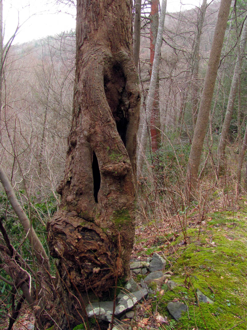
Gnarly twisted tree at the top of the Lower Higgins Creek Falls
Higgins Creek
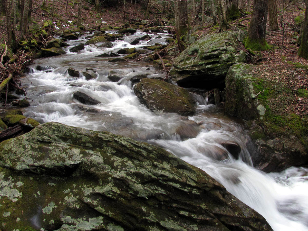
Higgins Creek

Higgins Creek
Going back down was easier than coming up but crossing the creeks with tired legs is much more challenging. There were no incidents thankfully and we made it back across all the creek crossing and by all the falls and down the steep hill to the car by a little after 5pm. This was a good thing since I had to work at 6pm and also my friend Legs from Wilmington was already at my house waiting to visit me. It had been a long, hard day but the reward of being on Chigger Ridge looking over at Buckeye Falls was more than worth it. Also, it was Dave`s first time and it is always a pleasure when someone new who really appreciates it can get to be there. I hope to get back there on a cloudier day with more water flowing over the falls to get a better picture for my collection soon. I also hope that we can complete another expedition to the base of the falls before Spring is full blown to get Dave there as well. The water levels are up right now so hoping to get in some good hikes to various waterfalls in the coming days. Until next time,,,
To see the complete collection of photo`s of Buckeye Falls, please visit our Photo Gallery here.

 My name is 'RAT' and I love the mountains and waterfalls of the East TN. area where I live and I hope you enjoy this blog about my outdoor adventures.


4 Comments to “Buckeye Falls Via Chigger Ridge – 1-29-2013”