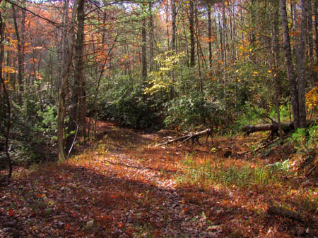
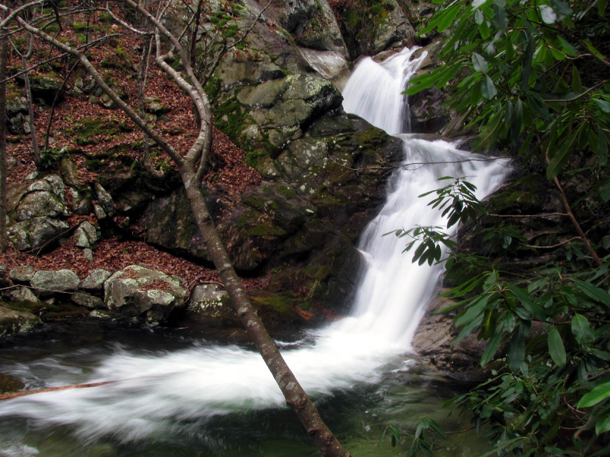
After our last trip to the Lower Higgins Creek area on Jan 24, 2012, it was decided that we would return there on our next adventure not only to show Bol’Dar the new ‘hidden falls‘ but, also because there are other waterfalls well above the Lower Higgins Creek Falls that are located even higher up the mountain beyond the turn off to the Birchfield Camp Branch Falls that we had not documented yet. We also had discussed possibly going to the ‘hidden lake‘ via the Birchfield Camp Branch Valley. Dave and Lou accompanied Bol’Dar and myself on this adventure and since they had already been to the hidden falls, they proceeded to hike up towards the unseen falls while we took the obscured old log road up to the hidden falls, and then climbed around those to the Lower Higgins Creek Falls and afterwards, climbed back up to the road where we would eventually catch up with Dave and Lou at the unseen falls further up the mountain towards Bearwallow Gap. It did not take long to reach the turnoff to the secret old log road where we parted ways temporarily.
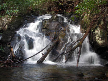
Waterfall found way above the Lower Higgins Creek Falls
(more…)
Posted on 29 March '12 by RAT, under RATtreks. 1 Comment.
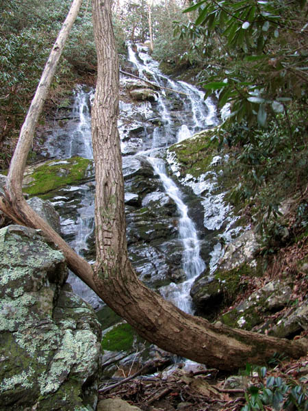
This was another one of those places that I had not visited since at least 20 years ago, the last time being with the old Rat > Patrol Hiking Club which used to take this route all the time back then on our way to places like Bearwallow Gap, Rich Mountain, Wilson Knob, Frozen Knob, Big Butte, etc., as it is one of the most direct and easiest routes to do so. We never bothered to stop and climb down to the base of the Lower Higgins Creek Falls so I only had one primitive photo (taken with 110 film) of them (taken from the trail above) so I have been wanting to get back up there when the water levels were up to see if I could get some good pics. This opportunity came on a Tuesday, Jan. 24, 2012 when my waterfall friend Dave Aldridge invited me to go with him and Lou to see the Lower Higgins Creek Falls and then on up to Birchfield Camp Falls which I eagerly accepted.

Lower Higgins Creek Falls
(more…)
Posted on 6 March '12 by RAT, under RATtreks. 1 Comment.
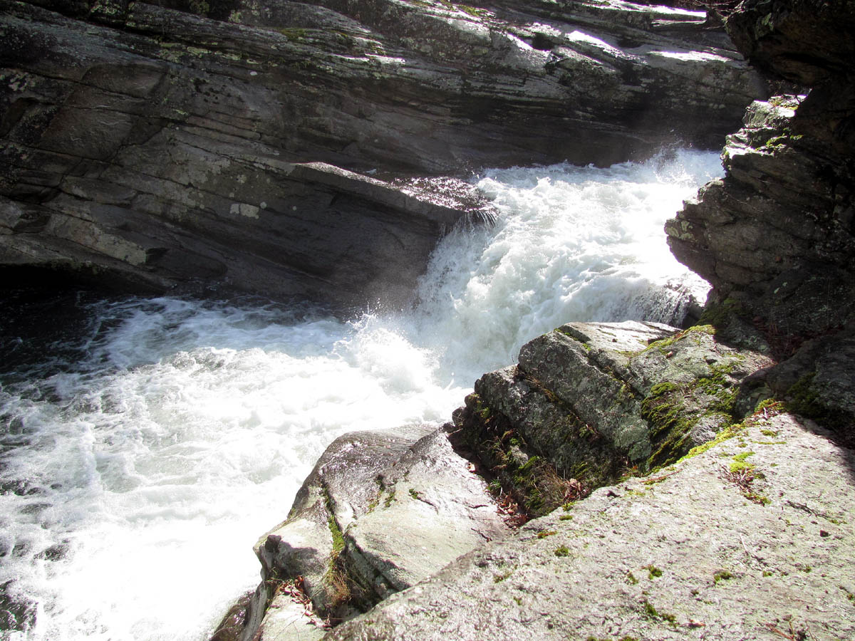
It has been a while since my last trip to the Elk River (Big Falls) area so when my friend Dave Aldridge asked if I was interested in going with him to Splash Dam Falls there was no hesitation in my saying yes. It was a mild winter day and the water levels were decent however the forecast was for sunny skies which would once again doom any chances we had of getting any good photos of these falls. Since it was a Tuesday we got a later start of around 10am due to my working until 5am that same morning but it is not far nor is it a difficult hike to get to the falls. We were there before noon (going in the only way I knew how) but, we would find a much easier way on the way out. The route starts at the Elk River Falls (aka Big Falls) and follows the Elk River until you take a side trail (crossing the Jones Creek) to the Appalachian Trail where you continue North until you reach the turn off to Splash Dam Falls. There is no signs or markings so you just have to know where it is in order to find them. Once you locate the turn off, it is a short ways to a hobo camp/party spot of sorts where there is always lots of trash and things hanging on clothes lines. After this you follow a trail through the open area to reach the top of the falls where you can walk out on a huge flat rock where the entire river squeezes down into the narrow crevice of the falls.

Splash Dam Falls
(more…)
Posted on 25 February '12 by RAT, under RATtreks. No Comments.
For many years I have been wanting to see the falls on Painter Creek as they are at least 200 feet in height (overall) which is quite intriguing for a waterfall lover however, it seems that I waited too long as easy access is now not available. This is due to the landowner being victimized by theft and vandalism in recent years causing him to block off the access and tighten up on the security of his house and property that is located there. The only information (and pics) my research could find on these falls was obtained by coming in the hard way from Cassi Creek which also requires permission to cross private property not to mention hiking up and over a steep mountain with no trails through laurel hells and having to climb back up and over on the return trip. Add in the fact that this brings you out on top of the falls and to see them and get any decent pictures would require a dangerous descent down them and the reverse to get back. The details of that trip did not interest me so about a year or more ago I spoke with a nice man who lives in the last house on the Painter Creek road who gave me the name and number of the lawyer who owns the private property behind the massive gate there but I ended up misplacing that information by the time I was ready to use it ! It just so happens that while on a waterfall hike with my friend Dave Aldridge, on our way back from Margarite Falls one day we met a nice guy and his dog heading into the mountain for a camping trip who turned out to be the lawyers partner who gave us the name and number again. This was not lost this time and Dave managed to contact the property owner and get us permission to cross his property in order to get to the falls. So on Friday, January 6, 2012, Dave, Lou, Bol’Dar and myself set out to find our way to these back-country falls.
Upper part of Painter Creek Falls
(more…)
Posted on 15 February '12 by RAT, under RATtreks. 2 Comments.
It was predicted to be a beautiful December day with warm temps so my friend Bol’Dar and I decided we would go back to the cliffs on Whitehouse Mountain that we call ‘Stonehenge’. This time we would be accompanied by Joe Parrot, an old friend whom we had not heard from in at least 15 years. If you read my blog from 12-3-2011, you will recall that we had actually thought of Joe while climbing the Middle Spring Ridge Trail, wondering what had happened to him. Low and behold he showed up at the Rat`s Hole several days later ! We all met at Hairnt-quarters around 9 am and after stopping for coffee we started our adventure at the trail-head in Rocky Fork by 10 am. The sun was starting to rise above the ridges as we made our way up the old road beside Rocky Fork Creek that had very impressive water levels which made the cascades very enjoyable to see and photograph. We noticed some recent bulldozer work and patches of new gravel along the road and someone had a truck and small trailer parked inside the gate. We later heard a four wheeler making several trips back and forth through the valley and by the time we made it to the summit we heard a rifle shot. It was assumed that someone with a key to the gate was hunting on the last day of deer season. After checking out the cascades I pointed out the place where I had been wanting to venture up the hill at, that I had calculated would be the best place to reach the bottom of the Stonehenge Cliffs. At that time Bol’Dar just shook his head as if to say “Well you COULD get there that way, but you`d have to dig way down’ !
Whitehouse Mountain and Cliffs aka 'Stonehenge'
(more…)
Posted on 26 January '12 by RAT, under RATtreks. No Comments.
Although I had recently visited the Devils Creek area in February of this year, my waterfall addicted friend Dave Aldridge had been antsy for us to take him there to see the multitude of waterfalls that form as the creek flows out the lower part of the steep and rugged gorge. Although it was a very chilly Saturday, my friend Bol’Dar and I decided that since Dave was available for a hike and since the water levels were at a respectable level from some recent rainfall, that we would take him to the waterfall mecca that only few people have seen. As I have mentioned before, these falls are protected from having very many visitors due to their inaccessibility not to mention they are not very well known and there is not any information available about them on the internet. Having found them some twenty odd years ago during a trip to Lost Cove, we have been visiting them infrequently ever since. Starting around 9am from Hairntquarters, we were hiking up the tracks by 10am. PLEASE NOTE: It is very dangerous not to mention illegal to walk on railroad tracks !!!! If you choose to do this, please do so at your own risk !!!!

Upper Devils Creek Falls
(more…)
Posted on 12 January '12 by RAT, under RATtreks. 1 Comment.
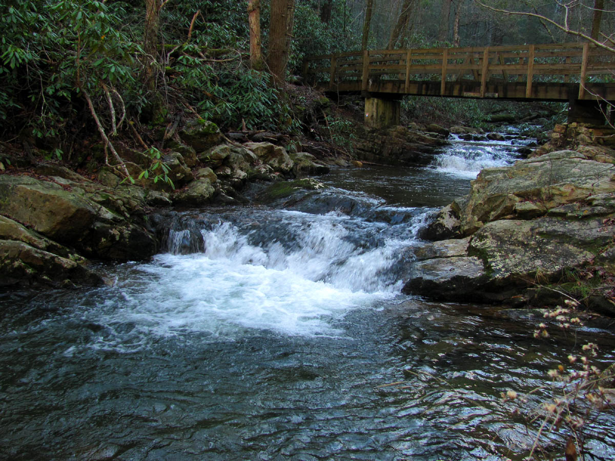
It has been many years since I did any hiking in the Horse Creek area and even longer since I have visited the falls on Pete`s Branch so, my friend Bol’Dar and I decided we would take advantage of the recent rains and get some decent pics of the falls. This seemed to be a good plan as the weather was fair for an early December day and the water levels had risen due to some recent rainfall in the days prior, however, this turned out to be not such a good idea. It seems we had not given any thought to it being the peak of bear hunting season and we found ourselves in the middle of at least a dozen trucks and even more hunters with their guns and hunting dogs all trying to kill a bear. As we walked up the rough forest road, we were passed by a few trucks in a hurry to get somewhere and we were told that it might not be a good idea for us to be walking there as they informed us there was a bear being chased in our direction which includes lots of hunters with guns. We were also reminded that we were not wearing orange as is required by law during this time of year and that my black pack would resemble a bear from a distance ! Of course this did not scare nor hinder us and we continued our trek towards the falls, stopping to check out the many cascades found along the way.
Horse Creek flowing under the Squibb Creek Trail Bridge
(more…)
Posted on 6 January '12 by RAT, under RATtreks. 1 Comment.
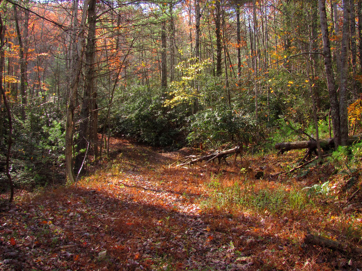
For over 20 years I have been telling about a pond on No Business Knob but, I can always see the doubt and disbelief in peoples eyes when hearing that story so, the time finally came when I decided a trip was in order to revisit the pond to not only verify its existence (as I had no pictures of it) but to also prove to myself that I did not imagine it ! My friend Bol’Dar was also anxious to see this pond because after hiking the Appalachian Trail across the knob and having climbed off trail to the summit of this gnarly hill where it is apparent that being aptly named, one has ‘no business’ being there, it is really hard to imagine a pond being anywhere in an area so steep and rugged. I had discovered this pond many years ago quite by accident when attempting to find a trail that would lead into the Devils Creek Valley in hopes of not only finding an easier way to get there but also eliminating having to walk so much on the railroad tracks. Of course we now know that there is no easy way to this rugged and pristine wonderland and perhaps that is a good thing as many times inaccessibility is Natures way of protecting some of her most prized treasures.
Trail-head at Unaka Springs
(more…)
Posted on 3 January '12 by RAT, under RATtreks. 4 Comments.
With the Fall colors being in almost full peak, my girlfriend Linda, Daisy the dog, and I took a trip to the Blue Ridge Parkway to enjoy them. We started just South of Grandfather Mountain and traveled all the way to Boone, NC. It was crowded but the views and colors were spectacular which made it all worth it. We stopped at the Dollar Store in Newland, NC and just across the street from there was this quaint little park complete with its own waterfalls. After stopping there briefly we continued to the high country where the views were breathtaking. The light was intensely bright but I got a few usable photos.

Viaduct along the Blue Ridge Parkway
(more…)
Posted on 23 December '11 by RAT, under RATtreks. No Comments.
When I am not trekking through the back-country looking for waterfalls you can sometimes find me high in ‘the balcony‘ on some rocky outcropping on top of some tall mountaintop enjoying whatever views might be available at the time. On Saturday October 8, 2011, my friend Bol’Dar and I began our adventure at Camp Creek Bald on top of what is called Viking Mountain. Our goal was to hang out on the two major cliffs near there being Whiterock and Blackstack Cliffs. One faces the North Carolina side and the other faces Tennessee so the views can be breathtaking. The fall colors were very nice so we hoped the views would be extra special for this trip. Our original plan had been to take the shortcut trail over to the Appalachian Trail and go North to Whiterock Cliffs on the Carolina side but, for some unknown reason we changed our minds and ended up walking the gravel road up to the fire tower on the high point of the mountain. This would add a few extra miles to our hike but it was worth it and after all, it was a beautiful sunny day and I needed the exercise.
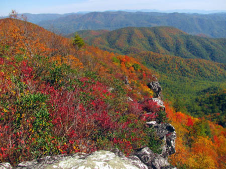
Whiterock Cliffs
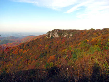
Blackstack Cliffs
(more…)
Posted on 19 December '11 by RAT, under RATtreks. 1 Comment.


 My name is 'RAT' and I love the mountains and waterfalls of the East TN. area where I live and I hope you enjoy this blog about my outdoor adventures.


